| Home | City Bus | Maps | Villages | Cities | Rail | Tourist Places | School | College | Pin Codes | Corona Cases Count |
| Distance Calculator Bus Services IFSC Codes Trace Mobile Number Weather Search Place Trace IP Available Cash ATM/Banks Locate Polling Booth Report an Error contact People |
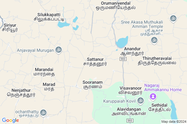
Sattanur
Sattanur Map
EDIT Map
Add Your House
 ..
..
Current Corona Virus Infected Patients Count in Ramanathapuram District
| City Name | District Name | Total Covid cases |
|---|---|---|
| Ramanathapuram District | Ramanathapuram | 15 |
Locality Name :
Sattanur
( சட்டநூற் )
Block Name : Rajasingamangalam
District : Ramanathapuram
State : Tamil Nadu
Language : Tamil
Current Time 06:53 AM
Date: Saturday , Apr 26,2025 (IST)
Time zone: IST (UTC+5:30)
Elevation / Altitude: 45 meters. Above Seal level
Telephone Code / Std Code: 04567
Assembly constituency : Sivaganga assembly constituency
Assembly MLA : Pr. Senthilnathan
Lok Sabha constituency : Sivaganga parliamentary constituency
Parliament MP : KARTI P CHIDAMBARAM
Serpanch Name :
Alternate Village Name : Sathanoor
Commodities Prices : Sivagangai Market / Mandi
Sattanur Live Weather
Temperature: 28.1 °C
scattered clouds
Humidity: 78%
Wind : 2.9 mt/sec towards E
StationName : "Mangalam"
observed on 31 Mins Back
Temperature: 28.1 °C
scattered clouds
Humidity: 78%
Wind : 2.9 mt/sec towards E
StationName : "Mangalam"
observed on 31 Mins Back
Sattanur Weather Forecast for Next 5 days
27-04-2025
29.0°C to 36.7°C
light rain, scattered clouds, few clouds, broken clouds
29.0°C to 36.7°C
light rain, scattered clouds, few clouds, broken clouds
28-04-2025
28.6°C to 37.5°C
broken clouds, overcast clouds, light rain
28.6°C to 37.5°C
broken clouds, overcast clouds, light rain
29-04-2025
28.5°C to 38.0°C
overcast clouds, scattered clouds
28.5°C to 38.0°C
overcast clouds, scattered clouds
30-04-2025
28.9°C to 38.4°C
overcast clouds, broken clouds, scattered clouds, clear sky
28.9°C to 38.4°C
overcast clouds, broken clouds, scattered clouds, clear sky
01-05-2025
28.8°C to 38.8°C
broken clouds, scattered clouds, few clouds
28.8°C to 38.8°C
broken clouds, scattered clouds, few clouds
Rivers Near Sattanur
Vaigai :Vaigai :ವೈಗೈ :வைகை :韦拉伊河
Naattaaru :Nattar :நாட்டாறு
Vaigai :Vaigai :ವೈಗೈ :வைகை :韦拉伊河
Naattaaru :Nattar :நாட்டாறு
About Sattanur
Correct below Info and add more info about SattanurSattanur is a Village in Rajasingamangalam Block in Ramanathapuram District of Tamil Nadu State, India. It is located 47 KM towards North from District head quarters Ramanathapuram. 16 KM from Rajasingamangalam. 475 KM from State capital Chennai
Karungudi ( 10 KM ) , Sethidal ( 11 KM ) , Kavanakottai ( 12 KM ) , Varavani ( 13 KM ) , Sengudi A/b ( 15 KM ) are the nearby Villages to Sattanur. Sattanur is surrounded by Rajasingamangalam Block towards East , Kalaiyarkoil Block towards west , Devakottai Block towards North , Nainarkoil Block towards South .
Paramakudi , Sivaganga , Karaikudi , Ramanathapuram are the near by Cities to Sattanur.
It is near to bay of bengal. There is a chance of humidity in the weather.
Sattanur 2011 Census Details
Sattanur Local Language is Tamil. Sattanur Village Total population is 871 and number of houses are 215. Female Population is 50.9%. Village literacy rate is 68.0% and the Female Literacy rate is 30.0%.
Population
| Census Parameter | Census Data |
| Total Population | 871 |
| Total No of Houses | 215 |
| Female Population % | 50.9 % ( 443) |
| Total Literacy rate % | 68.0 % ( 592) |
| Female Literacy rate | 30.0 % ( 261) |
| Scheduled Tribes Population % | 0.0 % ( 0) |
| Scheduled Caste Population % | 3.8 % ( 33) |
| Working Population % | 32.3 % |
| Child(0 -6) Population by 2011 | 76 |
| Girl Child(0 -6) Population % by 2011 | 50.0 % ( 38) |
Sattanur Census More Deatils.
Politics in Sattanur
MDMK , DMK , AIADMK , CPI , INC , ADMK are the major political parties in this area.Polling Stations /Booths near Sattanur
1)Adi Dravidar Welfare Higher Secondary School Mallal2)Swami Vivekananda Higher Secondary School Sivaganga
3)Ulagamatha High School Sakkoor
4)Govt. Higher Secondary School Periyakottai
5)Panchayat Union Middle School Melamangalam
HOW TO REACH Sattanur
By Rail
There is no railway station near to Sattanur in less than 10 km.Pincodes near Sattanur
630713 ( Suranam ) , 623401 ( Anandur ) , 630554 ( Mangalam (Sivaganga) )Colleges near Sattanur
Susai Educational Trust College
Address : Susai Educational Trust No-4/7,pullamadai Road, R.
Schools near Sattanur
Gt.hss (girls), R.s.mangalam
Address : rajasingamangalam , rajasingamangalam , ramanathapuram , Tamil Nadu . PIN- 623525 , Post - Rajasingamangalam
Gt. Hss, Thiruppalaikudi
Address : thiruppalaikudi , rajasingamangalam , ramanathapuram , Tamil Nadu . PIN- 623531 , Post - Tirupalaikudi
Gt.hss, Sanaveli
Address : sanaveli , rajasingamangalam , ramanathapuram , Tamil Nadu . PIN- 623538 , Post - Sanaveli
Gt. Hss, Anandur
Address : anandur , rajasingamangalam , ramanathapuram , Tamil Nadu . PIN- 623401 , Post - Anandur
Govt Health Centers near Sattanur
1) Sooranam , Primary Health Centre , Kalaiyar kovil Main road, , Akkavayal,2) Akkavayal , Health Sub centre , Oratchi kalyana mandapam near, , Sooranam
3) Kalankathankottai , Health Sub centre , Sooranam main road, , Kalangathankottai bus stop
Sub Villages in Sattanur
Hospitals in Sattanur,Rajasingamangalam
Government Hospital
Anandur - KaraiKudi Rd; Anandur; Tamil Nadu 623401; India
4.0 KM distance Detail
Government Primary Health Center
Aanandhur; Sivaganga; SH-33; Ramnad Anandur Karaikudi Road; Sivaganga; Sivaganga; 623401; India
4.0 KM distance Detail
more ..
Petrol Bunks in Sattanur,Rajasingamangalam
HP PETROL PUMP - SEMATTI AGENCY
HPC Dealer Paramkudi Main Road Marvamangalam-630554; Madurai; Tamil Nadu 630554; India
13.8 KM distance Detail
more ..
Schools in Sattanur,Rajasingamangalam
Panchayat Union Primary School
Nanamadai Road; nanamadai; Tamil Nadu 630713; India
2.3 KM distance Detail
Electronic Shops in Sattanur,Rajasingamangalam
Sathesh Audios Kalangathankottai
salaigramam road; Ilaiyankudi tk; Sivagangai dt. pincode; 630710; India
7.8 KM distance Detail
Super Markets in Sattanur,Rajasingamangalam
கே.வி.ஆர்.அரிசி மண்டி
Thanjavur - Kalayarkoil - Sayalkudi Rd; Maravamangalam; Tamil Nadu 630554; India
14.1 KM distance Detail
Local Parks in Sattanur,Rajasingamangalam
கருஞ்சுத்தி முஸ்லிம் தீனோர் பூங்கா
Karunchuthi Rd; Karunchutti; Tamil Nadu 630702; India
14.4 KM distance Detail
About Sattanur &
History
How to reach Sattanur
Tourist Places Near By Sattanur
Schools in Sattanur
Colleges in Sattanur
Temperature & weather of Sattanur
places in Sattanur
Sattanur photos
More Information
How to reach Sattanur
Tourist Places Near By Sattanur
Schools in Sattanur
Colleges in Sattanur
Temperature & weather of Sattanur
places in Sattanur
Sattanur photos
More Information
Village Talk
Post News or Events about this Village
Near Cities
Paramakudi 29 KM near
Sivaganga 34 KM near
Karaikudi 43 KM near
Ramanathapuram 43 KM near
Paramakudi 29 KM near
Sivaganga 34 KM near
Karaikudi 43 KM near
Ramanathapuram 43 KM near
Near By Taluks
Ilayankudi 12 KM near
Rajasingamangalam 15 KM near
Kalaiyarkoil 18 KM near
Devakottai 21 KM near
Ilayankudi 12 KM near
Rajasingamangalam 15 KM near
Kalaiyarkoil 18 KM near
Devakottai 21 KM near
Near By Air Ports
Madurai Airport 80 KM near
Civil Airport 129 KM near
Tuticorin Airport 152 KM near
Salem Airport 250 KM near
Madurai Airport 80 KM near
Civil Airport 129 KM near
Tuticorin Airport 152 KM near
Salem Airport 250 KM near
Near By Tourist Places
Karaikudi 43 KM near
Chettinad 55 KM near
Madurai 80 KM near
Rameswaram 88 KM near
Dhanushkodi 111 KM near
Karaikudi 43 KM near
Chettinad 55 KM near
Madurai 80 KM near
Rameswaram 88 KM near
Dhanushkodi 111 KM near
Near By Districts
Sivaganga 35 KM near
Ramanathapuram 45 KM near
Madurai 80 KM near
Pudukkottai 82 KM near
Sivaganga 35 KM near
Ramanathapuram 45 KM near
Madurai 80 KM near
Pudukkottai 82 KM near
Near By RailWay Station
Paramakkudi Rail Way Station 28 KM near
Sivaganga Rail Way Station 33 KM near
Paramakkudi Rail Way Station 28 KM near
Sivaganga Rail Way Station 33 KM near