| Home | City Bus | Maps | Villages | Cities | Rail | Tourist Places | School | College | Pin Codes | Corona Cases Count |
| Distance Calculator Bus Services IFSC Codes Trace Mobile Number Weather Search Place Trace IP Available Cash ATM/Banks Locate Polling Booth Report an Error contact People |
 ..
..
Current Corona Virus Infected Patients Count in Ramanagara District
| City Name | District Name | Total Covid cases |
|---|
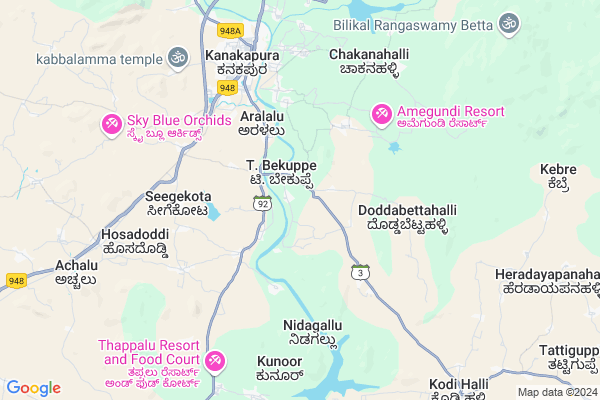
Taluk Name : Kanakapura
District : Ramanagara
State : Karnataka
Language : Kannada
Current Time 04:41 AM
Date: Saturday , Apr 26,2025 (IST)
Time zone: IST (UTC+5:30)
Elevation / Altitude: 692 meters. Above Seal level
Telephone Code / Std Code: 08117
Assembly constituency : Kanakapura assembly constituency
Assembly MLA : D K Shivakumar
Lok Sabha constituency : Bangalore Rural parliamentary constituency
Parliament MP : D.K. SURESH
Serpanch Name :
Pin Code : 562126
Post Office Name : Sathanur
Commodities Prices : Maddur Market / Mandi
Temperature: 25.4 °C
overcast clouds
Humidity: 54%
Wind : 1.22 mt/sec towards SE
StationName : "KÄ\u0081nkÄ\u0081nhalli"
observed on 19 Mins Back
24.4°C to 35.2°C
overcast clouds, broken clouds
23.7°C to 37.0°C
overcast clouds, broken clouds, light rain
24.0°C to 36.2°C
broken clouds, overcast clouds, scattered clouds, light rain
24.3°C to 35.7°C
overcast clouds, few clouds, scattered clouds, light rain
OverView of Sathanur
Sathanur village, situated in Kanakapura taluk, Ramanagar district, Karnataka, holds a significant historical narrative dating back to the 1600s, coinciding with the arrival of the British in India. During this era, Paalegra Shambulinge Gowda governed Kanakapura (known as Kanakanahalli) and Sathanur. His legacy continued through eight generations, with Patel Shambulinge Gowda particularly notable for his effective governance.
It was during the tenure of Patel Shambulinge Gowda that crucial infrastructure developments took place in Sathanur. These included the establishment of the current and water tank facilities, which played pivotal roles in enhancing the village's infrastructure and livelihoods.
It's fascinating how history intertwines with the development of regions, and the story of Sathanur village serves as a testament to the enduring legacy of its leaders and the progression of its community over the centuries.
Edit below overview about Sathanur
Nationa High Way :NH275
Nationa High Way :NH948
Hebballa :ಹೆಬ್ಬಳ್ಳ
Shimsha :ಶಿಂಶಾ
About Sathanur
Sathanur is a Village in Kanakapura Taluk in Ramanagara District of Karnataka State, India. It is located 35 KM towards South from District head quarters Ramanagara. 64 KM from State capital Bangalore
Sathanur Pin code is 562126 and postal head office is Sathanur .
Sathanur is surrounded by Thally Taluk towards East , Channapatna Taluk towards west , Ramanagara Taluk towards North , Malvalli Taluk towards west .
Ramanagaram , Malavalli , Maddur , Bangalore are the near by Cities to Sathanur.
Sathanur 2011 Census Details
Sathanur Local Language is Kannada. Sathanur Village Total population is 4966 and number of houses are 1162. Female Population is 49.1%. Village literacy rate is 66.8% and the Female Literacy rate is 29.8%.
Population
| Census Parameter | Census Data |
| Total Population | 4966 |
| Total No of Houses | 1162 |
| Female Population % | 49.1 % ( 2439) |
| Total Literacy rate % | 66.8 % ( 3317) |
| Female Literacy rate | 29.8 % ( 1478) |
| Scheduled Tribes Population % | 1.1 % ( 57) |
| Scheduled Caste Population % | 24.7 % ( 1225) |
| Working Population % | 40.9 % |
| Child(0 -6) Population by 2011 | 534 |
| Girl Child(0 -6) Population % by 2011 | 49.6 % ( 265) |
Sathanur Census More Deatils.
Politics in Sathanur
Indian National Congress , JD(S) , BJP , Indian National Congress (INC) , INC are the major political parties in this area.Polling Stations /Booths near Sathanur
1)Govt Lower Primary School Jakkegowdanadoddi2)Govt Lower Primary School Suranahalli
3)Govt Lower Primary School Room No. 2 Malagalu
4)Govt Pu College Room No 2
5)Govt Lower Primary School T Bekuppe
HOW TO REACH Sathanur
By Road
Kanakapura is the Nearest Town to Sathanur. Road connectivity is there from Kanakapura to Sathanur.By Rail
There is no railway station near to Sathanur in less than 10 km.Colleges near Sathanur
Shandilya Institute Of Nurturing Excellence (shine)Schools near Sathanur
Adrasha Model SchoolGovt Health Centers near Sathanur
1) KANAKAPURA TH , Kanakapura General Hospital , MG road , Near Rural college Kanakapura2) Kanakapura , MG road kanakapura , , Opposite to rural college kanakapura
3) Basaveshwaranagar , Sub Centre , , Anganawadi
Sub Villages in Sathanur
Schools in Sathanur,Kanakapura
Electronic Shops in Sathanur,Kanakapura
Super Markets in Sathanur,Kanakapura
Local Parks in Sathanur,Kanakapura
Police Stations near Sathanur,Kanakapura
Governement Offices near Sathanur,Kanakapura
How to reach Sathanur
Tourist Places Near By Sathanur
Schools in Sathanur
Colleges in Sathanur
Temperature & weather of Sathanur
places in Sathanur
Sathanur photos
More Information
Village Talk
Post News or Events about this Village
Ramanagaram 33 KM near
Malavalli 46 KM near
Maddur 48 KM near
Bangalore 60 KM near
Kanakapura 0 KM near
Thally 32 KM near
Channapatna 34 KM near
Ramanagara 35 KM near
Bengaluru International Airport 92 KM near
Mysore Airport 99 KM near
Salem Airport 137 KM near
Peelamedu Airport 189 KM near
Bheemeshwari 28 KM near
Shivanasamundram 43 KM near
Savandurga 52 KM near
Hogenakkal 61 KM near
MM Hills 61 KM near
Ramanagara 33 KM near
Bangalore 61 KM near
Mandya 65 KM near
Chamarajanagar 91 KM near
Ramanagaram Rail Way Station 33 KM near
Channapatna Rail Way Station 34 KM near