| Home | City Bus | Maps | Villages | Cities | Rail | Tourist Places | School | College | Pin Codes | Corona Cases Count |
| Distance Calculator Bus Services IFSC Codes Trace Mobile Number Weather Search Place Trace IP Available Cash ATM/Banks Locate Polling Booth Report an Error contact People |
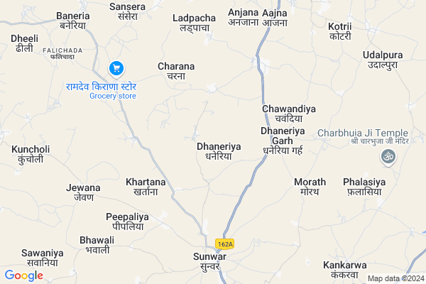
Dhaneriya Map
EDIT Map
Add Your House
 ..
..
Current Corona Virus Infected Patients Count in Rajsamand District
| City Name | District Name | Total Covid cases |
|---|---|---|
| Rajsamand District | Rajsamand | 1 |
Locality Name :
Dhaneriya
( धनेरिया )
Tehsil Name : Railmagra
District : Rajsamand
State : Rajasthan
Division : Udaipur
Language : Hindi and Rajasthani
Current Time 10:20 AM
Date: Friday , Apr 25,2025 (IST)
Time zone: IST (UTC+5:30)
Elevation / Altitude: 528 meters. Above Seal level
Telephone Code / Std Code: 02952
Assembly constituency : Nathdwara assembly constituency
Assembly MLA : Vishvaraj Singh Mewar
Lok Sabha constituency : Rajsamand parliamentary constituency
Parliament MP : Diya Kumari
Serpanch Name :
Pin Code : 313206
Post Office Name : Sanwar (Udaipur)
Commodities Prices : Fatehnagar Market / Mandi
National Highways Reachable To Dhaneriya
Nationa High Way :NH48
Nationa High Way :NH27
Nationa High Way :NH48
Nationa High Way :NH27
Rivers Near Dhaneriya
Berach
Sukri
Berach
Sukri
About Dhaneriya
Correct below Info and add more info about DhaneriyaDhaneriya is a Village in Railmagra Tehsil in Rajsamand District of Rajasthan State, India. It belongs to Udaipur Division . It is located 33 KM towards East from District head quarters Rajsamand. 16 KM from Railmagra. 333 KM from State capital Jaipur
Dhaneriya Pin code is 313206 and postal head office is Sanwar (Udaipur).
Sansera ( 10 KM ) , Rajpura ( 12 KM ) , Banediya ( 13 KM ) , Kotri ( 14 KM ) , Pakhand ( 15 KM ) are the nearby Villages to Dhaneriya. Dhaneriya is surrounded by Bhopalsagar Tehsil towards East , Mavli Tehsil towards west , Kapasan Tehsil towards East , Rajsamand Tehsil towards North .
Nathdwara , Rajsamand , Udaipur , Nimbahera are the near by Cities to Dhaneriya.
Dhaneriya 2011 Census Details
Dhaneriya Local Language is Hindi. Dhaneriya Village Total population is 3488 and number of houses are 790. Female Population is 50.1%. Village literacy rate is 54.8% and the Female Literacy rate is 21.5%.
Population
| Census Parameter | Census Data |
| Total Population | 3488 |
| Total No of Houses | 790 |
| Female Population % | 50.1 % ( 1748) |
| Total Literacy rate % | 54.8 % ( 1913) |
| Female Literacy rate | 21.5 % ( 749) |
| Scheduled Tribes Population % | 8.1 % ( 281) |
| Scheduled Caste Population % | 39.0 % ( 1360) |
| Working Population % | 48.1 % |
| Child(0 -6) Population by 2011 | 469 |
| Girl Child(0 -6) Population % by 2011 | 45.0 % ( 211) |
Dhaneriya Census More Deatils.
Politics in Dhaneriya
Bharatiya Janata Party , BJP , INC are the major political parties in this area.Polling Stations /Booths near Dhaneriya
1)Government Upper Primary School Jhar Sadari2)Government Senior Secondary School Banediya (right Part)
3)Government Senior Secondary School Bamniyakala (right Part)
4)Government Secondary School Kheri
5)Government Adarsh Girls Upper Primary School Molela
HOW TO REACH Dhaneriya
By Rail
Fatehnagar Rail Way Station is the very nearby railway stations to Dhaneriya.Colleges near Dhaneriya
Govt. College, Bhim
Address :
Shrinathji Institute Of Technology And Engineering,nathdwara
Address :
Seth Muraridas Binani Govt.collage
Address :
Govt. Colleage Deogarh
Address :
Shrinathji Institute Of Pharmacy
Address : Shrinath Ji Institute Of Pharmacy Upali Odan, Nath
Schools in Dhaneriya
R.n.t.p.s.dhaneriya
Address : dhaneriya , railmagra , rajsamand , Rajasthan . PIN- 313206 , Post - Sanwar (Udaipur)
G.g.u.p.s.dhaneriya
Address : dhaneriya , railmagra , rajsamand , Rajasthan . PIN- 313206 , Post - Sanwar (Udaipur)
G.s.sec.s., Dhaneriya
Address : dhaneriya , railmagra , rajsamand , Rajasthan . PIN- 313206 , Post - Sanwar (Udaipur)
Govt Health Centers near Dhaneriya
1) Mavli , Mavli , ,2) Peesawas , Peesawas , Peesawas , Peesawas
3) Bargaon , Bargaon , ,
Petrol Bunks in Dhaneriya,Railmagra
Shankar Mahadev Filling Station
Bhindar - Ramgarh Rd; Dhaneriya; Rajasthan 313206; India
3.4 KM distance Detail
Devnarayan Filling Station
Railmagra Road; Kesarpura; Pakhand; Rajasthan 313203; India
10.7 KM distance Detail
Boriwal Essar Filling Pump
Near Stadium Near Ashok Leyland Driving Institute; Relmangra; Rajasthan 313329; India
15.6 KM distance Detail
more ..
Schools in Dhaneriya,Railmagra
aadarsh rajkiya unch madhymik vidhyalay charana
Charana; Rajasthan 313206; India
2.4 KM distance Detail
Electronic Shops in Dhaneriya,Railmagra
Ashapura Hardware And Electric Store
Banedia Sansera Dariba Road; Baneria; Rajasthan 313203; India
10.8 KM distance Detail
Harshit hardware electric and sanitary
High Ct Rd; Bhagat Ki Kothi; Jodhpur; Rajasthan 313203; India
10.9 KM distance Detail
Governement Offices near Dhaneriya,Railmagra
रेगर दर्पन न्यूज पेपर कार्यालय रेलमगरा राजसमंद
NH162A; Relmangra; Rajasthan 313329; India
18.2 KM distance Detail
About Dhaneriya &
History
How to reach Dhaneriya
Tourist Places Near By Dhaneriya
Schools in Dhaneriya
Colleges in Dhaneriya
Temperature & weather of Dhaneriya
places in Dhaneriya
Dhaneriya photos
More Information
How to reach Dhaneriya
Tourist Places Near By Dhaneriya
Schools in Dhaneriya
Colleges in Dhaneriya
Temperature & weather of Dhaneriya
places in Dhaneriya
Dhaneriya photos
More Information
Village Talk
Post News or Events about this Village
Near Cities
Nathdwara 30 KM near
Rajsamand 36 KM near
Udaipur 58 KM near
Nimbahera 76 KM near
Nathdwara 30 KM near
Rajsamand 36 KM near
Udaipur 58 KM near
Nimbahera 76 KM near
Near By Taluks
Railmagra 15 KM near
Bhopalsagar 18 KM near
Mavli 21 KM near
Kapasan 31 KM near
Railmagra 15 KM near
Bhopalsagar 18 KM near
Mavli 21 KM near
Kapasan 31 KM near
Near By Air Ports
Dabok Airport 39 KM near
Jodhpur Airport 206 KM near
Ahmedabad Airport 281 KM near
Sanganeer Airport 308 KM near
Dabok Airport 39 KM near
Jodhpur Airport 206 KM near
Ahmedabad Airport 281 KM near
Sanganeer Airport 308 KM near
Near By Tourist Places
Nathdwara 29 KM near
Udaipur 58 KM near
Kumbhalgarh 64 KM near
Ranakpur 67 KM near
Bhilwara 84 KM near
Nathdwara 29 KM near
Udaipur 58 KM near
Kumbhalgarh 64 KM near
Ranakpur 67 KM near
Bhilwara 84 KM near
Near By Districts
Rajsamand 31 KM near
Udaipur 57 KM near
Chittorgarh 61 KM near
Bhilwara 84 KM near
Rajsamand 31 KM near
Udaipur 57 KM near
Chittorgarh 61 KM near
Bhilwara 84 KM near
Near By RailWay Station
Fatehnagar Rail Way Station 9 KM near
Mavli Junction Rail Way Station 16 KM near
Fatehnagar Rail Way Station 9 KM near
Mavli Junction Rail Way Station 16 KM near