| Home | City Bus | Maps | Villages | Cities | Rail | Tourist Places | School | College | Pin Codes | Corona Cases Count |
| Distance Calculator Bus Services IFSC Codes Trace Mobile Number Weather Search Place Trace IP Available Cash ATM/Banks Locate Polling Booth Report an Error contact People |
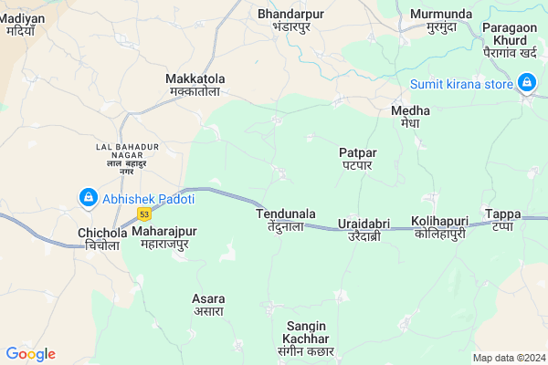
Jhandatalab
Jhandatalab Map
EDIT Map
Add Your House
 ..
..
Current Corona Virus Infected Patients Count in Rajnandgaon District
| City Name | District Name | Total Covid cases |
|---|---|---|
| Rajnandgaon | Rajnandgaon | 1 |
Locality Name :
Jhandatalab
( झण्डातलाब )
Tehsil Name : Dongarghar
District : Rajnandgaon
State : Chattisgarh
Language : Chhattisgarhi and Hindi
Current Time 10:17 PM
Date: Wednesday , Feb 05,2025 (IST)
Time zone: IST (UTC+5:30)
Elevation / Altitude: 353 meters. Above Seal level
Telephone Code / Std Code: 07744
Assembly constituency : Dongargaon assembly constituency
Assembly MLA : Daleshwar Sahu
Lok Sabha constituency : Rajnandgaon parliamentary constituency
Parliament MP : SANTOSH PANDEY
Serpanch Name :
Pin Code : 491557
Post Office Name : Chichola
Commodities Prices : Dongargarh Market / Mandi
National Highways Reachable To Jhandatalab
Nationa High Way :NH53
Nationa High Way :NH53
Rivers Near Jhandatalab
Sasakuran
Bagh
Sasakuran
Bagh
About Jhandatalab
Correct below Info and add more info about JhandatalabJhandatalab is a Village in Dongarghar Tehsil in Rajnandgaon District of Chattisgarh State, India. It is located 36 KM towards west from District head quarters Rajnandgaon. 10 KM from Dongarghar. 110 KM from State capital Raipur
Jhandatalab Pin code is 491557 and postal head office is Chichola .
Tendunala ( 3 KM ) , Patpar ( 4 KM ) , Pinkapar ( 4 KM ) , Uraidabri ( 4 KM ) , Maharajpur ( 5 KM ) are the nearby Villages to Jhandatalab. Jhandatalab is surrounded by Dongargaon Tehsil towards East , Chhuriya Tehsil towards South , Salekasa Tehsil towards west , A.Chowki (Td) Tehsil towards South .
Dongargarh , Rajnandgaon , Bhilai , Balod are the near by Cities to Jhandatalab.
Jhandatalab 2011 Census Details
Jhandatalab Local Language is Chhattisgarhi. Jhandatalab Village Total population is 1727 and number of houses are 305. Female Population is 50.4%. Village literacy rate is 67.4% and the Female Literacy rate is 30.7%.
Population
| Census Parameter | Census Data |
| Total Population | 1727 |
| Total No of Houses | 305 |
| Female Population % | 50.4 % ( 871) |
| Total Literacy rate % | 67.4 % ( 1164) |
| Female Literacy rate | 30.7 % ( 530) |
| Scheduled Tribes Population % | 42.5 % ( 734) |
| Scheduled Caste Population % | 8.6 % ( 149) |
| Working Population % | 53.9 % |
| Child(0 -6) Population by 2011 | 255 |
| Girl Child(0 -6) Population % by 2011 | 45.5 % ( 116) |
Jhandatalab Census More Deatils.
Politics in Jhandatalab
Bharatiya Janata Party , BJP , INC are the major political parties in this area.Polling Stations /Booths near Jhandatalab
1)Jarvahi2)Dhaba
3)Teka
4)Mokhli
5)Mangikhuta
HOW TO REACH Jhandatalab
By Rail
There is no railway station near to Jhandatalab in less than 10 km.Colleges near Jhandatalab
Kunjbihari Chaube Govt. Collage
Address :
Indira Kala Sangeet University
Address : Khairagarhchhattisgarhindia
Virangana Rani Avanti Bai College
Address : Ramatola, Raipur
Schools in Jhandatalab
M.s. (new) Jhandatalab
Address : jhandatalab , dongargarh , rajnandgaon , Chattisgarh . PIN- 491557 , Post - Chichola
Govt Health Centers near Jhandatalab
1) SHC Bakal , Sub Health Center Bakal , ,2) SHC Tendunala , Sub Health Center Tendunala , ,
3) Lalbhadur Nagar , PRIMARY HEALTH CENTER LAL BAHADUR NAGAR , ,
Hospitals in Jhandatalab,Dongarghar
Gayatri Medical & General
Lalbahadur nagar; Makkatola; Chhattisgarh 491557; India
6.8 KM distance Detail
more ..
Petrol Bunks in Jhandatalab,Dongarghar
HP PETROL PUMP - REET PETROLEUM
HPC Dealer NH 6; G.E. Road Urai Dabri; Dongargarh (tehsil); Raipur; Chhattisgarh 491445; India
4.0 KM distance Detail
more ..
Colleges in Jhandatalab,Dongarghar
Govt Industrial Training Institute
Lal Bahadur Nagar; Makkatola; Chhattisgarh 491557; India
7.8 KM distance Detail
Govt. Kunj Bihari Chaube College
Lal Bahadur Nagar; Makkatola; Chhattisgarh 491557; India
7.8 KM distance Detail
more ..
Schools in Jhandatalab,Dongarghar
Government Middile School Sanginkachhar
sanginkachhar chhattishgarh; 491558; India
3.6 KM distance Detail
Electronic Shops in Jhandatalab,Dongarghar
Shyam Mobile Repering Center
Lal Bahadur Nagar; Makkatola; Chhattisgarh 491557; India
6.8 KM distance Detail
Shri Ram Electronics
Lal Bahadur Nagar; Makkatola; Chhattisgarh 491557; India
6.8 KM distance Detail
Governement Offices near Jhandatalab,Dongarghar
Mharaja Ranjit Singh Hall
Khandupara; Dongargarh; Chhattisgarh 491445; India
12.9 KM distance Detail
About Jhandatalab &
History
How to reach Jhandatalab
Tourist Places Near By Jhandatalab
Schools in Jhandatalab
Colleges in Jhandatalab
Temperature & weather of Jhandatalab
places in Jhandatalab
Jhandatalab photos
More Information
How to reach Jhandatalab
Tourist Places Near By Jhandatalab
Schools in Jhandatalab
Colleges in Jhandatalab
Temperature & weather of Jhandatalab
places in Jhandatalab
Jhandatalab photos
More Information
Village Talk
Post News or Events about this Village
Near Cities
Dongargarh 12 KM near
Rajnandgaon 33 KM near
Bhilai 70 KM near
Balod 70 KM near
Dongargarh 12 KM near
Rajnandgaon 33 KM near
Bhilai 70 KM near
Balod 70 KM near
Near By Taluks
Dongarghar 10 KM near
Dongargaon 18 KM near
Chhuriya 20 KM near
A.Chowki (Td) 38 KM near
Dongarghar 10 KM near
Dongargaon 18 KM near
Chhuriya 20 KM near
A.Chowki (Td) 38 KM near
Near By Air Ports
Raipur Airport 116 KM near
Sonegaon Airport 195 KM near
Jabalpur Airport 217 KM near
Nanded Airport 465 KM near
Raipur Airport 116 KM near
Sonegaon Airport 195 KM near
Jabalpur Airport 217 KM near
Nanded Airport 465 KM near
Near By Tourist Places
Rajnandgaon 33 KM near
Durg 64 KM near
Bhilai 75 KM near
Raipur 105 KM near
Dhamtari 105 KM near
Rajnandgaon 33 KM near
Durg 64 KM near
Bhilai 75 KM near
Raipur 105 KM near
Dhamtari 105 KM near
Near By Districts
Rajnandgaon 34 KM near
Durg 64 KM near
Gondia 77 KM near
Raipur 105 KM near
Rajnandgaon 34 KM near
Durg 64 KM near
Gondia 77 KM near
Raipur 105 KM near
Near By RailWay Station
Dongargarh Rail Way Station 12 KM near
Raj Nandgaon Rail Way Station 34 KM near
Dongargarh Rail Way Station 12 KM near
Raj Nandgaon Rail Way Station 34 KM near