| Home | City Bus | Maps | Villages | Cities | Rail | Tourist Places | School | College | Pin Codes | Corona Cases Count |
| Distance Calculator Bus Services IFSC Codes Trace Mobile Number Weather Search Place Trace IP Available Cash ATM/Banks Locate Polling Booth Report an Error contact People |
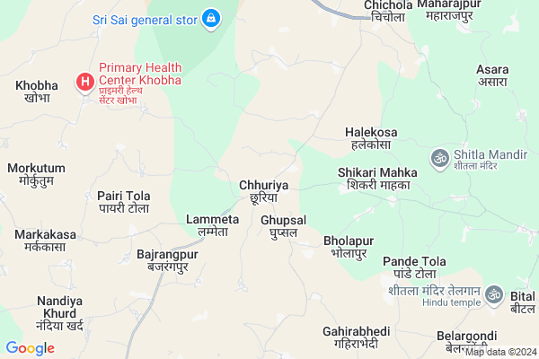
Chhuria
Chhuria Map
EDIT Map
Add Your House
 ..
..
Current Corona Virus Infected Patients Count in Rajnandgaon District
| City Name | District Name | Total Covid cases |
|---|---|---|
| Rajnandgaon | Rajnandgaon | 1 |
Locality Name :
Chhuria
( छुरिअ )
Tehsil Name : Chhuriya
District : Rajnandgaon
State : Chattisgarh
Language : Chhattisgarhi and Hindi
Current Time 12:14 PM
Date: Tuesday , Apr 29,2025 (IST)
Time zone: IST (UTC+5:30)
Elevation / Altitude: 353 meters. Above Seal level
Telephone Code / Std Code: 07744
Assembly constituency : Khujji assembly constituency
Assembly MLA : Bholaram Sahu
Lok Sabha constituency : Rajnandgaon parliamentary constituency
Parliament MP : SANTOSH PANDEY
Serpanch Name :
Pin Code : 491558
Post Office Name : Chhuria
Commodities Prices : Bandhabazar Market / Mandi
Chhuria Live Weather
Temperature: 40.0 °C
clear sky
Humidity: 19%
Wind : 7.17 mt/sec towards SW
StationName : "Dongargarh"
observed on Now
Temperature: 40.0 °C
clear sky
Humidity: 19%
Wind : 7.17 mt/sec towards SW
StationName : "Dongargarh"
observed on Now
Chhuria Weather Forecast for Next 5 days
30-04-2025
28.0°C to 40.8°C
few clouds, scattered clouds, broken clouds
28.0°C to 40.8°C
few clouds, scattered clouds, broken clouds
01-05-2025
26.1°C to 41.6°C
broken clouds, scattered clouds
26.1°C to 41.6°C
broken clouds, scattered clouds
02-05-2025
26.1°C to 42.7°C
scattered clouds, clear sky, few clouds
26.1°C to 42.7°C
scattered clouds, clear sky, few clouds
03-05-2025
26.6°C to 42.0°C
few clouds, clear sky, broken clouds
26.6°C to 42.0°C
few clouds, clear sky, broken clouds
04-05-2025
25.9°C to 42.9°C
broken clouds, clear sky, few clouds
25.9°C to 42.9°C
broken clouds, clear sky, few clouds
Edit below overview about Chhuria
Edit below overview about Chhuria
OverView of Chhuria
Its small town known for its beautiful natural view surrounded by hills and jungles. Chhuriya is a place Chhuriya block. It is the source place for nearby villagers.Chhuriya is one lsrger tehsil in rajnandgaon district. there is a hill which Hanuman's statue is situated in the top of hills. whetes from all chhuriya is visible.Edit below overview about Chhuria
National Highways Reachable To Chhuria
Nationa High Way :NH53
Nationa High Way :NH53
Rivers Near Chhuria
Sasakuran
Bagh
Sasakuran
Bagh
About Chhuria
Chhuria is a Town in Chhuriya Tehsil in Rajnandgaon District of Chattisgarh State, India. It is located 50 KM towards west from District head quarters Rajnandgaon. It is a Tehsil head quarter.
Chhuria Pin code is 491558 and postal head office is Chhuria .
Ghupsal (chhu) ( 3 KM ) , Lammeta ( 4 KM ) , Bholapur ( 4 KM ) , Shikarimahka ( 5 KM ) , Halekosa ( 5 KM ) are the nearby Villages to Chhuria. Chhuria is surrounded by Dongarghar Tehsil towards North , Deori Tehsil towards west , Dongargaon Tehsil towards East , A.Chowki (Td) Tehsil towards South .
Dongargarh , Rajnandgaon , Dalli-Rajhara , Gondiya are the nearby Cities to Chhuria.
Demographics of Chhuria
Chhattisgarhi is the Local Language here.Politics in Chhuria
Bharatiya Janata Party , BJP , INC are the major political parties in this area.Polling Stations /Booths near Chhuria
1)Chhuriyakla2)Chhachhanpahri
3)Chhuriya Kala
4)Chhuriya Kala
5)Chhuriyakla
HOW TO REACH Chhuria
By Rail
There is no railway station near to Chhuria in less than 10 km.Govt Health Centers near Chhuria
1) CHC Chhuria , Community Health Center Chhuria , ,2) SHC Bholapur , Sub Health Center Bholapur , ,
3) SHC Halekosa , Sub Health Center Halekosa , ,
Hospitals in Chhuria,Chhuriya
Govt. Hospital
New Delhi Main Rd; Chhuriya Mohalla; Madanpur Khadar; New Delhi; Delhi 491558; India
0.6 KM distance Detail
more ..
Petrol Bunks in Chhuria,Chhuriya
Reliance Petroleum
GRAM CHIRCHARI NH6 DIST RAJNANDGAON 491557; Chichola; Chhattisgarh 491557; India
9.5 KM distance Detail
HP PETROL PUMP - BAGGA PETROL STATION
NH 6; G road Opposite Gurudhwara; Kopedi; Thumribuord; Rajnandgoan; Chhattisgarh 491441; India
10.9 KM distance Detail
more ..
Colleges in Chhuria,Chhuriya
Government Queen Suryamukhi Devi College
Opp Police Station; Dongargaon Road; Churia; Chhattisgarh 491558; India
1.0 KM distance Detail
Govt. Kunj Bihari Chaube College
Lal Bahadur Nagar; Makkatola; Chhattisgarh 491557; India
14.6 KM distance Detail
more ..
Schools in Chhuria,Chhuriya
Royal Kids Convent School
Millpara; Bhakti Nagar; Rajkot; Chhattisgarh 491558; India
0.3 KM distance Detail
About Chhuria &
History
How to reach Chhuria
Tourist Places Near By Chhuria
Schools in Chhuria
Colleges in Chhuria
Temperature & weather of Chhuria
places in Chhuria
Chhuria photos
More Information
How to reach Chhuria
Tourist Places Near By Chhuria
Schools in Chhuria
Colleges in Chhuria
Temperature & weather of Chhuria
places in Chhuria
Chhuria photos
More Information
Town Talk
Post News or Events about this Town
Near Cities
Dongargarh 26 KM near
Rajnandgaon 47 KM near
Dalli-Rajhara 74 KM near
Gondiya 75 KM near
Dongargarh 26 KM near
Rajnandgaon 47 KM near
Dalli-Rajhara 74 KM near
Gondiya 75 KM near
Near By Taluks
Chhuriya 9 KM near
Dongarghar 25 KM near
Deori 29 KM near
Dongargaon 29 KM near
Chhuriya 9 KM near
Dongarghar 25 KM near
Deori 29 KM near
Dongargaon 29 KM near
Near By Air Ports
Raipur Airport 130 KM near
Sonegaon Airport 183 KM near
Jabalpur Airport 221 KM near
Nanded Airport 449 KM near
Raipur Airport 130 KM near
Sonegaon Airport 183 KM near
Jabalpur Airport 221 KM near
Nanded Airport 449 KM near
Near By Tourist Places
Rajnandgaon 47 KM near
Durg 78 KM near
Bhilai 90 KM near
Dhamtari 113 KM near
Bhandara 115 KM near
Rajnandgaon 47 KM near
Durg 78 KM near
Bhilai 90 KM near
Dhamtari 113 KM near
Bhandara 115 KM near
Near By Districts
Rajnandgaon 48 KM near
Gondia 75 KM near
Durg 78 KM near
Balaghat 112 KM near
Rajnandgaon 48 KM near
Gondia 75 KM near
Durg 78 KM near
Balaghat 112 KM near
Near By RailWay Station
Dongargarh Rail Way Station 26 KM near
Raj Nandgaon Rail Way Station 48 KM near
Dongargarh Rail Way Station 26 KM near
Raj Nandgaon Rail Way Station 48 KM near