| Home | City Bus | Maps | Villages | Cities | Rail | Tourist Places | School | College | Pin Codes | Corona Cases Count |
| Distance Calculator Bus Services IFSC Codes Trace Mobile Number Weather Search Place Trace IP Available Cash ATM/Banks Locate Polling Booth Report an Error contact People |
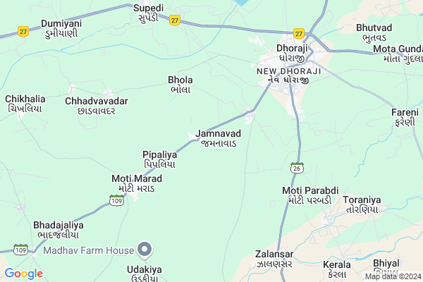
Jamnavad Map
EDIT Map
Add Your House
 ..
..
Current Corona Virus Infected Patients Count in Rajkot District
| City Name | District Name | Total Covid cases |
|---|---|---|
| Rajkot District | Rajkot | 38 |
| Rajkot | Rajkot | 7 |
Locality Name :
Jamnavad
( જમનાવાડ )
Taluka Name : Dhoraji
District : Rajkot
State : Gujarat
Language : Gujarati and Hindi, Urdu, English, Sindhi, Bengali, Tamil, Malayalam And Marathi
Current Time 09:18 AM
Date: Thursday , Apr 24,2025 (IST)
Time zone: IST (UTC+5:30)
Elevation / Altitude: 68 meters. Above Seal level
Telephone Code / Std Code: 02824
Assembly constituency : Dhoraji assembly constituency
Assembly MLA : Dr. Mahendrabhai Padalia
Lok Sabha constituency : Porbandar parliamentary constituency
Parliament MP : RAMESHBHAI LAVJIBHAI DHADUK
Serpanch Name :
Pin Code : 360410
Post Office Name : Dhoraji S.R. ND.T.
Commodities Prices : Dhoraji Market / Mandi
Jamnavad Live Weather
Temperature: 29.7 °C
clear sky
Humidity: 36%
Wind : 3.56 mt/sec towards NW
StationName : "Dhoraji"
observed on 1 Hours Back
Temperature: 29.7 °C
clear sky
Humidity: 36%
Wind : 3.56 mt/sec towards NW
StationName : "Dhoraji"
observed on 1 Hours Back
Jamnavad Weather Forecast for Next 5 days
25-04-2025
26.6°C to 40.3°C
clear sky
26.6°C to 40.3°C
clear sky
26-04-2025
25.4°C to 40.3°C
clear sky
25.4°C to 40.3°C
clear sky
27-04-2025
25.5°C to 41.7°C
clear sky
25.5°C to 41.7°C
clear sky
28-04-2025
25.5°C to 40.8°C
clear sky, scattered clouds
25.5°C to 40.8°C
clear sky, scattered clouds
29-04-2025
25.5°C to 41.1°C
clear sky, scattered clouds
25.5°C to 41.1°C
clear sky, scattered clouds
Edit below overview about Jamnavad
Edit below overview about Jamnavad
OverView of Jamnavad
Shree D H Pardava vidhyalayAddress:opp.bajali pvt.ltd jamnavad road ,Dhoraji,Rajkot,Gujarat,pin-360410Edit below overview about Jamnavad
National Highways Reachable To Jamnavad
Nationa High Way :NH27
Nationa High Way :NH 8D
Nationa High Way :NH27
Nationa High Way :NH 8D
About Jamnavad
Jamnavad is a Village in Dhoraji Taluka in Rajkot District of Gujarat State, India. It is located 89 KM towards South from District head quarters Rajkot. 5 KM from . 334 KM from State capital Gandhinagar
Jamnavad Pin code is 360410 and postal head office is Dhoraji S.R. ND.T..
Moti Marad ( 5 KM ) , Moti Parabdi ( 6 KM ) , Chhadvavadar ( 7 KM ) , Supedi ( 8 KM ) , Udakiya ( 8 KM ) are the nearby Villages to Jamnavad. Jamnavad is surrounded by Upleta Taluka towards west , Jetpur Taluka towards East , Junagadh Taluka towards South , Jamkandorna Taluka towards North .
Upleta , Junagadh , Manavadar , Keshod are the near by Cities to Jamnavad.
Jamnavad 2011 Census Details
Jamnavad Local Language is Gujarati. Jamnavad Village Total population is 2493 and number of houses are 522. Female Population is 49.6%. Village literacy rate is 74.4% and the Female Literacy rate is 33.8%.
Population
| Census Parameter | Census Data |
| Total Population | 2493 |
| Total No of Houses | 522 |
| Female Population % | 49.6 % ( 1236) |
| Total Literacy rate % | 74.4 % ( 1855) |
| Female Literacy rate | 33.8 % ( 843) |
| Scheduled Tribes Population % | 0.0 % ( 0) |
| Scheduled Caste Population % | 16.8 % ( 419) |
| Working Population % | 37.0 % |
| Child(0 -6) Population by 2011 | 221 |
| Girl Child(0 -6) Population % by 2011 | 49.3 % ( 109) |
Jamnavad Census More Deatils.
Politics in Jamnavad
BJP , INC are the major political parties in this area.Polling Stations /Booths near Jamnavad
1)Bhimora-22)Dhoraji-12
3)Dhoraji-13
4)Patnvav-4
5)Piplia-1
HOW TO REACH Jamnavad
By Rail
Dhoraji Rail Way Station , Supedi Rail Way Station are the very nearby railway stations to Jamnavad.Colleges near Jamnavad
Government Arts And Commerce Colledge
Address :
Sarvopari Science College
Address :
Shri Hn And Rn Doshi
Address :
Nanibrar Kumar Sala
Address :
Creation Bsw / Msw College
Address :
Schools in Jamnavad
Gopal Vidhyalay
Address : jamnavad , dhoraji , rajkot , Gujarat . PIN- 360410 , Post - Dhoraji S.R. ND.T.
Jamnavad Primary School
Address : jamnavad , dhoraji , rajkot , Gujarat . PIN- 360410 , Post - Dhoraji S.R. ND.T.
Govt Health Centers near Jamnavad
1) Sargavada , SUBCENTER SARAGWADA , , NEAR BUS STATION SARAGWADA2) C.M.Z. H. Junagardh , CIVIL HOSPITAL , NEAR AZAD CHOWK , NEAR AZAD CHOWK
3) Jamjodhpur , , Balwa Fatak ,
Hospitals in Jamnavad,Dhoraji
Govani Hospital
BEHIND GARDEN; NEAR; Railway Station Rd; New Dhoraji; Dhoraji; Gujarat 360410; India
5.2 KM distance Detail
Dr Dodia 'S Hospitals
1; Railway Station Rd; New Dhoraji; Dhoraji; Gujarat 360410; India
5.2 KM distance Detail
Dr Dodia 'S Home Care Clinic
b h; Janatha Rd; Panangad; Ernakulam; Kerala 682506; India
5.3 KM distance Detail
more ..
Petrol Bunks in Jamnavad,Dhoraji
HP PETROL PUMP - MATESWARI PETROLEUM
HP Petrol Pump Village Moti Marad Tal-dhoraji; Gujarat 360421; India
3.7 KM distance Detail
Dhoraji Filling Station Indian Oil Petrol Pump
Happy Home Colony; Rajkot; SH-109; Rajkot Road; Rajkot; Rajkot; Gujarat 360410; India
5.9 KM distance Detail
HP Petrol Pump
Railway Station Rd; Happy Home Colony; Dhoraji; Gujarat 360410; India
6.5 KM distance Detail
more ..
Colleges in Jamnavad,Dhoraji
Shree Kanji Odhavji Shah Municipal Arts & Comm. College
Near Ram mandir ; Station Plote; Dhoraji; Gujarat 360410; India
5.2 KM distance Detail
College Ground
GJ SH 109; Yami Park Apartment; New Dhoraji; Dhoraji; Gujarat 360410; India
5.4 KM distance Detail
K.O.Shah College
Yami Park Apartment; Venkateshwara Nagar; Dhoraji; Gujarat 360410; India
5.5 KM distance Detail
more ..
Schools in Jamnavad,Dhoraji
Drona International School
Jamnavad Rd; New Dhoraji; Dhoraji; Gujarat 360410; India
3.2 KM distance Detail
Super Markets in Jamnavad,Dhoraji
Shree Ram Superstore
4; Railway Station Rd; Vishi Plot; New Dhoraji; Dhoraji; Gujarat 360410; India
5.3 KM distance Detail
Sangam pan (lalitbhai.d.jagani)
near leuva patel samaj; Jamnavad Rd; New Dhoraji; Dhoraji; Gujarat 360410; India
5.5 KM distance Detail
Local Parks in Jamnavad,Dhoraji
Janta Garden; DHORAJI
1; Railway Station Rd; New Dhoraji; Dhoraji; Gujarat 360410; India
5.3 KM distance Detail
Madhav Darshan Park
behind of madhuli chambers; Jetpur Rd; Dhoraji; Gujarat 360410; India
7.9 KM distance Detail
Police Stations near Jamnavad,Dhoraji
Dhoraji City Police Station ધોરાજી સિટી પોલીસ સ્ટેશન
New Dhoraji; Dhoraji; Gujarat 360410; India
6.3 KM distance Detail
Governement Offices near Jamnavad,Dhoraji
Taluka Panchyat Dhoraji
Railway Station Rd; New Dhoraji; Dhoraji; Gujarat 360410; India
5.4 KM distance Detail
Bambagate PGVCL Office
Railway Station Rd; New Dhoraji; Dhoraji; Gujarat 360410; India
5.7 KM distance Detail
About Jamnavad &
History
How to reach Jamnavad
Tourist Places Near By Jamnavad
Schools in Jamnavad
Colleges in Jamnavad
Temperature & weather of Jamnavad
places in Jamnavad
Jamnavad photos
More Information
How to reach Jamnavad
Tourist Places Near By Jamnavad
Schools in Jamnavad
Colleges in Jamnavad
Temperature & weather of Jamnavad
places in Jamnavad
Jamnavad photos
More Information
Village Talk
Post News or Events about this Village
Near Cities
Upleta 16 KM near
Junagadh 22 KM near
Manavadar 39 KM near
Keshod 49 KM near
Upleta 16 KM near
Junagadh 22 KM near
Manavadar 39 KM near
Keshod 49 KM near
Near By Taluks
Dhoraji 5 KM near
Upleta 23 KM near
Jetpur 24 KM near
Junagadh 24 KM near
Dhoraji 5 KM near
Upleta 23 KM near
Jetpur 24 KM near
Junagadh 24 KM near
Near By Air Ports
Civil Airport 87 KM near
Porbandar Airport 87 KM near
Govardhanpur Airport 105 KM near
Diu Airport 135 KM near
Civil Airport 87 KM near
Porbandar Airport 87 KM near
Govardhanpur Airport 105 KM near
Diu Airport 135 KM near
Near By Tourist Places
Girnar 21 KM near
Junagadh 22 KM near
Gondal 55 KM near
Sasan Gir 69 KM near
Chorwad 85 KM near
Girnar 21 KM near
Junagadh 22 KM near
Gondal 55 KM near
Sasan Gir 69 KM near
Chorwad 85 KM near
Near By Districts
Junagadh 21 KM near
Rajkot 85 KM near
Porbandar 91 KM near
Amreli 94 KM near
Junagadh 21 KM near
Rajkot 85 KM near
Porbandar 91 KM near
Amreli 94 KM near
Near By RailWay Station
Dhoraji Rail Way Station 5.0 KM near
Supedi Rail Way Station 8.6 KM near
Jetalsar Junction Rail Way Station 19 KM near
Junagadh Junction Rail Way Station 22 KM near
Dhoraji Rail Way Station 5.0 KM near
Supedi Rail Way Station 8.6 KM near
Jetalsar Junction Rail Way Station 19 KM near
Junagadh Junction Rail Way Station 22 KM near