| Home | City Bus | Maps | Villages | Cities | Rail | Tourist Places | School | College | Pin Codes | Corona Cases Count |
| Distance Calculator Bus Services IFSC Codes Trace Mobile Number Weather Search Place Trace IP Available Cash ATM/Banks Locate Polling Booth Report an Error contact People |
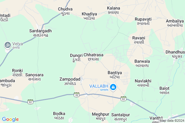
Chhatrasa Map
EDIT Map
Add Your House
 ..
..
Current Corona Virus Infected Patients Count in Rajkot District
| City Name | District Name | Total Covid cases |
|---|---|---|
| Rajkot District | Rajkot | 38 |
| Rajkot | Rajkot | 7 |
Locality Name :
Chhatrasa
( છત્રાસા )
Taluka Name : Dhoraji
District : Rajkot
State : Gujarat
Language : Gujarati and Hindi, Urdu, English, Sindhi, Bengali, Tamil, Malayalam And Marathi
Current Time 01:45 PM
Date: Friday , Mar 14,2025 (IST)
Time zone: IST (UTC+5:30)
Elevation / Altitude: 68 meters. Above Seal level
Telephone Code / Std Code: 02824
Assembly constituency : Dhoraji assembly constituency
Assembly MLA : Dr. Mahendrabhai Padalia
Lok Sabha constituency : Porbandar parliamentary constituency
Parliament MP : RAMESHBHAI LAVJIBHAI DHADUK
Serpanch Name :
Pin Code : 360421
Post Office Name : Moti Marad
Commodities Prices : Manavdar Market / Mandi
Edit below overview about Chhatrasa
Edit below overview about Chhatrasa
OverView of Chhatrasa
in the chhatrasa village majority of sarvaiya rajput. there is a very old fortress development by rajputEdit below overview about Chhatrasa
National Highways Reachable To Chhatrasa
Nationa High Way :NH27
Nationa High Way :NH 8D
Nationa High Way :NH27
Nationa High Way :NH 8D
About Chhatrasa
Chhatrasa is a Village in Dhoraji Taluka in Rajkot District of Gujarat State, India. It is located 116 KM towards South from District head quarters Rajkot. 23 KM from . 361 KM from State capital Gandhinagar
Chhatrasa Pin code is 360421 and postal head office is Moti Marad .
Bhader ( 11 KM ) , Chichod ( 12 KM ) , Patanvav ( 12 KM ) , Velariya ( 13 KM ) , Vadodar ( 14 KM ) are the nearby Villages to Chhatrasa. Chhatrasa is surrounded by Manavadar Taluka towards west , Dhoraji Taluka towards North , Junagadh Taluka towards East , Keshod Taluka towards South .
Manavadar , Junagadh , Keshod , Upleta are the near by Cities to Chhatrasa.
Chhatrasa 2011 Census Details
Chhatrasa Local Language is Gujarati. Chhatrasa Village Total population is 1080 and number of houses are 216. Female Population is 49.4%. Village literacy rate is 67.9% and the Female Literacy rate is 31.0%.
Population
| Census Parameter | Census Data |
| Total Population | 1080 |
| Total No of Houses | 216 |
| Female Population % | 49.4 % ( 534) |
| Total Literacy rate % | 67.9 % ( 733) |
| Female Literacy rate | 31.0 % ( 335) |
| Scheduled Tribes Population % | 0.0 % ( 0) |
| Scheduled Caste Population % | 25.0 % ( 270) |
| Working Population % | 32.1 % |
| Child(0 -6) Population by 2011 | 119 |
| Girl Child(0 -6) Population % by 2011 | 46.2 % ( 55) |
Chhatrasa Census More Deatils.
Politics in Chhatrasa
BJP , INC are the major political parties in this area.Polling Stations /Booths near Chhatrasa
1)Chhadavavdar-22)Juna Kalaria
3)Kalana-1
4)Kalana-2
5)Udakiya
HOW TO REACH Chhatrasa
By Rail
There is no railway station near to Chhatrasa in less than 10 km.Colleges near Chhatrasa
Government Arts And Commerce Colledge
Address :
Sarvopari Science College
Address :
Shri Hn And Rn Doshi
Address :
Nanibrar Kumar Sala
Address :
Creation Bsw / Msw College
Address :
Schools near Chhatrasa
Sarasvati Primary School
Address : dhoraji , dhoraji , rajkot , Gujarat . PIN- 360410 , Post - Dhoraji S.R. ND.T.
M M English School
Address : dhoraji , dhoraji , rajkot , Gujarat . PIN- 360410 , Post - Dhoraji S.R. ND.T.
Bhukhi Kanya Primary School
Address : bhukhi , dhoraji , rajkot , Gujarat . PIN- 360410 , Post - Dhoraji S.R. ND.T.
New Best English School
Address : dhoraji , dhoraji , rajkot , Gujarat . PIN- 360414
Govt Health Centers near Chhatrasa
1) C.M.Z. H. Junagardh , CIVIL HOSPITAL , NEAR AZAD CHOWK , NEAR AZAD CHOWK2) Sargavada , SUBCENTER SARAGWADA , , NEAR BUS STATION SARAGWADA
3) Jamjodhpur , , Balwa Fatak ,
Petrol Bunks in Chhatrasa,Dhoraji
Sai Filling Station Indian Oil Petrol Pump
Keshod - Mangrol Rd; Keshod; Gujarat 326610; India
8.6 KM distance Detail
more ..
Colleges in Chhatrasa,Dhoraji
JM Panera Arts Commerce & Computer Science College
Bantva Road; GJ SH 32; Manavadar; Gujarat 362630; India
17.3 KM distance Detail
more ..
Super Markets in Chhatrasa,Dhoraji
Hina Mandap Service
Panchsheel Society; Bavavadi; Manavadar; Gujarat 362630; India
15.8 KM distance Detail
Central Novelty Store
Jawahar Road; Ratanpara; Manavadar; Gujarat 362630; India
15.9 KM distance Detail
Local Parks in Chhatrasa,Dhoraji
Waghai Botanical Garden
South Dang Division Dang; Sardargadh; Gujarat 394710; India
8.0 KM distance Detail
Police Stations near Chhatrasa,Dhoraji
Junagadh Police Commissioner Office
Shashikunj; Junagadh; Gujarat 362001; India
22.8 KM distance Detail
About Chhatrasa &
History
How to reach Chhatrasa
Tourist Places Near By Chhatrasa
Schools in Chhatrasa
Colleges in Chhatrasa
Temperature & weather of Chhatrasa
places in Chhatrasa
Chhatrasa photos
More Information
How to reach Chhatrasa
Tourist Places Near By Chhatrasa
Schools in Chhatrasa
Colleges in Chhatrasa
Temperature & weather of Chhatrasa
places in Chhatrasa
Chhatrasa photos
More Information
Village Talk
Post News or Events about this Village
Near Cities
Manavadar 14 KM near
Junagadh 22 KM near
Keshod 26 KM near
Upleta 26 KM near
Manavadar 14 KM near
Junagadh 22 KM near
Keshod 26 KM near
Upleta 26 KM near
Near By Taluks
Vanthali 14 KM near
Manavadar 15 KM near
Dhoraji 22 KM near
Keshod 27 KM near
Vanthali 14 KM near
Manavadar 15 KM near
Dhoraji 22 KM near
Keshod 27 KM near
Near By Air Ports
Porbandar Airport 71 KM near
Civil Airport 113 KM near
Govardhanpur Airport 118 KM near
Diu Airport 127 KM near
Porbandar Airport 71 KM near
Civil Airport 113 KM near
Govardhanpur Airport 118 KM near
Diu Airport 127 KM near
Near By Tourist Places
Junagadh 23 KM near
Girnar 23 KM near
Sasan Gir 60 KM near
Chorwad 63 KM near
Porbandar 74 KM near
Junagadh 23 KM near
Girnar 23 KM near
Sasan Gir 60 KM near
Chorwad 63 KM near
Porbandar 74 KM near
Near By Districts
Junagadh 23 KM near
Porbandar 75 KM near
Amreli 111 KM near
Rajkot 112 KM near
Junagadh 23 KM near
Porbandar 75 KM near
Amreli 111 KM near
Rajkot 112 KM near
Near By RailWay Station
Junagadh Junction Rail Way Station 22 KM near
Keshod Rail Way Station 30 KM near
Junagadh Junction Rail Way Station 22 KM near
Keshod Rail Way Station 30 KM near