| Home | City Bus | Maps | Villages | Cities | Rail | Tourist Places | School | College | Pin Codes | Corona Cases Count |
| Distance Calculator Bus Services IFSC Codes Trace Mobile Number Weather Search Place Trace IP Available Cash ATM/Banks Locate Polling Booth Report an Error contact People |
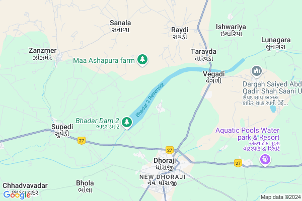
Bhukhi Map
EDIT Map
Add Your House
 ..
..
Current Corona Virus Infected Patients Count in Rajkot District
| City Name | District Name | Total Covid cases |
|---|---|---|
| Rajkot District | Rajkot | 38 |
| Rajkot | Rajkot | 7 |
Locality Name :
Bhukhi
( ભૂખી )
Taluka Name : Dhoraji
District : Rajkot
State : Gujarat
Language : Gujarati and Hindi, Urdu, English, Sindhi, Bengali, Tamil, Malayalam And Marathi
Current Time 09:23 AM
Date: Thursday , Apr 24,2025 (IST)
Time zone: IST (UTC+5:30)
Elevation / Altitude: 68 meters. Above Seal level
Telephone Code / Std Code: 02824
Assembly constituency : Dhoraji assembly constituency
Assembly MLA : Dr. Mahendrabhai Padalia
Lok Sabha constituency : Porbandar parliamentary constituency
Parliament MP : RAMESHBHAI LAVJIBHAI DHADUK
Serpanch Name :
Pin Code : 360410
Post Office Name : Dhoraji S.R. ND.T.
Commodities Prices : Dhoraji Market / Mandi
National Highways Reachable To Bhukhi
Nationa High Way :NH27
Nationa High Way :NH 8D
Nationa High Way :NH27
Nationa High Way :NH 8D
About Bhukhi
Correct below Info and add more info about BhukhiBhukhi is a Village in Dhoraji Taluka in Rajkot District of Gujarat State, India. It is located 79 KM towards South from District head quarters Rajkot. 14 KM from . 326 KM from State capital Gandhinagar
Bhukhi Pin code is 360410 and postal head office is Dhoraji S.R. ND.T..
Taravda ( 6 KM ) , Raydi ( 6 KM ) , Bhutvad ( 6 KM ) , Supedi ( 7 KM ) , Vegdi ( 7 KM ) are the nearby Villages to Bhukhi. Bhukhi is surrounded by Jetpur Taluka towards East , Jamkandorna Taluka towards North , Upleta Taluka towards west , Junagadh Taluka towards South .
Upleta , Junagadh , Manavadar , Kalavad are the near by Cities to Bhukhi.
Bhukhi 2011 Census Details
Bhukhi Local Language is Gujarati. Bhukhi Village Total population is 3095 and number of houses are 642. Female Population is 48.7%. Village literacy rate is 62.6% and the Female Literacy rate is 26.5%.
Population
| Census Parameter | Census Data |
| Total Population | 3095 |
| Total No of Houses | 642 |
| Female Population % | 48.7 % ( 1508) |
| Total Literacy rate % | 62.6 % ( 1937) |
| Female Literacy rate | 26.5 % ( 821) |
| Scheduled Tribes Population % | 2.0 % ( 63) |
| Scheduled Caste Population % | 13.5 % ( 418) |
| Working Population % | 56.7 % |
| Child(0 -6) Population by 2011 | 378 |
| Girl Child(0 -6) Population % by 2011 | 51.3 % ( 194) |
Bhukhi Census More Deatils.
Politics in Bhukhi
BJP , INC are the major political parties in this area.Polling Stations /Booths near Bhukhi
1)Dhoraji-182)Dhoraji-2
3)Dhoraji-54
4)Dhoraji-49
5)Dhank - 5
HOW TO REACH Bhukhi
By Rail
Dhoraji Rail Way Station , Supedi Rail Way Station are the very nearby railway stations to Bhukhi.Colleges near Bhukhi
Government Arts And Commerce Colledge
Address :
Sarvopari Science College
Address :
Shri Hn And Rn Doshi
Address :
Nanibrar Kumar Sala
Address :
Creation Bsw / Msw College
Address :
Schools in Bhukhi
Bhukhi Kanya Primary School
Address : bhukhi , dhoraji , rajkot , Gujarat . PIN- 360410 , Post - Dhoraji S.R. ND.T.
Bhukhi Kumar Primary School
Address : bhukhi , dhoraji , rajkot , Gujarat . PIN- 360410 , Post - Dhoraji S.R. ND.T.
Govt Health Centers near Bhukhi
1) Sargavada , SUBCENTER SARAGWADA , , NEAR BUS STATION SARAGWADA2) C.M.Z. H. Junagardh , CIVIL HOSPITAL , NEAR AZAD CHOWK , NEAR AZAD CHOWK
3) Jamjodhpur , , Balwa Fatak ,
Sub Villages in Bhukhi
Hospitals in Bhukhi,Dhoraji
Dr Jani Surgical Hospital
Jetpur Rd; Hirpara Wadi; Dhoraji; Gujarat 360410; India
6.1 KM distance Detail
more ..
Petrol Bunks in Bhukhi,Dhoraji
HP PETROL PUMP - DHANANJAY PETROLEUM
HP Petrol Pump RSA NO 42/P AND 56/P; Plot NO. 3 Vill. Vegadi; TAL. Dhoraji; Rajkot; Gujarat 360410; India
5.9 KM distance Detail
HP Petrol Pump
Railway Station Rd; Happy Home Colony; Dhoraji; Gujarat 360410; India
6.0 KM distance Detail
K O Shah Petrol Pump
Railway Station Rd; Darbar Gadh; Dhoraji; Gujarat 360410; India
6.0 KM distance Detail
Dhoraji Filling Station Indian Oil Petrol Pump
Happy Home Colony; Rajkot; SH-109; Rajkot Road; Rajkot; Rajkot; Gujarat 360410; India
6.3 KM distance Detail
more ..
Colleges in Bhukhi,Dhoraji
K.O.Shah College
Yami Park Apartment; Venkateshwara Nagar; Dhoraji; Gujarat 360410; India
6.7 KM distance Detail
College Ground
GJ SH 109; Yami Park Apartment; New Dhoraji; Dhoraji; Gujarat 360410; India
6.8 KM distance Detail
Shree Saraswati Nursing College
NEAR BHUTVAD PATIYA; DHORAJI JETPUR HIGHWAY; BHUTVAD; Rajkot; Gujarat 360410; India
7.2 KM distance Detail
more ..
Schools in Bhukhi,Dhoraji
Darul Uloom Miskiniya
Gujarat; Radha Nagar; Madina Nagar; Dhoraji; Gujarat 360410; India
5.8 KM distance Detail
Electronic Shops in Bhukhi,Dhoraji
Patel Mobile
main bazar near vegetable market; Dhoraji; Gujarat 360410; India
5.4 KM distance Detail
Assam Electronics
Main Bazar; Darbargadh Chowk; Dhoraji; Gujarat 360410; India
5.5 KM distance Detail
Morden Computer And Electronices
Happy Home Colony; Dhoraji; Gujarat 360410; India
6.1 KM distance Detail
Local Parks in Bhukhi,Dhoraji
Madhav Darshan Park
behind of madhuli chambers; Jetpur Rd; Dhoraji; Gujarat 360410; India
5.8 KM distance Detail
Dhareshwar Park
Gujarat State Highway 26; Jam Nagar; Dhoraji; Gujarat 360410; India
6.1 KM distance Detail
Police Stations near Bhukhi,Dhoraji
Dhoraji City Police Station ધોરાજી સિટી પોલીસ સ્ટેશન
New Dhoraji; Dhoraji; Gujarat 360410; India
6.6 KM distance Detail
Governement Offices near Bhukhi,Dhoraji
Taluka Health Office- Dhoraji
Jetpur Rd; Baharpura; Dhoraji; Gujarat 360410; India
5.9 KM distance Detail
DY. Collector Office
dy.collector office azaz chock; Dhoraji; Gujarat 360410; India
6.2 KM distance Detail
About Bhukhi &
History
How to reach Bhukhi
Tourist Places Near By Bhukhi
Schools in Bhukhi
Colleges in Bhukhi
Temperature & weather of Bhukhi
places in Bhukhi
Bhukhi photos
More Information
How to reach Bhukhi
Tourist Places Near By Bhukhi
Schools in Bhukhi
Colleges in Bhukhi
Temperature & weather of Bhukhi
places in Bhukhi
Bhukhi photos
More Information
Village Talk
Post News or Events about this Village
Near Cities
Upleta 18 KM near
Junagadh 32 KM near
Manavadar 48 KM near
Kalavad 54 KM near
Upleta 18 KM near
Junagadh 32 KM near
Manavadar 48 KM near
Kalavad 54 KM near
Near By Taluks
Dhoraji 13 KM near
Jetpur 20 KM near
Jamkandorna 21 KM near
Upleta 25 KM near
Dhoraji 13 KM near
Jetpur 20 KM near
Jamkandorna 21 KM near
Upleta 25 KM near
Near By Air Ports
Civil Airport 76 KM near
Porbandar Airport 92 KM near
Govardhanpur Airport 98 KM near
Diu Airport 143 KM near
Civil Airport 76 KM near
Porbandar Airport 92 KM near
Govardhanpur Airport 98 KM near
Diu Airport 143 KM near
Near By Tourist Places
Girnar 30 KM near
Junagadh 32 KM near
Gondal 47 KM near
Rajkot 75 KM near
Sasan Gir 77 KM near
Girnar 30 KM near
Junagadh 32 KM near
Gondal 47 KM near
Rajkot 75 KM near
Sasan Gir 77 KM near
Near By Districts
Junagadh 30 KM near
Rajkot 75 KM near
Amreli 92 KM near
Jamnagar 94 KM near
Junagadh 30 KM near
Rajkot 75 KM near
Amreli 92 KM near
Jamnagar 94 KM near
Near By RailWay Station
Dhoraji Rail Way Station 7.6 KM near
Supedi Rail Way Station 8.2 KM near
Jetalsar Junction Rail Way Station 16 KM near
Navagadh Rail Way Station 20 KM near
Dhoraji Rail Way Station 7.6 KM near
Supedi Rail Way Station 8.2 KM near
Jetalsar Junction Rail Way Station 16 KM near
Navagadh Rail Way Station 20 KM near