| Home | City Bus | Maps | Villages | Cities | Rail | Tourist Places | School | College | Pin Codes | Corona Cases Count |
| Distance Calculator Bus Services IFSC Codes Trace Mobile Number Weather Search Place Trace IP Available Cash ATM/Banks Locate Polling Booth Report an Error contact People |
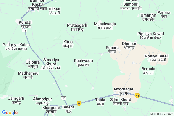
Kuchwada
Kuchwada Map
EDIT Map
Add Your House
 ..
..
Current Corona Virus Infected Patients Count in Raisen District
| City Name | District Name | Total Covid cases |
|---|---|---|
| Raisen District | Raisen | 27 |
Locality Name :
Kuchwada
( कुचवाड़ा )
Tehsil Name : Udaipura
District : Raisen
State : Madhya Pradesh
Division : Bhopal
Language : Hindi
Current Time 10:53 AM
Date: Friday , Apr 25,2025 (IST)
Time zone: IST (UTC+5:30)
Elevation / Altitude: 355 meters. Above Seal level
Telephone Code / Std Code: 07485
Assembly constituency : Udaipura assembly constituency
Assembly MLA : Narendra Shivaji Patel
Lok Sabha constituency : Hoshangabad parliamentary constituency
Parliament MP : UDAY PRATAP SINGH
Serpanch Name :
Pin Code : 464672
Post Office Name :
Alternate Village Name : Kuchawada
Commodities Prices : Udaipura Market / Mandi
Rivers Near Kuchwada
Biranj Nadi
Ikyawan Nadi
Biranj Nadi
Ikyawan Nadi
About Kuchwada
Correct below Info and add more info about KuchwadaKuchwada is a Village in Udaipura Tehsil in Raisen District of Madhya Pradesh State, India. It belongs to Bhopal Division . It is located 74 KM towards East from District head quarters Raisen. 26 KM from Udaipura. 113 KM from State capital Bhopal
Kuchwada Pin code is 464672 and postal head office is .
Pratapgarh ( 4 KM ) , Singhpur ( 5 KM ) , Shahpura ( 5 KM ) , Manakwada ( 6 KM ) , Noornagar ( 6 KM ) are the nearby Villages to Kuchwada. Kuchwada is surrounded by Udaipura Tehsil towards East , Badi Tehsil towards west , Gairatganj Tehsil towards North , Sainkheda Tehsil towards East .
Pipariya , Sohagpur , Raisen , Rahatgarh are the near by Cities to Kuchwada.
This Place is in the border of the Raisen District and Narsinghpur District. Narsinghpur District Sainkheda is East towards this place .
Kuchwada 2011 Census Details
Kuchwada Local Language is Hindi. Kuchwada Village Total population is 2153 and number of houses are 478. Female Population is 46.4%. Village literacy rate is 55.6% and the Female Literacy rate is 20.9%.
Population
| Census Parameter | Census Data |
| Total Population | 2153 |
| Total No of Houses | 478 |
| Female Population % | 46.4 % ( 999) |
| Total Literacy rate % | 55.6 % ( 1198) |
| Female Literacy rate | 20.9 % ( 451) |
| Scheduled Tribes Population % | 6.8 % ( 146) |
| Scheduled Caste Population % | 22.9 % ( 492) |
| Working Population % | 50.8 % |
| Child(0 -6) Population by 2011 | 290 |
| Girl Child(0 -6) Population % by 2011 | 50.3 % ( 146) |
Kuchwada Census More Deatils.
Politics in Kuchwada
Bharatiya Janata Party , BJP , INC are the major political parties in this area.Polling Stations /Booths near Kuchwada
1)Kuchavada2)Kotapar Mahant
3)Khuniya
4)Dhandhala
5)Semarikhuvachand
HOW TO REACH Kuchwada
By Rail
There is no railway station near to Kuchwada in less than 10 km.Colleges near Kuchwada
Bansal College Of Engineering
Address : Bansal College Of Engineering Bisen Road Goharganj
Schools in Kuchwada
Gms Kuchawada
Address : kuchawada , udaipura , raisen , Madhya Pradesh . PIN- 464671 , Post - Khargone
Govt Health Centers near Kuchwada
1) SHC Mankawada , 0 , 0 , AWC Manakwada2) SHC Noornagar , 0 , NEAR MAIN MARKET , BAZAR CHOWK
3) SHC Khargone , 0 , 0 , 0
Colleges in Kuchwada,Udaipura
Aryabhatt College of Technology and Science
Aryabhatt Parishar; Bamhori-Gaybyan Road; Dist-; Udaipura; Madhya Pradesh 464770; India
20.2 KM distance Detail
more ..
Schools in Kuchwada,Udaipura
Govt. Middle School mankawada
address; Street; Repalle; Andhra Pradesh 522265; India
5.5 KM distance Detail
Super Markets in Kuchwada,Udaipura
Raghuwanshi Book Stationary Atta Chuck Udaipura
; Udaipura; Madhya Pradesh 464770; India
20.4 KM distance Detail
Local Parks in Kuchwada,Udaipura
Raghuwanshi Marrige Garden
Silwani Road; Udaipura; Madhya Pradesh 464770; India
19.5 KM distance Detail
About Kuchwada &
History
How to reach Kuchwada
Tourist Places Near By Kuchwada
Schools in Kuchwada
Colleges in Kuchwada
Temperature & weather of Kuchwada
places in Kuchwada
Kuchwada photos
More Information
How to reach Kuchwada
Tourist Places Near By Kuchwada
Schools in Kuchwada
Colleges in Kuchwada
Temperature & weather of Kuchwada
places in Kuchwada
Kuchwada photos
More Information
Village Talk
Post News or Events about this Village
Near Cities
Pipariya 49 KM near
Sohagpur 59 KM near
Raisen 67 KM near
Rahatgarh 79 KM near
Pipariya 49 KM near
Sohagpur 59 KM near
Raisen 67 KM near
Rahatgarh 79 KM near
Near By Taluks
Silwani 17 KM near
Udaipura 24 KM near
Badi 30 KM near
Gairatganj 35 KM near
Silwani 17 KM near
Udaipura 24 KM near
Badi 30 KM near
Gairatganj 35 KM near
Near By Air Ports
Bhopal Airport 117 KM near
Jabalpur Airport 189 KM near
Sonegaon Airport 268 KM near
Khajuraho Airport 273 KM near
Bhopal Airport 117 KM near
Jabalpur Airport 189 KM near
Sonegaon Airport 268 KM near
Khajuraho Airport 273 KM near
Near By Tourist Places
Raisen 69 KM near
Vidisha 77 KM near
Sanchi 82 KM near
Pachmarhi 85 KM near
Bhimbetka 93 KM near
Raisen 69 KM near
Vidisha 77 KM near
Sanchi 82 KM near
Pachmarhi 85 KM near
Bhimbetka 93 KM near
Near By Districts
Raisen 71 KM near
Vidisha 77 KM near
Hoshangabad 89 KM near
Narsinghpur 95 KM near
Raisen 71 KM near
Vidisha 77 KM near
Hoshangabad 89 KM near
Narsinghpur 95 KM near
Near By RailWay Station
Pipariya Rail Way Station 49 KM near
Gadarwara Rail Way Station 58 KM near
Pipariya Rail Way Station 49 KM near
Gadarwara Rail Way Station 58 KM near