| Home | City Bus | Maps | Villages | Cities | Rail | Tourist Places | School | College | Pin Codes | Corona Cases Count |
| Distance Calculator Bus Services IFSC Codes Trace Mobile Number Weather Search Place Trace IP Available Cash ATM/Banks Locate Polling Booth Report an Error contact People |
Bhanwargarh
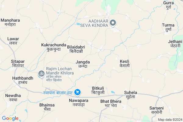
Bhanwargarh Map
EDIT Map
Add Your House
 ..
..
Current Corona Virus Infected Patients Count in Raipur District
| City Name | District Name | Total Covid cases |
|---|---|---|
| Raipur District | Raipur | 3 |
| Raipur | Raipur | 3 |
Locality Name :
Bhanwargarh
( भंवरगढ़ )
Tehsil Name : Simga
District : Raipur
State : Chattisgarh
Language : Chhattisgarhi and Hindi
Current Time 12:24 PM
Date: Sunday , Apr 27,2025 (IST)
Time zone: IST (UTC+5:30)
Elevation / Altitude: 283 meters. Above Seal level
Telephone Code / Std Code: 07721
Assembly constituency : Baloda Bazar assembly constituency
Assembly MLA : Tank Ram Verma
Lok Sabha constituency : Raipur parliamentary constituency
Parliament MP : Sunil Kumar Soni
Serpanch Name :
Alternate Village Name : Bhowargarh
Commodities Prices : Neora Market / Mandi
Rivers Near Bhanwargarh
Khorsi
Mahanadi :Mahanadi River :महानदी नदी
Khorsi
Mahanadi :Mahanadi River :महानदी नदी
About Bhanwargarh
Correct below Info and add more info about BhanwargarhBhanwargarh is a Village in Simga Tehsil in Raipur District of Chattisgarh State, India. It is located 64 KM towards North from District head quarters Raipur. 13 KM from Simga. 63 KM from State capital Raipur
Kesli ( 3 KM ) , Kukrachunda ( 5 KM ) , Suhela ( 6 KM ) , Bodtara ( 6 KM ) , Gadadih ( 7 KM ) are the nearby Villages to Bhanwargarh. Bhanwargarh is surrounded by Bhatapara Tehsil towards North , Tilda Tehsil towards South , Palari Tehsil towards East , Baloda Bazar Tehsil towards East .
Bhatapara , Tilda Newra , Baloda Bazar , Bemetra are the near by Cities to Bhanwargarh.
This Place is in the border of the Raipur District and Durg District. Durg District Bemetara is west towards this place .
Bhanwargarh(Bhawargarh) 2011 Census Details
Bhanwargarh Local Language is Chhattisgarhi. Bhanwargarh(Bhawargarh) Village Total population is 609 and number of houses are 115. Female Population is 49.9%. Village literacy rate is 66.8% and the Female Literacy rate is 29.1%.
Population
| Census Parameter | Census Data |
| Total Population | 609 |
| Total No of Houses | 115 |
| Female Population % | 49.9 % ( 304) |
| Total Literacy rate % | 66.8 % ( 407) |
| Female Literacy rate | 29.1 % ( 177) |
| Scheduled Tribes Population % | 13.8 % ( 84) |
| Scheduled Caste Population % | 13.5 % ( 82) |
| Working Population % | 59.6 % |
| Child(0 -6) Population by 2011 | 92 |
| Girl Child(0 -6) Population % by 2011 | 51.1 % ( 47) |
Bhanwargarh(Bhawargarh) Census More Deatils.
Politics in Bhanwargarh
Bharatiya Janata Party , BJP , INC are the major political parties in this area.Polling Stations /Booths near Bhanwargarh
1)Bhatbhera2)Gujra
3)Limahi
4)Jalso
5)Baoudabajar
HOW TO REACH Bhanwargarh
By Rail
Bhatapara Rail Way Station , Hathbandh Rail Way Station are the very nearby railway stations to Bhanwargarh.Pincodes near Bhanwargarh
493113 ( Hathband ) , 493195 ( Hirmi ) , 493331 ( Rawan )Colleges near Bhanwargarh
College Of Agriculture
Address :
Set Fulcha Agrawall Smrity Mahavidyalay Nawapara
Address :
Sahid Veer Narayan Singh Govt. Collage Bilaigarh
Address :
Kruti Institute Of Techology And Engineering
Address : 2km From Vidhan Sabha
Govt Brijlal Verma Collage, Palari, Balodabazar
Address :
Schools near Bhanwargarh
Bandna Publick School
Address : simga , simga , raipur , Chattisgarh . PIN- 493101 , Post - Simga
Shakti Convent School
Address : simga , simga , raipur , Chattisgarh . PIN- 493101 , Post - Simga
Govt M.s.
Address : nawagaon , simga , raipur , Chattisgarh . PIN- 493101 , Post - Simga
Govt.n.m.s.dhodha
Address : dhoda , simga , raipur , Chattisgarh . PIN- 493113 , Post - Hathband
Govt Health Centers near Bhanwargarh
1) SHC Jagda , , High School Ke Pass Jagda ,2) SHC Bitkuli(RIPR) , , Samudayik Bhawan Bitkuli ,
3) SHC Farhada , , Gram Punchayat Bhawan Farhada ,
Hospitals in Bhanwargarh,Simga
Bio technecal & formecik lab
Bhathapara Road; Suhela; Chhattisgarh 493195; India
6.6 KM distance Detail
more ..
Petrol Bunks in Bhanwargarh,Simga
HP PETROL PUMP - SAUDAMINI FUELS
HP Petrol Pump Village Suhela PO Hirmi; Tehsil Simga; Raipur; Chhattisgarh 493195; India
6.2 KM distance Detail
more ..
Colleges in Bhanwargarh,Simga
Govt. Minimata Girls College; Balodabazar
Baloda Bazar; Bhatapara; Chhattisgarh BHATAPARA; India
11.7 KM distance Detail
Government Polytechnic Bhatapara
Deori; Distt.-Balodabazar; Bhatapara; Chhattisgarh 493118; India
11.7 KM distance Detail
Dau Kalyan Singh College Of Agriculture and Research Station; Alesur Bhatapara
Alesur; Chhattisgarh 493118; India
12.1 KM distance Detail
Government G. N. A. P.G. College
Sant Mata Karma Ward; Bhatapara; Chhattisgarh 493118; India
12.8 KM distance Detail
more ..
About Bhanwargarh &
History
How to reach Bhanwargarh
Tourist Places Near By Bhanwargarh
Schools in Bhanwargarh
Colleges in Bhanwargarh
Temperature & weather of Bhanwargarh
places in Bhanwargarh
Bhanwargarh photos
More Information
How to reach Bhanwargarh
Tourist Places Near By Bhanwargarh
Schools in Bhanwargarh
Colleges in Bhanwargarh
Temperature & weather of Bhanwargarh
places in Bhanwargarh
Bhanwargarh photos
More Information
Village Talk
Post News or Events about this Village
Near Cities
Bhatapara 10 KM near
Tilda Newra 21 KM near
Baloda Bazar 26 KM near
Bemetra 46 KM near
Bhatapara 10 KM near
Tilda Newra 21 KM near
Baloda Bazar 26 KM near
Bemetra 46 KM near
Near By Taluks
Simga 12 KM near
Bhatapara 17 KM near
Tilda 23 KM near
Palari 30 KM near
Simga 12 KM near
Bhatapara 17 KM near
Tilda 23 KM near
Palari 30 KM near
Near By Air Ports
Raipur Airport 62 KM near
Jabalpur Airport 263 KM near
Sonegaon Airport 340 KM near
Ranchi Airport 442 KM near
Raipur Airport 62 KM near
Jabalpur Airport 263 KM near
Sonegaon Airport 340 KM near
Ranchi Airport 442 KM near
Near By Tourist Places
Bilaspur 58 KM near
Raipur 60 KM near
Mahasamund 70 KM near
Bhilai 84 KM near
Janjgir 86 KM near
Bilaspur 58 KM near
Raipur 60 KM near
Mahasamund 70 KM near
Bhilai 84 KM near
Janjgir 86 KM near
Near By Districts
Bilaspur 58 KM near
Raipur 61 KM near
Mahasamund 70 KM near
Kabirdham 92 KM near
Bilaspur 58 KM near
Raipur 61 KM near
Mahasamund 70 KM near
Kabirdham 92 KM near
Near By RailWay Station
Bhatapara Rail Way Station 10 KM near
Tilda Rail Way Station 19 KM near
Bhatapara Rail Way Station 10 KM near
Tilda Rail Way Station 19 KM near