| Home | City Bus | Maps | Villages | Cities | Rail | Tourist Places | School | College | Pin Codes | Corona Cases Count |
| Distance Calculator Bus Services IFSC Codes Trace Mobile Number Weather Search Place Trace IP Available Cash ATM/Banks Locate Polling Booth Report an Error contact People |
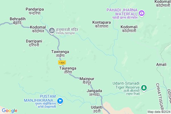
Amalipadar
Amalipadar Map
EDIT Map
Add Your House
 ..
..
Current Corona Virus Infected Patients Count in Raipur District
| City Name | District Name | Total Covid cases |
|---|---|---|
| Raipur District | Raipur | 3 |
| Raipur | Raipur | 3 |
Locality Name :
Amalipadar
( अमलीपदर )
Tehsil Name : Mainpur
District : Raipur
State : Chattisgarh
Language : Chhattisgarhi and Hindi
Current Time 11:35 AM
Date: Tuesday , Apr 29,2025 (IST)
Time zone: IST (UTC+5:30)
Elevation / Altitude: 317 meters. Above Seal level
Telephone Code / Std Code: 07700
Assembly constituency : Bindranawagarh assembly constituency
Assembly MLA : Janak Dhruw
Lok Sabha constituency : Mahasamund parliamentary constituency
Parliament MP : CHUNNI LAL SAHU
Serpanch Name :
Pin Code : 493890
Post Office Name : Deobhog
Commodities Prices : Belarbahara Market / Mandi
Amalipadar Live Weather
Temperature: 37.8 °C
clear sky
Humidity: 18%
Wind : 3.18 mt/sec towards W
StationName : "KharhiÄ\u0081l"
observed on 29 Mins Back
Temperature: 37.8 °C
clear sky
Humidity: 18%
Wind : 3.18 mt/sec towards W
StationName : "KharhiÄ\u0081l"
observed on 29 Mins Back
Amalipadar Weather Forecast for Next 5 days
30-04-2025
25.1°C to 39.9°C
clear sky, few clouds, scattered clouds, light rain, broken clouds
25.1°C to 39.9°C
clear sky, few clouds, scattered clouds, light rain, broken clouds
01-05-2025
25.2°C to 38.7°C
scattered clouds, few clouds, clear sky, light rain
25.2°C to 38.7°C
scattered clouds, few clouds, clear sky, light rain
02-05-2025
25.3°C to 40.1°C
scattered clouds, clear sky
25.3°C to 40.1°C
scattered clouds, clear sky
03-05-2025
23.7°C to 38.7°C
scattered clouds, clear sky, moderate rain, light rain
23.7°C to 38.7°C
scattered clouds, clear sky, moderate rain, light rain
04-05-2025
24.2°C to 40.6°C
few clouds, clear sky, scattered clouds, light rain, broken clouds
24.2°C to 40.6°C
few clouds, clear sky, scattered clouds, light rain, broken clouds
National Highways Reachable To Amalipadar
Nationa High Way :NH130C
Nationa High Way :NH130C
Rivers Near Amalipadar
Sondur
Oilar Jhor :Oilar Jhor
Sondur
Oilar Jhor :Oilar Jhor
About Amalipadar
Correct below Info and add more info about AmalipadarAmalipadar is a Village in Mainpur Tehsil in Raipur District of Chattisgarh State, India. It is located 162 KM towards South from District head quarters Raipur. 163 KM from State capital Raipur
Amalipadar Pin code is 493890 and postal head office is Deobhog .
Amalipadar is surrounded by Sinapali Tehsil towards East , Boden Tehsil towards East , Raighar Tehsil towards west , Chandahandi Tehsil towards South .
Umarkote , Kantabanji , Kanker , Titlagarh are the near by Cities to Amalipadar.
Amlipadar 2011 Census Details
Amalipadar Local Language is Chhattisgarhi. Amlipadar Village Total population is 3748 and number of houses are 1014. Female Population is 51.5%. Village literacy rate is 59.8% and the Female Literacy rate is 25.0%.
Population
| Census Parameter | Census Data |
| Total Population | 3748 |
| Total No of Houses | 1014 |
| Female Population % | 51.5 % ( 1929) |
| Total Literacy rate % | 59.8 % ( 2241) |
| Female Literacy rate | 25.0 % ( 937) |
| Scheduled Tribes Population % | 25.4 % ( 952) |
| Scheduled Caste Population % | 6.0 % ( 225) |
| Working Population % | 38.0 % |
| Child(0 -6) Population by 2011 | 442 |
| Girl Child(0 -6) Population % by 2011 | 47.7 % ( 211) |
Amlipadar Census More Deatils.
Politics in Amalipadar
Bharatiya Janata Party , BJP , INC are the major political parties in this area.Polling Stations /Booths near Amalipadar
1)Gudbheli2)Badegobra
3)Suroongpani
4)Jangal Dhavalpur
5)Kothigaon
HOW TO REACH Amalipadar
By Rail
There is no railway station near to Amalipadar in less than 10 km.Colleges near Amalipadar
College Of Agriculture
Address :
Set Fulcha Agrawall Smrity Mahavidyalay Nawapara
Address :
Sahid Veer Narayan Singh Govt. Collage Bilaigarh
Address :
Kruti Institute Of Techology And Engineering
Address : 2km From Vidhan Sabha
Govt Brijlal Verma Collage, Palari, Balodabazar
Address :
Schools near Amalipadar
Govt.r.s.m.s.dheharguda
Address : deharguda , mainpur , raipur , Chattisgarh . PIN- 493888
Middle School
Address : chalnapadar , mainpur , raipur , Chattisgarh . PIN- 493890 , Post - Deobhog
Middle School
Address : kuhimal , mainpur , raipur , Chattisgarh . PIN- 493890 , Post - Deobhog
Middle School
Address : girhola , mainpur , raipur , Chattisgarh . PIN- 493888
Govt Health Centers near Amalipadar
1) SHC Koyba , Sub Health centre koyba , , main road koiba2) SHC Jangda , Sub Health centre Jangada , ,
3) SHC Karlajhar , Sub Health centre Karlajhar , ,
Schools in Amalipadar,Mainpur
Government Middle School
Mainpur; Raipur; Indagaon; Chhattisgarh 493888; India
13.9 KM distance Detail
Super Markets in Amalipadar,Mainpur
Local Parks in Amalipadar,Mainpur
Police Stations near Amalipadar,Mainpur
Governement Offices near Amalipadar,Mainpur
About Amalipadar &
History
How to reach Amalipadar
Tourist Places Near By Amalipadar
Schools in Amalipadar
Colleges in Amalipadar
Temperature & weather of Amalipadar
places in Amalipadar
Amalipadar photos
More Information
How to reach Amalipadar
Tourist Places Near By Amalipadar
Schools in Amalipadar
Colleges in Amalipadar
Temperature & weather of Amalipadar
places in Amalipadar
Amalipadar photos
More Information
Village Talk
Post News or Events about this Village
Near Cities
Umarkote 62 KM near
Kantabanji 81 KM near
Kanker 96 KM near
Titlagarh 99 KM near
Umarkote 62 KM near
Kantabanji 81 KM near
Kanker 96 KM near
Titlagarh 99 KM near
Near By Taluks
Mainpur 0 KM near
Sinapali 38 KM near
Boden 40 KM near
Raighar 43 KM near
Mainpur 0 KM near
Sinapali 38 KM near
Boden 40 KM near
Raighar 43 KM near
Near By Air Ports
Raipur Airport 143 KM near
Vishakhapatnam Airport 321 KM near
Rajahmundry Airport 384 KM near
Sonegaon Airport 395 KM near
Raipur Airport 143 KM near
Vishakhapatnam Airport 321 KM near
Rajahmundry Airport 384 KM near
Sonegaon Airport 395 KM near
Near By Tourist Places
Kanker 94 KM near
Kalahandi 107 KM near
Dhamtari 111 KM near
Mahasamund 120 KM near
Jagdalpur 137 KM near
Kanker 94 KM near
Kalahandi 107 KM near
Dhamtari 111 KM near
Mahasamund 120 KM near
Jagdalpur 137 KM near
Near By Districts
Nuapada 86 KM near
Kanker 96 KM near
Kalahandi 104 KM near
Dhamtari 110 KM near
Nuapada 86 KM near
Kanker 96 KM near
Kalahandi 104 KM near
Dhamtari 110 KM near
Near By RailWay Station
Kantabanji Rail Way Station 80 KM near
Khariar Road Rail Way Station 95 KM near
Kantabanji Rail Way Station 80 KM near
Khariar Road Rail Way Station 95 KM near