| Home | City Bus | Maps | Villages | Cities | Rail | Tourist Places | School | College | Pin Codes | Corona Cases Count |
| Distance Calculator Bus Services IFSC Codes Trace Mobile Number Weather Search Place Trace IP Available Cash ATM/Banks Locate Polling Booth Report an Error contact People |
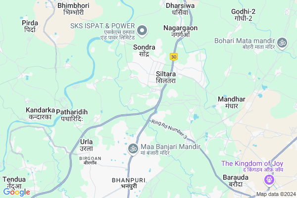
Nimora
Nimora Map
EDIT Map
Add Your House
 ..
..
Current Corona Virus Infected Patients Count in Raipur District
| City Name | District Name | Total Covid cases |
|---|---|---|
| Raipur District | Raipur | 3 |
| Raipur | Raipur | 3 |
Locality Name :
Nimora
( निमोरा )
Tehsil Name : Dharsiwa
District : Raipur
State : Chattisgarh
Language : Chhattisgarhi and Hindi
Current Time 11:46 AM
Date: Friday , Apr 25,2025 (IST)
Time zone: IST (UTC+5:30)
Elevation / Altitude: 286 meters. Above Seal level
Telephone Code / Std Code: 0771
Assembly constituency : Dharsiwa assembly constituency
Assembly MLA : Anuj Sharma
Lok Sabha constituency : Raipur parliamentary constituency
Parliament MP : Sunil Kumar Soni
Serpanch Name :
Pin Code : 493221
Post Office Name : Birgaon
Commodities Prices : Raipur Market / Mandi
Nimora Live Weather
Temperature: 38.2 °C
haze
Humidity: 23%
Wind : 3.09 mt/sec towards W
StationName : "Raipur"
observed on 7 Mins Back
Temperature: 38.2 °C
haze
Humidity: 23%
Wind : 3.09 mt/sec towards W
StationName : "Raipur"
observed on 7 Mins Back
Nimora Weather Forecast for Next 5 days
26-04-2025
32.6°C to 43.4°C
clear sky, overcast clouds, broken clouds
32.6°C to 43.4°C
clear sky, overcast clouds, broken clouds
27-04-2025
30.6°C to 43.6°C
broken clouds, clear sky, few clouds, scattered clouds, light rain, overcast clouds
30.6°C to 43.6°C
broken clouds, clear sky, few clouds, scattered clouds, light rain, overcast clouds
28-04-2025
29.0°C to 39.0°C
overcast clouds, broken clouds, light rain, clear sky
29.0°C to 39.0°C
overcast clouds, broken clouds, light rain, clear sky
29-04-2025
26.8°C to 40.2°C
clear sky, scattered clouds, light rain, few clouds
26.8°C to 40.2°C
clear sky, scattered clouds, light rain, few clouds
30-04-2025
27.6°C to 42.0°C
scattered clouds, clear sky
27.6°C to 42.0°C
scattered clouds, clear sky
Edit below overview about Nimora
Edit below overview about Nimora
OverView of Nimora
very good nearest Agricultural area of Paddy field one Big Farmer name Sudhir Kumar Jha Known as "Jha-Maharaj"Edit below overview about Nimora
Rivers Near Nimora
Shivnath :Seonath
Mahanadi :Mahanadi River :महानदी नदी
Shivnath :Seonath
Mahanadi :Mahanadi River :महानदी नदी
About Nimora
Nimora is a Village in Dharsiwa Tehsil in Raipur District of Chattisgarh State, India. It is located 14 KM towards North from District head quarters Raipur. 5 KM from Dharsiwa. 12 KM from State capital Raipur
Nimora Pin code is 493221 and postal head office is Birgaon .
Sondra ( 2 KM ) , Siltara ( 4 KM ) , Industrial Area ( 4 KM ) , Rawabhata ( 4 KM ) , Murethi ( 5 KM ) are the nearby Villages to Nimora. Nimora is surrounded by Raipur Tehsil towards South , Tilda Tehsil towards East , Berla Tehsil towards North , Dhamdha Tehsil towards west .
Birgaon , Raipur , Tilda Newra , Durg-Bhilai Nagar are the near by Cities to Nimora.
Nimora -1 (Nimora) 2011 Census Details
Nimora Local Language is Chhattisgarhi. Nimora -1 (Nimora) Village Total population is 2179 and number of houses are 403. Female Population is 49.1%. Village literacy rate is 63.4% and the Female Literacy rate is 27.5%.
Population
| Census Parameter | Census Data |
| Total Population | 2179 |
| Total No of Houses | 403 |
| Female Population % | 49.1 % ( 1070) |
| Total Literacy rate % | 63.4 % ( 1381) |
| Female Literacy rate | 27.5 % ( 600) |
| Scheduled Tribes Population % | 0.1 % ( 3) |
| Scheduled Caste Population % | 22.7 % ( 495) |
| Working Population % | 43.9 % |
| Child(0 -6) Population by 2011 | 350 |
| Girl Child(0 -6) Population % by 2011 | 48.6 % ( 170) |
Nimora -1 (Nimora) Census More Deatils.
Politics in Nimora
Bharatiya Janata Party , BJP , INC are the major political parties in this area.Polling Stations /Booths near Nimora
1)Sakri2)Sankra
3)Nilja
4)Nimora
5)Devri
HOW TO REACH Nimora
By Rail
Mandhar Rail Way Station , Urkura Rail Way Station are the very nearby railway stations to Nimora.Colleges near Nimora
Vindhya Institute Of Technology (vit)
Address : Raipur (cg)
Shiksha Snatak Mahavidyalaya
Address : Mandhar, Distt. Raipur
Pragati College Of Engineering And Management
Address : Sejbahar
Schools in Nimora
M S
Address : nimora , dharshiwa , raipur , Chattisgarh . PIN- 493221 , Post - Birgaon
Govt Health Centers near Nimora
1) SHC Sondara , SHC Sondara , Near Aayurvedik Hospital, , Bazar Chowk,2) Ward 06 Birangana Awantibai A , W.R.S. Prem Nagar , Prem Nagar , W.R.S. Colony
3) Ward 04 Yatiyaytnlal A @Night Selter Kaksha Bhanpuri , Kavilash Nagar Aaganwadi , Kavilash Nagar , Bhanpuri
Hospitals in Nimora,Dharsiwa
Gov. Hospital
Rawabhata; Transport Nagar; Birgoan; Raipur; Chhattisgarh 492003; India
3.8 KM distance Detail
ESI Hospital Raipur
Birpur; Rawabhata; Industrial Area; Bhanpuri; Raipur; Chhattisgarh 492003; India
3.8 KM distance Detail
more ..
Petrol Bunks in Nimora,Dharsiwa
Bharat Petroleum
Dhaneli 1; Raipur; NH-200; Bilaspur Raipur Highway; Raipur; Raipur; Chhattisgarh 497222; India
2.5 KM distance Detail
more ..
Colleges in Nimora,Dharsiwa
Bacon Mahavidyla Birgaon
Transport Nagar; Birgoan; Raipur; Chhattisgarh 492003; India
3.5 KM distance Detail
AISECT - NSDC
Main Road; Adawani Colony; Madhav Rao Sapre Nagar; Birgoan; Raipur; Chhattisgarh 492001; India
5.6 KM distance Detail
Alvina Aata Chakki Urla Raipur
Urla Rd; Urla Basti; Birgoan; Urla; Chhattisgarh 492003; India
6.7 KM distance Detail
more ..
Schools in Nimora,Dharsiwa
Government Primary School Nimora New
NIMORA Abhanpur; Raipur; Chhattisgarh 493661; India
0.2 KM distance Detail
Goverment Primary & Middle School Dhaneli1
Raipur; Chhattisgarh 493111; India
1.4 KM distance Detail
Super Markets in Nimora,Dharsiwa
अनुभव मोबाइल एंड प्रोविजन स्टोर AnuBhav Mobile
Sarora; Chhattisgarh 493221; India
1.0 KM distance Detail
Local Parks in Nimora,Dharsiwa
Amar Jawan
Raipur - Bilaspur Expy; Rawabhata; Industrial Area; Birgoan; Raipur; Chhattisgarh 492003; India
4.9 KM distance Detail
Gandhi Uddhan
Nagar Palika Nigam; Birgoan Road; Birgoan; Raipur; Chhattisgarh 492001; India
6.2 KM distance Detail
Santoshi Nagar Khamtari Park
Santoshi Nagar; Khamtarai; Raipur; Chhattisgarh 492014; India
9.3 KM distance Detail
Police Stations near Nimora,Dharsiwa
Police Office
Rawabhata; Industrial Area; Bhanpuri; Raipur; Chhattisgarh 492003; India
4.8 KM distance Detail
Urla Police Station
Urla Industrial Complex; Birgoan; Raipur; Chhattisgarh 492003; India
6.6 KM distance Detail
Governement Offices near Nimora,Dharsiwa
RAIPUR PUNJAB FREIGHT CARRIER
Transport Nagar; Birgoan; Raipur; Chhattisgarh 492003; India
4.4 KM distance Detail
Mahabir Transport
Transport Nagar; Birgoan; Raipur; Chhattisgarh 492003; India
4.7 KM distance Detail
Goodwill Raipur Finance& Insurence Services
Rawabhata; Industrial Area; Bhanpuri; Raipur; Chhattisgarh 492003; India
4.9 KM distance Detail
About Nimora &
History
How to reach Nimora
Tourist Places Near By Nimora
Schools in Nimora
Colleges in Nimora
Temperature & weather of Nimora
places in Nimora
Nimora photos
More Information
How to reach Nimora
Tourist Places Near By Nimora
Schools in Nimora
Colleges in Nimora
Temperature & weather of Nimora
places in Nimora
Nimora photos
More Information
Village Talk
Post News or Events about this Village
Near Cities
Birgaon 6 KM near
Raipur 12 KM near
Tilda Newra 29 KM near
Durg-Bhilai Nagar 30 KM near
Birgaon 6 KM near
Raipur 12 KM near
Tilda Newra 29 KM near
Durg-Bhilai Nagar 30 KM near
Near By Taluks
Dharsiwa 5 KM near
Raipur 12 KM near
Tilda 28 KM near
Berla 29 KM near
Dharsiwa 5 KM near
Raipur 12 KM near
Tilda 28 KM near
Berla 29 KM near
Near By Air Ports
Raipur Airport 23 KM near
Jabalpur Airport 257 KM near
Sonegaon Airport 302 KM near
Khajuraho Airport 475 KM near
Raipur Airport 23 KM near
Jabalpur Airport 257 KM near
Sonegaon Airport 302 KM near
Khajuraho Airport 475 KM near
Near By Tourist Places
Raipur 12 KM near
Bhilai 36 KM near
Durg 47 KM near
Mahasamund 60 KM near
Rajnandgaon 78 KM near
Raipur 12 KM near
Bhilai 36 KM near
Durg 47 KM near
Mahasamund 60 KM near
Rajnandgaon 78 KM near
Near By Districts
Raipur 13 KM near
Durg 47 KM near
Mahasamund 60 KM near
Rajnandgaon 78 KM near
Raipur 13 KM near
Durg 47 KM near
Mahasamund 60 KM near
Rajnandgaon 78 KM near
Near By RailWay Station
Mandhar Rail Way Station 6.8 KM near
Urkura Rail Way Station 7.9 KM near
Raipur Junction Rail Way Station 11 KM near
Tilda Rail Way Station 30 KM near
Mandhar Rail Way Station 6.8 KM near
Urkura Rail Way Station 7.9 KM near
Raipur Junction Rail Way Station 11 KM near
Tilda Rail Way Station 30 KM near