| Home | City Bus | Maps | Villages | Cities | Rail | Tourist Places | School | College | Pin Codes | Corona Cases Count |
| Distance Calculator Bus Services IFSC Codes Trace Mobile Number Weather Search Place Trace IP Available Cash ATM/Banks Locate Polling Booth Report an Error contact People |
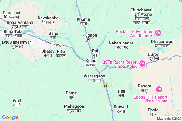
Kolad
Kolad Map
EDIT Map
Add Your House
 ..
..
Current Corona Virus Infected Patients Count in Raigad District
| City Name | District Name | Total Covid cases |
|---|
Locality Name :
Kolad
( कोलाड )
Taluka Name : Roha
District : Raigad
State : Maharashtra
Region : Konkan
Division : Konkan
Language : Marathi and Hindi
Current Time 01:14 PM
Date: Friday , Apr 25,2025 (IST)
Time zone: IST (UTC+5:30)
Elevation / Altitude: 11 meters. Above Seal level
Telephone Code / Std Code: 02194
Assembly constituency : Pen assembly constituency
Assembly MLA : Ravisheth Patil
Lok Sabha constituency : Raigad parliamentary constituency
Parliament MP : Tatkare Sunil Dattatray
Serpanch Name :
Pin Code : 402304
Post Office Name : Kolad
Commodities Prices : Roha Market / Mandi
Kolad Live Weather
Temperature: 35.5 °C
scattered clouds
Humidity: 23%
Wind : 2.23 mt/sec towards NW
StationName : "Roha"
observed on 2 Hours Back
Temperature: 35.5 °C
scattered clouds
Humidity: 23%
Wind : 2.23 mt/sec towards NW
StationName : "Roha"
observed on 2 Hours Back
Kolad Weather Forecast for Next 5 days
26-04-2025
26.0°C to 38.8°C
scattered clouds, few clouds, clear sky, broken clouds
26.0°C to 38.8°C
scattered clouds, few clouds, clear sky, broken clouds
27-04-2025
24.8°C to 39.1°C
scattered clouds, clear sky
24.8°C to 39.1°C
scattered clouds, clear sky
28-04-2025
24.3°C to 37.9°C
clear sky, few clouds
24.3°C to 37.9°C
clear sky, few clouds
29-04-2025
23.9°C to 37.1°C
clear sky
23.9°C to 37.1°C
clear sky
30-04-2025
24.1°C to 37.1°C
clear sky
24.1°C to 37.1°C
clear sky
National Highways Reachable To Kolad
Nationa High Way :NH753F
Nationa High Way :NH753F
Rivers Near Kolad
Amba
Kundalika
Amba
Kundalika
About Kolad
Correct below Info and add more info about KoladKolad is a Village in Roha Taluka in Raigad District of Maharashtra State, India. It belongs to Konkan region . It belongs to Konkan Division . It is located 52 KM towards East from District head quarters Alibag. 11 KM from Roha. 90 KM from State capital Mumbai
Kolad Pin code is 402304 and postal head office is Kolad .
Ambewadi ( 1 KM ) , Gove ( 2 KM ) , Sambhe ( 3 KM ) , Pugaon ( 3 KM ) , Killa ( 4 KM ) are the nearby Villages to Kolad. Kolad is surrounded by Tala Taluka towards South , Sudhagad Taluka towards North , Mangaon Taluka towards South , Murud Taluka towards west .
Nandgaon , Pen , Mahad , Lonavla are the near by Cities to Kolad.
It is near to arabian sea. There is a chance of humidity in the weather.
Kolad 2011 Census Details
Kolad Local Language is Marathi. Kolad Village Total population is 1684 and number of houses are 353. Female Population is 49.5%. Village literacy rate is 78.1% and the Female Literacy rate is 35.7%.
Population
| Census Parameter | Census Data |
| Total Population | 1684 |
| Total No of Houses | 353 |
| Female Population % | 49.5 % ( 833) |
| Total Literacy rate % | 78.1 % ( 1316) |
| Female Literacy rate | 35.7 % ( 602) |
| Scheduled Tribes Population % | 8.4 % ( 142) |
| Scheduled Caste Population % | 10.5 % ( 176) |
| Working Population % | 32.5 % |
| Child(0 -6) Population by 2011 | 163 |
| Girl Child(0 -6) Population % by 2011 | 50.9 % ( 83) |
Kolad Census More Deatils.
Politics in Kolad
PWPI , Nationalist Congress Party , BJP , NCP , SHS , INC are the major political parties in this area.Polling Stations /Booths near Kolad
1)Ambeghar 22)Ambewadi 1
3)Ambewadi 2
4)Palas
5)Varap
HOW TO REACH Kolad
By Rail
Kolad Rail Way Station is the very nearby railway stations to Kolad. are the Rail way stations reachable from near by towns.By Road
Murud are the nearby by towns to Kolad having road connectivity to KoladColleges near Kolad
Kes's Dr. C.d.deshmukh College, Roha.
Address :
Schools in Kolad
Kolad High Sch And Jr.college
Address : kolad , roha , raigarh (maharashtra) , Maharashtra . PIN- 402304 , Post - Kolad
R.z.p Pri Central Sch Kolad
Address : kolad , roha , raigarh (maharashtra) , Maharashtra . PIN- 402304 , Post - Kolad
Govt Health Centers near Kolad
1) Mahagaon , SubCenter Mahagaon , Mahagaon tal mangaon Raigad - Mangaon Raigad , Mahagaon tal mangaon Raigad - Mangaon Raigad2) Mangaon , SubCenter Mahagaon , ,
3) Ratwad , SubCenter Ratwad , Near temple , SubCenter Ratwad Tal Mangaon Raigad
Schools in Kolad,Roha
Electronic Shops in Kolad,Roha
Super Markets in Kolad,Roha
Local Parks in Kolad,Roha
Tamini Ghat Water Fall
Tamhini Ghat Rd; Sanaswadi; Maharashtra 402120; India
21.7 KM distance Detail
Police Stations near Kolad,Roha
Governement Offices near Kolad,Roha
About Kolad &
History
How to reach Kolad
Tourist Places Near By Kolad
Schools in Kolad
Colleges in Kolad
Temperature & weather of Kolad
places in Kolad
Kolad photos
More Information
How to reach Kolad
Tourist Places Near By Kolad
Schools in Kolad
Colleges in Kolad
Temperature & weather of Kolad
places in Kolad
Kolad photos
More Information
Village Talk
Post News or Events about this Village
Near Cities
Nandgaon 34 KM near
Pen 43 KM near
Mahad 45 KM near
Lonavla 48 KM near
Nandgaon 34 KM near
Pen 43 KM near
Mahad 45 KM near
Lonavla 48 KM near
Near By Taluks
Roha 11 KM near
Tala 17 KM near
Sudhagad 21 KM near
Mangaon 23 KM near
Roha 11 KM near
Tala 17 KM near
Sudhagad 21 KM near
Mangaon 23 KM near
Near By Air Ports
Lohegaon Airport 86 KM near
Chhatrapati Shivaji International Airport 94 KM near
Gandhinagar Airport 206 KM near
Kolhapur Airport 254 KM near
Lohegaon Airport 86 KM near
Chhatrapati Shivaji International Airport 94 KM near
Gandhinagar Airport 206 KM near
Kolhapur Airport 254 KM near
Near By Tourist Places
Kolad 0 KM near
Raigad 13 KM near
Nagothane 18 KM near
Murud Janjira 32 KM near
Lavasa 35 KM near
Kolad 0 KM near
Raigad 13 KM near
Nagothane 18 KM near
Murud Janjira 32 KM near
Lavasa 35 KM near
Near By Districts
Raigad 50 KM near
Pune 78 KM near
Mumbai 83 KM near
Thane 110 KM near
Raigad 50 KM near
Pune 78 KM near
Mumbai 83 KM near
Thane 110 KM near
Near By RailWay Station
Kolad Rail Way Station 0.3 KM near
Roha Rail Way Station 11 KM near
Mangaon Rail Way Station 21 KM near
Kolad Rail Way Station 0.3 KM near
Roha Rail Way Station 11 KM near
Mangaon Rail Way Station 21 KM near