| Home | City Bus | Maps | Villages | Cities | Rail | Tourist Places | School | College | Pin Codes | Corona Cases Count |
| Distance Calculator Bus Services IFSC Codes Trace Mobile Number Weather Search Place Trace IP Available Cash ATM/Banks Locate Polling Booth Report an Error contact People |
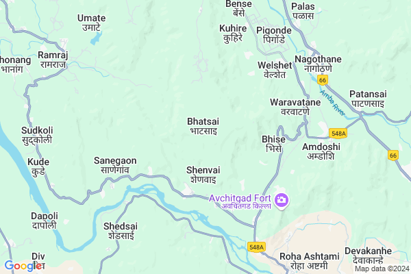
Bhatsai
Bhatsai Map
EDIT Map
Add Your House
 ..
..
Current Corona Virus Infected Patients Count in Raigad District
| City Name | District Name | Total Covid cases |
|---|
Locality Name :
Bhatsai
( भटसाई )
Taluka Name : Roha
District : Raigad
State : Maharashtra
Region : Konkan
Division : Konkan
Language : Marathi and Hindi
Current Time 01:56 PM
Date: Monday , Apr 28,2025 (IST)
Time zone: IST (UTC+5:30)
Elevation / Altitude: 11 meters. Above Seal level
Telephone Code / Std Code: 02194
Assembly constituency : Alibag assembly constituency
Assembly MLA : Mahendra Hari Dalvi
Lok Sabha constituency : Raigad parliamentary constituency
Parliament MP : Tatkare Sunil Dattatray
Serpanch Name :
Pin Code : 402109
Post Office Name : Roha
Commodities Prices : Roha Market / Mandi
National Highways Reachable To Bhatsai
Nationa High Way :NH753F
Nationa High Way :NH753F
Rivers Near Bhatsai
Amba
Kundalika
Amba
Kundalika
About Bhatsai
Correct below Info and add more info about BhatsaiBhatsai is a Village in Roha Taluka in Raigad District of Maharashtra State, India. It belongs to Konkan region . It belongs to Konkan Division . It is located 31 KM towards East from District head quarters Alibag. 11 KM from Roha. 70 KM from State capital Mumbai
Bhatsai Pin code is 402109 and postal head office is Roha .
Wavepotge ( 3 KM ) , Wani ( 4 KM ) , Bhise ( 4 KM ) , Kadsure ( 4 KM ) , Sanegaon ( 5 KM ) are the nearby Villages to Bhatsai. Bhatsai is surrounded by Murud Taluka towards South , Sudhagad Taluka towards East , Alibag Taluka towards North , Pen Taluka towards North .
Nandgaon , Pen , Uran , Lonavla are the near by Cities to Bhatsai.
It is near to arabian sea. There is a chance of humidity in the weather.
Bhatsai 2011 Census Details
Bhatsai Local Language is Marathi. Bhatsai Village Total population is 1045 and number of houses are 251. Female Population is 49.4%. Village literacy rate is 67.1% and the Female Literacy rate is 30.8%.
Population
| Census Parameter | Census Data |
| Total Population | 1045 |
| Total No of Houses | 251 |
| Female Population % | 49.4 % ( 516) |
| Total Literacy rate % | 67.1 % ( 701) |
| Female Literacy rate | 30.8 % ( 322) |
| Scheduled Tribes Population % | 20.0 % ( 209) |
| Scheduled Caste Population % | 8.4 % ( 88) |
| Working Population % | 46.7 % |
| Child(0 -6) Population by 2011 | 114 |
| Girl Child(0 -6) Population % by 2011 | 42.1 % ( 48) |
Bhatsai Census More Deatils.
Politics in Bhatsai
PWPI , Nationalist Congress Party , PWP , NCP , SHS , INC are the major political parties in this area.Polling Stations /Booths near Bhatsai
1)Shedasai2)Diviparangi
3)Vave 2
4)Waghvira
5)Zirad-3
HOW TO REACH Bhatsai
By Rail
Nidi Rail Way Station , Nagothane Rail Way Station are the very nearby railway stations to Bhatsai. are the Rail way stations reachable from near by towns.By Road
Murud are the nearby by towns to Bhatsai having road connectivity to BhatsaiColleges near Bhatsai
Kes's Dr. C.d.deshmukh College, Roha.
Address :
Schools in Bhatsai
R.z.p. Pri. School Bhatsai
Address : bhatsai , roha , raigarh (maharashtra) , Maharashtra . PIN- 402109 , Post - Roha
Govt Health Centers near Bhatsai
1) Bhivari , Ap.Bhivari Tal Haveli Dist Pune , Grampanchayat Near , Grampanchayat Near2) Urulikanchan , Ap.Uralikanchan Tal Haveli Dist Pune , Railyway Station Near , Railyway Station Near
3) Uruli Kanchan , Ap.Uralikanchan Tal Haveli Dist Pune , Railyway Station Near , Railyway Station Near
Schools in Bhatsai,Roha
Electronic Shops in Bhatsai,Roha
Super Markets in Bhatsai,Roha
Local Parks in Bhatsai,Roha
Police Stations near Bhatsai,Roha
Governement Offices near Bhatsai,Roha
About Bhatsai &
History
How to reach Bhatsai
Tourist Places Near By Bhatsai
Schools in Bhatsai
Colleges in Bhatsai
Temperature & weather of Bhatsai
places in Bhatsai
Bhatsai photos
More Information
How to reach Bhatsai
Tourist Places Near By Bhatsai
Schools in Bhatsai
Colleges in Bhatsai
Temperature & weather of Bhatsai
places in Bhatsai
Bhatsai photos
More Information
Village Talk
Post News or Events about this Village
Near Cities
Nandgaon 24 KM near
Pen 28 KM near
Uran 47 KM near
Lonavla 48 KM near
Nandgaon 24 KM near
Pen 28 KM near
Uran 47 KM near
Lonavla 48 KM near
Near By Taluks
Roha 10 KM near
Murud 22 KM near
Sudhagad 22 KM near
Alibag 26 KM near
Roha 10 KM near
Murud 22 KM near
Sudhagad 22 KM near
Alibag 26 KM near
Near By Air Ports
Chhatrapati Shivaji International Airport 76 KM near
Lohegaon Airport 99 KM near
Gandhinagar Airport 200 KM near
Kolhapur Airport 273 KM near
Chhatrapati Shivaji International Airport 76 KM near
Lohegaon Airport 99 KM near
Gandhinagar Airport 200 KM near
Kolhapur Airport 273 KM near
Near By Tourist Places
Nagothane 7 KM near
Raigad 12 KM near
Kolad 19 KM near
Kashid 22 KM near
Nagaon Beach 23 KM near
Nagothane 7 KM near
Raigad 12 KM near
Kolad 19 KM near
Kashid 22 KM near
Nagaon Beach 23 KM near
Near By Districts
Raigad 30 KM near
Mumbai 65 KM near
Pune 92 KM near
Thane 94 KM near
Raigad 30 KM near
Mumbai 65 KM near
Pune 92 KM near
Thane 94 KM near
Near By RailWay Station
Nidi Rail Way Station 5.9 KM near
Nagothane Rail Way Station 8.5 KM near
Roha Rail Way Station 9 KM near
Mangaon Rail Way Station 40 KM near
Nidi Rail Way Station 5.9 KM near
Nagothane Rail Way Station 8.5 KM near
Roha Rail Way Station 9 KM near
Mangaon Rail Way Station 40 KM near