| Home | City Bus | Maps | Villages | Cities | Rail | Tourist Places | School | College | Pin Codes | Corona Cases Count |
| Distance Calculator Bus Services IFSC Codes Trace Mobile Number Weather Search Place Trace IP Available Cash ATM/Banks Locate Polling Booth Report an Error contact People |
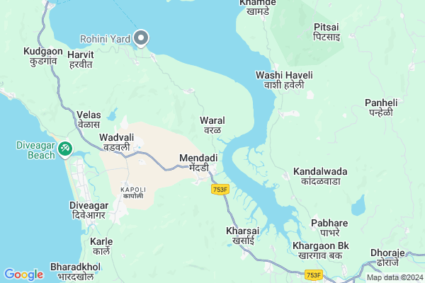
Waral
Waral Map
EDIT Map
Add Your House
 ..
..
Current Corona Virus Infected Patients Count in Raigad District
| City Name | District Name | Total Covid cases |
|---|
Locality Name :
Waral
( वराळ )
Taluka Name : Mhasala
District : Raigad
State : Maharashtra
Region : Konkan
Division : Konkan
Language : Marathi and Hindi
Current Time 06:55 AM
Date: Saturday , Apr 26,2025 (IST)
Time zone: IST (UTC+5:30)
Elevation / Altitude: 13 meters. Above Seal level
Telephone Code / Std Code: 02149
Assembly constituency : Shrivardhan assembly constituency
Assembly MLA : Aditi Sunil Tatkare
Lok Sabha constituency : Raigad parliamentary constituency
Parliament MP : Tatkare Sunil Dattatray
Serpanch Name :
Pin Code : 402105
Post Office Name : Mhasla
Commodities Prices : Murud Market / Mandi
Waral Live Weather
Temperature: 25.7 °C
few clouds
Humidity: 76%
Wind : 1.19 mt/sec towards N
StationName : "Mhasla"
observed on 2 Hours Back
Temperature: 25.7 °C
few clouds
Humidity: 76%
Wind : 1.19 mt/sec towards N
StationName : "Mhasla"
observed on 2 Hours Back
Waral Weather Forecast for Next 5 days
27-04-2025
25.4°C to 33.4°C
clear sky, few clouds, broken clouds, scattered clouds
25.4°C to 33.4°C
clear sky, few clouds, broken clouds, scattered clouds
28-04-2025
25.5°C to 32.6°C
clear sky, few clouds
25.5°C to 32.6°C
clear sky, few clouds
29-04-2025
24.8°C to 32.0°C
clear sky, few clouds
24.8°C to 32.0°C
clear sky, few clouds
30-04-2025
25.0°C to 31.4°C
clear sky
25.0°C to 31.4°C
clear sky
Edit below overview about Waral
Edit below overview about Waral
OverView of Waral
Hello, Myself Prashant Patil resident of waral village waral village is based on raigad district and away from mumbai just of 4.5hrs by bus we can travel over here by rails but only up to Mangaon its an actually situated in natural area nothing any artificial located over here.so to whoms you are waiting just come and see original about my waral village.Edit below overview about Waral
National Highways Reachable To Waral
Nationa High Way :NH965DD
Nationa High Way :NH66
Nationa High Way :NH965DD
Nationa High Way :NH66
Rivers Near Waral
Savitri River
Savitri River
Savitri River
Savitri River
About Waral
Waral is a Village in Mhasala Taluka in Raigad District of Maharashtra State, India. It belongs to Konkan region . It belongs to Konkan Division . It is located 62 KM towards South from District head quarters Alibag. 13 KM from Mhasala. 108 KM from State capital Mumbai
Waral Pin code is 402105 and postal head office is Mhasla .
Kalsuri ( 2 KM ) , Gondghar ( 4 KM ) , Washi Haveli ( 5 KM ) , Kudki ( 5 KM ) , Majgaon ( 5 KM ) are the nearby Villages to Waral. Waral is surrounded by Mhasala Taluka towards South , Tala Taluka towards East , Murud Taluka towards North , Mangaon Taluka towards East .
Nandgaon , Mahad , Pen , Mahabaleswar are the near by Cities to Waral.
It is near to arabian sea. There is a chance of humidity in the weather.
Waral 2011 Census Details
Waral Local Language is Marathi. Waral Village Total population is 1160 and number of houses are 355. Female Population is 60.0%. Village literacy rate is 64.1% and the Female Literacy rate is 34.2%.
Population
| Census Parameter | Census Data |
| Total Population | 1160 |
| Total No of Houses | 355 |
| Female Population % | 60.0 % ( 696) |
| Total Literacy rate % | 64.1 % ( 743) |
| Female Literacy rate | 34.2 % ( 397) |
| Scheduled Tribes Population % | 2.2 % ( 26) |
| Scheduled Caste Population % | 6.5 % ( 75) |
| Working Population % | 37.1 % |
| Child(0 -6) Population by 2011 | 129 |
| Girl Child(0 -6) Population % by 2011 | 51.9 % ( 67) |
Waral Census More Deatils.
Politics in Waral
Nationalist Congress Party , NCP , SHS , INC are the major political parties in this area.Polling Stations /Booths near Waral
1)Varak2)Medhe
3)Mendadi 1
4)Kalsambade
5)Mendadi 2
HOW TO REACH Waral
By Rail
There is no railway station near to Waral in less than 10 km. are the Rail way stations reachable from near by towns.By Road
Shrivardhan are the nearby by towns to Waral having road connectivity to WaralColleges near Waral
S A K Juniour College Pangloli
Address :
Vasant Rao Naik College
Address :
Schools in Waral
R.z.p. School Waral Urdu
Address : waral , mhasala , raigarh (maharashtra) , Maharashtra . PIN- 402105 , Post - Mhasla
R.z.p. School Waral
Address : waral , mhasala , raigarh (maharashtra) , Maharashtra . PIN- 402105 , Post - Mhasla
Govt Health Centers near Waral
1) Waral , SC Waral , Waral Near Bus Stop , Waral Near Bus Stop2) Mendadi , Sc Mendadi , At post Mendadi ,Tal Mhasala , At post Mendadi ,Tal Mhasala
3) Mendadi , Phc Mendadi , Near Muslim Mohalla , Near Muslim Mohalla
Schools in Waral,Mhasala
Electronic Shops in Waral,Mhasala
Super Markets in Waral,Mhasala
Local Parks in Waral,Mhasala
Police Stations near Waral,Mhasala
Governement Offices near Waral,Mhasala
About Waral &
History
How to reach Waral
Tourist Places Near By Waral
Schools in Waral
Colleges in Waral
Temperature & weather of Waral
places in Waral
Waral photos
More Information
How to reach Waral
Tourist Places Near By Waral
Schools in Waral
Colleges in Waral
Temperature & weather of Waral
places in Waral
Waral photos
More Information
Village Talk
Post News or Events about this Village
Near Cities
Nandgaon 27 KM near
Mahad 42 KM near
Pen 67 KM near
Mahabaleswar 79 KM near
Nandgaon 27 KM near
Mahad 42 KM near
Pen 67 KM near
Mahabaleswar 79 KM near
Near By Taluks
Shrivardhan 11 KM near
Mhasala 12 KM near
Tala 15 KM near
Murud 23 KM near
Shrivardhan 11 KM near
Mhasala 12 KM near
Tala 15 KM near
Murud 23 KM near
Near By Air Ports
Lohegaon Airport 113 KM near
Chhatrapati Shivaji International Airport 113 KM near
Gandhinagar Airport 237 KM near
Kolhapur Airport 244 KM near
Lohegaon Airport 113 KM near
Chhatrapati Shivaji International Airport 113 KM near
Gandhinagar Airport 237 KM near
Kolhapur Airport 244 KM near
Near By Tourist Places
Murud Janjira 15 KM near
Shrivardhan 19 KM near
Harihareshwar 26 KM near
Kolad 31 KM near
Kashid 34 KM near
Murud Janjira 15 KM near
Shrivardhan 19 KM near
Harihareshwar 26 KM near
Kolad 31 KM near
Kashid 34 KM near
Near By Districts
Raigad 60 KM near
Mumbai 99 KM near
Pune 104 KM near
Satara 129 KM near
Raigad 60 KM near
Mumbai 99 KM near
Pune 104 KM near
Satara 129 KM near
Near By RailWay Station
Mangaon Rail Way Station 27 KM near
Roha Rail Way Station 31 KM near
Mangaon Rail Way Station 27 KM near
Roha Rail Way Station 31 KM near