| Home | City Bus | Maps | Villages | Cities | Rail | Tourist Places | School | College | Pin Codes | Corona Cases Count |
| Distance Calculator Bus Services IFSC Codes Trace Mobile Number Weather Search Place Trace IP Available Cash ATM/Banks Locate Polling Booth Report an Error contact People |
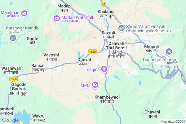
Vadval
Vadval Map
EDIT Map
Add Your House
 ..
..
Current Corona Virus Infected Patients Count in Raigad District
| City Name | District Name | Total Covid cases |
|---|
Locality Name :
Vadval
( वाडवळ )
Taluka Name : Khalapur
District : Raigad
State : Maharashtra
Region : Konkan
Division : Konkan
Language : Marathi and Hindi
Current Time 10:43 AM
Date: Friday , Apr 25,2025 (IST)
Time zone: IST (UTC+5:30)
Elevation / Altitude: 63 meters. Above Seal level
Telephone Code / Std Code: 02192
Assembly constituency : Karjat assembly constituency
Assembly MLA : Mahendra Sadashiv Thorve
Lok Sabha constituency : Maval parliamentary constituency
Parliament MP : SHRIRANG APPA CHANDU BARNE
Serpanch Name :
Pin Code : 410203
Post Office Name : Shilphata
Alternate Village Name : Wadwal
Commodities Prices : Karjat(Raigad) Market / Mandi
Vadval Live Weather
Temperature: 33.2 °C
clear sky
Humidity: 32%
Wind : 1.49 mt/sec towards NW
StationName : "Khopoli"
observed on 47 Mins Back
Temperature: 33.2 °C
clear sky
Humidity: 32%
Wind : 1.49 mt/sec towards NW
StationName : "Khopoli"
observed on 47 Mins Back
Vadval Weather Forecast for Next 5 days
26-04-2025
27.1°C to 38.7°C
clear sky, scattered clouds, broken clouds
27.1°C to 38.7°C
clear sky, scattered clouds, broken clouds
27-04-2025
25.8°C to 39.2°C
scattered clouds, clear sky, few clouds
25.8°C to 39.2°C
scattered clouds, clear sky, few clouds
28-04-2025
25.3°C to 38.0°C
clear sky, few clouds
25.3°C to 38.0°C
clear sky, few clouds
29-04-2025
24.3°C to 37.8°C
clear sky
24.3°C to 37.8°C
clear sky
30-04-2025
24.8°C to 36.7°C
clear sky
24.8°C to 36.7°C
clear sky
Edit below overview about Vadval
Edit below overview about Vadval
OverView of Vadval
There is five small villages coming under Vadval as..1.Vasote, 2.Tambi, 3.Takavli, 4.Kusavde, 5.Dhavli updated by vishal sakpalEdit below overview about Vadval
National Highways Reachable To Vadval
Nationa High Way :NH548A
Nationa High Way :NH348
Nationa High Way :NH548A
Nationa High Way :NH348
Rivers Near Vadval
Bhogeshwari :भोगेश्वरी
Bhogeshwari :भोगेश्वरी
About Vadval
Vadval is a Village in Khalapur Taluka in Raigad District of Maharashtra State, India. It belongs to Konkan region . It belongs to Konkan Division . It is located 52 KM towards East from District head quarters Alibag. 8 KM from Khalapur. 59 KM from State capital Mumbai
Vadval Pin code is 410203 and postal head office is Shilphata .
Apati ( 2 KM ) , Thanenhave ( 3 KM ) , Savroli ( 4 KM ) , Sajgaon ( 4 KM ) , Chilthan ( 4 KM ) are the nearby Villages to Vadval. Vadval is surrounded by Pen Taluka towards west , Sudhagad Taluka towards South , Karjat Taluka towards North , Panvel Taluka towards North .
Lonavla , Pen , Panvel , Uran are the near by Cities to Vadval.
Vadval 2011 Census Details
Vadval Local Language is Marathi. Vadval Village Total population is 1880 and number of houses are 367. Female Population is 49.2%. Village literacy rate is 74.6% and the Female Literacy rate is 33.3%.
Population
| Census Parameter | Census Data |
| Total Population | 1880 |
| Total No of Houses | 367 |
| Female Population % | 49.2 % ( 925) |
| Total Literacy rate % | 74.6 % ( 1403) |
| Female Literacy rate | 33.3 % ( 626) |
| Scheduled Tribes Population % | 2.3 % ( 43) |
| Scheduled Caste Population % | 0.2 % ( 3) |
| Working Population % | 35.5 % |
| Child(0 -6) Population by 2011 | 223 |
| Girl Child(0 -6) Population % by 2011 | 49.3 % ( 110) |
Vadval Census More Deatils.
Politics in Vadval
PWPI , NCP , Shivsena , SHS are the major political parties in this area.Polling Stations /Booths near Vadval
1)Damat2)Devanhave 1
3)Khopoli 5 Lavji
4)Gaurakamath
5)Dikasal
HOW TO REACH Vadval
By Rail
Lowjee Rail Way Station , Khopoli Rail Way Station are the very nearby railway stations to Vadval. Panvel Junction Rail Way Station (near to Panvel) , Khandeshwar Rail Way Station (near to Panvel) , Karjat Junction Rail Way Station (near to Karjat) , Palasdhari Rail Way Station (near to Karjat) , Khopoli Rail Way Station (near to Khopoli) , Lowjee Rail Way Station (near to Khopoli) are the Rail way stations reachable from near by towns.By Road
Khopoli , Karjat , Panvel are the nearby by towns to Vadval having road connectivity to VadvalColleges near Vadval
J.b.sawant Edu.societys Tmc College
Address :
G.b.wader Collage Pali
Address :
S A K Juniour College Pangloli
Address :
Doshi Vakil Arts & G.c.u.b Sci & Com Collage - Goregaon
Address :
M.t.e.s. Doshi Vakil Arts & G.c.u.b Sci & Com Collage - Goregaon
Address :
Schools in Vadval
Madhyamik Vidy. Vadval
Address : vadval , khalapur , raigarh (maharashtra) , Maharashtra . PIN- 410203 , Post - Shilphata
R.z.p. Pri School Vadval
Address : vadval , khalapur , raigarh (maharashtra) , Maharashtra . PIN- 410203 , Post - Shilphata
Govt Health Centers near Vadval
1) Honad , Sc Honad , , Near ZP School Honad2) Usaroli , SC Usaroli , Near ZP School Usaroli , Near ZP School Usaroli
3) Kumbhivali , SC Kumbhivali , Kumbhivali Khalapur , Kumbhivali Khalapur Raigad
Sub Villages in Vadval
Petrol Bunks in Vadval,Khalapur
ESSAR PETROL PUMP(Suvarnareshma)
Pen - Khopoli Rd; Tambati; Maharashtra 410203; India
1.2 KM distance Detail
HP Petrol Pump - Shri Ashtavinayak Petroleum
Survey NO. 26; Hissa NO.1 At+post Dahivali Pali Phata; Khopoli PEN Road; Vashi; Maharashtra 410203; India
2.8 KM distance Detail
more ..
Colleges in Vadval,Khalapur
Shri Chhatrapati Vidyalay Vavoshi And Junior College
Gorthan Bk.; Maharashtra 402107; India
5.9 KM distance Detail
Bhausaheb Nene Arts; Commerce And Science College
Pen; Maharashtra 402107; India
6.6 KM distance Detail
more ..
Schools in Vadval,Khalapur
Chilthan HighSchool;Chilthan.
At:Chilthan; Po:Donvat; Khalapur; Maharashtra 410203; India
3.4 KM distance Detail
Electronic Shops in Vadval,Khalapur
Om Baba Electronic
Takvali; vadval road; vadval; Khopoli; Maharashtra 410203; India
0.4 KM distance Detail
Mobil wurth amaron
shop no 2 ;chawre legacy near Ibrahim masjid opp .flyover nallasopara west; palghar; Maharashtra 410203; India
3.7 KM distance Detail
Super Markets in Vadval,Khalapur
shivam kirana and frut
Takai - Adoshi Road; Sajgaon; Maharashtra 410203; India
5.0 KM distance Detail
Shree Samarth Collection
75; Pen - Khopoli Rd; Jambhivali; Maharashtra 402107; India
5.9 KM distance Detail
Police Stations near Vadval,Khalapur
Khandala.highway Police Chowky
67; Hill top colony; Old Mumbai - Pune Hwy; Khandala; Kune N.m.; Maharashtra 410301; India
12.2 KM distance Detail
About Vadval &
History
How to reach Vadval
Tourist Places Near By Vadval
Schools in Vadval
Colleges in Vadval
Temperature & weather of Vadval
places in Vadval
Vadval photos
More Information
How to reach Vadval
Tourist Places Near By Vadval
Schools in Vadval
Colleges in Vadval
Temperature & weather of Vadval
places in Vadval
Vadval photos
More Information
Village Talk
Post News or Events about this Village
Near Cities
Lonavla 16 KM near
Pen 22 KM near
Panvel 32 KM near
Uran 38 KM near
Lonavla 16 KM near
Pen 22 KM near
Panvel 32 KM near
Uran 38 KM near
Near By Taluks
Khalapur 8 KM near
Pen 22 KM near
Sudhagad 25 KM near
Karjat 26 KM near
Khalapur 8 KM near
Pen 22 KM near
Sudhagad 25 KM near
Karjat 26 KM near
Near By Air Ports
Chhatrapati Shivaji International Airport 60 KM near
Lohegaon Airport 80 KM near
Gandhinagar Airport 160 KM near
Chikkalthana Airport 284 KM near
Chhatrapati Shivaji International Airport 60 KM near
Lohegaon Airport 80 KM near
Gandhinagar Airport 160 KM near
Chikkalthana Airport 284 KM near
Near By Tourist Places
Khandala 12 KM near
Rajmachi 16 KM near
Karjat 17 KM near
Durshet 19 KM near
Karnala 22 KM near
Khandala 12 KM near
Rajmachi 16 KM near
Karjat 17 KM near
Durshet 19 KM near
Karnala 22 KM near
Near By Districts
Raigad 49 KM near
Mumbai 58 KM near
Thane 71 KM near
Pune 76 KM near
Raigad 49 KM near
Mumbai 58 KM near
Thane 71 KM near
Pune 76 KM near
Near By RailWay Station
Lowjee Rail Way Station 8.9 KM near
Khopoli Rail Way Station 9.3 KM near
Khandala Rail Way Station 13 KM near
Lonavala Rail Way Station 16 KM near
Lowjee Rail Way Station 8.9 KM near
Khopoli Rail Way Station 9.3 KM near
Khandala Rail Way Station 13 KM near
Lonavala Rail Way Station 16 KM near