| Home | City Bus | Maps | Villages | Cities | Rail | Tourist Places | School | College | Pin Codes | Corona Cases Count |
| Distance Calculator Bus Services IFSC Codes Trace Mobile Number Weather Search Place Trace IP Available Cash ATM/Banks Locate Polling Booth Report an Error contact People |
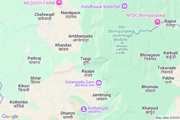
Tungi
Tungi Map
EDIT Map
Add Your House
 ..
..
Current Corona Virus Infected Patients Count in Raigad District
| City Name | District Name | Total Covid cases |
|---|
Locality Name :
Tungi
( तुंगी )
Taluka Name : Karjat
District : Raigad
State : Maharashtra
Region : Konkan
Division : Konkan
Language : Marathi and Hindi
Current Time 07:14 PM
Date: Tuesday , Apr 29,2025 (IST)
Time zone: IST (UTC+5:30)
Elevation / Altitude: 57 meters. Above Seal level
Telephone Code / Std Code: 02489
Assembly constituency : Karjat assembly constituency
Assembly MLA : Mahendra Sadashiv Thorve
Lok Sabha constituency : Maval parliamentary constituency
Parliament MP : SHRIRANG APPA CHANDU BARNE
Serpanch Name :
Pin Code : 410201
Post Office Name : Karjat (Raigarh(MH))
Main Village Name : Khandas
Commodities Prices : Karjat(Raigad) Market / Mandi
Tungi Live Weather
Temperature: 34.3 °C
clear sky
Humidity: 31%
Wind : 5.45 mt/sec towards W
StationName : "Neral"
observed on 2 Hours Back
Temperature: 34.3 °C
clear sky
Humidity: 31%
Wind : 5.45 mt/sec towards W
StationName : "Neral"
observed on 2 Hours Back
Tungi Weather Forecast for Next 5 days
30-04-2025
26.0°C to 34.4°C
clear sky
26.0°C to 34.4°C
clear sky
01-05-2025
25.6°C to 41.1°C
clear sky
25.6°C to 41.1°C
clear sky
02-05-2025
24.6°C to 40.1°C
clear sky
24.6°C to 40.1°C
clear sky
03-05-2025
25.2°C to 41.2°C
clear sky
25.2°C to 41.2°C
clear sky
04-05-2025
24.3°C to 38.3°C
clear sky, broken clouds, scattered clouds
24.3°C to 38.3°C
clear sky, broken clouds, scattered clouds
Edit below overview about Tungi
Edit below overview about Tungi
OverView of Tungi
tungi is a very good place to visit you can see different types of animals birds its very cold at night even in the morningsEdit below overview about Tungi
National Highways Reachable To Tungi
Nationa High Way :NH48
Nationa High Way :NH348A
Nationa High Way :NH48
Nationa High Way :NH348A
Rivers Near Tungi
Mithi River :Mithi River :मिठी नदी
Mithi River :Mithi River :मिठी नदी
About Tungi
Tungi is a small Village/hamlet in Karjat Taluka in Raigad District of Maharashtra State, India. It comes under Khandas Panchayath. It belongs to Konkan region . It belongs to Konkan Division . It is located 94 KM towards East from District head quarters Alibag. 21 KM from Karjat. 81 KM from State capital Mumbai
Tungi Pin code is 410201 and postal head office is Karjat (Raigarh(MH)).
Jambrung ( 5 KM ) , Kashele ( 13 KM ) , Ware ( 14 KM ) , Mandawane ( 14 KM ) , Savale ( 14 KM ) are the nearby Villages to Tungi. Tungi is surrounded by Murbad Taluka towards North , Ambernath Taluka towards west , Maval Taluka towards South , Khalapur Taluka towards west .
Lonavla , Ambernath , Talegaon Dabhade , Junnar are the near by Cities to Tungi.
Tungi 2011 Census Details
Tungi Local Language is Marathi. Tungi Village Total population is 315 and number of houses are 65. Female Population is 52.1%. Village literacy rate is 78.1% and the Female Literacy rate is 36.5%.
Population
| Census Parameter | Census Data |
| Total Population | 315 |
| Total No of Houses | 65 |
| Female Population % | 52.1 % ( 164) |
| Total Literacy rate % | 78.1 % ( 246) |
| Female Literacy rate | 36.5 % ( 115) |
| Scheduled Tribes Population % | 74.0 % ( 233) |
| Scheduled Caste Population % | 0.0 % ( 0) |
| Working Population % | 50.8 % |
| Child(0 -6) Population by 2011 | 25 |
| Girl Child(0 -6) Population % by 2011 | 60.0 % ( 15) |
Tungi Census More Deatils.
Politics in Tungi
PWPI , NCP , Shivsena , SHS are the major political parties in this area.Polling Stations /Booths near Tungi
1)Tivare2)Potal
3)Akasal
4)Khandape
5)Khandas 1
HOW TO REACH Tungi
By Rail
There is no railway station near to Tungi in less than 10 km. Badlapur Rail Way Station (near to Badlapur) , Karjat Junction Rail Way Station (near to Karjat) , Palasdhari Rail Way Station (near to Karjat) , Vangani Rail Way Station (near to Badlapur) are the Rail way stations reachable from near by towns.By Road
Karjat , Badlapur are the nearby by towns to Tungi having road connectivity to TungiColleges near Tungi
J.b.sawant Edu.societys Tmc College
Address :
G.b.wader Collage Pali
Address :
S A K Juniour College Pangloli
Address :
Doshi Vakil Arts & G.c.u.b Sci & Com Collage - Goregaon
Address :
M.t.e.s. Doshi Vakil Arts & G.c.u.b Sci & Com Collage - Goregaon
Address :
Schools in Tungi
R.z.p.shchool Khandas
Address :
Govt Health Centers near Tungi
1) Kumbhephal , , Kumbhephal ,2) Khandas , Phc Khandas , Near Private High School Khandas , Near Private High School Khandas
3) Jamrung , SC Jamrung , ,
Petrol Bunks in Tungi,Karjat
HP Petrol Pump - Bhimashankar Auto Service
Kashele; Maharashtra 410201; India
13.6 KM distance Detail
HP PETROL PUMP - BHIMA SHANKAR AUTO SERVICE
VPO Kashele TAL Karjat; Karjat - Murbad Rd; Vashi; Maharashtra 410201; India
13.7 KM distance Detail
more ..
Colleges in Tungi,Karjat
IBSAR Group of Colleges
Tarfe Need; Karjat; Dist. Raigad; Dahivali; Maharashtra 410201; India
22.3 KM distance Detail
more ..
Schools in Tungi,Karjat
Well; the starting point of Bhimashankar Trek via Sidhi Ghat
Ambherpada; Maharashtra 410201; India
2.4 KM distance Detail
Electronic Shops in Tungi,Karjat
shree om sai mobail shop
Chauk - Karjat - Murbad Rd; Kashele; Maharashtra 410201; India
13.3 KM distance Detail
Local Parks in Tungi,Karjat
Shri Bhimashankar Jyotirlinga Wildlife Reserve
Ganpati Ghat Walkway; Bhimashankar; Maharashtra 410201; India
0.6 KM distance Detail
Paw Haven - A Wellness Getaway in Nature For You & Your Pet
Karjat - Kalmba Road; Karjat - Kashele - Khandas Rd; Maharashtra 410201; India
3.0 KM distance Detail
About Tungi &
History
How to reach Tungi
Tourist Places Near By Tungi
Schools in Tungi
Colleges in Tungi
Temperature & weather of Tungi
places in Tungi
Tungi photos
More Information
How to reach Tungi
Tourist Places Near By Tungi
Schools in Tungi
Colleges in Tungi
Temperature & weather of Tungi
places in Tungi
Tungi photos
More Information
Village Talk
Post News or Events about this Village
Near Cities
Lonavla 39 KM near
Ambernath 44 KM near
Talegaon Dabhade 45 KM near
Junnar 46 KM near
Lonavla 39 KM near
Ambernath 44 KM near
Talegaon Dabhade 45 KM near
Junnar 46 KM near
Near By Taluks
Karjat 20 KM near
Murbad 26 KM near
Ambernath 36 KM near
Maval 39 KM near
Karjat 20 KM near
Murbad 26 KM near
Ambernath 36 KM near
Maval 39 KM near
Near By Air Ports
Lohegaon Airport 75 KM near
Chhatrapati Shivaji International Airport 76 KM near
Gandhinagar Airport 119 KM near
Chikkalthana Airport 242 KM near
Lohegaon Airport 75 KM near
Chhatrapati Shivaji International Airport 76 KM near
Gandhinagar Airport 119 KM near
Chikkalthana Airport 242 KM near
Near By Tourist Places
Bhimashankar 3 KM near
Karjat 28 KM near
Matheran 30 KM near
Rajmachi 30 KM near
Kamshet 35 KM near
Bhimashankar 3 KM near
Karjat 28 KM near
Matheran 30 KM near
Rajmachi 30 KM near
Kamshet 35 KM near
Near By Districts
Thane 75 KM near
Pune 76 KM near
Mumbai 82 KM near
Raigad 91 KM near
Thane 75 KM near
Pune 76 KM near
Mumbai 82 KM near
Raigad 91 KM near
Near By RailWay Station
Karjat Junction Rail Way Station 29 KM near
Lonavala Rail Way Station 39 KM near
Karjat Junction Rail Way Station 29 KM near
Lonavala Rail Way Station 39 KM near