| Home | City Bus | Maps | Villages | Cities | Rail | Tourist Places | School | College | Pin Codes | Corona Cases Count |
| Distance Calculator Bus Services IFSC Codes Trace Mobile Number Weather Search Place Trace IP Available Cash ATM/Banks Locate Polling Booth Report an Error contact People |
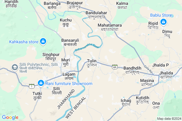
Tulin
Tulin Map
EDIT Map
Add Your House
 ..
..
Current Corona Virus Infected Patients Count in Purulia District
| City Name | District Name | Total Covid cases |
|---|
Locality Name :
Tulin
( তুলুন )
Block Name : Jhalda-i
District : Purulia
State : West Bengal
Division : Burdwan
Language : Bengali and English
Current Time 10:32 AM
Date: Monday , Apr 28,2025 (IST)
Time zone: IST (UTC+5:30)
Elevation / Altitude: 249 meters. Above Seal level
Telephone Code / Std Code: 03254
Assembly constituency : Baghmundi assembly constituency
Assembly MLA : Sushanta Mahato
Lok Sabha constituency : Purulia parliamentary constituency
Parliament MP : JYOTIRMAY SINGH MAHATO
Serpanch Name :
Pin Code : 723212
Post Office Name : Tulin
Commodities Prices : Balarampur Market / Mandi
Tulin Live Weather
Temperature: 33.4 °C
few clouds
Humidity: 25%
Wind : 4.4 mt/sec towards NW
StationName : "Muri"
observed on 1 Hours Back
Temperature: 33.4 °C
few clouds
Humidity: 25%
Wind : 4.4 mt/sec towards NW
StationName : "Muri"
observed on 1 Hours Back
Tulin Weather Forecast for Next 5 days
29-04-2025
22.5°C to 36.5°C
few clouds, scattered clouds, light rain, broken clouds
22.5°C to 36.5°C
few clouds, scattered clouds, light rain, broken clouds
30-04-2025
22.3°C to 34.5°C
clear sky, few clouds, scattered clouds, light rain, overcast clouds
22.3°C to 34.5°C
clear sky, few clouds, scattered clouds, light rain, overcast clouds
01-05-2025
22.1°C to 37.5°C
clear sky, scattered clouds, moderate rain, broken clouds, overcast clouds
22.1°C to 37.5°C
clear sky, scattered clouds, moderate rain, broken clouds, overcast clouds
02-05-2025
22.6°C to 34.8°C
broken clouds, few clouds, scattered clouds, light rain, overcast clouds
22.6°C to 34.8°C
broken clouds, few clouds, scattered clouds, light rain, overcast clouds
03-05-2025
23.4°C to 34.7°C
overcast clouds, broken clouds, few clouds, scattered clouds, clear sky
23.4°C to 34.7°C
overcast clouds, broken clouds, few clouds, scattered clouds, clear sky
National Highways Reachable To Tulin
Nationa High Way :NH43
Nationa High Way :NH20;NH43
Nationa High Way :NH43
Nationa High Way :NH20;NH43
Rivers Near Tulin
Subarnarheka River
Subarnarekha river
Subarnarheka River
Subarnarekha river
About Tulin
Correct below Info and add more info about TulinTulin is a Village in Jhalda-i Block in Purulia District of West Bengal State, India. It belongs to Burdwan Division . It is located 57 KM towards west from District head quarters Purulia. 6 KM from Jhalda-Darda. 314 KM from State capital Kolkata
Tulin Pin code is 723212 and postal head office is Tulin .
Kalma ( 9 KM ) , Ilu-jargo ( 10 KM ) , Rigid ( 10 KM ) , Jhalda-darda ( 12 KM ) , Chekya ( 13 KM ) are the nearby Villages to Tulin. Tulin is surrounded by Silli Block towards west , Jhalda-Ii Block towards East , Kasmar Block towards North , Gola Block towards North .
Purulia , Bokaro Steel City , Tenu Dam-cum- Kathhara , Phusro are the near by Cities to Tulin.
This Place is in the border of the Purulia District and Ranchi District. Ranchi District Silli is west towards this place . It is near to the Jharkhand State Border.
Tulin 2011 Census Details
Tulin Local Language is Bengali. Tulin Village Total population is 9844 and number of houses are 1959. Female Population is 48.7%. Village literacy rate is 67.1% and the Female Literacy rate is 28.5%.
Population
| Census Parameter | Census Data |
| Total Population | 9844 |
| Total No of Houses | 1959 |
| Female Population % | 48.7 % ( 4790) |
| Total Literacy rate % | 67.1 % ( 6602) |
| Female Literacy rate | 28.5 % ( 2804) |
| Scheduled Tribes Population % | 2.2 % ( 218) |
| Scheduled Caste Population % | 8.3 % ( 820) |
| Working Population % | 35.3 % |
| Child(0 -6) Population by 2011 | 1222 |
| Girl Child(0 -6) Population % by 2011 | 47.5 % ( 580) |
Tulin Census More Deatils.
Politics in Tulin
Bharatiya Janata Party , AITC , AIFB , INC are the major political parties in this area.Polling Stations /Booths near Tulin
1)Torang Primary School -room-12)Tulin Balika Prathamik Bidyalay -room-1
3)Tulin Board Primary Bidyalay -room-1
4)Tulin Board Primary Bidyalay -room-2
5)Tulin Jaisiaram High School
HOW TO REACH Tulin
By Rail
Tulin Rail Way Station , Muri Junction Rail Way Station are the very nearby railway stations to Tulin.Colleges near Tulin
Panchakot Mahavidyalaya
Address :
G.m.m.t.t.i Pirrah,kenda,purulia
Address :
Kotshila Mahavidyalaya
Address : Vill+po-jiudaru,ps-kotshila,dist-purulia
Schools in Tulin
Tulin Jai Sia Ram H.s. School
Address : North Side of Tulin Haat Bagan
Govt Health Centers near Tulin
1) Belkuri PHC , Belkuri PHC , Belkuri , Belkuri PHC2) Nekre PHC , Nekre SC , Nekre , Nekre PHC
3) Nekre SC , Nekre SC , Nekre , Nekre PHC
Hospitals in Tulin,Jhalda-i
LAXMI HOMOEO CLINIC.--D.R.A.K Goswami.(Homoeo Physician)
Tulin; West Bengal 723212; India
0.4 KM distance Detail
Hindalco General Hospital
HINDALCO Colony Rd; Muri; West Bengal 835101; India
2.2 KM distance Detail
more ..
Petrol Bunks in Tulin,Jhalda-i
Indian Oil Petrol Pump ( Singh Ji )
Ranchi - Purulia Rd; Sulumjuri; Jharkhand 835102; India
5.4 KM distance Detail
more ..
Colleges in Tulin,Jhalda-i
ITI Durgi
Durgi Road; near Durgi Training Camp; Durgi; West Bengal 723202; India
8.1 KM distance Detail
SARAJUPRASAD GOVT INDUSTRIAL TRAINING INSTITUTE
AT + P.O - Durgi; P.S - Jhaldah; DIST; West Bengal 723202; India
8.1 KM distance Detail
Achhruram Memorial College Jhalda
Kushal Polysacks; State Highway 4A; Bargram; West Bengal 723202; India
11.9 KM distance Detail
more ..
Schools in Tulin,Jhalda-i
Tulin Tapoban High School
Ranchi - Purulia Rd; Tulin; West Bengal 723212; India
0.2 KM distance Detail
Tulin Girls' Primary School
Ranchi - Purulia Rd; Tulin; West Bengal 723212; India
0.3 KM distance Detail
Tulin Hindi Board Primary School
upparpara westbengal; Tulin; West Bengal 723212; India
0.7 KM distance Detail
Electronic Shops in Tulin,Jhalda-i
MAA MOBILE POINT
Tulin Railway Station; Station Rd; Tulin; West Bengal 723212; India
1.1 KM distance Detail
Super Markets in Tulin,Jhalda-i
Bipasha Communication
United Bank Of India; Durgu;; Durgu; West Bengal; India
14.5 KM distance Detail
Police Stations near Tulin,Jhalda-i
Purulia-Ranchi State Highway
Jharkhand State Highway 1; Muri; Jharkhand 835101; India
3.9 KM distance Detail
Jhalda Police Station New
Kushal Polysacks; SH 4A; Bargram; West Bengal 723202; India
11.9 KM distance Detail
Governement Offices near Tulin,Jhalda-i
South Eastern Railway Men's Union
Purana Bazar; Chata Muri; Ranchi; Jharkhand 835101; India
2.9 KM distance Detail
About Tulin &
History
How to reach Tulin
Tourist Places Near By Tulin
Schools in Tulin
Colleges in Tulin
Temperature & weather of Tulin
places in Tulin
Tulin photos
More Information
How to reach Tulin
Tourist Places Near By Tulin
Schools in Tulin
Colleges in Tulin
Temperature & weather of Tulin
places in Tulin
Tulin photos
More Information
Village Talk
Post News or Events about this Village
Near Cities
Purulia 44 KM near
Bokaro Steel City 46 KM near
Tenu Dam-cum- Kathhara 46 KM near
Phusro 49 KM near
Purulia 44 KM near
Bokaro Steel City 46 KM near
Tenu Dam-cum- Kathhara 46 KM near
Phusro 49 KM near
Near By Taluks
Jhalda-I 6 KM near
Silli 10 KM near
Jhalda-Ii 12 KM near
Kasmar 23 KM near
Jhalda-I 6 KM near
Silli 10 KM near
Jhalda-Ii 12 KM near
Kasmar 23 KM near
Near By Air Ports
Ranchi Airport 65 KM near
Gaya Airport 201 KM near
Patna Airport 290 KM near
Netaji Subhas Chandra Bose Airport 306 KM near
Ranchi Airport 65 KM near
Gaya Airport 201 KM near
Patna Airport 290 KM near
Netaji Subhas Chandra Bose Airport 306 KM near
Near By Tourist Places
Bokaro Steel City 40 KM near
Purulia 44 KM near
Dassam Falls 50 KM near
Ranchi 66 KM near
Jamshedpur 80 KM near
Bokaro Steel City 40 KM near
Purulia 44 KM near
Dassam Falls 50 KM near
Ranchi 66 KM near
Jamshedpur 80 KM near
Near By Districts
Bokaro 50 KM near
Ramgarh 53 KM near
Purulia 54 KM near
Ranchi 65 KM near
Bokaro 50 KM near
Ramgarh 53 KM near
Purulia 54 KM near
Ranchi 65 KM near
Near By RailWay Station
Tulin Rail Way Station 1.4 KM near
Muri Junction Rail Way Station 2.7 KM near
Silli Rail Way Station 8.3 KM near
Jhalida Rail Way Station 9 KM near
Tulin Rail Way Station 1.4 KM near
Muri Junction Rail Way Station 2.7 KM near
Silli Rail Way Station 8.3 KM near
Jhalida Rail Way Station 9 KM near