| Home | City Bus | Maps | Villages | Cities | Rail | Tourist Places | School | College | Pin Codes | Corona Cases Count |
| Distance Calculator Bus Services IFSC Codes Trace Mobile Number Weather Search Place Trace IP Available Cash ATM/Banks Locate Polling Booth Report an Error contact People |
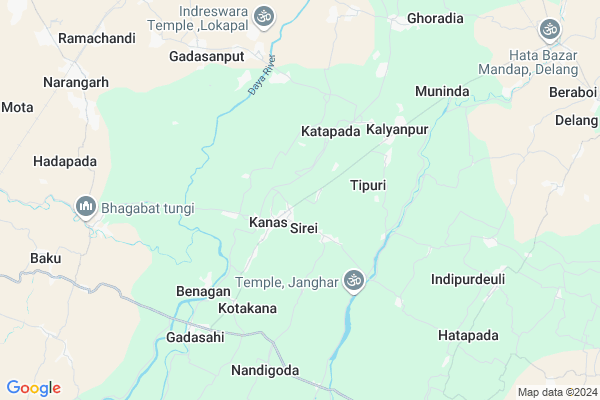
Rahandia Map
EDIT Map
Add Your House
 ..
..
Current Corona Virus Infected Patients Count in Puri District
| City Name | District Name | Total Covid cases |
|---|---|---|
| Puri District | Puri | 1 |
Locality Name :
Rahandia
( ରହାନଡିଆ )
Tehsil Name : Kanas
District : Puri
State : Odisha
Language : Oriya and Hindi
Current Time 10:21 AM
Date: Tuesday , Apr 29,2025 (IST)
Time zone: IST (UTC+5:30)
Elevation / Altitude: 15 meters. Above Seal level
Telephone Code / Std Code: 06755
Assembly constituency : Satyabadi assembly constituency
Assembly MLA : umakanta samantray
Lok Sabha constituency : Puri parliamentary constituency
Parliament MP : PINAKI MISRA
Serpanch Name :
Pin Code : 752017
Post Office Name : Kanas
Commodities Prices : Dumal Market / Mandi
Rahandia Live Weather
Temperature: 30.3 °C
clear sky
Humidity: 48%
Wind : 5.71 mt/sec towards S
StationName : "Jatani"
observed on 5 Mins Back
Temperature: 30.3 °C
clear sky
Humidity: 48%
Wind : 5.71 mt/sec towards S
StationName : "Jatani"
observed on 5 Mins Back
Rahandia Weather Forecast for Next 5 days
30-04-2025
27.1°C to 35.4°C
clear sky, heavy intensity rain, few clouds
27.1°C to 35.4°C
clear sky, heavy intensity rain, few clouds
01-05-2025
24.3°C to 34.4°C
clear sky, light rain
24.3°C to 34.4°C
clear sky, light rain
02-05-2025
22.9°C to 34.4°C
clear sky, few clouds, light rain, scattered clouds, moderate rain
22.9°C to 34.4°C
clear sky, few clouds, light rain, scattered clouds, moderate rain
03-05-2025
22.3°C to 34.6°C
few clouds, scattered clouds, heavy intensity rain, light rain
22.3°C to 34.6°C
few clouds, scattered clouds, heavy intensity rain, light rain
04-05-2025
23.3°C to 34.2°C
broken clouds, clear sky, few clouds, light rain, overcast clouds
23.3°C to 34.2°C
broken clouds, clear sky, few clouds, light rain, overcast clouds
National Highways Reachable To Rahandia
Nationa High Way :NH316
Nationa High Way :NH316
Rivers Near Rahandia
Duanta
Kusumi
Duanta
Kusumi
About Rahandia
Correct below Info and add more info about RahandiaRahandia is a small Village/hamlet in Kanas Tehsil in Puri District of Odisha State, India. It is located 32 KM towards North from District head quarters Puri. 5 KM from Kanas. 40 KM from State capital Bhubaneswar
Rahandia Pin code is 752017 and postal head office is Kanas .
Pandiakera ( 3 KM ) , Badas ( 4 KM ) , Gadabalabhadrapur ( 4 KM ) , Trilochanapur ( 4 KM ) , Kalyanpur ( 5 KM ) are the nearby Villages to Rahandia. Rahandia is surrounded by Delanga Tehsil towards East , Satyabadi Tehsil towards East , Khordha Tehsil towards North , Tangi Tehsil towards west .
Jatani , Khordha , Puri , Bhubaneswar are the near by Cities to Rahandia.
This Place is in the border of the Puri District and Khordha District. Khordha District Jatni is North towards this place .
Rahandia 2011 Census Details
Rahandia Local Language is Oriya. Rahandia Village Total population is 684 and number of houses are 148. Female Population is 48.5%. Village literacy rate is 82.3% and the Female Literacy rate is 36.1%.
Population
| Census Parameter | Census Data |
| Total Population | 684 |
| Total No of Houses | 148 |
| Female Population % | 48.5 % ( 332) |
| Total Literacy rate % | 82.3 % ( 563) |
| Female Literacy rate | 36.1 % ( 247) |
| Scheduled Tribes Population % | 0.0 % ( 0) |
| Scheduled Caste Population % | 8.3 % ( 57) |
| Working Population % | 29.5 % |
| Child(0 -6) Population by 2011 | 69 |
| Girl Child(0 -6) Population % by 2011 | 56.5 % ( 39) |
Rahandia Census More Deatils.
Politics in Rahandia
INC is the major political party in this area.Polling Stations /Booths near Rahandia
1)Rudhupur Pry. School2)Pakshimunda Project Pry. School
3)Taila Bhagabatipada Pry. School
4)Bagalpur Pry. School
5)Gaupada Pry. School
HOW TO REACH Rahandia
By Rail
Tapang Rail Way Station , Dhaulimuhan Rail Way Station are the very nearby railway stations to Rahandia.Colleges near Rahandia
Mangala Mahavidyalaya
Address :
Jagannath Computer Academy
Address :
Nayahat Mahavidyalaya
Address :
Mangal Moha Bidyalaya,kaktpur
Address :
Pipilicollege,pipili,puri
Address :
Schools near Rahandia
Anlajodi Hs
Address : analajodi , kanas , puri , Sikkim . PIN- 752050 , Post - Retang Colony
Chupuringh Gram Panchayat Hs
Address : chupuringi , kanas , puri , Sikkim . PIN- 752017 , Post - Kanas
Sahupada Hs
Address : sahupada , kanas , puri , Sikkim . PIN- 752019 , Post - Nirakarpur
Viswanath Smruti Vidyaniketan
Address : sirei , kanas , puri , Sikkim . PIN- 752017 , Post - Kanas
Govt Health Centers near Rahandia
1) Balapur , Balapur SC , Balapur , Balapur2) Narangarh , Narangarh SC , Narangarh , Narangarh
3) HADAPADA , HADAPADA PHC , HADAPADA , HADAPADA
Hospitals in Rahandia,Kanas
ashirbad medicine store
Kanas-Delang Rd; Delangakothabar; Odisha 752015; India
1.2 KM distance Detail
more ..
Police Stations near Rahandia,Kanas
Gadisagada Police Station
Gadisagada;; Gopinathpur - Kalapadar Rd; Jamilagoda; Odisha 752017; India
13.5 KM distance Detail
About Rahandia &
History
How to reach Rahandia
Tourist Places Near By Rahandia
Schools in Rahandia
Colleges in Rahandia
Temperature & weather of Rahandia
places in Rahandia
Rahandia photos
More Information
How to reach Rahandia
Tourist Places Near By Rahandia
Schools in Rahandia
Colleges in Rahandia
Temperature & weather of Rahandia
places in Rahandia
Rahandia photos
More Information
Village Talk
Post News or Events about this Village
Near Cities
Jatani 20 KM near
Khordha 21 KM near
Puri 32 KM near
Bhubaneswar 38 KM near
Jatani 20 KM near
Khordha 21 KM near
Puri 32 KM near
Bhubaneswar 38 KM near
Near By Taluks
Kanas 5 KM near
Delanga 10 KM near
Satyabadi 20 KM near
Khordha 20 KM near
Kanas 5 KM near
Delanga 10 KM near
Satyabadi 20 KM near
Khordha 20 KM near
Near By Air Ports
Bhubaneswar Airport 35 KM near
Vishakhapatnam Airport 403 KM near
Ranchi Airport 413 KM near
Netaji Subhas Chandra Bose Airport 460 KM near
Bhubaneswar Airport 35 KM near
Vishakhapatnam Airport 403 KM near
Ranchi Airport 413 KM near
Netaji Subhas Chandra Bose Airport 460 KM near
Near By Tourist Places
Puri 31 KM near
Bhubaneswar 40 KM near
Nandan Kanan National Park 51 KM near
Konark 52 KM near
Chilika 54 KM near
Puri 31 KM near
Bhubaneswar 40 KM near
Nandan Kanan National Park 51 KM near
Konark 52 KM near
Chilika 54 KM near
Near By Districts
Puri 30 KM near
Khordha 39 KM near
Cuttack 63 KM near
Jagatsinghapur 67 KM near
Puri 30 KM near
Khordha 39 KM near
Cuttack 63 KM near
Jagatsinghapur 67 KM near
Near By RailWay Station
Nirakarpur Rail Way Station 15 KM near
Khurda Road Junction Rail Way Station 18 KM near
Nirakarpur Rail Way Station 15 KM near
Khurda Road Junction Rail Way Station 18 KM near