| Home | City Bus | Maps | Villages | Cities | Rail | Tourist Places | School | College | Pin Codes | Corona Cases Count |
| Distance Calculator Bus Services IFSC Codes Trace Mobile Number Weather Search Place Trace IP Available Cash ATM/Banks Locate Polling Booth Report an Error contact People |
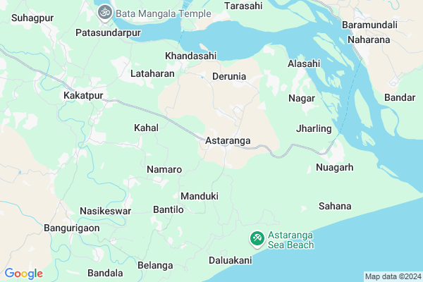
Patasundarpur Map
EDIT Map
Add Your House
 ..
..
Current Corona Virus Infected Patients Count in Puri District
| City Name | District Name | Total Covid cases |
|---|---|---|
| Puri District | Puri | 1 |
Locality Name :
Patasundarpur
( ପତ୍ତସୁନ୍ଦରପୁର )
Tehsil Name : Astaranga
District : Puri
State : Odisha
Language : Oriya and Hindi
Current Time 07:39 PM
Date: Tuesday , Apr 29,2025 (IST)
Time zone: IST (UTC+5:30)
Elevation / Altitude: 8 meters. Above Seal level
Telephone Code / Std Code: 06758
Assembly constituency : Kakatpur assembly constituency
Assembly MLA : surendra sethi
Lok Sabha constituency : Jagatsinghpur parliamentary constituency
Parliament MP : RAJASHREE MALLICK
Serpanch Name :
Commodities Prices : Nimapara Market / Mandi
National Highways Reachable To Patasundarpur
Nationa High Way :NH316
Nationa High Way :NH55
Nationa High Way :NH316
Nationa High Way :NH55
Rivers Near Patasundarpur
Brahmani :Брагмані
Mahanadi
Brahmani :Брагмані
Mahanadi
About Patasundarpur
Correct below Info and add more info about PatasundarpurPatasundarpur is a small Village/hamlet in Astaranga Tehsil in Puri District of Odisha State, India. It is located 57 KM towards East from District head quarters Puri. 64 KM from State capital Bhubaneswar
Patasundarpur is surrounded by Kakat Pur Tehsil towards west , Naugaon Tehsil towards North , Balikuda Tehsil towards North , Gop Tehsil towards west .
Jagatsinghapur , Puri , Paradip , Bhubaneswar are the near by Cities to Patasundarpur.
This Place is in the border of the Puri District and Jagatsinghapur District. Jagatsinghapur District Naugaon is North towards this place . It is near to bay of bengal. There is a chance of humidity in the weather.
Patasundarpur 2011 Census Details
Patasundarpur Local Language is Oriya. Patasundarpur Village Total population is 1281 and number of houses are 304. Female Population is 47.9%. Village literacy rate is 73.2% and the Female Literacy rate is 31.1%.
Population
| Census Parameter | Census Data |
| Total Population | 1281 |
| Total No of Houses | 304 |
| Female Population % | 47.9 % ( 613) |
| Total Literacy rate % | 73.2 % ( 938) |
| Female Literacy rate | 31.1 % ( 399) |
| Scheduled Tribes Population % | 0.0 % ( 0) |
| Scheduled Caste Population % | 99.9 % ( 1280) |
| Working Population % | 26.4 % |
| Child(0 -6) Population by 2011 | 145 |
| Girl Child(0 -6) Population % by 2011 | 45.5 % ( 66) |
Patasundarpur Census More Deatils.
Politics in Patasundarpur
BJD is the major political party in this area.Polling Stations /Booths near Patasundarpur
1)Kuapada Pry. School2)Kuhudi U.g.u.p. School
3)Asana U.g.u.p.school
4)Mahalapada Pry. School
5)Krupasindupur Pry. School Krupasindhu
HOW TO REACH Patasundarpur
By Rail
There is no railway station near to Patasundarpur in less than 10 km.Pincodes near Patasundarpur
752109 ( Astaranga ) , 752119 ( Lataharan ) , 752118 ( Bangurigaon )Colleges near Patasundarpur
Jagannath Computer Academy
Address :
Dr Abhinash Chandra Homeopathy College
Address : Unit 3, Nr Kesri Talkies, Kharvel Nagar,, Ashok Na
Satyasai Medical College
Address : 420, Sikharchandi,, Bjb Nagar, Bhubaneshwar - 7510
Orissa Medical College Of Medicines & Research
Address : Naharkanta,, Kharvel Nagar, Bhubaneshwar - 751001
Mahavir Institute Of Engineering And Technology
Address : P.o. - Palaspur,bhubaneswar
Schools in Patasundarpur
Jamarsuan Ugups
Address : patasundarpur , astarang , puri , Sikkim . PIN- 752109 , Post - Astaranga
Govt Health Centers near Patasundarpur
1) Tarasahi , Ichhapur , Ichhapur , Ichhapur PANCHAYAT OFFICE2) SC Ichhapur , ICHHAPUR SC , ICHHAPUR , ICHHAPUR PANCHAYAT OFFICE
3) Nariso , NARISO , NARISO , NARISO
Colleges in Patasundarpur,Astaranga
Kalinga Residental +3 College
Astaranga-Jahania Road; Astaranga; Odisha 752109; India
1.1 KM distance Detail
more ..
Schools in Patasundarpur,Astaranga
Astaranga Girls High School
Astaranga-Jahania Road; Astaranga; Odisha 752109; India
0.8 KM distance Detail
Labana Satyagraha High School
Kakatpur-Astaranga Rd; khudi; Astaranga; Odisha 752109; India
0.8 KM distance Detail
Astaranga High school
Astaranga-Bangurigaon Rd; Astaranga; Odisha 752109; India
0.8 KM distance Detail
Electronic Shops in Patasundarpur,Astaranga
prasan ommkar furniture laxmi mandap
Kakatpur-Astaranga Rd; Astaranga; Odisha 752109; India
0.9 KM distance Detail
Super Markets in Patasundarpur,Astaranga
Mutunia Mlik Collection Centre
Mutunia Village Rd; Mutunia; Odisha 752108; India
8.5 KM distance Detail
Police Stations near Patasundarpur,Astaranga
Astaranga Police Station
Astaranga-Bangurigaon Rd; Astaranga; Odisha 752109; India
0.9 KM distance Detail
About Patasundarpur &
History
How to reach Patasundarpur
Tourist Places Near By Patasundarpur
Schools in Patasundarpur
Colleges in Patasundarpur
Temperature & weather of Patasundarpur
places in Patasundarpur
Patasundarpur photos
More Information
How to reach Patasundarpur
Tourist Places Near By Patasundarpur
Schools in Patasundarpur
Colleges in Patasundarpur
Temperature & weather of Patasundarpur
places in Patasundarpur
Patasundarpur photos
More Information
Village Talk
Post News or Events about this Village
Near Cities
Jagatsinghapur 37 KM near
Puri 54 KM near
Paradip 59 KM near
Bhubaneswar 64 KM near
Jagatsinghapur 37 KM near
Puri 54 KM near
Paradip 59 KM near
Bhubaneswar 64 KM near
Near By Taluks
Astaranga 0 KM near
Kakat Pur 10 KM near
Naugaon 16 KM near
Balikuda 18 KM near
Astaranga 0 KM near
Kakat Pur 10 KM near
Naugaon 16 KM near
Balikuda 18 KM near
Near By Air Ports
Bhubaneswar Airport 61 KM near
Netaji Subhas Chandra Bose Airport 417 KM near
Ranchi Airport 429 KM near
Vishakhapatnam Airport 454 KM near
Bhubaneswar Airport 61 KM near
Netaji Subhas Chandra Bose Airport 417 KM near
Ranchi Airport 429 KM near
Vishakhapatnam Airport 454 KM near
Near By Tourist Places
Konark 22 KM near
Puri 54 KM near
Paradeep Beach 59 KM near
Bhubaneswar 64 KM near
Nandan Kanan National Park 73 KM near
Konark 22 KM near
Puri 54 KM near
Paradeep Beach 59 KM near
Bhubaneswar 64 KM near
Nandan Kanan National Park 73 KM near
Near By Districts
Jagatsinghapur 36 KM near
Puri 55 KM near
Khordha 64 KM near
Kendrapara 68 KM near
Jagatsinghapur 36 KM near
Puri 55 KM near
Khordha 64 KM near
Kendrapara 68 KM near
Near By RailWay Station
Sakhi Gopal Rail Way Station 52 KM near
Puri Rail Way Station 53 KM near
Sakhi Gopal Rail Way Station 52 KM near
Puri Rail Way Station 53 KM near