| Home | City Bus | Maps | Villages | Cities | Rail | Tourist Places | School | College | Pin Codes | Corona Cases Count |
| Distance Calculator Bus Services IFSC Codes Trace Mobile Number Weather Search Place Trace IP Available Cash ATM/Banks Locate Polling Booth Report an Error contact People |
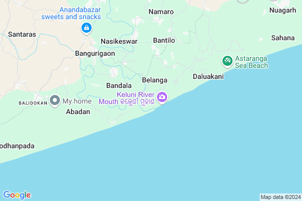
Keutajanga Map
EDIT Map
Add Your House
 ..
..
Current Corona Virus Infected Patients Count in Puri District
| City Name | District Name | Total Covid cases |
|---|---|---|
| Puri District | Puri | 1 |
Locality Name :
Keutajanga
( କେଉଁଟଜନଗା )
Tehsil Name : Astaranga
District : Puri
State : Odisha
Language : Oriya and Hindi
Current Time 07:42 PM
Date: Tuesday , Apr 29,2025 (IST)
Time zone: IST (UTC+5:30)
Elevation / Altitude: 8 meters. Above Seal level
Telephone Code / Std Code: 06758
Assembly constituency : Kakatpur assembly constituency
Assembly MLA :
Lok Sabha constituency : Jagatsinghpur parliamentary constituency
Parliament MP :
Serpanch Name :
Commodities Prices : Nimapara Market / Mandi
Keutajanga Live Weather
Temperature: 28.3 °C
clear sky
Humidity: 81%
Wind : 5.49 mt/sec towards S
StationName : "Konark"
observed on 58 Mins Back
Temperature: 28.3 °C
clear sky
Humidity: 81%
Wind : 5.49 mt/sec towards S
StationName : "Konark"
observed on 58 Mins Back
Keutajanga Weather Forecast for Next 5 days
30-04-2025
26.0°C to 29.2°C
light rain, moderate rain
26.0°C to 29.2°C
light rain, moderate rain
01-05-2025
26.0°C to 32.7°C
scattered clouds, clear sky, light rain, moderate rain, broken clouds
26.0°C to 32.7°C
scattered clouds, clear sky, light rain, moderate rain, broken clouds
02-05-2025
22.6°C to 32.3°C
light rain, scattered clouds, moderate rain, overcast clouds
22.6°C to 32.3°C
light rain, scattered clouds, moderate rain, overcast clouds
03-05-2025
25.2°C to 31.7°C
scattered clouds, few clouds, light rain
25.2°C to 31.7°C
scattered clouds, few clouds, light rain
04-05-2025
26.5°C to 32.9°C
broken clouds, clear sky, light rain, overcast clouds
26.5°C to 32.9°C
broken clouds, clear sky, light rain, overcast clouds
National Highways Reachable To Keutajanga
Nationa High Way :NH316
Nationa High Way :NH55
Nationa High Way :NH316
Nationa High Way :NH55
Rivers Near Keutajanga
Brahmani :Брагмані
Mahanadi
Brahmani :Брагмані
Mahanadi
About Keutajanga
Correct below Info and add more info about KeutajangaKeutajanga is a small Village/hamlet in Astaranga Tehsil in Puri District of Odisha State, India. It is located 52 KM towards East from District head quarters Puri. 8 KM from Astarang. 66 KM from State capital Bhubaneswar
Nasikeswar ( 5 KM ) , Chhuriana ( 5 KM ) , Manduki ( 6 KM ) , Bangurigaon ( 6 KM ) , Saripur ( 6 KM ) are the nearby Villages to Keutajanga. Keutajanga is surrounded by Kakat Pur Tehsil towards west , Naugaon Tehsil towards North , Gop Tehsil towards west , Balikuda Tehsil towards North .
Jagatsinghapur , Puri , Bhubaneswar , Paradip are the near by Cities to Keutajanga.
This Place is in the border of the Puri District and Jagatsinghapur District. Jagatsinghapur District Naugaon is North towards this place . It is near to bay of bengal. There is a chance of humidity in the weather.
Keutajanga 2011 Census Details
Keutajanga Local Language is Oriya. Keutajanga Village Total population is 219 and number of houses are 53. Female Population is 49.8%. Village literacy rate is 74.9% and the Female Literacy rate is 30.1%.
Population
| Census Parameter | Census Data |
| Total Population | 219 |
| Total No of Houses | 53 |
| Female Population % | 49.8 % ( 109) |
| Total Literacy rate % | 74.9 % ( 164) |
| Female Literacy rate | 30.1 % ( 66) |
| Scheduled Tribes Population % | 0.0 % ( 0) |
| Scheduled Caste Population % | 0.0 % ( 0) |
| Working Population % | 52.1 % |
| Child(0 -6) Population by 2011 | 18 |
| Girl Child(0 -6) Population % by 2011 | 66.7 % ( 12) |
Keutajanga Census More Deatils.
Politics in Keutajanga
BJD is the major political party in this area.Polling Stations /Booths near Keutajanga
1)Badasirei U.g.u.p. School Badasirei2)Badaolangar Pry. School
3)Athatira Pry. School
4)Sisua Psme School-1
5)Siripur Project U.p School Siripur
HOW TO REACH Keutajanga
By Rail
There is no railway station near to Keutajanga in less than 10 km.Pincodes near Keutajanga
752118 ( Bangurigaon ) , 752109 ( Astaranga ) , 752108 ( Kakatpur )Colleges near Keutajanga
Jagannath Computer Academy
Address :
Dr Abhinash Chandra Homeopathy College
Address : Unit 3, Nr Kesri Talkies, Kharvel Nagar,, Ashok Na
Satyasai Medical College
Address : 420, Sikharchandi,, Bjb Nagar, Bhubaneshwar - 7510
Orissa Medical College Of Medicines & Research
Address : Naharkanta,, Kharvel Nagar, Bhubaneshwar - 751001
Mahavir Institute Of Engineering And Technology
Address : P.o. - Palaspur,bhubaneswar
Schools in Keutajanga
Bira Pratappur Ps
Address : keutajanga , astarang , puri , Sikkim . PIN- 752109 , Post - Astaranga
Govt Health Centers near Keutajanga
1) Tarasahi , Ichhapur , Ichhapur , Ichhapur PANCHAYAT OFFICE2) SC Ichhapur , ICHHAPUR SC , ICHHAPUR , ICHHAPUR PANCHAYAT OFFICE
3) Nariso , NARISO , NARISO , NARISO
Hospitals in Keutajanga,Astaranga
Bangurigaon medical
Anandbazar; Ganipur - Bangurigaon Rd; Bangurigaon; Odisha 752118; India
6.1 KM distance Detail
more ..
Colleges in Keutajanga,Astaranga
Ratanpur Science Degree College
Bangurigaon-Udayapur Road; Udayapur; Odisha 752109; India
5.1 KM distance Detail
more ..
Schools in Keutajanga,Astaranga
Janata High School-Bantilo
Astaranga-Bangurigaon Rd; Bantilo; Odisha 752109; India
3.7 KM distance Detail
Electronic Shops in Keutajanga,Astaranga
SAI MANGALA ELECTRICALS & MOBILES
Konark-Kakatpur Rd; Nasikeswar; Odisha 752109; India
5.1 KM distance Detail
A.G.N.T Electronics & Electrical Workshop
8; Anandbazar-Bangurigaon Road; Bangurigaon; Odisha 752118; India
5.9 KM distance Detail
Super Markets in Keutajanga,Astaranga
Mutunia Mlik Collection Centre
Mutunia Village Rd; Mutunia; Odisha 752108; India
16.5 KM distance Detail
Barunai Balkular Milk Plant
Mutunia Village Rd; Mutunia; Odisha 752108; India
16.7 KM distance Detail
Police Stations near Keutajanga,Astaranga
Astaranga Police Station
Astaranga-Bangurigaon Rd; Astaranga; Odisha 752109; India
9.7 KM distance Detail
Governement Offices near Keutajanga,Astaranga
Korana Gram Panchayat Office
Astaranga-Bangurigaon Rd; Korana; Odisha 752109; India
4.4 KM distance Detail
R I OFFICE BANGURIGAN
8; Anandbazar-Bangurigaon Road; Bangurigaon; Odisha 752118; India
6.2 KM distance Detail
About Keutajanga &
History
How to reach Keutajanga
Tourist Places Near By Keutajanga
Schools in Keutajanga
Colleges in Keutajanga
Temperature & weather of Keutajanga
places in Keutajanga
Keutajanga photos
More Information
How to reach Keutajanga
Tourist Places Near By Keutajanga
Schools in Keutajanga
Colleges in Keutajanga
Temperature & weather of Keutajanga
places in Keutajanga
Keutajanga photos
More Information
Village Talk
Post News or Events about this Village
Near Cities
Jagatsinghapur 45 KM near
Puri 48 KM near
Bhubaneswar 67 KM near
Paradip 68 KM near
Jagatsinghapur 45 KM near
Puri 48 KM near
Bhubaneswar 67 KM near
Paradip 68 KM near
Near By Taluks
Astaranga 8 KM near
Kakat Pur 9 KM near
Gop 24 KM near
Naugaon 24 KM near
Astaranga 8 KM near
Kakat Pur 9 KM near
Gop 24 KM near
Naugaon 24 KM near
Near By Air Ports
Bhubaneswar Airport 64 KM near
Netaji Subhas Chandra Bose Airport 426 KM near
Ranchi Airport 437 KM near
Vishakhapatnam Airport 446 KM near
Bhubaneswar Airport 64 KM near
Netaji Subhas Chandra Bose Airport 426 KM near
Ranchi Airport 437 KM near
Vishakhapatnam Airport 446 KM near
Near By Tourist Places
Konark 16 KM near
Puri 48 KM near
Bhubaneswar 67 KM near
Paradeep Beach 68 KM near
Nandan Kanan National Park 77 KM near
Konark 16 KM near
Puri 48 KM near
Bhubaneswar 67 KM near
Paradeep Beach 68 KM near
Nandan Kanan National Park 77 KM near
Near By Districts
Jagatsinghapur 44 KM near
Puri 49 KM near
Khordha 67 KM near
Kendrapara 77 KM near
Jagatsinghapur 44 KM near
Puri 49 KM near
Khordha 67 KM near
Kendrapara 77 KM near
Near By RailWay Station
Puri Rail Way Station 47 KM near
Sakhi Gopal Rail Way Station 48 KM near
Puri Rail Way Station 47 KM near
Sakhi Gopal Rail Way Station 48 KM near