| Home | City Bus | Maps | Villages | Cities | Rail | Tourist Places | School | College | Pin Codes | Corona Cases Count |
| Distance Calculator Bus Services IFSC Codes Trace Mobile Number Weather Search Place Trace IP Available Cash ATM/Banks Locate Polling Booth Report an Error contact People |
Solu
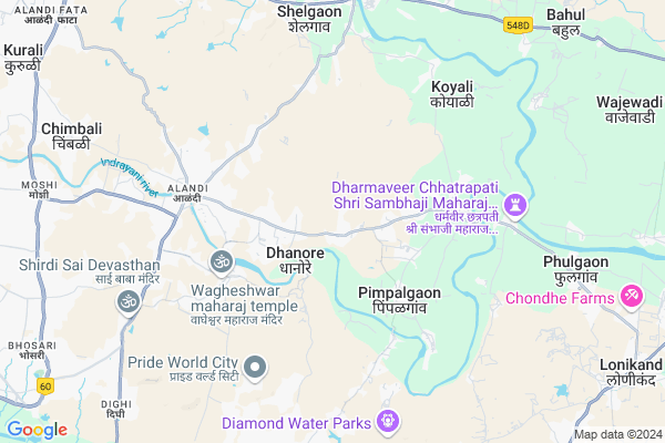
Solu Map
EDIT Map
Add Your House
 ..
..
Current Corona Virus Infected Patients Count in Pune District
| City Name | District Name | Total Covid cases |
|---|---|---|
| Pune District | Pune | 514 |
| PMC | Pune | 69 |
| Pimpri-Chinchwad | Pune | 49 |
| Pune | Pune | 40 |
| Pune Rural | Pune | 17 |
| PCMC | Pune | 8 |
| Parvati - Pune | Pune | 3 |
| Baramati | Pune | 1 |
| Hadapsar-Pune | Pune | 1 |
| Bhawani Peth Pune | Pune | 1 |
| Pune Dist | Pune | 1 |
| Limboni Nagar Pune | Pune | 1 |
| Hadapsar - Pune | Pune | 1 |
Locality Name :
Solu
( सोलू )
Taluka Name : Khed
District : Pune
State : Maharashtra
Region : Desh or Paschim Maharashtra
Division : Pune
Language : Marathi and Hindi, Kannada, Marwari
Current Time 01:06 PM
Date: Friday , Apr 25,2025 (IST)
Time zone: IST (UTC+5:30)
Elevation / Altitude: 596 meters. Above Seal level
Telephone Code / Std Code: 02135
Assembly constituency : Khed Alandi assembly constituency
Assembly MLA : Dilip Dattatray Mohite
Lok Sabha constituency : Shirur parliamentary constituency
Parliament MP : Dr. Amol Ramsing Kolhe
Serpanch Name :
Pin Code : 412105
Post Office Name : Alandi Devachi
Commodities Prices : Pune(Moshi) Market / Mandi
National Highways Reachable To Solu
Nationa High Way :NH360;NH953
Nationa High Way :NH65
Nationa High Way :NH360;NH953
Nationa High Way :NH65
Rivers Near Solu
Mandhal
Bhogawati
Mandhal
Bhogawati
About Solu
Correct below Info and add more info about SoluSolu is a Village in Khed Taluka in Pune District of Maharashtra State, India. It belongs to Desh or Paschim Maharashtra region . It belongs to Pune Division . It is located 21 KM towards North from District head quarters Pune. 25 KM from Khed. 141 KM from State capital Mumbai
Solu Pin code is 412105 and postal head office is Alandi Devachi .
Nirgudi ( 2 KM ) , Markal ( 2 KM ) , Nirgudi ( 3 KM ) , Charholi Budruk ( 4 KM ) , Charholi Kh. ( 4 KM ) are the nearby Villages to Solu. Solu is surrounded by Pune Taluka towards South , Khed Taluka towards North , Haveli Taluka towards South , Talegaon Dabhade Taluka towards west .
Pimpri-Chinchwad , Pune , Talegaon Dabhade , Manchar are the near by Cities to Solu.
Solu 2011 Census Details
Solu Local Language is Marathi. Solu Village Total population is 2883 and number of houses are 622. Female Population is 47.7%. Village literacy rate is 72.4% and the Female Literacy rate is 32.6%.
Population
| Census Parameter | Census Data |
| Total Population | 2883 |
| Total No of Houses | 622 |
| Female Population % | 47.7 % ( 1376) |
| Total Literacy rate % | 72.4 % ( 2088) |
| Female Literacy rate | 32.6 % ( 940) |
| Scheduled Tribes Population % | 0.4 % ( 12) |
| Scheduled Caste Population % | 15.4 % ( 443) |
| Working Population % | 49.1 % |
| Child(0 -6) Population by 2011 | 388 |
| Girl Child(0 -6) Population % by 2011 | 46.6 % ( 181) |
Solu Census More Deatils.
Politics in Solu
Nationalist Congress Party , NCP , SHS are the major political parties in this area.Polling Stations /Booths near Solu
1)Z.p School Siddhegavan West Facing Room No.12)Z.p School Solu South Facing East Side Room No.2
3)Aashram Shala Kohinde Khurd North Side Room No.1
4)Z.p School Yeniye Khurd Room No.1 From West Side
5)Z.p School Pimpalgaon T Khed (doundkarwadi) Northern Facing West Side Room No.1
HOW TO REACH Solu
By Rail
There is no railway station near to Solu in less than 10 km. Begdewadi Rail Way Station (near to Dehu Road) , Dehu Road Rail Way Station (near to Dehu Road) , Ghorawadi Rail Way Station (near to Talegaon Dabhade) , Talegaon Rail Way Station (near to Talegaon Dabhade) are the Rail way stations reachable from near by towns.By Road
Alandi , Dehu Road , Talegaon Dabhade are the nearby by towns to Solu having road connectivity to SoluColleges near Solu
Hutatma Rajguru Mahavidyalaya,rajguru Nagar Tal-khed Dist -pune
Address : A/p Rajguru Nagar,tal.khed.dist.pune-410505
श्रीराम शिक्षण प्रसारक मंडळाचे नवचैतन्य उच्च माध्यमिक विद्यालय काळुस
Address : Pune, Khed, Kalus, In Front Kalasawar Temple, Beside River
Schools in Solu
Zpps Shree Sant Muktabai Mad Solu
Address : solu , khed , pune , Maharashtra . PIN- 412105 , Post - Alandi Devachi
Zpps Solu
Address : solu , khed , pune , Maharashtra . PIN- 412105 , Post - Alandi Devachi
Govt Health Centers near Solu
1) Solu , , ,2) Markal , , ,
3) Vadgaon Ghenand , , ,
Hospitals in Solu,Khed
Dr. Shrikant Kurhade
KK Multispeciality Hospital; Opposite SBI; Alandi - Markal Rd; Alandi; Pune; Maharashtra 411025; India
1.1 KM distance Detail
prakash medical
near water tank; markal alandi road;tq.khed markal; pune; Maharashtra 412105; India
3.1 KM distance Detail
chaitanya homoeo clinic
Alandi - Markal Rd; Alandi; Markal; Maharashtra 412105; India
4.2 KM distance Detail
more ..
Petrol Bunks in Solu,Khed
Rahee Petroleum BPCL Outlet
Alandi - Markal Rd; Solu; Maharashtra 412105; India
0.5 KM distance Detail
HP PETROL PUMP - GAWADE PATIL PETROLEUM
GAT NO. 147; Alandi Markal Road Village Dhnore Taluka Khed; Pune; 412105; India
2.6 KM distance Detail
more ..
Colleges in Solu,Khed
Ajeenkya DY Patil University's - School of Film and Media
Charholi Budruk; Pune; Maharashtra 412105; India
4.2 KM distance Detail
Jagannathpuri Sopan jai park
Charholi Road; Charholi Budruk; Maharashtra 412105; India
4.8 KM distance Detail
Prajapita Brahmakumari ishwariya vishwavidyalaya
Alandi - Markal Rd; Alandi; Maharashtra 412105; India
4.9 KM distance Detail
D Y Patil International College
Charoli Budruk; Tal. Haveli; Lohegaon; Pune; Maharashtra 412105; India
5.0 KM distance Detail
more ..
Schools in Solu,Khed
Z.p Primary School Solu
Alandi - Markal Rd; Markal; Maharashtra 412105; India
2.2 KM distance Detail
Super Markets in Solu,Khed
Harshkumar Chrodiya Super Market
Bazaar Peth;Near Bank Of Maharashtra; Charholi Budruk; Maharashtra 412105; India
4.2 KM distance Detail
Local Parks in Solu,Khed
Indrayani Park
Triveni Ashram road; Near Vipassana meditation Centre; Pune; Markal; Maharashtra 412105; India
5.3 KM distance Detail
Police Stations near Solu,Khed
Vishrantwadi Police Chowki
Near Hanuman Mandir; Charholi Budruk; Pimpri-Chinchwad; Maharashtra 412105; India
4.4 KM distance Detail
Alandi Police Station
Alandi Police Station; Alandi; Maharashtra 412105; India
5.2 KM distance Detail
Dighi Police Station
Tajne Mala; Wadmukhwadi; Charholi Budruk; Pimpri-Chinchwad; Maharashtra 412105; India
7.4 KM distance Detail
Governement Offices near Solu,Khed
Grampanchayat Karyalay Solu
Gaonthan Parisar Solu; Alandi - Markal Rd; Solu; Maharashtra; India
0.8 KM distance Detail
Grampanchyat Karyalay Dhanore
Near Parachi Taliim; Dhanore; Maharashtra 412105; India
2.1 KM distance Detail
About Solu &
History
How to reach Solu
Tourist Places Near By Solu
Schools in Solu
Colleges in Solu
Temperature & weather of Solu
places in Solu
Solu photos
More Information
How to reach Solu
Tourist Places Near By Solu
Schools in Solu
Colleges in Solu
Temperature & weather of Solu
places in Solu
Solu photos
More Information
Village Talk
Post News or Events about this Village
Near Cities
Pimpri-Chinchwad 17 KM near
Pune 20 KM near
Talegaon Dabhade 31 KM near
Manchar 41 KM near
Pimpri-Chinchwad 17 KM near
Pune 20 KM near
Talegaon Dabhade 31 KM near
Manchar 41 KM near
Near By Taluks
Pimpri-Chinchwad 18 KM near
Pune 21 KM near
Khed 24 KM near
Haveli 28 KM near
Pimpri-Chinchwad 18 KM near
Pune 21 KM near
Khed 24 KM near
Haveli 28 KM near
Near By Air Ports
Lohegaon Airport 11 KM near
Chhatrapati Shivaji International Airport 136 KM near
Gandhinagar Airport 162 KM near
Chikkalthana Airport 227 KM near
Lohegaon Airport 11 KM near
Chhatrapati Shivaji International Airport 136 KM near
Gandhinagar Airport 162 KM near
Chikkalthana Airport 227 KM near
Near By Tourist Places
Vadhu Tulapur 11 KM near
Pimpri-Chinchwad 17 KM near
Pune 21 KM near
Kamshet 47 KM near
Lavasa 60 KM near
Vadhu Tulapur 11 KM near
Pimpri-Chinchwad 17 KM near
Pune 21 KM near
Kamshet 47 KM near
Lavasa 60 KM near
Near By Districts
Pune 20 KM near
Ahmednagar 108 KM near
Satara 122 KM near
Raigad 126 KM near
Pune 20 KM near
Ahmednagar 108 KM near
Satara 122 KM near
Raigad 126 KM near
Near By RailWay Station
Khadki Rail Way Station 17 KM near
Chinchwad Rail Way Station 17 KM near
Khadki Rail Way Station 17 KM near
Chinchwad Rail Way Station 17 KM near