| Home | City Bus | Maps | Villages | Cities | Rail | Tourist Places | School | College | Pin Codes | Corona Cases Count |
| Distance Calculator Bus Services IFSC Codes Trace Mobile Number Weather Search Place Trace IP Available Cash ATM/Banks Locate Polling Booth Report an Error contact People |
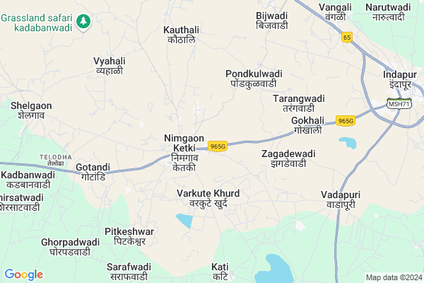
Akole
Akole Map
EDIT Map
Add Your House
 ..
..
Current Corona Virus Infected Patients Count in Pune District
| City Name | District Name | Total Covid cases |
|---|---|---|
| Pune District | Pune | 514 |
| PMC | Pune | 69 |
| Pimpri-Chinchwad | Pune | 49 |
| Pune | Pune | 40 |
| Pune Rural | Pune | 17 |
| PCMC | Pune | 8 |
| Parvati - Pune | Pune | 3 |
| Hadapsar-Pune | Pune | 1 |
| Bhawani Peth Pune | Pune | 1 |
| Pune Dist | Pune | 1 |
| Limboni Nagar Pune | Pune | 1 |
| Hadapsar - Pune | Pune | 1 |
| Baramati | Pune | 1 |
Locality Name :
Akole
( अकोले )
Taluka Name : Indapur
District : Pune
State : Maharashtra
Region : Desh or Paschim Maharashtra
Division : Pune
Language : Marathi and Hindi, Kannada, Marwari
Current Time 11:27 AM
Date: Tuesday , Apr 29,2025 (IST)
Time zone: IST (UTC+5:30)
Elevation / Altitude: 493 meters. Above Seal level
Telephone Code / Std Code: 02111
Assembly constituency : Indapur assembly constituency
Assembly MLA : Dattatray Vithoba Bharane
Lok Sabha constituency : Baramati parliamentary constituency
Parliament MP : Supriya Sule
Serpanch Name :
Pin Code : 413130
Post Office Name : Bhigwan
Commodities Prices : Indapur Market / Mandi
Akole Live Weather
Temperature: 32.4 °C
clear sky
Humidity: 28%
Wind : 4.32 mt/sec towards NW
StationName : "Kalas"
observed on 2 Hours Back
Temperature: 32.4 °C
clear sky
Humidity: 28%
Wind : 4.32 mt/sec towards NW
StationName : "Kalas"
observed on 2 Hours Back
Akole Weather Forecast for Next 5 days
30-04-2025
30.2°C to 39.4°C
clear sky, broken clouds, scattered clouds
30.2°C to 39.4°C
clear sky, broken clouds, scattered clouds
01-05-2025
27.8°C to 40.8°C
clear sky, scattered clouds
27.8°C to 40.8°C
clear sky, scattered clouds
02-05-2025
26.6°C to 41.0°C
few clouds, clear sky, scattered clouds
26.6°C to 41.0°C
few clouds, clear sky, scattered clouds
03-05-2025
27.1°C to 40.4°C
clear sky, scattered clouds
27.1°C to 40.4°C
clear sky, scattered clouds
04-05-2025
26.9°C to 39.6°C
few clouds, broken clouds, scattered clouds, clear sky
26.9°C to 39.6°C
few clouds, broken clouds, scattered clouds, clear sky
National Highways Reachable To Akole
Nationa High Way :NH160
Nationa High Way :NH548C
Nationa High Way :NH160
Nationa High Way :NH548C
Rivers Near Akole
Sina :सीना नदी :Сіна
Sina :सीना नदी :Сіна
Sina :सीना नदी :Сіна
Sina :सीना नदी :Сіна
About Akole
Correct below Info and add more info about AkoleAkole is a Village in Indapur Taluka in Pune District of Maharashtra State, India. It belongs to Desh or Paschim Maharashtra region . It belongs to Pune Division . It is located 143 KM towards East from District head quarters Pune. 282 KM from State capital Mumbai
Akole Pin code is 413130 and postal head office is Bhigwan .
Akole is surrounded by Malshiras Taluka towards South , Karmala Taluka towards East , Baramati Taluka towards west , Madha Taluka towards East .
Baramati , Mhaswad , Phaltan , Daund are the near by Cities to Akole.
Akole 2011 Census Details
Akole Local Language is Marathi. Akole Village Total population is 3273 and number of houses are 678. Female Population is 48.2%. Village literacy rate is 70.3% and the Female Literacy rate is 31.3%.
Population
| Census Parameter | Census Data |
| Total Population | 3273 |
| Total No of Houses | 678 |
| Female Population % | 48.2 % ( 1576) |
| Total Literacy rate % | 70.3 % ( 2301) |
| Female Literacy rate | 31.3 % ( 1024) |
| Scheduled Tribes Population % | 1.3 % ( 41) |
| Scheduled Caste Population % | 19.3 % ( 631) |
| Working Population % | 39.7 % |
| Child(0 -6) Population by 2011 | 378 |
| Girl Child(0 -6) Population % by 2011 | 44.4 % ( 168) |
Akole Census More Deatils.
Politics in Akole
Nationalist Congress Party , BJP , NCP , RSP , INC are the major political parties in this area.Polling Stations /Booths near Akole
1)Icds School Bawada West Facing Bldg.room No.1 Of North Side2)Z.p. Pri. School Ranmodwadi New Bldg. Room No.4 Of South Side.
3)Mahatma Phule Vidhyalaya Varkute (kh) East West Bldg. Room No.3 Of West Side.
4)Mahatma Phule Vidyalay Nimgaon Ketki Room No 1 East Side
5)Z.p. Pri. School Khamgalwadi (khouthali) West Facing Hexagonal Bldg
HOW TO REACH Akole
By Rail
There is no railway station near to Akole in less than 10 km. Baramati Rail Way Station (near to Baramati) , Katphal Rail Way Station (near to Baramati) are the Rail way stations reachable from near by towns.By Road
Indapur , Baramati are the nearby by towns to Akole having road connectivity to AkoleColleges near Akole
Shri Chhatrapati High School &jr Collage
Address :
Namdeo Kachare College Of Arts And Commerce Kacharewadi
Address :
Art Science And Commerce College Indapur
Address : Indapur
Schools in Akole
Shri Ankaleshwar Vid. Akole
Address : akole , indapur , pune , Maharashtra . PIN- 413130 , Post - Bhigwan
Zpps Akole
Address : akole , indapur , pune , Maharashtra . PIN- 413130 , Post - Bhigwan
Govt Health Centers near Akole
1) Kachrewadi , 8 , Shelgaon Nimgaon Road , Grampanchayat2) Gotandi , 39 , Baramati Indapur Road , Grampanchayat
3) Bijwadi , 5 , Pune Solapur Highway Road , Sugarcane Factory
Hospitals in Akole,Indapur
प्राथमिक आरोग्य केंद्र बिजवडी उपकेंद्र गोतंडी
54; MH SH 221; Telodha; MH SH 221; Telodha; Hagarewadi; Maharashtra 413132; India
7.8 KM distance Detail
more ..
Colleges in Akole,Indapur
Vishwasrao Ransing College;Kalamb
Kalamb-Walchandnagar; Taluka Indapur; Maharashtra 413114; India
20.8 KM distance Detail
more ..
Schools in Akole,Indapur
Gotandi Madhyamik Vidyalaya
54; MH SH 221; Telodha; MH SH 221; Telodha; Hagarewadi; Maharashtra 413132; India
7.7 KM distance Detail
गौतमेश्वर माध्यमिक विद्यालय गोतंडी
54; MH SH 221; Telodha; MH SH 221; Telodha; Hagarewadi; Maharashtra 413132; India
7.7 KM distance Detail
ZP School
54; MH SH 221 Telodha; MH SH 221; Telodha; Hagarewadi; Maharashtra 413132; India
7.8 KM distance Detail
Nutan Madhyamik Vidyalaya; Kauthali
Loni Deokar - Nimgaon Ketki Rd; Kauthali; Maharashtra 413132; India
8.7 KM distance Detail
Local Parks in Akole,Indapur
Dr. Babasaheb Ambedkar Udyan
Walchand Nagar - Bawda Rd; Walchandnagar; Maharashtra 413114; India
18.9 KM distance Detail
Police Stations near Akole,Indapur
Walchandnagar Police Station
Indapur; Near junction; Pune; Maharashtra 413104; India
18.9 KM distance Detail
About Akole &
History
How to reach Akole
Tourist Places Near By Akole
Schools in Akole
Colleges in Akole
Temperature & weather of Akole
places in Akole
Akole photos
More Information
How to reach Akole
Tourist Places Near By Akole
Schools in Akole
Colleges in Akole
Temperature & weather of Akole
places in Akole
Akole photos
More Information
Village Talk
Post News or Events about this Village
Near Cities
Baramati 41 KM near
Mhaswad 59 KM near
Phaltan 60 KM near
Daund 62 KM near
Baramati 41 KM near
Mhaswad 59 KM near
Phaltan 60 KM near
Daund 62 KM near
Near By Taluks
Indapur 0 KM near
Malshiras 29 KM near
Karmala 43 KM near
Baramati 50 KM near
Indapur 0 KM near
Malshiras 29 KM near
Karmala 43 KM near
Baramati 50 KM near
Near By Air Ports
Sholapur Airport 131 KM near
Lohegaon Airport 134 KM near
Latur Airport 186 KM near
Kolhapur Airport 190 KM near
Sholapur Airport 131 KM near
Lohegaon Airport 134 KM near
Latur Airport 186 KM near
Kolhapur Airport 190 KM near
Near By Tourist Places
Pandharpur 69 KM near
Satara 118 KM near
Ahmednagar 125 KM near
Vadhu Tulapur 127 KM near
Solapur 127 KM near
Pandharpur 69 KM near
Satara 118 KM near
Ahmednagar 125 KM near
Vadhu Tulapur 127 KM near
Solapur 127 KM near
Near By Districts
Satara 121 KM near
Solapur 128 KM near
Ahmednagar 129 KM near
Osmanabad 134 KM near
Satara 121 KM near
Solapur 128 KM near
Ahmednagar 129 KM near
Osmanabad 134 KM near
Near By RailWay Station
Bhigwan Rail Way Station 33 KM near
Jeur Rail Way Station 34 KM near
Bhigwan Rail Way Station 33 KM near
Jeur Rail Way Station 34 KM near