| Home | City Bus | Maps | Villages | Cities | Rail | Tourist Places | School | College | Pin Codes | Corona Cases Count |
| Distance Calculator Bus Services IFSC Codes Trace Mobile Number Weather Search Place Trace IP Available Cash ATM/Banks Locate Polling Booth Report an Error contact People |
Perambur
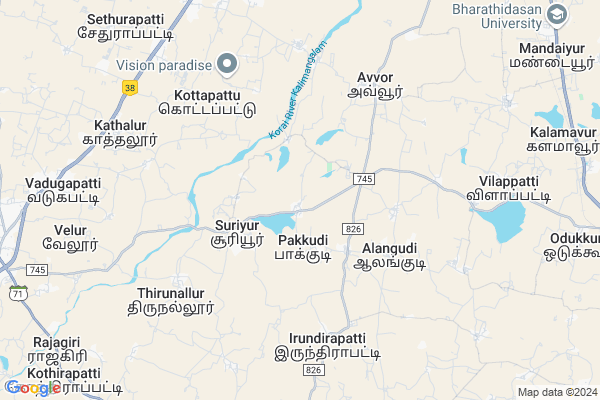
Perambur Map
EDIT Map
Add Your House
 ..
..
Current Corona Virus Infected Patients Count in Pudukkottai District
| City Name | District Name | Total Covid cases |
|---|---|---|
| Pudukkottai District | Pudukkottai | 1 |
Locality Name :
Perambur
( பெரம்பூர் )
Block Name : Viralimalai
District : Pudukkottai
State : Tamil Nadu
Language : Tamil
Current Time 12:06 PM
Date: Wednesday , Apr 30,2025 (IST)
Time zone: IST (UTC+5:30)
Elevation / Altitude: 131 meters. Above Seal level
Telephone Code / Std Code: 04332
Assembly constituency : Viralimalai assembly constituency
Assembly MLA : Vijaya Basker C
Lok Sabha constituency : Karur parliamentary constituency
Parliament MP : Jothimani S
Serpanch Name :
Pin Code : 621316
Post Office Name : Viralimalai
Commodities Prices : Budalur Market / Mandi
Perambur Live Weather
Temperature: 33.8 °C
overcast clouds
Humidity: 48%
Wind : 1.67 mt/sec towards S
StationName : "Iluppūr"
observed on 1 Hours Back
Temperature: 33.8 °C
overcast clouds
Humidity: 48%
Wind : 1.67 mt/sec towards S
StationName : "Iluppūr"
observed on 1 Hours Back
Perambur Weather Forecast for Next 5 days
01-05-2025
29.0°C to 38.4°C
overcast clouds, broken clouds, light rain
29.0°C to 38.4°C
overcast clouds, broken clouds, light rain
02-05-2025
28.4°C to 36.9°C
overcast clouds, light rain
28.4°C to 36.9°C
overcast clouds, light rain
03-05-2025
27.3°C to 38.7°C
overcast clouds, broken clouds, light rain
27.3°C to 38.7°C
overcast clouds, broken clouds, light rain
04-05-2025
27.5°C to 36.5°C
overcast clouds, light rain
27.5°C to 36.5°C
overcast clouds, light rain
05-05-2025
27.5°C to 39.3°C
overcast clouds, broken clouds, few clouds, light rain
27.5°C to 39.3°C
overcast clouds, broken clouds, few clouds, light rain
Edit below overview about Perambur
Edit below overview about Perambur
OverView of Perambur
Perambur is a beautiful village. It has large pond. Once upon a time an ambal flower is flows around on the pond. It very beautiful and lovely. So, perambur which is come from the word is ambal derives ambur. The day after it was called ambur. Yes, if the village is great so, it was called also perambal -perambur. It has large pond, the people basic work is agriculture. It has one of the famous temple in the village it is called sri muthu mariyamman temple and sellu KARUPPU temple. more thousand people around lives in the village.P.u.e. school is here. It has four large ponds and 1354 acres agri land. The village starts from sri maruthangulathan dynasty. They are very brave and kind persons. Then it is ruled by viralimalai king devendran. next it had ruled by kathalur king THIRUPPALI. Now, The village is ruled by king SUBAM. SENTHIL, he was a great political leader in the village. He is a good and kind person.
Malampatti is a beautiful village here popular charch temples and agriculture is important work st francis charch and pillayar kovil and linga malai forest is lee jaartin in malammpatti is beautiful village.
Edit below overview about Perambur
National Highways Reachable To Perambur
Nationa High Way :NH38
Nationa High Way :NH336
Nationa High Way :NH38
Nationa High Way :NH336
Rivers Near Perambur
Koraiyar
Koraiyar
About Perambur
Perambur is a Village in Viralimalai Block in Pudukkottai District of Tamil Nadu State, India. It is located 37 KM towards North from District head quarters Pudukkottai. 4 KM from Viralimalai. 377 KM from State capital Chennai
Perambur Pin code is 621316 and postal head office is Viralimalai .
Pakkudi ( 5 KM ) , Thirunallur ( 5 KM ) , Neerpalani ( 7 KM ) , Velur ( 8 KM ) , Nangupatti ( 9 KM ) are the nearby Villages to Perambur. Perambur is surrounded by Manikandam Block towards North , Annavasal Block towards South , Tiruchirappalli Block towards North , Thiruverambur Block towards North .
Tiruchirappalli , Pudukkottai , Lalgudi , Nanjikottai are the near by Cities to Perambur.
This Place is in the border of the Pudukkottai District and Tiruchirappalli District. Tiruchirappalli District Manapparai is west towards this place .
Perambur 2011 Census Details
Perambur Local Language is Tamil. Perambur Village Total population is 3109 and number of houses are 720. Female Population is 49.6%. Village literacy rate is 59.9% and the Female Literacy rate is 25.9%.
Population
| Census Parameter | Census Data |
| Total Population | 3109 |
| Total No of Houses | 720 |
| Female Population % | 49.6 % ( 1542) |
| Total Literacy rate % | 59.9 % ( 1862) |
| Female Literacy rate | 25.9 % ( 805) |
| Scheduled Tribes Population % | 0.0 % ( 0) |
| Scheduled Caste Population % | 21.0 % ( 652) |
| Working Population % | 61.3 % |
| Child(0 -6) Population by 2011 | 360 |
| Girl Child(0 -6) Population % by 2011 | 45.6 % ( 164) |
Perambur Census More Deatils.
Politics in Perambur
DMK , AIADMK , NCO , INC are the major political parties in this area.Polling Stations /Booths near Perambur
1)"anganwadi Center Terraced Building East Facing Namana Raya Chatram (kalamavur) 622502"2)"government Higher Sec. School
3)"government Higher Sec. School
4)"panchayat Union Elementary School New Terraced Building Senthamangalam 622104"
5)Panchayat Union Elementary School
HOW TO REACH Perambur
By Rail
There is no railway station near to Perambur in less than 10 km.Colleges near Perambur
M.a.r. College Of Engineering And Technology
Address : Trichy - Viralimalai Main Road Boothakudi Rasanaic
Bishop Packiam Arockiasamy College Of Education
Address : Bishop Packiam Arokiaswamy College Of Education Va
Srinivasa Polytechnic College
Address : Srinivasa Polytechnic College Srinivasa Nagar, Kal
Sri Suba Bharathi T.t.i. For Women
Address : Sri Suba Bharathi T.t.i. For Women Kaikkurichi Pos
Schools in Perambur
Pums.malampatti
Address : perambur , viralimalai , pudukkottai , Tamil Nadu . PIN- 621316 , Post - Viralimalai
Govt Health Centers near Perambur
1) Maruthampatti , govt.building , keeranur road , P.U.Primary school2) Kalimangalam , HSC Kalimangalam , Mosque Street ,
3) Neerpalani , Govt.Building , viralimalai to keeranur road , Govt.High School
Sub Villages in Perambur
Hospitals in Perambur,Viralimalai
Government Hospital
Keeranur-Viralimalai Rd; Neerpalani; Tamil Nadu 622515; India
7.3 KM distance Detail
Bharthasakthi primary health care and counselling centre
Fathimanagar; Tamil Nadu 621316; India
8.2 KM distance Detail
Brothers of St. John of God
53; Queen Victoria Road;Poonamallee; Chennai; Tamil Nadu 600056; India
8.5 KM distance Detail
more ..
Petrol Bunks in Perambur,Viralimalai
Indian Oil Petrol Pump
Velur; Tiruchirappalli; NH-45B; Trichy Madurai Highway; Trichy; Tiruchirapalli; Tamil Nadu 621316; India
11.2 KM distance Detail
Bharat Petroleum
Nagamangalam; Tiruchirappalli; NH-45B; Trichy Madurai Highway; Trichy; Tiruchirapalli; Tamil Nadu 620012; India
11.3 KM distance Detail
R. VENUGOAP REDDIAR
Pottapatti-Nagamangalam Rd; Indira Nagar; Surappatti; Tamil Nadu 620012; India
11.4 KM distance Detail
more ..
Colleges in Perambur,Viralimalai
Good Samaritan Teacher Training Institute
Kunnathur; Tamil Nadu 621316; India
7.4 KM distance Detail
Thozhilathibar Teacher Training Institute
Trichy - Madurai Hwy; Melapachchakudi; Tamil Nadu 621316; India
9.2 KM distance Detail
more ..
Schools in Perambur,Viralimalai
த. சு. லு. தி. திரியேகநாதர் ஆலயம். கோட்டைக்காரன்பட்டி
Alangudi; Tamil Nadu 622515; India
4.1 KM distance Detail
primary school velrampatti
velrampatti (panchayath) viralimalai tk (dt); Alangudi; Tamil Nadu; India
5.1 KM distance Detail
Electronic Shops in Perambur,Viralimalai
230kv Substation Alundur
Trichy - Madurai Hwy; Alundur; Tamil Nadu 620012; India
9.7 KM distance Detail
Super Markets in Perambur,Viralimalai
Ksmaligai
602153;78.666312; X; Sardar Vallabhbhai Patel Rd; Central Railway Godown; Mazgaon; Mumbai; Maharashtra 400009; India
3.1 KM distance Detail
Police Stations near Perambur,Viralimalai
Mandayur Police Station
Ramanathapuram Rd; Mandaiyur; Tamil Nadu 622515; India
12.7 KM distance Detail
Viralimalai Police Station
Kulithalai - Manapparai Rd; Viralimalai; Tamil Nadu 621316; India
13.6 KM distance Detail
Governement Offices near Perambur,Viralimalai
Panchayath Office Kunnathur
Soorakudi Patty; Kunnathur; Tamil Nadu 621316; India
9.9 KM distance Detail
About Perambur &
History
How to reach Perambur
Tourist Places Near By Perambur
Schools in Perambur
Colleges in Perambur
Temperature & weather of Perambur
places in Perambur
Perambur photos
More Information
How to reach Perambur
Tourist Places Near By Perambur
Schools in Perambur
Colleges in Perambur
Temperature & weather of Perambur
places in Perambur
Perambur photos
More Information
Village Talk
Post News or Events about this Village
Near Cities
Tiruchirappalli 23 KM near
Pudukkottai 36 KM near
Lalgudi 37 KM near
Nanjikottai 60 KM near
Tiruchirappalli 23 KM near
Pudukkottai 36 KM near
Lalgudi 37 KM near
Nanjikottai 60 KM near
Near By Taluks
Viralimalai 4 KM near
Manikandam 15 KM near
Annavasal 20 KM near
Tiruchirappalli 23 KM near
Viralimalai 4 KM near
Manikandam 15 KM near
Annavasal 20 KM near
Tiruchirappalli 23 KM near
Near By Air Ports
Civil Airport 19 KM near
Madurai Airport 119 KM near
Salem Airport 141 KM near
Peelamedu Airport 203 KM near
Civil Airport 19 KM near
Madurai Airport 119 KM near
Salem Airport 141 KM near
Peelamedu Airport 203 KM near
Near By Tourist Places
Tiruchy 22 KM near
Chettinad 58 KM near
Thanjavur 62 KM near
Karaikudi 71 KM near
Dindigul 87 KM near
Tiruchy 22 KM near
Chettinad 58 KM near
Thanjavur 62 KM near
Karaikudi 71 KM near
Dindigul 87 KM near
Near By Districts
Tiruchirappalli 24 KM near
Pudukkottai 36 KM near
Thanjavur 63 KM near
Karur 80 KM near
Tiruchirappalli 24 KM near
Pudukkottai 36 KM near
Thanjavur 63 KM near
Karur 80 KM near
Near By RailWay Station
Tiruchchirappalli Junction Rail Way Station 22 KM near
Srirangam Rail Way Station 30 KM near
Tiruchchirappalli Junction Rail Way Station 22 KM near
Srirangam Rail Way Station 30 KM near