| Home | City Bus | Maps | Villages | Cities | Rail | Tourist Places | School | College | Pin Codes | Corona Cases Count |
| Distance Calculator Bus Services IFSC Codes Trace Mobile Number Weather Search Place Trace IP Available Cash ATM/Banks Locate Polling Booth Report an Error contact People |
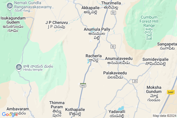
Racharla
Racharla Map
EDIT Map
Add Your House
 ..
..
Current Corona Virus Infected Patients Count in Prakasam District
| City Name | District Name | Total Covid cases |
|---|---|---|
| Prakasam District | Prakasam | 23 |
| Ongole | Prakasam | 19 |
| Chirala | Prakasam | 7 |
| Kunkalamarru,karamchedu | Prakasam | 2 |
| Konakalamitta Mandal | Prakasam | 1 |
| Kandukuru | Prakasam | 1 |
| Kunkala Marru | Prakasam | 1 |
| Markapur | Prakasam | 1 |
| Islamapet | Prakasam | 1 |
Locality Name :
Racharla
( రాచర్ల )
Mandal Name : Racherla
District : Prakasam
State : Andhra Pradesh
Region : Andhra
Language : Telugu
Current Time 01:13 PM
Date: Sunday , Apr 27,2025 (IST)
Time zone: IST (UTC+5:30)
Elevation / Altitude: 231 meters. Above Seal level
Telephone Code / Std Code: 08405
Assembly constituency : assembly constituency
Assembly MLA : Anna Rambabu
Lok Sabha constituency : parliamentary constituency
Parliament MP : MAGUNTA SREENIVASULU REDDY
Serpanch Name :
Pin Code : 523368
Post Office Name : Racherla
Alternate Village Name : Racherla
Commodities Prices : Atmakur Market / Mandi
Racharla Live Weather
Temperature: 36.9 °C
overcast clouds
Humidity: 27%
Wind : 4.51 mt/sec towards E
StationName : "Cumbum"
observed on 31 Mins Back
Temperature: 36.9 °C
overcast clouds
Humidity: 27%
Wind : 4.51 mt/sec towards E
StationName : "Cumbum"
observed on 31 Mins Back
Racharla Weather Forecast for Next 5 days
28-04-2025
26.3°C to 38.8°C
broken clouds, overcast clouds
26.3°C to 38.8°C
broken clouds, overcast clouds
29-04-2025
26.7°C to 39.6°C
overcast clouds, broken clouds, scattered clouds
26.7°C to 39.6°C
overcast clouds, broken clouds, scattered clouds
30-04-2025
27.6°C to 41.7°C
scattered clouds, few clouds, clear sky, overcast clouds, broken clouds
27.6°C to 41.7°C
scattered clouds, few clouds, clear sky, overcast clouds, broken clouds
01-05-2025
28.6°C to 41.0°C
broken clouds, clear sky, scattered clouds, overcast clouds
28.6°C to 41.0°C
broken clouds, clear sky, scattered clouds, overcast clouds
02-05-2025
28.2°C to 43.0°C
scattered clouds, clear sky, overcast clouds
28.2°C to 43.0°C
scattered clouds, clear sky, overcast clouds
National Highways Reachable To Racharla
Nationa High Way :NH40
Nationa High Way :NH40
Rivers Near Racharla
Kannikala Vagu
Kundu River
Kannikala Vagu
Kundu River
About Racharla
Correct below Info and add more info about RacharlaRacharla is a Town in Racherla Mandal in Prakasam District of Andhra Pradesh State, India. It belongs to Andhra region . It is located 135 KM towards west from District head quarters Ongole. It is a Mandal head quarter.
Racharla Pin code is 523368 and postal head office is Racherla .
Palakaveedu ( 4 KM ) , Oddulavagupalli ( 6 KM ) , Satyavolu ( 7 KM ) , Timmapuram ( 7 KM ) , Gudimetta ( 8 KM ) are the nearby Villages to Racharla. Racharla is surrounded by Giddaluru Mandal towards South , Bestavaripeta Mandal towards East , Komarolu Mandal towards South , Cumbum Mandal towards East .
Markapur , Nandyal , Chapirevula , Srisailam Project (Right Flank Colony) Township are the nearby Cities to Racharla.
Racherla 2011 Census Details
Racharla Local Language is Telugu. Racherla town Total population is 6518 and number of houses are 1608. Female Population is 54.3%. town literacy rate is 60.3% and the Female Literacy rate is 28.0%.
Population
| Census Parameter | Census Data |
| Total Population | 6518 |
| Total No of Houses | 1608 |
| Female Population % | 54.3 % ( 3539) |
| Total Literacy rate % | 60.3 % ( 3931) |
| Female Literacy rate | 28.0 % ( 1826) |
| Scheduled Tribes Population % | 1.1 % ( 74) |
| Scheduled Caste Population % | 19.6 % ( 1275) |
| Working Population % | 47.7 % |
| Child(0 -6) Population by 2011 | 702 |
| Girl Child(0 -6) Population % by 2011 | 46.2 % ( 324) |
Racherla Census More Deatils.
Demographics of Racharla
Telugu is the Local Language here. Total population of Racharla is 5645 .Males are 2787 and Females are 2,858 living in 1393 Houses. Total area of Racharla is 2318 hectares.HOW TO REACH Racharla
By Road
Markapur is the Nearest Town to Racharla. Markapur is 59 km from Racharla. Road connectivity is there from Markapur to Racharla.By Rail
Gudimetta Rail Way Station , Somidevipalle Rail Way Station are the very nearby railway stations to Racharla. Also you can consider railway Stations from Near By town Markapur. Markapur Road Rail Way Station are the railway stations near to Markapur. You can reach from Markapur to Racharla by road after .By Bus
Racherla APSRTC Bus Station , Giddalur APSRTC Bus Station , Munhadlapadu APSRTC Bus Station are the nearby by Bus Stations to Racharla .APSRTC runs Number of busses from major cities to here.Govt Health Centers near Racharla
1) RACHERLA , , , Lybrary2) ANUMALAPALLI , Aug-32 , Ramalayam , Ramalayam
3) ANUMALAVEEDU , , Mainroad , B.C.Hostal
Sub Villages in Racharla
Hospitals in Racharla,Racherla
Sri Sri Sri Vemayaswamy Ayurvedha Oushadhi
Cholla veedu; Andhra Pradesh 523372; India
8.6 KM distance Detail
more ..
Petrol Bunks in Racharla,Racherla
Indian Oil - Petrol Bunk
Kurnool - Ongole Main Rd; Giddalur; Andhra Pradesh 523357; India
10.8 KM distance Detail
HP Petrol Bunk(Hari Hara F/S)
Kurnool - Ongole Main Rd; Giddalur; Andhra Pradesh 523357; India
10.8 KM distance Detail
Bharat - Petrol Bunk (Vijay Kumar Reddy)
Ganesh Nagar; Giddalur; Andhra Pradesh 523357; India
11.0 KM distance Detail
more ..
Colleges in Racharla,Racherla
St. Pauls College of Education
Near Market Yard; Racherla Road; Giddalur-Prakasam; Ongole; Andhra Pradesh 523368; India
9.0 KM distance Detail
Sri Jeevanajyothi Degree College
Above HDFC Bank; A.P.; Racherla Rd; Giddalur; Andhra Pradesh 523357; India
9.5 KM distance Detail
more ..
Electronic Shops in Racharla,Racherla
Suhana Electronics
Racherla Gate Center; Giddalur; Andhra Pradesh 523357; India
11.0 KM distance Detail
Super Markets in Racharla,Racherla
VARALAKSHMI SUPER MARKET
Ganesh Nagar; NEAR HEAD POST OFFICE; VARALAKSHMI COMPLEX; Giddalur; Andhra Pradesh 523357; India
11.4 KM distance Detail
Balaji General Stores.. Subbu.Giddalur
Ganesh Nagar; Giddalur; Andhra Pradesh 523357; India
11.5 KM distance Detail
Local Parks in Racharla,Racherla
Children's Park
Potti Sriramulu Veedhi; Giddalur; Andhra Pradesh 523357; India
11.7 KM distance Detail
Police Stations near Racharla,Racherla
Giddalur Police Station
Rangamma House; Giddalur; Andhra Pradesh 523357; India
11.7 KM distance Detail
Bestavaripeta Police station
Prakasam; Sri Nagar Colony; Andhra Pradesh 523334; India
20.8 KM distance Detail
About Racharla &
History
How to reach Racharla
Tourist Places Near By Racharla
Schools in Racharla
Colleges in Racharla
Temperature & weather of Racharla
places in Racharla
Racharla photos
More Information
How to reach Racharla
Tourist Places Near By Racharla
Schools in Racharla
Colleges in Racharla
Temperature & weather of Racharla
places in Racharla
Racharla photos
More Information
Town Talk
Post News or Events about this Town
Near Cities
Markapur 51 KM near
Nandyal 56 KM near
Chapirevula 63 KM near
Srisailam Project (Right Flank Colony) Township 78 KM near
Markapur 51 KM near
Nandyal 56 KM near
Chapirevula 63 KM near
Srisailam Project (Right Flank Colony) Township 78 KM near
Near By Taluks
Racherla 2 KM near
Giddaluru 13 KM near
Bestavaripeta 18 KM near
Komarolu 20 KM near
Racherla 2 KM near
Giddaluru 13 KM near
Bestavaripeta 18 KM near
Komarolu 20 KM near
Near By Air Ports
Rajiv Gandhi International Airport 230 KM near
Tirupati Airport 237 KM near
Vijayawada Airport 257 KM near
Bengaluru International Airport 319 KM near
Rajiv Gandhi International Airport 230 KM near
Tirupati Airport 237 KM near
Vijayawada Airport 257 KM near
Bengaluru International Airport 319 KM near
Near By Tourist Places
Srisailam 77 KM near
Kurnool 117 KM near
Kadapa 124 KM near
Nagarjunsagar 144 KM near
Nellore 176 KM near
Srisailam 77 KM near
Kurnool 117 KM near
Kadapa 124 KM near
Nagarjunsagar 144 KM near
Nellore 176 KM near
Near By Districts
Kurnool 117 KM near
Cuddapah 125 KM near
Prakasam 129 KM near
Spsr Nellore 176 KM near
Kurnool 117 KM near
Cuddapah 125 KM near
Prakasam 129 KM near
Spsr Nellore 176 KM near
Near By RailWay Station
Gudimetta Rail Way Station 7.9 KM near
Giddalur Rail Way Station 10 KM near
Diguvametta Rail Way Station 18 KM near
Gudimetta Rail Way Station 7.9 KM near
Giddalur Rail Way Station 10 KM near
Diguvametta Rail Way Station 18 KM near