| Home | City Bus | Maps | Villages | Cities | Rail | Tourist Places | School | College | Pin Codes | Corona Cases Count |
| Distance Calculator Bus Services IFSC Codes Trace Mobile Number Weather Search Place Trace IP Available Cash ATM/Banks Locate Polling Booth Report an Error contact People |
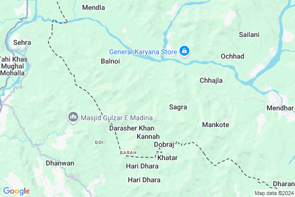
Mankote Lower
Mankote Lower Map
EDIT Map
Add Your House
 ..
..
Current Corona Virus Infected Patients Count in Poonch District
| City Name | District Name | Total Covid cases |
|---|
Locality Name :
Mankote Lower
( मनकोट लोअर )
Block Name : Mendhar
District : Poonch
State : Jammu & Kashmir
Language : Urdu and Dogri, Gojri
Current Time 11:48 AM
Date: Wednesday , Apr 30,2025 (IST)
Time zone: IST (UTC+5:30)
Elevation / Altitude: 1580 meters. Above Seal level
Telephone Code / Std Code: 01965
Assembly constituency : assembly constituency
Assembly MLA :
Lok Sabha constituency : parliamentary constituency
Parliament MP :
Serpanch Name :
Pin Code : 185111
Post Office Name : Dharamsal Mendhar
Commodities Prices : Rajouri (F&V) Market / Mandi
National Highways Reachable To Mankote Lower
Nationa High Way :NH144A
Nationa High Way :NH144A
Rivers Near Mankote Lower
Rupri Nar
Doodhganga
Rupri Nar
Doodhganga
About Mankote Lower
Correct below Info and add more info about Mankote LowerMankote Lower is a Village in Mendhar Block in Poonch District of Jammu & Kashmir State, India. It is located 21 KM towards South from District head quarters Poonch. 9 KM from Mendhar. 102 KM from State capital Srinagar, Jammu
Mankote Lower Pin code is 185111 and postal head office is Dharamsal Mendhar .
Balnoi ( 6 KM ) , Dharana Upper ( 6 KM ) , Dharana Lower ( 6 KM ) , Sagra ( 6 KM ) , Sakhi Maidan ( 6 KM ) are the nearby Villages to Mankote Lower. Mankote Lower is surrounded by Balakote Block towards East , Poonch Block towards North , Surankote Block towards East , Manjakote Block towards East .
Punch , Rajauri , Baramula , Sopore are the near by Cities to Mankote Lower.
This Place is in the border of the Poonch District and Rajauri District. Rajauri District Manjakote is East towards this place .
Mankote 2011 Census Details
Mankote Lower Local Language is Urdu. Mankote Village Total population is 4866 and number of houses are 956. Female Population is 50.2%. Village literacy rate is 44.3% and the Female Literacy rate is 17.6%.
Population
| Census Parameter | Census Data |
| Total Population | 4866 |
| Total No of Houses | 956 |
| Female Population % | 50.2 % ( 2441) |
| Total Literacy rate % | 44.3 % ( 2156) |
| Female Literacy rate | 17.6 % ( 855) |
| Scheduled Tribes Population % | 52.7 % ( 2565) |
| Scheduled Caste Population % | 0.0 % ( 0) |
| Working Population % | 28.8 % |
| Child(0 -6) Population by 2011 | 912 |
| Girl Child(0 -6) Population % by 2011 | 49.2 % ( 449) |
Mankote Census More Deatils.
HOW TO REACH Mankote Lower
By Rail
There is no railway station near to Mankote Lower in less than 10 km.Colleges near Mankote Lower
Govt Degree College Mendhar
Address :
Muqaddas Degree College
Address :
Schools in Mankote Lower
Public Edu Trust
Address : mankote , mankote , punch , Jammu & Kashmir . PIN- 185211
Gm S Magloon
Address : mankote , mankote , punch , Jammu & Kashmir . PIN- 185211
M S Mankote(boys)
Address : mankote , mankote , punch , Jammu & Kashmir . PIN- 185211
Muqadas Academy
Address : mankote , mankote , punch , Jammu & Kashmir . PIN- 185211
M S Nar Mankote
Address : mankote , mankote , punch , Jammu & Kashmir . PIN- 185211
Govt Health Centers near Mankote Lower
1) PHC DHARMARI , PHC DHARMARI , DHARMARI , MAIN BAZAR DHARMARI2) C B Nath , , CheckBadrinath ,
3) NTPHC Shadimarg , , ,
Hospitals in Mankote Lower,Mendhar
Dr Sajid Mehra
गणेश मैदान; Saki Vihar; MHADA Colony; Powai; Mumbai; Maharashtra 400072
7.5 KM distance Detail
Danyal And Bilal Dental Clinic
Near New Bus Stand On Nakiyal Road; Kotli Azad Kashmir; 11100
19.1 KM distance Detail
more ..
Schools in Mankote Lower,Mendhar
Yaseen English School; Musthafa Nagar-Mendhar
Musthafa Nagar- DT); Jammu and Kashmir; Mendhar
11.2 KM distance Detail
Electronic Shops in Mankote Lower,Mendhar
pinnacle tech mendhar
MAIN MARKET MENDHAR POONCH JAMMU AND KASHMIR; MENDHAR; Jammu and Kashmir 185111; India
9.9 KM distance Detail
Times computers Mendhar
Gali No. 1 Near Bus Stand; Jammu and Kashmir; Mendhar; 185111
10.0 KM distance Detail
About Mankote Lower &
History
How to reach Mankote Lower
Tourist Places Near By Mankote Lower
Schools in Mankote Lower
Colleges in Mankote Lower
Temperature & weather of Mankote Lower
places in Mankote Lower
Mankote Lower photos
More Information
How to reach Mankote Lower
Tourist Places Near By Mankote Lower
Schools in Mankote Lower
Colleges in Mankote Lower
Temperature & weather of Mankote Lower
places in Mankote Lower
Mankote Lower photos
More Information
Village Talk
Post News or Events about this Village
Near Cities
Punch 20 KM near
Rajauri 38 KM near
Baramula 80 KM near
Sopore 96 KM near
Punch 20 KM near
Rajauri 38 KM near
Baramula 80 KM near
Sopore 96 KM near
Near By Taluks
Mendhar 8 KM near
Balakote 16 KM near
Poonch 20 KM near
Surankote 24 KM near
Mendhar 8 KM near
Balakote 16 KM near
Poonch 20 KM near
Surankote 24 KM near
Near By Air Ports
Srinagar Airport 88 KM near
Satwari Airport 142 KM near
Pathankot Airport 239 KM near
Raja Sansi Airport 249 KM near
Srinagar Airport 88 KM near
Satwari Airport 142 KM near
Pathankot Airport 239 KM near
Raja Sansi Airport 249 KM near
Near By Tourist Places
Poonch 20 KM near
Rajauri 40 KM near
Khilanmarg 61 KM near
Gulmarg 66 KM near
Yusmarg 69 KM near
Poonch 20 KM near
Rajauri 40 KM near
Khilanmarg 61 KM near
Gulmarg 66 KM near
Yusmarg 69 KM near
Near By Districts
Poonch 20 KM near
Rajauri 40 KM near
Baramulla 80 KM near
Shopian 82 KM near
Poonch 20 KM near
Rajauri 40 KM near
Baramulla 80 KM near
Shopian 82 KM near
Near By RailWay Station
Jammu Tawi Rail Way Station 141 KM near
Udhampur Rail Way Station 143 KM near
Jammu Tawi Rail Way Station 141 KM near
Udhampur Rail Way Station 143 KM near