| Home | City Bus | Maps | Villages | Cities | Rail | Tourist Places | School | College | Pin Codes | Corona Cases Count |
| Distance Calculator Bus Services IFSC Codes Trace Mobile Number Weather Search Place Trace IP Available Cash ATM/Banks Locate Polling Booth Report an Error contact People |
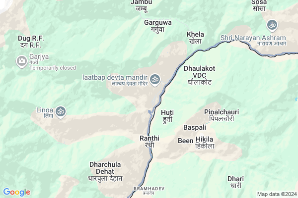
Tidang
Tidang Map
EDIT Map
Add Your House
 ..
..
Current Corona Virus Infected Patients Count in Pithoragarh District
| City Name | District Name | Total Covid cases |
|---|
Locality Name :
Tidang
( तीदांग )
Block Name : Dharchula
District : Pithoragarh
State : Uttarakhand
Language : Hindi and Urdu, Kumauni
Current Time 03:12 PM
Date: Wednesday , Feb 05,2025 (IST)
Time zone: IST (UTC+5:30)
Elevation / Altitude: 258 meters. Above Seal level
Telephone Code / Std Code: 05967
Assembly constituency : Dharchula assembly constituency
Assembly MLA : Harish Singh Dhami
Lok Sabha constituency : Almora parliamentary constituency
Parliament MP : Ajay Tamta
Serpanch Name :
Pin Code : 262576
Post Office Name : Baluwakote
Tidang Live Weather
Temperature: 15.2 °C
few clouds
Humidity: 32%
Wind : 3.43 mt/sec towards SW
StationName : "DhÄ\u0081rchula"
observed on 1 Hours Back
Temperature: 15.2 °C
few clouds
Humidity: 32%
Wind : 3.43 mt/sec towards SW
StationName : "DhÄ\u0081rchula"
observed on 1 Hours Back
Tidang Weather Forecast for Next 5 days
06-02-2025
1.2°C to 11.2°C
light rain, few clouds, light snow, broken clouds, clear sky
1.2°C to 11.2°C
light rain, few clouds, light snow, broken clouds, clear sky
07-02-2025
-0.1°C to 12.2°C
clear sky
-0.1°C to 12.2°C
clear sky
08-02-2025
1.3°C to 13.6°C
clear sky, few clouds
1.3°C to 13.6°C
clear sky, few clouds
09-02-2025
2.9°C to 14.5°C
clear sky, few clouds, broken clouds
2.9°C to 14.5°C
clear sky, few clouds, broken clouds
10-02-2025
3.6°C to 14.0°C
scattered clouds, few clouds, clear sky, broken clouds
3.6°C to 14.0°C
scattered clouds, few clouds, clear sky, broken clouds
Rivers Near Tidang
Maheshwari Nadi
Leti Rauli
Maheshwari Nadi
Leti Rauli
About Tidang
Correct below Info and add more info about TidangTidang is a Village in Dharchula Block in Pithoragarh District of Uttarakhand State, India. It is located 59 KM towards North from District head quarters Pithoragarh. 289 KM from State capital Dehradun
Tidang Pin code is 262576 and postal head office is Baluwakote .
Tidang is surrounded by Munsyari Block towards west , Kanalichina Block towards South , Didihat Block towards west , Munakot Block towards South .
Pithoragarh , Champawat , Almora , Nainital are the near by Cities to Tidang.
Tidang 2011 Census Details
Tidang Local Language is Hindi. Tidang Village Total population is 296 and number of houses are 121. Female Population is 35.5%. Village literacy rate is 89.9% and the Female Literacy rate is 32.1%.
Population
| Census Parameter | Census Data |
| Total Population | 296 |
| Total No of Houses | 121 |
| Female Population % | 35.5 % ( 105) |
| Total Literacy rate % | 89.9 % ( 266) |
| Female Literacy rate | 32.1 % ( 95) |
| Scheduled Tribes Population % | 47.3 % ( 140) |
| Scheduled Caste Population % | 37.8 % ( 112) |
| Working Population % | 81.8 % |
| Child(0 -6) Population by 2011 | 23 |
| Girl Child(0 -6) Population % by 2011 | 34.8 % ( 8) |
Tidang Census More Deatils.
Politics in Tidang
INC , BJP , INC are the major political parties in this area.Polling Stations /Booths near Tidang
1)Chami2)Kimkhola
3)Bon
4)Kotyura
5)Block Sanshadhan Kendra Munsyari Hall
HOW TO REACH Tidang
By Rail
There is no railway station near to Tidang in less than 10 km.Colleges near Tidang
G I C Gandginager
Address :
Rajendra Singh Pawar
Address : Smkot Teela
Schools in Tidang
G.p.s.tidang
Address : tidang , dharchula , pithoragarh , Uttarakhand . PIN- 262576 , Post - Baluwakote
Govt Health Centers near Tidang
1) Dharchula Main center , SUB CENTER , HOSPITAL CLONI , BALMIKI MANDIR2) CHC Dharchula , CHC DHARCHULA , HOSPITAL CLONI , BALMIKI MANDIR
3) Madkot , Madkot , Madkot ,
Hospitals in Tidang,Dharchula
Common Service Center (CSC)
Malli Bazar; Khalanga; Dharchula; Uttarakhand 10100; India
11.0 KM distance Detail
Geetanjali Pathology Lab
Hospital Road; Khalanga; Dharchula; Uttarakhand 10100; India
11.0 KM distance Detail
District Hospital
Kailash Mansarovar Road; Khalanga; Dharchula; Uttarakhand 10100; Nepal
11.0 KM distance Detail
more ..
Colleges in Tidang,Dharchula
G.G.I.C Dharchula
1; India - Nepal Rd; Khalanga; Dharchula; Uttarakhand 262545; India
11.2 KM distance Detail
G.G.I.C. College
Kailash Mansarovar Road; Khalanga; Dharchula; Uttarakhand 10100; Nepal
11.2 KM distance Detail
more ..
Electronic Shops in Tidang,Dharchula
Surendra Nabiyal Electronics Homeware Bed mattreses
1; India - Nepal Rd; Khalanga; Dharchula; Uttarakhand 262545; India - Nepal Rd; Khalanga; Dharchula; Uttarakhand 262545; India
11.0 KM distance Detail
MB Mobile
Delhi - Dharchula Hwy; Khalanga; Dharchula; Uttarakhand 10100; India
11.0 KM distance Detail
Super Markets in Tidang,Dharchula
Governement Offices near Tidang,Dharchula
District Coordination Committee Office Darchula
Mahakali Highway; Bangabagar 10100; Nepal
10.8 KM distance Detail
About Tidang &
History
How to reach Tidang
Tourist Places Near By Tidang
Schools in Tidang
Colleges in Tidang
Temperature & weather of Tidang
places in Tidang
Tidang photos
More Information
How to reach Tidang
Tourist Places Near By Tidang
Schools in Tidang
Colleges in Tidang
Temperature & weather of Tidang
places in Tidang
Tidang photos
More Information
Village Talk
Post News or Events about this Village
Near Cities
Pithoragarh 57 KM near
Champawat 89 KM near
Almora 107 KM near
Nainital 137 KM near
Pithoragarh 57 KM near
Champawat 89 KM near
Almora 107 KM near
Nainital 137 KM near
Near By Taluks
Dharchula 0 KM near
Munsyari 37 KM near
Kanalichina 39 KM near
Didihat 43 KM near
Dharchula 0 KM near
Munsyari 37 KM near
Kanalichina 39 KM near
Didihat 43 KM near
Near By Air Ports
Pantnagar Airport 163 KM near
Dehra Dun Airport 277 KM near
Muzaffarnagar Airport 320 KM near
Simla Airport 395 KM near
Pantnagar Airport 163 KM near
Dehra Dun Airport 277 KM near
Muzaffarnagar Airport 320 KM near
Simla Airport 395 KM near
Near By Tourist Places
Pithoragarh 57 KM near
Chaukori 59 KM near
Abbott Mount 80 KM near
Bageshwar 86 KM near
Champawat 90 KM near
Pithoragarh 57 KM near
Chaukori 59 KM near
Abbott Mount 80 KM near
Bageshwar 86 KM near
Champawat 90 KM near
Near By Districts
Pithoragarh 57 KM near
Bageshwar 86 KM near
Champawat 89 KM near
Almora 106 KM near
Pithoragarh 57 KM near
Bageshwar 86 KM near
Champawat 89 KM near
Almora 106 KM near
Near By RailWay Station
Kathgodam Rail Way Station 138 KM near
Haldwani Rail Way Station 143 KM near
Kathgodam Rail Way Station 138 KM near
Haldwani Rail Way Station 143 KM near