| Home | City Bus | Maps | Villages | Cities | Rail | Tourist Places | School | College | Pin Codes | Corona Cases Count |
| Distance Calculator Bus Services IFSC Codes Trace Mobile Number Weather Search Place Trace IP Available Cash ATM/Banks Locate Polling Booth Report an Error contact People |
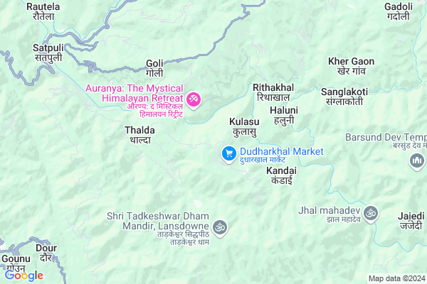
Kota Talla
Kota Talla Map
EDIT Map
Add Your House
 ..
..
Current Corona Virus Infected Patients Count in Pauri Garhwal District
| City Name | District Name | Total Covid cases |
|---|---|---|
| Dugadda | Pauri Garhwal | 1 |
Locality Name :
Kota Talla
( कोटा तल्ला )
Block Name : Zahrikhal
District : Pauri Garhwal
State : Uttarakhand
Language : Hindi and Urdu
Current Time 12:22 PM
Date: Tuesday , Apr 29,2025 (IST)
Time zone: IST (UTC+5:30)
Assembly constituency : Chaubattakhal assembly constituency
Assembly MLA : Satpal Maharaj
Lok Sabha constituency : Garhwal parliamentary constituency
Parliament MP : Tirath Singh Rawat
Serpanch Name :
Commodities Prices : Najibabad Market / Mandi
National Highways Reachable To Kota Talla
Nationa High Way :NH534
Nationa High Way :Old NH 58
Nationa High Way :NH534
Nationa High Way :Old NH 58
Rivers Near Kota Talla
Khoh
Kathron Nadi
Khoh
Kathron Nadi
About Kota Talla
Correct below Info and add more info about Kota TallaKota Talla is a Village in Zahrikhal Block in Pauri Garhwal District of Uttarakhand State, India. It is located 34 KM towards South from District head quarters Pauri. 9 KM from Zahrikhal. 102 KM from State capital Dehradun
Kulasu ( 1 KM ) , Haluni ( 4 KM ) , Pasta ( 4 KM ) , Bantholi ( 5 KM ) , Malai ( 5 KM ) are the nearby Villages to Kota Talla. Kota Talla is surrounded by Ekeshwar Block towards North , Pokhra Block towards East , Rikhnikhal Block towards South , Duggada Block towards west .
Kotdwara , Pauri , Najibabad , Haridwar are the near by Cities to Kota Talla.
Demographics of Kota Talla
Hindi is the Local Language here.Politics in Kota Talla
BJP , BJP , INC are the major political parties in this area.Polling Stations /Booths near Kota Talla
1)Gps Kota2)Gps Kothila
3)Gps Halaie Malli
4)Gps Thalda
5)Gps Ranaswa
HOW TO REACH Kota Talla
By Rail
There is no railway station near to Kota Talla in less than 10 km.Pincodes near Kota Talla
246172 ( Satpuli ) , 246129 ( Dudharkhal ) , 246131 ( Ekeshwar (A) )Colleges near Kota Talla
Dr. B.gopal Reddy Compus Puari Garhwal
Address :
Puriyadang Intercollege
Address :
Government Degree College Chaubattakhal
Address :
Government Inter College Haldukhal
Address :
Goverment Inter Collage Sidhkhal Churani
Address :
Schools near Kota Talla
As Lansdown
Address : jaiharikhal , jayharikhal , garhwal , Uttarakhand . PIN- 246155 , Post - Lansdowne
Ghs Thalda
Address : thalda , jayharikhal , garhwal , Uttarakhand . PIN- 246172 , Post - Satpuli
Ups Mathali
Address : mathali , jayharikhal , garhwal , Uttarakhand . PIN- 246155 , Post - Lansdowne
Gic Khairasain
Address : khairasain , jaiharikhal , garhwal , Uttarakhand . PIN- 246172 , Post - Satpuli
Govt Health Centers near Kota Talla
1) Dudarkhal SC , Dudharkhal , Dudharkhal , Dudharkhal2) Dudharkhal APHC , Dudharkhal , Dudharkhal , Dudharkhal
3) Satpuli APHC , Satpuli , Satpuli , Satpuli
Colleges in Kota Talla,Zahrikhal
Rajkiya Inter College
Garhwal; NH-119; Kotdwar Road; Dugadda; Dugadda; Uttarakhand 246174; India
14.7 KM distance Detail
more ..
Schools in Kota Talla,Zahrikhal
Rajkiya Kanya Purv Madhyamik Vidyalaya
Devikhal; Garhwal; NH-119; Kotdwar Road; Lansdowne; Lansdowne; Uttarakhand 266193; India
17.7 KM distance Detail
Electronic Shops in Kota Talla,Zahrikhal
Super Markets in Kota Talla,Zahrikhal
Police Stations near Kota Talla,Zahrikhal
Governement Offices near Kota Talla,Zahrikhal
About Kota Talla &
History
How to reach Kota Talla
Tourist Places Near By Kota Talla
Schools in Kota Talla
Colleges in Kota Talla
Temperature & weather of Kota Talla
places in Kota Talla
Kota Talla photos
More Information
How to reach Kota Talla
Tourist Places Near By Kota Talla
Schools in Kota Talla
Colleges in Kota Talla
Temperature & weather of Kota Talla
places in Kota Talla
Kota Talla photos
More Information
Village Talk
Post News or Events about this Village
Near Cities
Kotdwara 31 KM near
Pauri 32 KM near
Najibabad 58 KM near
Haridwar 59 KM near
Kotdwara 31 KM near
Pauri 32 KM near
Najibabad 58 KM near
Haridwar 59 KM near
Near By Taluks
Zahrikhal 8 KM near
Ekeshwar 11 KM near
Pokhra 12 KM near
Rikhnikhal 16 KM near
Zahrikhal 8 KM near
Ekeshwar 11 KM near
Pokhra 12 KM near
Rikhnikhal 16 KM near
Near By Air Ports
Dehra Dun Airport 97 KM near
Pantnagar Airport 129 KM near
Muzaffarnagar Airport 133 KM near
Simla Airport 233 KM near
Dehra Dun Airport 97 KM near
Pantnagar Airport 129 KM near
Muzaffarnagar Airport 133 KM near
Simla Airport 233 KM near
Near By Tourist Places
Lansdowne 13 KM near
Pauri 33 KM near
Devprayag 38 KM near
Corbett National Park 45 KM near
Rudra Prayag 54 KM near
Lansdowne 13 KM near
Pauri 33 KM near
Devprayag 38 KM near
Corbett National Park 45 KM near
Rudra Prayag 54 KM near
Near By Districts
Pauri Garhwal 33 KM near
Rudra Prayag 54 KM near
Haridwar 68 KM near
Tehri Garhwal 72 KM near
Pauri Garhwal 33 KM near
Rudra Prayag 54 KM near
Haridwar 68 KM near
Tehri Garhwal 72 KM near
Near By RailWay Station
Najibabad Junction Rail Way Station 60 KM near
Raiwala Junction Rail Way Station 65 KM near
Najibabad Junction Rail Way Station 60 KM near
Raiwala Junction Rail Way Station 65 KM near