| Home | City Bus | Maps | Villages | Cities | Rail | Tourist Places | School | College | Pin Codes | Corona Cases Count |
| Distance Calculator Bus Services IFSC Codes Trace Mobile Number Weather Search Place Trace IP Available Cash ATM/Banks Locate Polling Booth Report an Error contact People |
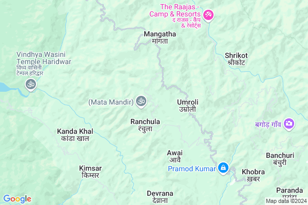
Kolshi
Kolshi Map
EDIT Map
Add Your House
 ..
..
Current Corona Virus Infected Patients Count in Pauri Garhwal District
| City Name | District Name | Total Covid cases |
|---|---|---|
| Dugadda | Pauri Garhwal | 1 |
Locality Name :
Kolshi
( कोलशी )
Block Name : Yamkeshwar
District : Pauri Garhwal
State : Uttarakhand
Language : Hindi and Urdu
Current Time 12:22 PM
Date: Tuesday , Apr 29,2025 (IST)
Time zone: IST (UTC+5:30)
Elevation / Altitude: 355 meters. Above Seal level
Telephone Code / Std Code: 01378
Assembly constituency : Yamkeshwar assembly constituency
Assembly MLA : Renu Bisht
Lok Sabha constituency : Garhwal parliamentary constituency
Parliament MP : Tirath Singh Rawat
Serpanch Name :
Alternate Village Name : Kolsi
Commodities Prices : Rishikesh Market / Mandi
Kolshi Live Weather
Temperature: 28.7 °C
few clouds
Humidity: 27%
Wind : 1.83 mt/sec towards SW
StationName : "Birbhaddar"
observed on 1 Hours Back
Temperature: 28.7 °C
few clouds
Humidity: 27%
Wind : 1.83 mt/sec towards SW
StationName : "Birbhaddar"
observed on 1 Hours Back
Kolshi Weather Forecast for Next 5 days
30-04-2025
19.3°C to 31.9°C
scattered clouds, broken clouds, light rain
19.3°C to 31.9°C
scattered clouds, broken clouds, light rain
01-05-2025
19.1°C to 33.5°C
overcast clouds, broken clouds, clear sky
19.1°C to 33.5°C
overcast clouds, broken clouds, clear sky
02-05-2025
17.6°C to 34.0°C
broken clouds, overcast clouds, scattered clouds, light rain
17.6°C to 34.0°C
broken clouds, overcast clouds, scattered clouds, light rain
03-05-2025
17.5°C to 32.9°C
light rain, overcast clouds, heavy intensity rain
17.5°C to 32.9°C
light rain, overcast clouds, heavy intensity rain
04-05-2025
18.3°C to 32.2°C
light rain, overcast clouds, scattered clouds
18.3°C to 32.2°C
light rain, overcast clouds, scattered clouds
National Highways Reachable To Kolshi
Nationa High Way :Old NH 58
Nationa High Way :NH334
Nationa High Way :Old NH 58
Nationa High Way :NH334
Rivers Near Kolshi
Nayar River (East)
Huim
Nayar River (East)
Huim
About Kolshi
Correct below Info and add more info about KolshiKolshi is a Village in Yamkeshwar Block in Pauri Garhwal District of Uttarakhand State, India. It is located 46 KM towards west from District head quarters Pauri. 59 KM from State capital Dehradun
Kolshi is surrounded by Rishikesh Block towards west , Duggada Block towards South , Narendra Nagar Block towards North , Haridwar Block towards west .
Haridwar , Rishikesh , Kotdwara , Chamba are the near by Cities to Kolshi.
This Place is in the border of the Pauri Garhwal District and Haridwar District. Haridwar District Haridwar is west towards this place . Also it is in the Border of other district Tehri Garhwal .
Kolsi 2011 Census Details
Kolshi Local Language is Hindi. Kolsi Village Total population is 212 and number of houses are 47. Female Population is 52.8%. Village literacy rate is 77.4% and the Female Literacy rate is 37.7%.
Population
| Census Parameter | Census Data |
| Total Population | 212 |
| Total No of Houses | 47 |
| Female Population % | 52.8 % ( 112) |
| Total Literacy rate % | 77.4 % ( 164) |
| Female Literacy rate | 37.7 % ( 80) |
| Scheduled Tribes Population % | 0.0 % ( 0) |
| Scheduled Caste Population % | 0.0 % ( 0) |
| Working Population % | 48.6 % |
| Child(0 -6) Population by 2011 | 22 |
| Girl Child(0 -6) Population % by 2011 | 50.0 % ( 11) |
Kolsi Census More Deatils.
Politics in Kolshi
BJP , INC are the major political parties in this area.Polling Stations /Booths near Kolshi
1)Gps Pogatha2)Gps Hatnur
3)Gic Thanur
4)Gic Yamakeshvar W.p.
5)Gps Thangar
HOW TO REACH Kolshi
By Rail
There is no railway station near to Kolshi in less than 10 km.Pincodes near Kolshi
246121 ( Bhrigukhal (A) ) , 249304 ( Swargashram ) , 249306 ( Chila Colony )Colleges near Kolshi
Yamkeshwar Inter College
Address :
Schools near Kolshi
Gic Banchuri
Address : banchuri , yamkeshwar , garhwal , Uttarakhand . PIN- 246121 , Post - Bhrigukhal (A)
Ups Laxmanjhoola
Address : ward no 5 , yamkeshwar , garhwal , Uttarakhand . PIN- 249304 , Post - Swargashram
Ups Gangabhogpur
Address : gangabhogpur , yamkeshwar , garhwal , Uttarakhand . PIN- 249306 , Post - Chila Colony
Ic Neelkanth
Address : neelkanth , yamkeshwar , garhwal , Uttarakhand . PIN- 249304 , Post - Swargashram
Govt Health Centers near Kolshi
1) Devli SC , Diwli , Dewli , PS School2) Chiloli SC , Chiloli SC , Chiloli sc ,
3) Kinsur SC , Kinsur , Kinsur , Kinsur
Hospitals in Kolshi,Yamkeshwar
Govt.Ayurvedic Hospital Pokharkhal;Pauri Garhwal
hospital Road;k otali; Uttarakhand 246121; India
5.3 KM distance Detail
Sai Hospital;Meethi Beri Tiraha;
Laldhang Rd; Lal Dhang; Uttarakhand 246763; India
21.2 KM distance Detail
more ..
Colleges in Kolshi,Yamkeshwar
Shiksha Coaching Center
Haridwar Rd; Haripur Kalan; Haridwar; Uttarakhand 249205; India
22.2 KM distance Detail
Kunwer Prabha Public School & degree college
Rasool Pur Mithi Beri; Uttarakhand 246749; India
22.6 KM distance Detail
more ..
Schools in Kolshi,Yamkeshwar
Sattva Yoga Academy; Best Yoga School in Rishikesh; Yoga Retreat
Mohan Chatti; Via Laxman Jhula P.O.Jogiana;; Rishikesh; Uttarakhand 249304; India
9.2 KM distance Detail
Electronic Shops in Kolshi,Yamkeshwar
Vidhi Enterprises.
188; Vidyarchana Sadan near Adbhut Mandir Anand Utsav road; Haripur Kalan; Haridwar; Uttarakhand 249205; India
21.8 KM distance Detail
Super Markets in Kolshi,Yamkeshwar
Local Parks in Kolshi,Yamkeshwar
RiverStone Camps (Camping and Rafting In Rishikesh)
Nail Gaon; Uttarakhand 246121; India
7.8 KM distance Detail
Rajaji National Park Shoolin Jungle Lodge
Pauri Garhwal; Uttarakhand 246121; India
8.0 KM distance Detail
Rajaji National Park - Wild Brook Retreat
Rajaji National Park; Via Chila; Near Vindhya Wasini Temple; Gohari Range; Bukundi; Uttarakhand 246001; India
8.8 KM distance Detail
Police Stations near Kolshi,Yamkeshwar
Haripur Kalan Police Chowki
Haripur Kalan; Haridwar; Uttarakhand 249411; India
23.0 KM distance Detail
Governement Offices near Kolshi,Yamkeshwar
About Kolshi &
History
How to reach Kolshi
Tourist Places Near By Kolshi
Schools in Kolshi
Colleges in Kolshi
Temperature & weather of Kolshi
places in Kolshi
Kolshi photos
More Information
How to reach Kolshi
Tourist Places Near By Kolshi
Schools in Kolshi
Colleges in Kolshi
Temperature & weather of Kolshi
places in Kolshi
Kolshi photos
More Information
Village Talk
Post News or Events about this Village
Near Cities
Haridwar 17 KM near
Rishikesh 18 KM near
Kotdwara 33 KM near
Chamba 43 KM near
Haridwar 17 KM near
Rishikesh 18 KM near
Kotdwara 33 KM near
Chamba 43 KM near
Near By Taluks
Yamkeshwar 0 KM near
Rishikesh 17 KM near
Duggada 25 KM near
Narendra Nagar 28 KM near
Yamkeshwar 0 KM near
Rishikesh 17 KM near
Duggada 25 KM near
Narendra Nagar 28 KM near
Near By Air Ports
Dehra Dun Airport 56 KM near
Muzaffarnagar Airport 105 KM near
Pantnagar Airport 166 KM near
Chandigarh Airport 192 KM near
Dehra Dun Airport 56 KM near
Muzaffarnagar Airport 105 KM near
Pantnagar Airport 166 KM near
Chandigarh Airport 192 KM near
Near By Tourist Places
Rishikesh 18 KM near
Haridwar 26 KM near
Devprayag 29 KM near
Lansdowne 34 KM near
Rajaji National Park 40 KM near
Rishikesh 18 KM near
Haridwar 26 KM near
Devprayag 29 KM near
Lansdowne 34 KM near
Rajaji National Park 40 KM near
Near By Districts
Haridwar 26 KM near
Pauri Garhwal 44 KM near
Tehri Garhwal 50 KM near
Dehradun 58 KM near
Haridwar 26 KM near
Pauri Garhwal 44 KM near
Tehri Garhwal 50 KM near
Dehradun 58 KM near
Near By RailWay Station
Raiwala Junction Rail Way Station 21 KM near
Haridwar Rail Way Station 26 KM near
Raiwala Junction Rail Way Station 21 KM near
Haridwar Rail Way Station 26 KM near