| Home | City Bus | Maps | Villages | Cities | Rail | Tourist Places | School | College | Pin Codes | Corona Cases Count |
| Distance Calculator Bus Services IFSC Codes Trace Mobile Number Weather Search Place Trace IP Available Cash ATM/Banks Locate Polling Booth Report an Error contact People |
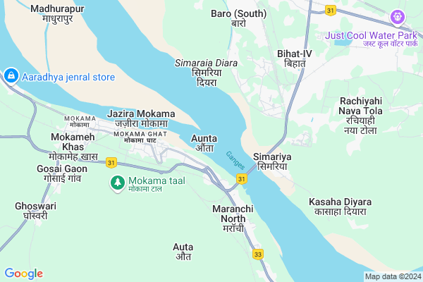
Aunta Map
EDIT Map
Add Your House
 ..
..
Current Corona Virus Infected Patients Count in Patna District
| City Name | District Name | Total Covid cases |
|---|---|---|
| Patna District | Patna | 22 |
| Khajpura | Patna | 10 |
| Patna | Patna | 1 |
Locality Name :
Aunta
( ौंटा )
Block Name : Mokama
District : Patna
State : Bihar
Division : Patna
Language : Hindi and Magahi, Maithali, Bhojpuri, English, Angika
Current Time 12:45 PM
Date: Sunday , Apr 27,2025 (IST)
Time zone: IST (UTC+5:30)
Elevation / Altitude: 48 meters. Above Seal level
Telephone Code / Std Code: 06279
Assembly constituency : Mokama assembly constituency
Assembly MLA : Anant Kumar Singh
Lok Sabha constituency : Munger parliamentary constituency
Parliament MP : RAJIV RANJAN SINGH ALIAS LALAN SINGH
Serpanch Name :
Pin Code : 803303
Post Office Name : Mokamaghat
Alternate Village Name : Auta
Aunta Live Weather
Temperature: 36.6 °C
overcast clouds
Humidity: 25%
Wind : 2.27 mt/sec towards E
StationName : "Mokameh"
observed on 2 Hours Back
Temperature: 36.6 °C
overcast clouds
Humidity: 25%
Wind : 2.27 mt/sec towards E
StationName : "Mokameh"
observed on 2 Hours Back
Aunta Weather Forecast for Next 5 days
28-04-2025
26.3°C to 41.2°C
overcast clouds
26.3°C to 41.2°C
overcast clouds
29-04-2025
25.5°C to 39.7°C
overcast clouds, broken clouds, light rain
25.5°C to 39.7°C
overcast clouds, broken clouds, light rain
30-04-2025
24.3°C to 33.7°C
light rain, overcast clouds, broken clouds, few clouds, scattered clouds
24.3°C to 33.7°C
light rain, overcast clouds, broken clouds, few clouds, scattered clouds
01-05-2025
24.2°C to 36.3°C
broken clouds, overcast clouds, clear sky, scattered clouds
24.2°C to 36.3°C
broken clouds, overcast clouds, clear sky, scattered clouds
02-05-2025
24.6°C to 35.9°C
overcast clouds, light rain, broken clouds
24.6°C to 35.9°C
overcast clouds, light rain, broken clouds
Edit below overview about Aunta
Edit below overview about Aunta
OverView of Aunta
nearest school- shila high schooladdress sangth sthan auntaaunta is high educated village in biharEdit below overview about Aunta
National Highways Reachable To Aunta
Nationa High Way :NH20
Nationa High Way :NH333B
Nationa High Way :NH20
Nationa High Way :NH333B
Rivers Near Aunta
Burhi Gandak
Garkhe
Burhi Gandak
Garkhe
About Aunta
Aunta is a Village in Mokama Block in Patna District of Bihar State, India. It belongs to Patna Division . It is located 103 KM towards East from District head quarters Patna. 2 KM from Mokama. 103 KM from State capital Patna
Aunta Pin code is 803303 and postal head office is Mokamaghat .
Maranchi North ( 5 KM ) , Maranchi South ( 6 KM ) , Mokama ( 6 KM ) , Gosai Gaon ( 7 KM ) , Ghoswari ( 7 KM ) are the nearby Villages to Aunta. Aunta is surrounded by Ghoswari Block towards west , Barauni Block towards North , Teghra Block towards North , Barahiya Block towards South .
Mokama , Mokameh , Barahiya , Begusarai are the near by Cities to Aunta.
This Place is in the border of the Patna District and Begusarai District. Begusarai District Barauni is North towards this place .
Auta 2011 Census Details
Aunta Local Language is Hindi. Auta Village Total population is 10880 and number of houses are 1862. Female Population is 48.0%. Village literacy rate is 61.8% and the Female Literacy rate is 25.6%.
Population
| Census Parameter | Census Data |
| Total Population | 10880 |
| Total No of Houses | 1862 |
| Female Population % | 48.0 % ( 5218) |
| Total Literacy rate % | 61.8 % ( 6724) |
| Female Literacy rate | 25.6 % ( 2785) |
| Scheduled Tribes Population % | 0.0 % ( 0) |
| Scheduled Caste Population % | 10.8 % ( 1179) |
| Working Population % | 39.6 % |
| Child(0 -6) Population by 2011 | 1659 |
| Girl Child(0 -6) Population % by 2011 | 48.8 % ( 810) |
Auta Census More Deatils.
Politics in Aunta
JD(U) , LJP , Janata Dal (United) , RJD , are the major political parties in this area.Polling Stations /Booths near Aunta
1)Madhya Vidyalay Ajagara (purwi Bhag)2)Samudayik Bhavan Sultanapur
3)Madhya Vidyalay Panchamahala (pashchimi Bhag)
4)Prathamik Vidyalay Chhapedatar Purwi Bhag
5)Madhya Vidyalay Mamarakhabad (purwi Bhag)
HOW TO REACH Aunta
By Rail
Aunta Halt Rail Way Station , Tall Junction Rail Way Station are the very nearby railway stations to Aunta. Mokama Rail Way Station (near to Mokameh) , Barhiya Rail Way Station (near to Barahiya) , Tall Junction Rail Way Station (near to Mokameh) , Rampur Dumra Junction Rail Way Station (near to Barahiya) are the Rail way stations reachable from near by towns.By Road
Mokameh , Barahiya are the nearby by towns to Aunta having road connectivity to AuntaColleges near Aunta
Nazreth Hospital
Address : Mokama, P O Mokama Jn, Patna
Schools near Aunta
P.s. Maranchi Kasha
Address : maranchi , mokama , patna , Bihar . PIN- 803301 , Post - Hathidah
M.s. Sheonar
Address : sheonar , mokama , patna , Bihar . PIN- 803302 , Post - Mokamachauk
M.s. Sherpur
Address : malpur , mokama , patna , Bihar . PIN- 803301 , Post - Hathidah
M.s.c.c.m.vidayalay
Address : wardno. , mokama , patna , Bihar . PIN- 803302 , Post - Mokamachauk
Govt Health Centers near Aunta
1) Aunta , HSC AUNTA , Aunta , CRPF CAMP2) Murarpur Harsidhi , HSC , murarpur , murarpur
3) Panchmahala , HSC PANCHAMAHLA , Panchmahala , NH
Hospitals in Aunta,Mokama
Satyam And Ryan Houses
hathidah; near; maa kali mandir Road; Auta; Bihar 803301; India
2.1 KM distance Detail
Haniman Homeopathic ( Dr.devi Saw )
Barh - Mokama - Barahia Rd; Panchmahla; Bihar 803303; India
3.7 KM distance Detail
more ..
Petrol Bunks in Aunta,Mokama
Indian Oil Corporation Ltd (MAKHARIA SERVICE STATION)
Hathidah Buzurg; Bihar 803301; India
2.0 KM distance Detail
more ..
Colleges in Aunta,Mokama
Bachu Pd Singh Mahila Training College Sisouni; Mokama Ghat
Mokama Ghat; Dhourani Tola; Panchmahla; Bihar 803303; India
3.8 KM distance Detail
RSM Railway Aided High School
Mokama Ghat; Dhourani Tola; Sikhari Chak; Bihar 803303; India
4.0 KM distance Detail
B. A.C.K.S BARKADA ARNAV SINGH EDUCATION
Bihat sudi sthan ward; 26; Bihar; India
5.6 KM distance Detail
more ..
Schools in Aunta,Mokama
Shila high school ; Aunta
vill- post office- aunta; police station-hathidah;; Aunta; Bihar 803303; India
1.5 KM distance Detail
Ideal Convent;School
Hathidah Jn Stairs; Hathidah Buzurg; Bihar 803301; India
1.5 KM distance Detail
Electronic Shops in Aunta,Mokama
श्री बाला जी टायर रिपेयरिंग
Bata more Patna road NH-80; Bhagalpur; Bihar 803301; India
1.6 KM distance Detail
Parwez Electronics;Dariyapur
Barh - Mokama - Barahia Rd; Gurudev Tola; Mokama; Mokameh Khas; Bihar 803302; India
1.6 KM distance Detail
Super Markets in Aunta,Mokama
Rajak Market Dariyapur
Barh - Mokama - Barahia Rd; Aunta; Bihar 803301; India
1.6 KM distance Detail
About Aunta &
History
How to reach Aunta
Tourist Places Near By Aunta
Schools in Aunta
Colleges in Aunta
Temperature & weather of Aunta
places in Aunta
Aunta photos
More Information
How to reach Aunta
Tourist Places Near By Aunta
Schools in Aunta
Colleges in Aunta
Temperature & weather of Aunta
places in Aunta
Aunta photos
More Information
Village Talk
Post News or Events about this Village
Near Cities
Mokama 5 KM near
Mokameh 6 KM near
Barahiya 12 KM near
Begusarai 17 KM near
Mokama 5 KM near
Mokameh 6 KM near
Barahiya 12 KM near
Begusarai 17 KM near
Near By Taluks
Mokama 2 KM near
Ghoswari 7 KM near
Barauni 11 KM near
Teghra 13 KM near
Mokama 2 KM near
Ghoswari 7 KM near
Barauni 11 KM near
Teghra 13 KM near
Near By Air Ports
Patna Airport 103 KM near
Gaya Airport 141 KM near
Ranchi Airport 268 KM near
Bagdogra Airport 307 KM near
Patna Airport 103 KM near
Gaya Airport 141 KM near
Ranchi Airport 268 KM near
Bagdogra Airport 307 KM near
Near By Tourist Places
Nalanda 55 KM near
Bihar Sharif 56 KM near
Munger 57 KM near
Samastipur 62 KM near
Kakolat 81 KM near
Nalanda 55 KM near
Bihar Sharif 56 KM near
Munger 57 KM near
Samastipur 62 KM near
Kakolat 81 KM near
Near By Districts
Begusarai 17 KM near
Lakhisarai 29 KM near
Sheikhpura 34 KM near
Nalanda 55 KM near
Begusarai 17 KM near
Lakhisarai 29 KM near
Sheikhpura 34 KM near
Nalanda 55 KM near
Near By RailWay Station
Aunta Halt Rail Way Station 3.3 KM near
Rajendra Pul Rail Way Station 3.6 KM near
Hathidah Junction Rail Way Station 3.6 KM near
Mokama Rail Way Station 7 KM near
Aunta Halt Rail Way Station 3.3 KM near
Rajendra Pul Rail Way Station 3.6 KM near
Hathidah Junction Rail Way Station 3.6 KM near
Mokama Rail Way Station 7 KM near