| Home | City Bus | Maps | Villages | Cities | Rail | Tourist Places | School | College | Pin Codes | Corona Cases Count |
| Distance Calculator Bus Services IFSC Codes Trace Mobile Number Weather Search Place Trace IP Available Cash ATM/Banks Locate Polling Booth Report an Error contact People |
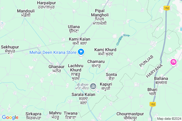
Chamaru Map
EDIT Map
Add Your House
 ..
..
Current Corona Virus Infected Patients Count in Patiala District
| City Name | District Name | Total Covid cases |
|---|---|---|
| Patiala District | Patiala | 56 |
| Rajpura | Patiala | 5 |
Locality Name :
Chamaru
( ਚਮਾਰੁ )
Tehsil Name : Ghanaur
District : Patiala
State : Punjab
Language : Punjabi
Current Time 04:43 PM
Date: Monday , Apr 28,2025 (IST)
Time zone: IST (UTC+5:30)
Elevation / Altitude: 263 meters. Above Seal level
Telephone Code / Std Code: 01762
Assembly constituency : Ghanaur assembly constituency
Assembly MLA : Gurlal Ghanaur
Lok Sabha constituency : Patiala parliamentary constituency
Parliament MP : Preneet Kaur
Serpanch Name :
Commodities Prices : Ghanaur Market / Mandi
Chamaru Live Weather
Temperature: 41.7 °C
clear sky
Humidity: 6%
Wind : 1.34 mt/sec towards NW
StationName : "Ghanaur"
observed on 1 Hours Back
Temperature: 41.7 °C
clear sky
Humidity: 6%
Wind : 1.34 mt/sec towards NW
StationName : "Ghanaur"
observed on 1 Hours Back
Chamaru Weather Forecast for Next 5 days
29-04-2025
28.4°C to 41.4°C
clear sky
28.4°C to 41.4°C
clear sky
30-04-2025
26.2°C to 41.2°C
clear sky
26.2°C to 41.2°C
clear sky
01-05-2025
26.6°C to 42.5°C
few clouds, broken clouds, scattered clouds, clear sky
26.6°C to 42.5°C
few clouds, broken clouds, scattered clouds, clear sky
02-05-2025
26.9°C to 42.5°C
clear sky, broken clouds, scattered clouds, light rain
26.9°C to 42.5°C
clear sky, broken clouds, scattered clouds, light rain
03-05-2025
27.0°C to 40.5°C
overcast clouds, broken clouds, scattered clouds, few clouds
27.0°C to 40.5°C
overcast clouds, broken clouds, scattered clouds, few clouds
Edit below overview about Chamaru
Edit below overview about Chamaru
OverView of Chamaru
Garhi sahib gurdwara . mollu , akali ,gurdas and rorah patti main area of the village and major popullation sarwara jatt sikhEdit below overview about Chamaru
National Highways Reachable To Chamaru
Nationa High Way :NH7
Nationa High Way :NH44
Nationa High Way :NH7
Nationa High Way :NH44
Rivers Near Chamaru
Tangri
Tangri
About Chamaru
Chamaru is a Village in Ghanaur Tehsil in Patiala District of Punjab State, India. It is located 28 KM towards East from District head quarters Patiala. 4 KM from Ghanauri Khera. 53 KM from State capital Chandigarh
Lachhru Khurd ( 1 KM ) , Kami Khurd ( 2 KM ) , Kapuri ( 3 KM ) , Kami Kalan ( 3 KM ) , Ram Pur ( 3 KM ) are the nearby Villages to Chamaru. Chamaru is surrounded by Ambala-I Tehsil towards East , Ambala-Ii Tehsil towards East , Rajpura Tehsil towards North , Bhuner Heri Tehsil towards South .
Ambala , Rajpura , Babiyal , Patiala are the near by Cities to Chamaru.
This Place is in the border of the Patiala District and Ambala District. Ambala District Ambala-i is East towards this place . It is near to the Haryana State Border.
Chamaru 2011 Census Details
Chamaru Local Language is Punjabi. Chamaru Village Total population is 2763 and number of houses are 494. Female Population is 46.2%. Village literacy rate is 61.4% and the Female Literacy rate is 25.8%.
Population
| Census Parameter | Census Data |
| Total Population | 2763 |
| Total No of Houses | 494 |
| Female Population % | 46.2 % ( 1276) |
| Total Literacy rate % | 61.4 % ( 1696) |
| Female Literacy rate | 25.8 % ( 714) |
| Scheduled Tribes Population % | 0.0 % ( 0) |
| Scheduled Caste Population % | 16.8 % ( 464) |
| Working Population % | 31.2 % |
| Child(0 -6) Population by 2011 | 321 |
| Girl Child(0 -6) Population % by 2011 | 43.9 % ( 141) |
Chamaru Census More Deatils.
Politics in Chamaru
SAD , INC are the major political parties in this area.Polling Stations /Booths near Chamaru
1)Govt.ele.school Chalherhi (west Side)2)Govt.ele.school Chamaru (east Side)
3)Govt.high.shool Jand Mangoli (west Side)
4)Govt.high.shool Lachhru Kalan (east Side)
5)Govt.ele.school Rampur (east Side)
HOW TO REACH Chamaru
By Rail
There is no railway station near to Chamaru in less than 10 km.Pincodes near Chamaru
140601 ( Banur ) , 140702 ( Ghanur ) , 147021 ( Guruteghbahadurgarh )Colleges near Chamaru
Swift Institute Of Nursing
Address : Swift Institute Of Nursing, Village Ghaggar Sarai,
Schools near Chamaru
Alimajra Primery School
Address : left hand side at the entrence of the village.
Sarswati Bal Vida Kender Mandouli
Address : mandouli
ਸਰਕਾਰੀ ਸਕੂਲ ਮੰਡੋਲੀ
Address :
Government Elementary School
Address : chattar nagar
Govt Health Centers near Chamaru
1) Massingan , Sub Center Massingan , Panchaiyat Ghar , Near Bus Stand Massingan2) Jharmiri , Sub Centre Charmiri , ,
3) SDH Rajpura , AP Jain Civil Hospital , Rajpura Town , Rajpura Town
Petrol Bunks in Chamaru,Ghanaur
Petrol Pump; Baghora
Patiala to Ghahaur to Shambhu Rd; Lanjan; Punjab 140702; India
6.9 KM distance Detail
more ..
Governement Offices near Chamaru,Ghanaur
Public Works Department Water Supply
Mahavir Nagar; Ambala; Haryana 134003; India
12.5 KM distance Detail
About Chamaru &
History
How to reach Chamaru
Tourist Places Near By Chamaru
Schools in Chamaru
Colleges in Chamaru
Temperature & weather of Chamaru
places in Chamaru
Chamaru photos
More Information
How to reach Chamaru
Tourist Places Near By Chamaru
Schools in Chamaru
Colleges in Chamaru
Temperature & weather of Chamaru
places in Chamaru
Chamaru photos
More Information
Village Talk
Post News or Events about this Village
Near Cities
Ambala 14 KM near
Rajpura 20 KM near
Babiyal 23 KM near
Patiala 28 KM near
Ambala 14 KM near
Rajpura 20 KM near
Babiyal 23 KM near
Patiala 28 KM near
Near By Taluks
Ghanaur 4 KM near
Ambala-I 13 KM near
Ambala-Ii 21 KM near
Rajpura 21 KM near
Ghanaur 4 KM near
Ambala-I 13 KM near
Ambala-Ii 21 KM near
Rajpura 21 KM near
Near By Air Ports
Chandigarh Airport 44 KM near
Ludhiana Airport 110 KM near
Simla Airport 110 KM near
Dehra Dun Airport 148 KM near
Chandigarh Airport 44 KM near
Ludhiana Airport 110 KM near
Simla Airport 110 KM near
Dehra Dun Airport 148 KM near
Near By Tourist Places
Patel Park in Ambala Cantt 14 KM near
Patiala 28 KM near
Kurukshetra 44 KM near
Fatehgarh-Sahib 45 KM near
Panchkula 49 KM near
Patel Park in Ambala Cantt 14 KM near
Patiala 28 KM near
Kurukshetra 44 KM near
Fatehgarh-Sahib 45 KM near
Panchkula 49 KM near
Near By Districts
Ambala 14 KM near
Patiala 28 KM near
S.A.S Nagar 45 KM near
Fatehgarh Sahib 47 KM near
Ambala 14 KM near
Patiala 28 KM near
S.A.S Nagar 45 KM near
Fatehgarh Sahib 47 KM near
Near By RailWay Station
Ambala City Rail Way Station 13 KM near
Ambala Cantt. Junction Rail Way Station 19 KM near
Ambala City Rail Way Station 13 KM near
Ambala Cantt. Junction Rail Way Station 19 KM near