| Home | City Bus | Maps | Villages | Cities | Rail | Tourist Places | School | College | Pin Codes | Corona Cases Count |
| Distance Calculator Bus Services IFSC Codes Trace Mobile Number Weather Search Place Trace IP Available Cash ATM/Banks Locate Polling Booth Report an Error contact People |
Parsa
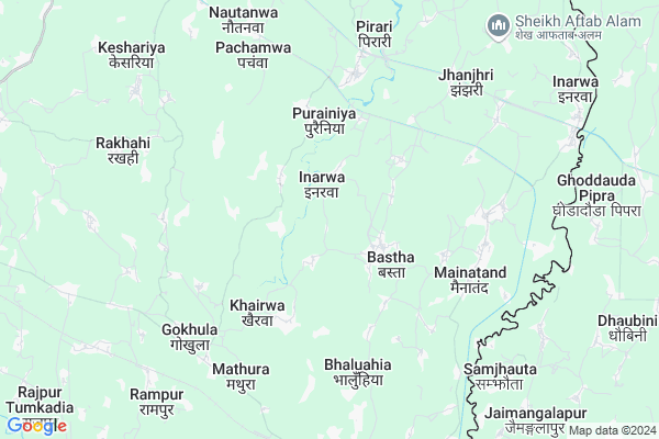
Parsa Map
EDIT Map
Add Your House
 ..
..
Current Corona Virus Infected Patients Count in Pashchim Champaran District
| City Name | District Name | Total Covid cases |
|---|
Locality Name :
Parsa
( परसा )
Block Name : Mainatand
District : Pashchim Champaran
State : Bihar
Division : Tirhut
Language : Maithili and Hindi, Urdu, Bhojpuri
Current Time 10:10 AM
Date: Wednesday , Mar 12,2025 (IST)
Time zone: IST (UTC+5:30)
Elevation / Altitude: 82 meters. Above Seal level
Telephone Code / Std Code: 06253
Assembly constituency : Sikta assembly constituency
Assembly MLA : Birendra Prasad Gupta
Lok Sabha constituency : Valmiki Nagar parliamentary constituency
Parliament MP : BAIDYANATH PRASAD MAHTO
Serpanch Name :
Pin Code : 845306
Post Office Name : Mainatand
Main Village Name : PARSA
Commodities Prices : Tamkuhi Road Market / Mandi
Parsa Live Weather
Temperature: 27.5 °C
clear sky
Humidity: 20%
Wind : 3.22 mt/sec towards SE
StationName : "Nirmalbasti"
observed on 35 Mins Back
Temperature: 27.5 °C
clear sky
Humidity: 20%
Wind : 3.22 mt/sec towards SE
StationName : "Nirmalbasti"
observed on 35 Mins Back
Parsa Weather Forecast for Next 5 days
13-03-2025
20.6°C to 34.1°C
clear sky
20.6°C to 34.1°C
clear sky
14-03-2025
19.2°C to 36.3°C
few clouds, clear sky, broken clouds, scattered clouds
19.2°C to 36.3°C
few clouds, clear sky, broken clouds, scattered clouds
15-03-2025
20.4°C to 37.9°C
clear sky, few clouds
20.4°C to 37.9°C
clear sky, few clouds
16-03-2025
22.1°C to 39.0°C
few clouds, broken clouds, scattered clouds, clear sky
22.1°C to 39.0°C
few clouds, broken clouds, scattered clouds, clear sky
17-03-2025
22.9°C to 40.5°C
clear sky, scattered clouds, few clouds
22.9°C to 40.5°C
clear sky, scattered clouds, few clouds
Edit below overview about Parsa
Edit below overview about Parsa
OverView of Parsa
this is a small village near marjadwa railway station,this village under comes mahuawa sagrauwa panvhayat bullock mainatand in west champaran bihar,agriculture are main sources of people all community are live together with love education system-govt primary school and govt madarsa are there.Edit below overview about Parsa
Rivers Near Parsa
Burhi Gandak
Gandak :गंडक नदी
Burhi Gandak
Gandak :गंडक नदी
About Parsa
Parsa is a small Village/hamlet in Mainatand Block in Pashchim Champaran District of Bihar State, India. It comes under PARSA Panchayath. It belongs to Tirhut Division . It is located 41 KM towards North from District head quarters Bettiah. 204 KM from State capital Patna
Parsa Pin code is 845306 and postal head office is Mainatand .
Parsa is surrounded by Narkatiaganj Block towards west , Sikta Block towards South , Gaunaha Block towards North , Lauriya Block towards west .
Narkatiaganj , Chanpatia , Ramnagar , Bettiah are the near by Cities to Parsa.
Parsa 2011 Census Details
Parsa Local Language is Maithili. Parsa Village Total population is 3328 and number of houses are 518. Female Population is 46.8%. Village literacy rate is 50.7% and the Female Literacy rate is 19.2%.
Population
| Census Parameter | Census Data |
| Total Population | 3328 |
| Total No of Houses | 518 |
| Female Population % | 46.8 % ( 1556) |
| Total Literacy rate % | 50.7 % ( 1686) |
| Female Literacy rate | 19.2 % ( 638) |
| Scheduled Tribes Population % | 0.0 % ( 1) |
| Scheduled Caste Population % | 4.8 % ( 160) |
| Working Population % | 45.0 % |
| Child(0 -6) Population by 2011 | 822 |
| Girl Child(0 -6) Population % by 2011 | 47.7 % ( 392) |
Parsa Census More Deatils.
Politics in Parsa
JD(U) , BJP , Janata Dal (United) , INC are the major political parties in this area.Polling Stations /Booths near Parsa
1)Prathamik Vidyalay Aryanagar2)Utkramit Madhya Vidhalay Bhavara Paschim Bhag
3)Utkramit Madhya Vidyalay Bhavara Purvi Bhag
4)Prathamik Vidyalay Khamhiya
5)Panchayat Bhavan Bhangaha
HOW TO REACH Parsa
By Rail
Marajdwa Rail Way Station , Gokhula Rail Way Station are the very nearby railway stations to Parsa. Narkatia Junction Rail Way Station (near to Narkatiaganj) , Narkatiaganj Junction Rail Way Station (near to Narkatiaganj) are the Rail way stations reachable from near by towns.By Road
Narkatiaganj are the nearby by towns to Parsa having road connectivity to ParsaColleges near Parsa
Reekh Narayan High School Laxmipur
Address :
Schools in Parsa
Madrasa Manzrul Ulum Parsa
Address : parsa , mainatand , pashchim champaran , Bihar . PIN- 845306 , Post - Mainatand
Govt Health Centers near Parsa
1) Srirampur , Govt Building , Sri Rampur , Near Nahar2) Semari , Govt Building , Semari , Near GPS School
3) Siswa Raxaul , Private Building in the House of Awadesh Rai , Siswa , Siswa Bazar
Schools in Parsa,Mainatand
Government School
845306; Chhatauni Rd; Tulsi Nagar; Kukudakhandi; Odisha 761100; India
4.2 KM distance Detail
Scientist Making School Pirari Bazar Hostel
Mathura - Padari - Chauhatta Rd; Inarwa; Bihar 845306; India
4.3 KM distance Detail
Electronic Shops in Parsa,Mainatand
Shahid developer
At-manjharia Po-Bhaluwahia ps- Purshotampur Distt; Bihar; India
3.6 KM distance Detail
About Parsa &
History
How to reach Parsa
Tourist Places Near By Parsa
Schools in Parsa
Colleges in Parsa
Temperature & weather of Parsa
places in Parsa
Parsa photos
More Information
How to reach Parsa
Tourist Places Near By Parsa
Schools in Parsa
Colleges in Parsa
Temperature & weather of Parsa
places in Parsa
Parsa photos
More Information
Village Talk
Post News or Events about this Village
Near Cities
Narkatiaganj 13 KM near
Chanpatia 21 KM near
Ramnagar 31 KM near
Bettiah 38 KM near
Narkatiaganj 13 KM near
Chanpatia 21 KM near
Ramnagar 31 KM near
Bettiah 38 KM near
Near By Taluks
Mainatand 0 KM near
Narkatiaganj 14 KM near
Sikta 19 KM near
Gaunaha 22 KM near
Mainatand 0 KM near
Narkatiaganj 14 KM near
Sikta 19 KM near
Gaunaha 22 KM near
Near By Air Ports
Gorakhpur Airport 136 KM near
Patna Airport 196 KM near
Varanasi Airport 284 KM near
Gaya Airport 296 KM near
Gorakhpur Airport 136 KM near
Patna Airport 196 KM near
Varanasi Airport 284 KM near
Gaya Airport 296 KM near
Near By Tourist Places
Lauria Nandangarh 27 KM near
Motihari 67 KM near
Kushinagar 91 KM near
Kesariya 97 KM near
Buddha Stupa 97 KM near
Lauria Nandangarh 27 KM near
Motihari 67 KM near
Kushinagar 91 KM near
Kesariya 97 KM near
Buddha Stupa 97 KM near
Near By Districts
Pashchim Champaran 38 KM near
Purbi Champaran 70 KM near
Gopalganj 82 KM near
Kushi Nagar 89 KM near
Pashchim Champaran 38 KM near
Purbi Champaran 70 KM near
Gopalganj 82 KM near
Kushi Nagar 89 KM near
Near By RailWay Station
Marajdwa Rail Way Station 8.7 KM near
Gokhula Rail Way Station 8.9 KM near
Narkatiaganj Junction Rail Way Station 15 KM near
Chanpatia Rail Way Station 22 KM near
Marajdwa Rail Way Station 8.7 KM near
Gokhula Rail Way Station 8.9 KM near
Narkatiaganj Junction Rail Way Station 15 KM near
Chanpatia Rail Way Station 22 KM near