| Home | City Bus | Maps | Villages | Cities | Rail | Tourist Places | School | College | Pin Codes | Corona Cases Count |
| Distance Calculator Bus Services IFSC Codes Trace Mobile Number Weather Search Place Trace IP Available Cash ATM/Banks Locate Polling Booth Report an Error contact People |
Kothala
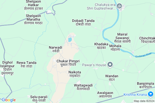
Kothala Map
EDIT Map
Add Your House
 ..
..
Current Corona Virus Infected Patients Count in Parbhani District
| City Name | District Name | Total Covid cases |
|---|---|---|
| Parbhani District | Parbhani | 1 |
Locality Name :
Kothala
( कोथळा )
Taluka Name : Sonpeth
District : Parbhani
State : Maharashtra
Region : Marathwada
Division : Aurangabad
Language : Marathi and Andh, Hindi
Current Time 12:30 PM
Date: Tuesday , Apr 29,2025 (IST)
Time zone: IST (UTC+5:30)
Elevation / Altitude: 409 meters. Above Seal level
Telephone Code / Std Code: 02453
Assembly constituency : Pathri assembly constituency
Assembly MLA : Warpudkar Suresh Ambadasrao
Lok Sabha constituency : Parbhani parliamentary constituency
Parliament MP : JADHAV SANJAY (BANDU) HARIBHAU
Serpanch Name :
Pin Code : 431516
Post Office Name : Sonpeth
Commodities Prices : Sonpeth Market / Mandi
National Highways Reachable To Kothala
Nationa High Way :NH752K;NH361F
Nationa High Way :NH361F
Nationa High Way :NH752K;NH361F
Nationa High Way :NH361F
Rivers Near Kothala
Gaibipir
Wan
Gaibipir
Wan
About Kothala
Correct below Info and add more info about KothalaKothala is a Village in Sonpeth Taluka in Parbhani District of Maharashtra State, India. It belongs to Marathwada region . It belongs to Aurangabad Division . It is located 41 KM towards South from District head quarters Parbhani. 458 KM from State capital Mumbai
Kothala Pin code is 431516 and postal head office is Sonpeth .
Kothala is surrounded by Parali V . Taluka towards South , Gangakhed Taluka towards East , Manwat Taluka towards North , Pathri Taluka towards North .
Parli , Pathri , Manwath , Parbhani are the near by Cities to Kothala.
This Place is in the border of the Parbhani District and Beed District. Beed District Parali V . is South towards this place .
Kothala 2011 Census Details
Kothala Local Language is Marathi. Kothala Village Total population is 1321 and number of houses are 254. Female Population is 47.9%. Village literacy rate is 54.4% and the Female Literacy rate is 21.5%.
Population
| Census Parameter | Census Data |
| Total Population | 1321 |
| Total No of Houses | 254 |
| Female Population % | 47.9 % ( 633) |
| Total Literacy rate % | 54.4 % ( 719) |
| Female Literacy rate | 21.5 % ( 284) |
| Scheduled Tribes Population % | 6.1 % ( 80) |
| Scheduled Caste Population % | 13.2 % ( 175) |
| Working Population % | 65.1 % |
| Child(0 -6) Population by 2011 | 181 |
| Girl Child(0 -6) Population % by 2011 | 42.5 % ( 77) |
Kothala Census More Deatils.
Politics in Kothala
NCP , Shivsena , SHS , INC are the major political parties in this area.Polling Stations /Booths near Kothala
1)Z.p.p.s.bukhtarwadi2)Z.p.p.s. Kolhawadi Room No 1
3)Z.p.p.s. Narlad Room No 1
4)Z.p.p.s. Narwadi
5)Z.p.p.s. Nagarjawla Room No 1
HOW TO REACH Kothala
By Rail
Ukhali Rail Way Station , Vadgaon Rail Way Station are the very nearby railway stations to Kothala. Gangakher Rail Way Station (near to Gangakhed) , Parli Vaijnath Rail Way Station (near to Parli) are the Rail way stations reachable from near by towns.By Road
Sonpeth , Parli , Gangakhed are the nearby by towns to Kothala having road connectivity to KothalaColleges near Kothala
Late. Bajirao Deshmukh Jr. College , Shelgaon
Address :
Mahatma Phule Arts And Science Juniour College
Address : Ukhali Bk Tal.sonpeth Dist Parbhani
Schools in Kothala
Late Bochare Hs Kothala
Address : kothala , sonpeth , parbhani , Maharashtra . PIN- 431516 , Post - Sonpeth
Zpps Kothala
Address : kothala , sonpeth , parbhani , Maharashtra . PIN- 431516 , Post - Sonpeth
Govt Health Centers near Kothala
1) Shirshi (Bk) , Sub Centre Shirshi (Bk) , Shirshi (Bk) , At Post Sonpeth2) Dharasur , Primary Health Center Dharasur , Dharasur , Post Office Dharasur
3) Dhamani , Sub Centre Dhamani , Dhamani , At Post Sonpeth
Sub Villages in Kothala
Petrol Bunks in Kothala,Sonpeth
Gurukrupa Tire And Washing Center
Sonpeth - Gangakhed Rd; Shelgaon Maratha; Maharashtra 431516; India
7.8 KM distance Detail
GuruKrupa Tyre And Service Center
Shelgaon Maratha; Maharashtra 431516; India
8.9 KM distance Detail
Hindustan Petroleum
Sonpeth; Parbhani; Pathri Sonpeth Parli Road; Parbhani; Parbhani; Maharashtra 431516; India
13.4 KM distance Detail
more ..
Colleges in Kothala,Sonpeth
Late Ramesh Warpudkar Arts; Commerce & Science College
Sonpeth - Parli Road; Rajabhau kadam Nagar; Dist. Parbhani; Sonpeth; Maharashtra 431516; India
13.5 KM distance Detail
Shri Mahalingeshwar Jr. College Sonpeth
Shelgaon road; सोनपेठ-SONPETH; Maharashtra 431516; India
14.2 KM distance Detail
more ..
Schools in Kothala,Sonpeth
Kai.Manshig Naike English School
Rawla Dagla Ka Khera; Bodiyana; Chittorgarh; Rajasthan 431516; India
0.7 KM distance Detail
नृसिंह माध्यमिक व उच्च माध्य. विद्यालय; नरवाडी.
Tukai Tanda; Maharashtra 431516; India
3.1 KM distance Detail
Electronic Shops in Kothala,Sonpeth
Mauli Electronic
Narwadi - Gangkhed Rd; Tukai Tanda; Maharashtra 431516; India
2.9 KM distance Detail
Police Stations near Kothala,Sonpeth
Police Station Sonpeth
Sonpeth; Parbhani; Pathri Sonpeth Parli Road; Parbhani; Parbhani; Maharashtra 431516; India
14.2 KM distance Detail
Governement Offices near Kothala,Sonpeth
Village Panchayat Ukkadgaon
Ukkadgaon; Parbhani; Parli Gangakhed Road; Parbhani; Parbhani; Maharashtra 431515; India
12.0 KM distance Detail
About Kothala &
History
How to reach Kothala
Tourist Places Near By Kothala
Schools in Kothala
Colleges in Kothala
Temperature & weather of Kothala
places in Kothala
Kothala photos
More Information
How to reach Kothala
Tourist Places Near By Kothala
Schools in Kothala
Colleges in Kothala
Temperature & weather of Kothala
places in Kothala
Kothala photos
More Information
Village Talk
Post News or Events about this Village
Near Cities
Parli 19 KM near
Pathri 36 KM near
Manwath 38 KM near
Parbhani 40 KM near
Parli 19 KM near
Pathri 36 KM near
Manwath 38 KM near
Parbhani 40 KM near
Near By Taluks
Sonpeth 0 KM near
Parali V . 20 KM near
Gangakhed 22 KM near
Manwat 35 KM near
Sonpeth 0 KM near
Parali V . 20 KM near
Gangakhed 22 KM near
Manwat 35 KM near
Near By Air Ports
Latur Airport 74 KM near
Nanded Airport 88 KM near
Chikkalthana Airport 176 KM near
Sholapur Airport 187 KM near
Latur Airport 74 KM near
Nanded Airport 88 KM near
Chikkalthana Airport 176 KM near
Sholapur Airport 187 KM near
Near By Tourist Places
Hingoli 111 KM near
Tuljapur 137 KM near
Washim 151 KM near
Bidar 177 KM near
Solapur 182 KM near
Hingoli 111 KM near
Tuljapur 137 KM near
Washim 151 KM near
Bidar 177 KM near
Solapur 182 KM near
Near By Districts
Parbhani 39 KM near
Latur 74 KM near
Nanded 86 KM near
Beed 98 KM near
Parbhani 39 KM near
Latur 74 KM near
Nanded 86 KM near
Beed 98 KM near
Near By RailWay Station
Gangakher Rail Way Station 19 KM near
Parli Vaijnath Rail Way Station 20 KM near
Gangakher Rail Way Station 19 KM near
Parli Vaijnath Rail Way Station 20 KM near