| Home | City Bus | Maps | Villages | Cities | Rail | Tourist Places | School | College | Pin Codes | Corona Cases Count |
| Distance Calculator Bus Services IFSC Codes Trace Mobile Number Weather Search Place Trace IP Available Cash ATM/Banks Locate Polling Booth Report an Error contact People |
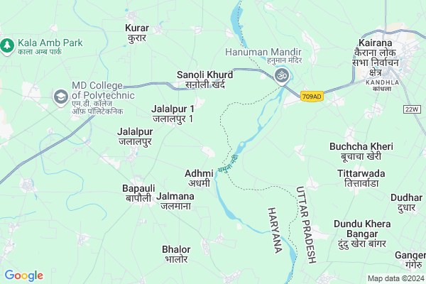
Nanhera Map
EDIT Map
Add Your House
 ..
..
Current Corona Virus Infected Patients Count in Panipat District
| City Name | District Name | Total Covid cases |
|---|---|---|
| Panipat District | Panipat | 9 |
| Panipat | Panipat | 3 |
Locality Name :
Nanhera
( नान्हेरा )
City Name : Bapoli
District : Panipat
State : Haryana
Division : Rohtak
Language : Hindi and Punjabi
Current Time 02:38 PM
Date: Friday , Apr 25,2025 (IST)
Time zone: IST (UTC+5:30)
Elevation / Altitude: 234 meters. Above Seal level
Telephone Code / Std Code: 0180
Assembly constituency : Samalkha assembly constituency
Assembly MLA : Dharam Singh Chhoker
Lok Sabha constituency : Karnal parliamentary constituency
Parliament MP : Sanjay Bhatia
Pin Code : 132103
Post Office Name : Panipat
Commodities Prices : Kairana Market / Mandi
Nanhera Live Weather
Temperature: 42.0 °C
clear sky
Humidity: 3%
Wind : 4.87 mt/sec towards NW
StationName : "Kairana"
observed on 2 Mins Back
Temperature: 42.0 °C
clear sky
Humidity: 3%
Wind : 4.87 mt/sec towards NW
StationName : "Kairana"
observed on 2 Mins Back
Nanhera Weather Forecast for Next 5 days
26-04-2025
28.7°C to 41.4°C
clear sky, scattered clouds, broken clouds
28.7°C to 41.4°C
clear sky, scattered clouds, broken clouds
27-04-2025
27.7°C to 40.7°C
overcast clouds, broken clouds
27.7°C to 40.7°C
overcast clouds, broken clouds
28-04-2025
28.0°C to 42.4°C
overcast clouds, broken clouds, clear sky
28.0°C to 42.4°C
overcast clouds, broken clouds, clear sky
29-04-2025
26.0°C to 43.8°C
clear sky, few clouds
26.0°C to 43.8°C
clear sky, few clouds
30-04-2025
27.2°C to 43.6°C
few clouds, clear sky, scattered clouds, overcast clouds
27.2°C to 43.6°C
few clouds, clear sky, scattered clouds, overcast clouds
National Highways Reachable To Nanhera
Nationa High Way :NH9
Nationa High Way :NH152D
Nationa High Way :NH9
Nationa High Way :NH152D
About Nanhera
Correct below Info and add more info about NanheraNanhera is a Locality in Bapoli City in Haryana State, India. It is belongs to Rohtak Division .
Nanhera Pin code is 132103 and postal head office is Panipat .
Rishpur , Jalmana , Sanoli Khurd , Jalalpur-ii , Jalalpur-i are the nearby Localities to Nanhera.
Panipat , Samalkha , Shamli , Gharaunda are the nearby Cities to Bapoli.
Demographics of Nanhera
Hindi is the Local Language here.Politics in Nanhera
HJCBL , INC , INLD are the major political parties in this area.Polling Stations /Booths near Nanhera
1)Govt Middle School Right Side Room Adhmi2)Govt Middle School Left Side Room Adhmi
3)Govt Middle School Right Side Room Shimla Gujran
4)Govt Middle School Left Side Room Nanhera
5)Govt. High School Right Side Room Bhodwal Majri
HOW TO REACH Nanhera
By Rail
There is no railway station near to Nanhera in less than 10 km.Govt Health Centers near Nanhera
1) Admi , , ,2) Goela Khera , , ,
3) CHC Bapoli , , ,
Petrol Bunks in Nanhera,Bapoli
Hanuman Oil Company Hindustan Petroleum
Jalalpur; Panipat; Samalkha Road; Panipat; Panipat; Haryana 132104; India
2.3 KM distance Detail
HP PETROL PUMP - HP HANUMAN OIL COMPANY
1 Sanauli SUB Tehsil Bapoli; Tehsil Samalkha; Bapoli Rd; Jalalpur; Haryana 132104; India
2.6 KM distance Detail
Rawal Ksk Filling Station Indian Oil Petrol Pump
Jalalpur; Haryana 132104; India
3.0 KM distance Detail
Rawal Filling Station Indian Oil Petrol Pump
Jalalpur; Panipat; Samalkha Road; Panipat; Panipat; Haryana 132104; India
3.1 KM distance Detail
more ..
Schools in Nanhera,Bapoli
Government Senior Secondary School
Jalalpur; Panipat; Samalkha Road; Panipat; Panipat; Haryana 132104; India
2.6 KM distance Detail
Local Parks in Nanhera,Bapoli
Colonel Chaudhry Farm House
Ujha Rd; Shanti Colony; Ugra Kheri; Panipat; Haryana 132104; India
12.3 KM distance Detail
Police Stations near Nanhera,Bapoli
Police Station Kotawli
SH 12; Allkalan Colony; Kairana; Uttar Pradesh 247774; India
10.8 KM distance Detail
Governement Offices near Nanhera,Bapoli
Atal Seva Kendra; CSC BAPOLI
Adj. Tehsil Bapoli Campus; Shop No.37; Anaj Mandi; Bapoli;; Panipat; Haryana 132103; India
4.7 KM distance Detail
About Nanhera &
History
How to reach Nanhera
Tourist Places Near By Nanhera
Schools in Nanhera
Colleges in Nanhera
Temperature & weather of Nanhera
places in Nanhera
Nanhera photos
More Information
How to reach Nanhera
Tourist Places Near By Nanhera
Schools in Nanhera
Colleges in Nanhera
Temperature & weather of Nanhera
places in Nanhera
Nanhera photos
More Information
Locality Talk
Post News or Events about this Locality
Near Cities
Panipat 16 KM near
Samalkha 19 KM near
Shamli 22 KM near
Gharaunda 28 KM near
Panipat 16 KM near
Samalkha 19 KM near
Shamli 22 KM near
Gharaunda 28 KM near
Near By Taluks
Bapoli 4 KM near
Kairana 15 KM near
Panipat 16 KM near
Samalkha 18 KM near
Bapoli 4 KM near
Kairana 15 KM near
Panipat 16 KM near
Samalkha 18 KM near
Near By Air Ports
Muzaffarnagar Airport 60 KM near
Indira Gandhi International Airport 100 KM near
Dehra Dun Airport 154 KM near
Chandigarh Airport 167 KM near
Muzaffarnagar Airport 60 KM near
Indira Gandhi International Airport 100 KM near
Dehra Dun Airport 154 KM near
Chandigarh Airport 167 KM near
Near By Tourist Places
panipat 16 KM near
Karna lake 50 KM near
Meerut 78 KM near
Kurukshetra 87 KM near
Delhi 90 KM near
panipat 16 KM near
Karna lake 50 KM near
Meerut 78 KM near
Kurukshetra 87 KM near
Delhi 90 KM near
Near By Districts
Panipat 16 KM near
Karnal 43 KM near
Sonipat 48 KM near
Baghpat 52 KM near
Panipat 16 KM near
Karnal 43 KM near
Sonipat 48 KM near
Baghpat 52 KM near
Near By RailWay Station
Panipat Junction Rail Way Station 17 KM near
Samalkha Rail Way Station 19 KM near
Panipat Junction Rail Way Station 17 KM near
Samalkha Rail Way Station 19 KM near