| Home | City Bus | Maps | Villages | Cities | Rail | Tourist Places | School | College | Pin Codes | Corona Cases Count |
| Distance Calculator Bus Services IFSC Codes Trace Mobile Number Weather Search Place Trace IP Available Cash ATM/Banks Locate Polling Booth Report an Error contact People |
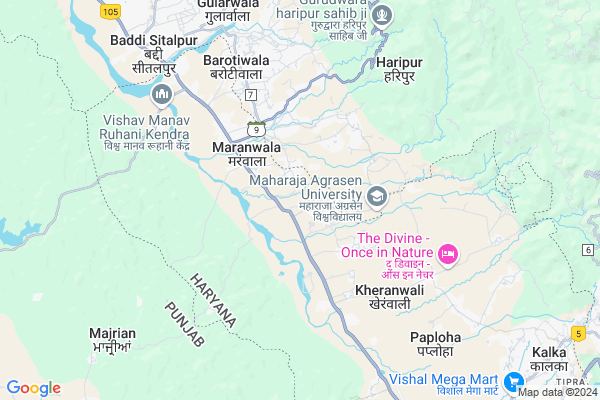
Nanakpur Map
EDIT Map
Add Your House
 ..
..
Current Corona Virus Infected Patients Count in Panchkula District
| City Name | District Name | Total Covid cases |
|---|---|---|
| Panchkula District | Panchkula | 17 |
| Panchkula | Panchkula | 1 |
Locality Name :
Nanakpur
( नानकपुर )
Tehsil Name : Pinjore
District : Panchkula
State : Haryana
Division : Ambala
Language : Hindi and English, Punjabi
Current Time 09:33 PM
Date: Sunday , Apr 27,2025 (IST)
Time zone: IST (UTC+5:30)
Elevation / Altitude: 658 meters. Above Seal level
Assembly constituency : Kalka assembly constituency
Assembly MLA : Pardeep Chaudhary
Lok Sabha constituency : Ambala parliamentary constituency
Parliament MP : RATTAN LAL KATARIA
Serpanch Name :
Pin Code : 134102
Post Office Name : Pinjore
Commodities Prices : Panchkul(Kalka) Market / Mandi
Nanakpur Live Weather
Temperature: 27.0 °C
clear sky
Humidity: 12%
Wind : 3.07 mt/sec towards NE
StationName : "Kasauli"
observed on Now
Temperature: 27.0 °C
clear sky
Humidity: 12%
Wind : 3.07 mt/sec towards NE
StationName : "Kasauli"
observed on Now
Nanakpur Weather Forecast for Next 5 days
28-04-2025
25.1°C to 28.1°C
clear sky
25.1°C to 28.1°C
clear sky
29-04-2025
24.0°C to 40.6°C
clear sky
24.0°C to 40.6°C
clear sky
30-04-2025
25.3°C to 40.5°C
few clouds, broken clouds, clear sky
25.3°C to 40.5°C
few clouds, broken clouds, clear sky
01-05-2025
26.2°C to 40.9°C
clear sky, scattered clouds, broken clouds
26.2°C to 40.9°C
clear sky, scattered clouds, broken clouds
02-05-2025
23.0°C to 40.4°C
clear sky, broken clouds, scattered clouds, light rain
23.0°C to 40.4°C
clear sky, broken clouds, scattered clouds, light rain
National Highways Reachable To Nanakpur
Nationa High Way :NH152
Nationa High Way :NH44
Nationa High Way :NH152
Nationa High Way :NH44
Rivers Near Nanakpur
Pandoa
Tangri
Pandoa
Tangri
About Nanakpur
Correct below Info and add more info about NanakpurNanakpur is a Village in Pinjore Tehsil in Panchkula District of Haryana State, India. It belongs to Ambala Division . It is located 23 KM towards North from District head quarters Panchkula. 11 KM from Pinjore. 21 KM from State capital Chandigarh
Nanakpur Pin code is 134102 and postal head office is Pinjore .
Rampur Jangi ( 1 KM ) , Karanpur ( 2 KM ) , Johluwal ( 3 KM ) , Maranwala ( 3 KM ) , Kona ( 3 KM ) are the nearby Villages to Nanakpur. Nanakpur is surrounded by Pinjore Tehsil towards South , Dharampur Tehsil towards East , Majri Tehsil towards west , Chandigarh Tehsil towards South .
Karoran , Kalka , Baddi , Pinjore are the near by Cities to Nanakpur.
This Place is in the border of the Panchkula District and Solan District. Solan District Dharampur is East towards this place . Also it is in the Border of other district Chandigarh . It is in the border of two states. First State is Himachal Pradesh State towards East and second state is Chandigarh State towards East .
Nanakpur 2011 Census Details
Nanakpur Local Language is Hindi. Nanakpur Village Total population is 2436 and number of houses are 456. Female Population is 47.8%. Village literacy rate is 65.6% and the Female Literacy rate is 28.0%.
Population
| Census Parameter | Census Data |
| Total Population | 2436 |
| Total No of Houses | 456 |
| Female Population % | 47.8 % ( 1164) |
| Total Literacy rate % | 65.6 % ( 1597) |
| Female Literacy rate | 28.0 % ( 682) |
| Scheduled Tribes Population % | 0.0 % ( 0) |
| Scheduled Caste Population % | 14.6 % ( 356) |
| Working Population % | 38.6 % |
| Child(0 -6) Population by 2011 | 317 |
| Girl Child(0 -6) Population % by 2011 | 46.1 % ( 146) |
Nanakpur Census More Deatils.
Politics in Nanakpur
BJP , INC , INLD are the major political parties in this area.Polling Stations /Booths near Nanakpur
1)Nanak Pur2)Nagal Rutal
3)Rajipur Jajhra
4)Ram Pur
5)Kandiyala
HOW TO REACH Nanakpur
By Rail
Kalka Rail Way Station is the very nearby railway stations to Nanakpur.Colleges near Nanakpur
Manav Group Of Institutes
Address : Hisar-chandigarh Road,national Highway 65,vpo Jave
Schools in Nanakpur
Gsss Nanakpour
Address : nanakpur , pinjore , panchkula , Haryana . PIN- 134102 , Post - Pinjore
Bgms Nanakpur
Address : nanakpur , pinjore , panchkula , Haryana . PIN- 134102 , Post - Pinjore
Govt Health Centers near Nanakpur
1) SC Chandi Tanda , , ,2) SC Karanpur , , ,
3) ESI Dispensary , , ,
Hospitals in Nanakpur,Pinjore
J.N Shory Multispeciality Hospital
Nalagarh Road; Shiv Shakti Colony; Model Town; Pinjore; Haryana 134104; India
12.5 KM distance Detail
Sharma Enterprises
Pinjore - Swarghat Rd; Shiv Shakti Colony; Pinjore; Haryana 134104; India
12.6 KM distance Detail
more ..
Petrol Bunks in Nanakpur,Pinjore
TARGET FUELS & LUBRICANTS
PINJORE BADDI; PINJORE BAD; PANCHKULA; Haryana 134102; India
10.5 KM distance Detail
more ..
Colleges in Nanakpur,Pinjore
Electronics and Computer Department PEC
Sector 12; Chandigarh; 160012; India
16.3 KM distance Detail
more ..
Schools in Nanakpur,Pinjore
Government Primary School;Masol
village-Masol; Sahibzada Ajit Singh Nagar; Punjab 133301; India
6.6 KM distance Detail
PC Senior Secondary School
Model Town; Pinjore; Basdevpura; Haryana 134104; India
11.9 KM distance Detail
Super Kids Playway School;
; 134101; Shiv Shakti Colony; Pinjore; Haryana; India
12.8 KM distance Detail
Electronic Shops in Nanakpur,Pinjore
Shree Balaji (DTH Service)
Vill Dhamala; opposite bharat petrol pump; Pinjore - Swarghat Rd; Haryana 134102; India
10.5 KM distance Detail
Jai Maa Lakshmi Enterprises
Anchal Vihar Colony; Lohgarh; Pinjore; Basdevpura; Haryana 133301; India
11.1 KM distance Detail
Swastika Electronics
Pinjore - Swarghat Rd; Basdevpura; Haryana 133301; India
11.1 KM distance Detail
Local Parks in Nanakpur,Pinjore
Yadavindra Gardens Pinjore
Ambala-Shimla Highway; Pinjore; Haryana 134102; India
13.3 KM distance Detail
Police Stations near Nanakpur,Pinjore
Traffic Light
B-19 HMT; Chandigarh Kalka Rd; B Block; HMT Twp; Pinjore; Haryana 134101; India
13.9 KM distance Detail
Governement Offices near Nanakpur,Pinjore
Starling Customs
First Floor; Chotti Karoran Road; Near Gurdwara; Nayagaon; Chandigarh 160103; India
14.0 KM distance Detail
Office of Speaker Punjab Vidhan Sabha
Punjab Vidhan Sabha; Sector 1; Chandigarh; 160001; India
16.3 KM distance Detail
About Nanakpur &
History
How to reach Nanakpur
Tourist Places Near By Nanakpur
Schools in Nanakpur
Colleges in Nanakpur
Temperature & weather of Nanakpur
places in Nanakpur
Nanakpur photos
More Information
How to reach Nanakpur
Tourist Places Near By Nanakpur
Schools in Nanakpur
Colleges in Nanakpur
Temperature & weather of Nanakpur
places in Nanakpur
Nanakpur photos
More Information
Village Talk
Post News or Events about this Village
Near Cities
Karoran 9 KM near
Kalka 10 KM near
Baddi 10 KM near
Pinjore 12 KM near
Karoran 9 KM near
Kalka 10 KM near
Baddi 10 KM near
Pinjore 12 KM near
Near By Taluks
Kalka 10 KM near
Pinjore 10 KM near
Dharampur 13 KM near
Majri 19 KM near
Kalka 10 KM near
Pinjore 10 KM near
Dharampur 13 KM near
Majri 19 KM near
Near By Air Ports
Chandigarh Airport 26 KM near
Simla Airport 43 KM near
Ludhiana Airport 106 KM near
Bhuntar Airport 139 KM near
Chandigarh Airport 26 KM near
Simla Airport 43 KM near
Ludhiana Airport 106 KM near
Bhuntar Airport 139 KM near
Near By Tourist Places
Kasauli 12 KM near
Yadavindra gardens 12 KM near
Parwanoo 12 KM near
Chandigarh 19 KM near
Chandigarh 19 KM near
Kasauli 12 KM near
Yadavindra gardens 12 KM near
Parwanoo 12 KM near
Chandigarh 19 KM near
Chandigarh 19 KM near
Near By Districts
Chandigarh 20 KM near
Panchkula 23 KM near
S.A.S Nagar 25 KM near
Solan 27 KM near
Chandigarh 20 KM near
Panchkula 23 KM near
S.A.S Nagar 25 KM near
Solan 27 KM near
Near By RailWay Station
Kalka Rail Way Station 10 KM near
Chandi Mandir Rail Way Station 19 KM near
Kalka Rail Way Station 10 KM near
Chandi Mandir Rail Way Station 19 KM near