| Home | City Bus | Maps | Villages | Cities | Rail | Tourist Places | School | College | Pin Codes | Corona Cases Count |
| Distance Calculator Bus Services IFSC Codes Trace Mobile Number Weather Search Place Trace IP Available Cash ATM/Banks Locate Polling Booth Report an Error contact People |
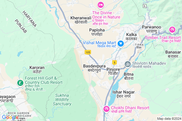
Dhamala Map
EDIT Map
Add Your House
 ..
..
Current Corona Virus Infected Patients Count in Panchkula District
| City Name | District Name | Total Covid cases |
|---|---|---|
| Panchkula District | Panchkula | 17 |
| Panchkula | Panchkula | 1 |
Locality Name :
Dhamala
( धमला )
Tehsil Name : Pinjore
District : Panchkula
State : Haryana
Division : Ambala
Language : Hindi and English, Punjabi
Current Time 08:53 PM
Date: Sunday , Apr 27,2025 (IST)
Time zone: IST (UTC+5:30)
Elevation / Altitude: 658 meters. Above Seal level
Assembly constituency : Kalka assembly constituency
Assembly MLA : Pardeep Chaudhary
Lok Sabha constituency : Ambala parliamentary constituency
Parliament MP : RATTAN LAL KATARIA
Serpanch Name :
Pin Code : 134102
Post Office Name : Pinjore
Commodities Prices : Panchkul(Kalka) Market / Mandi
Dhamala Live Weather
Temperature: 37.8 °C
clear sky
Humidity: 5%
Wind : 4.25 mt/sec towards W
StationName : "Pinjaur"
observed on 2 Hours Back
Temperature: 37.8 °C
clear sky
Humidity: 5%
Wind : 4.25 mt/sec towards W
StationName : "Pinjaur"
observed on 2 Hours Back
Dhamala Weather Forecast for Next 5 days
28-04-2025
25.1°C to 34.9°C
clear sky
25.1°C to 34.9°C
clear sky
29-04-2025
24.0°C to 40.2°C
clear sky
24.0°C to 40.2°C
clear sky
30-04-2025
25.2°C to 40.0°C
scattered clouds, few clouds, clear sky
25.2°C to 40.0°C
scattered clouds, few clouds, clear sky
01-05-2025
26.2°C to 40.4°C
clear sky, scattered clouds, broken clouds
26.2°C to 40.4°C
clear sky, scattered clouds, broken clouds
02-05-2025
23.2°C to 39.8°C
clear sky, overcast clouds, broken clouds, light rain
23.2°C to 39.8°C
clear sky, overcast clouds, broken clouds, light rain
National Highways Reachable To Dhamala
Nationa High Way :NH152
Nationa High Way :NH44
Nationa High Way :NH152
Nationa High Way :NH44
Rivers Near Dhamala
Pandoa
Tangri
Pandoa
Tangri
About Dhamala
Correct below Info and add more info about DhamalaDhamala is a Village in Pinjore Tehsil in Panchkula District of Haryana State, India. It belongs to Ambala Division . It is located 15 KM towards North from District head quarters Panchkula. 1 KM from Pinjore. 16 KM from State capital Chandigarh
Dhamala Pin code is 134102 and postal head office is Pinjore .
Vasdevpura ( 1 KM ) , Majri Jattan ( 1 KM ) , Manakpur Devilal ( 3 KM ) , Tagra Hansua ( 3 KM ) , Shiv Shakti Colony ( 3 KM ) are the nearby Villages to Dhamala. Dhamala is surrounded by Kalka Tehsil towards East , Panchkula Tehsil towards South , Chandigarh Tehsil towards west , Dharampur Tehsil towards North .
Pinjore , Kalka , Karoran , Chandigarh are the near by Cities to Dhamala.
This Place is in the border of the Panchkula District and Solan District. Solan District Dharampur is North towards this place . Also it is in the Border of other district Chandigarh . It is in the border of two states. First State is Himachal Pradesh State towards North and second state is Chandigarh State towards North .
Dhamala 2011 Census Details
Dhamala Local Language is Hindi. Dhamala Village Total population is 1873 and number of houses are 328. Female Population is 47.2%. Village literacy rate is 67.4% and the Female Literacy rate is 28.4%.
Population
| Census Parameter | Census Data |
| Total Population | 1873 |
| Total No of Houses | 328 |
| Female Population % | 47.2 % ( 884) |
| Total Literacy rate % | 67.4 % ( 1263) |
| Female Literacy rate | 28.4 % ( 531) |
| Scheduled Tribes Population % | 0.0 % ( 0) |
| Scheduled Caste Population % | 16.1 % ( 302) |
| Working Population % | 32.8 % |
| Child(0 -6) Population by 2011 | 232 |
| Girl Child(0 -6) Population % by 2011 | 44.8 % ( 104) |
Dhamala Census More Deatils.
Politics in Dhamala
BJP , INC , INLD are the major political parties in this area.Polling Stations /Booths near Dhamala
1)Dakroge2)Kotiya
3)Bans Utro Bhoj Nangal
4)Majra Mahatab
5)Bas Dev Pura
HOW TO REACH Dhamala
By Rail
Kalka Rail Way Station , Taksal Rail Way Station are the very nearby railway stations to Dhamala.Colleges near Dhamala
Manav Group Of Institutes
Address : Hisar-chandigarh Road,national Highway 65,vpo Jave
Schools in Dhamala
Gms Dhamala
Address : dhamala , pinjore , panchkula , Haryana . PIN- 134102 , Post - Pinjore
Govt Health Centers near Dhamala
1) SC Ratpur , , ,2) SC Pinjore I , , ,
3) SC Pinjore II , , ,
Schools in Dhamala,Pinjore
Electronic Shops in Dhamala,Pinjore
Super Markets in Dhamala,Pinjore
Local Parks in Dhamala,Pinjore
Police Stations near Dhamala,Pinjore
Governement Offices near Dhamala,Pinjore
About Dhamala &
History
How to reach Dhamala
Tourist Places Near By Dhamala
Schools in Dhamala
Colleges in Dhamala
Temperature & weather of Dhamala
places in Dhamala
Dhamala photos
More Information
How to reach Dhamala
Tourist Places Near By Dhamala
Schools in Dhamala
Colleges in Dhamala
Temperature & weather of Dhamala
places in Dhamala
Dhamala photos
More Information
Village Talk
Post News or Events about this Village
Near Cities
Pinjore 3 KM near
Kalka 5 KM near
Karoran 7 KM near
Chandigarh 13 KM near
Pinjore 3 KM near
Kalka 5 KM near
Karoran 7 KM near
Chandigarh 13 KM near
Near By Taluks
Pinjore 1 KM near
Kalka 5 KM near
Panchkula 15 KM near
Chandigarh 15 KM near
Pinjore 1 KM near
Kalka 5 KM near
Panchkula 15 KM near
Chandigarh 15 KM near
Near By Air Ports
Chandigarh Airport 19 KM near
Simla Airport 47 KM near
Ludhiana Airport 111 KM near
Dehra Dun Airport 137 KM near
Chandigarh Airport 19 KM near
Simla Airport 47 KM near
Ludhiana Airport 111 KM near
Dehra Dun Airport 137 KM near
Near By Tourist Places
Yadavindra gardens 3 KM near
Parwanoo 8 KM near
Kasauli 13 KM near
Panchkula 14 KM near
Chandigarh 15 KM near
Yadavindra gardens 3 KM near
Parwanoo 8 KM near
Kasauli 13 KM near
Panchkula 14 KM near
Chandigarh 15 KM near
Near By Districts
Panchkula 14 KM near
Chandigarh 15 KM near
S.A.S Nagar 22 KM near
Solan 26 KM near
Panchkula 14 KM near
Chandigarh 15 KM near
S.A.S Nagar 22 KM near
Solan 26 KM near
Near By RailWay Station
Kalka Rail Way Station 6.0 KM near
Taksal Rail Way Station 8.5 KM near
Chandi Mandir Rail Way Station 10 KM near
Kalka Rail Way Station 6.0 KM near
Taksal Rail Way Station 8.5 KM near
Chandi Mandir Rail Way Station 10 KM near