| Home | City Bus | Maps | Villages | Cities | Rail | Tourist Places | School | College | Pin Codes | Corona Cases Count |
| Distance Calculator Bus Services IFSC Codes Trace Mobile Number Weather Search Place Trace IP Available Cash ATM/Banks Locate Polling Booth Report an Error contact People |
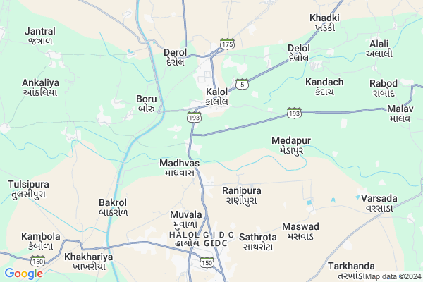
Alindra
Alindra Map
EDIT Map
Add Your House
 ..
..
Current Corona Virus Infected Patients Count in Panch Mahals District
| City Name | District Name | Total Covid cases |
|---|
Locality Name :
Alindra
( અલીન્દ્રા )
Taluka Name : Kalol
District : Panch Mahals
State : Gujarat
Language : Gujarati and Hindi
Current Time 08:20 AM
Date: Wednesday , Apr 30,2025 (IST)
Time zone: IST (UTC+5:30)
Elevation / Altitude: 81 meters. Above Seal level
Telephone Code / Std Code: 02676
Assembly constituency : Kalol assembly constituency
Assembly MLA : Thakor Laxmanji Punjaji (BAKAJI)
Lok Sabha constituency : Panchmahal parliamentary constituency
Parliament MP : Ratansinh Magansinh Rathod
Serpanch Name :
Pin Code : 389330
Post Office Name : Kalol (Panch Mahals)
Main Village Name : Alindra
Commodities Prices : Godhra(Timbaroad) Market / Mandi
National Highways Reachable To Alindra
Nationa High Way :NH47
Nationa High Way :NH64
Nationa High Way :NH47
Nationa High Way :NH64
Rivers Near Alindra
Orsang River
Orsang River
About Alindra
Correct below Info and add more info about AlindraAlindra is a small Village/hamlet in Kalol Taluka in Panch Mahals District of Gujarat State, India. It comes under Alindra Panchayath. It is located 30 KM towards South from District head quarters Godhra. 8 KM from . 128 KM from State capital Gandhinagar
Alindra Pin code is 389330 and postal head office is Kalol (Panch Mahals).
Katol ( 3 KM ) , Medapur ( 4 KM ) , Navaria ( 4 KM ) , Boru ( 4 KM ) , Shamaldevi ( 5 KM ) are the nearby Villages to Alindra. Alindra is surrounded by Savli Taluka towards west , Halol Taluka towards South , Ghoghamba Taluka towards East , Godhra Taluka towards North .
Godhra , Umreth , Vadodara , Padra are the near by Cities to Alindra.
Alindra 2011 Census Details
Alindra Local Language is Gujarati. Alindra Village Total population is 641 and number of houses are 125. Female Population is 49.0%. Village literacy rate is 65.2% and the Female Literacy rate is 27.6%.
Population
| Census Parameter | Census Data |
| Total Population | 641 |
| Total No of Houses | 125 |
| Female Population % | 49.0 % ( 314) |
| Total Literacy rate % | 65.2 % ( 418) |
| Female Literacy rate | 27.6 % ( 177) |
| Scheduled Tribes Population % | 11.2 % ( 72) |
| Scheduled Caste Population % | 6.7 % ( 43) |
| Working Population % | 33.1 % |
| Child(0 -6) Population by 2011 | 113 |
| Girl Child(0 -6) Population % by 2011 | 50.4 % ( 57) |
Alindra Census More Deatils.
Politics in Alindra
Bharatiya Janata Party , BJP , SWA , INC are the major political parties in this area.Polling Stations /Booths near Alindra
1)Alali-22)Kalol-20
3)Kalol-7
4)Kalol-3
5)Kalol-21 ( Doltapura)
HOW TO REACH Alindra
By Rail
Bakrol Rail Way Station , Derol Rail Way Station are the very nearby railway stations to Alindra.Colleges near Alindra
Smt. Chandrika Rashmikant Gardi Arts College, Munpur
Address :
S.p.patel Arts Colege Simaliya
Address :
Kalol Institute Of Pharmacy
Address : Kalol Institute Of Pharmacy, Kalol, Ahmadabad
Shri Shamlaji Homeopathic Medical College & Institute
Address : Shri Shamlaji Homeopathic Medical College & Instit
M. & V. Arts And Commerce College
Address : B/h S. T. Workshop, Godhara Road, Halol – 389 350.
Schools in Alindra
Alindra P.shala
Address : alindra , kalol , panch mahals , Gujarat . PIN- 389330 , Post - Kalol (Panch Mahals)
Govt Health Centers near Alindra
1) Kalol , chc kalol , opp geb , halol godhra road2) Derol Gam , primary health center derolgam , nr water tank , nr water tank
3) Kanod , kanod , opp busstand , Nr Vejalpur Sansoli Road
Hospitals in Alindra,Kalol
Community Health Centre and Referal Hospital
SH 87; Kalol; Gujarat 389330; India
2.1 KM distance Detail
more ..
Petrol Bunks in Alindra,Kalol
Jay Narayan Filling Station;Reliance Petrol Pump
Halol Kalol High Way; Madhvas; Gujarat 389360; India
2.3 KM distance Detail
Shrr Mahaveer Petroleum Reliance Petroleum
Panchmahal; SH-175; Panchmahal Road; Muvala; Muvala; Gujarat 389350; India
2.3 KM distance Detail
more ..
Colleges in Alindra,Kalol
Gurukrupa Paramedical and Nursing Institute
kalol busstand near;ankur vidhyalay; Kalol; Gujarat; India
2.4 KM distance Detail
M.M.Gandhi College
Derol Station Rd; Shantikunj Society; Kalol; Gujarat 389330; India
2.7 KM distance Detail
Sarvoday College of Education
Samaldevi; Derol Station; Ta Kalol; Dist P.M.S.; Jeli; Gujarat 389320; India
6.3 KM distance Detail
more ..
Schools in Alindra,Kalol
Urdu & Gujarati School; Kalol
13; Gujarat State Highway 87; Mahesh Nagar Mahesh Nagar Kalol; Gujarat 389330; India
2.1 KM distance Detail
Creative Career Academy
Amrut complex ; opposite bustand ; beside BOB ATM; Kalol; Gujarat 389330; India
2.3 KM distance Detail
Kalol Primary School No 9
near three fingers circle; front of vinayk oza hospital; Kalol; Gujarat; India
2.5 KM distance Detail
Super Markets in Alindra,Kalol
Shree Krushna Provision Store
13; GJ SH 87; Saraswat Society; Jantral; Kalol; Gujarat 389330; India
2.7 KM distance Detail
Police Stations near Alindra,Kalol
Halol Mini Police Station
Halol-Pavagadh Rd; Vitthalpura; Adarsh Society; Halol; Gujarat 389350; India
10.9 KM distance Detail
Governement Offices near Alindra,Kalol
Baal Vikas Pariyojna
Panchmahal; SH-175; Panchmahal Road; Kalol; Kalol; Gujarat 389320; India
2.2 KM distance Detail
About Alindra &
History
How to reach Alindra
Tourist Places Near By Alindra
Schools in Alindra
Colleges in Alindra
Temperature & weather of Alindra
places in Alindra
Alindra photos
More Information
How to reach Alindra
Tourist Places Near By Alindra
Schools in Alindra
Colleges in Alindra
Temperature & weather of Alindra
places in Alindra
Alindra photos
More Information
Village Talk
Post News or Events about this Village
Near Cities
Godhra 28 KM near
Umreth 41 KM near
Vadodara 49 KM near
Padra 60 KM near
Godhra 28 KM near
Umreth 41 KM near
Vadodara 49 KM near
Padra 60 KM near
Near By Taluks
Kalol 8 KM near
Savli 19 KM near
Halol 21 KM near
Ghoghamba 25 KM near
Kalol 8 KM near
Savli 19 KM near
Halol 21 KM near
Ghoghamba 25 KM near
Near By Air Ports
Vadodara Airport 42 KM near
Ahmedabad Airport 112 KM near
Bhavnagar Airport 180 KM near
Dabok Airport 257 KM near
Vadodara Airport 42 KM near
Ahmedabad Airport 112 KM near
Bhavnagar Airport 180 KM near
Dabok Airport 257 KM near
Near By Tourist Places
Champaner 15 KM near
Pavagadh 16 KM near
Baroda 47 KM near
Anand 60 KM near
Kheda 91 KM near
Champaner 15 KM near
Pavagadh 16 KM near
Baroda 47 KM near
Anand 60 KM near
Kheda 91 KM near
Near By Districts
Panch Mahals 29 KM near
Vadodara 49 KM near
Anand 58 KM near
Narmada 89 KM near
Panch Mahals 29 KM near
Vadodara 49 KM near
Anand 58 KM near
Narmada 89 KM near
Near By RailWay Station
Derol Rail Way Station 5.2 KM near
Bakrol Rail Way Station 5.3 KM near
Champaner Road Rail Way Station 8.9 KM near
Godhra Junction Rail Way Station 28 KM near
Derol Rail Way Station 5.2 KM near
Bakrol Rail Way Station 5.3 KM near
Champaner Road Rail Way Station 8.9 KM near
Godhra Junction Rail Way Station 28 KM near