| Home | City Bus | Maps | Villages | Cities | Rail | Tourist Places | School | College | Pin Codes | Corona Cases Count |
| Distance Calculator Bus Services IFSC Codes Trace Mobile Number Weather Search Place Trace IP Available Cash ATM/Banks Locate Polling Booth Report an Error contact People |
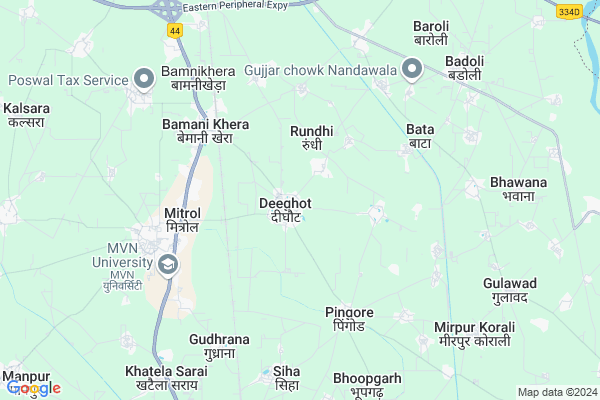
Deeghot Map
EDIT Map
Add Your House
 ..
..
Current Corona Virus Infected Patients Count in Palwal District
| City Name | District Name | Total Covid cases |
|---|---|---|
| Palwal District | Palwal | 33 |
| Palwal | Palwal | 1 |
Locality Name :
Deeghot
( दीघोट )
Tehsil Name : Hodal
District : Palwal
State : Haryana
Division : Gurgaon
Language : Hindi and Punjabi
Current Time 10:44 AM
Date: Tuesday , Apr 29,2025 (IST)
Time zone: IST (UTC+5:30)
Elevation / Altitude: 191 meters. Above Seal level
Assembly constituency : Hodal assembly constituency
Assembly MLA : Jagdish Nayar
Lok Sabha constituency : Faridabad parliamentary constituency
Parliament MP : KRISHAN PAL
Serpanch Name :
Pin Code : 121105
Post Office Name : Aurangabad (Faridabad)
Commodities Prices : Palwal Market / Mandi
Edit below overview about Deeghot
Edit below overview about Deeghot
OverView of Deeghot
Near Deeghot one school is jljschool To the Highway grant trank road. InDeeghot a College name is GVN college.Edit below overview about Deeghot
National Highways Reachable To Deeghot
Nationa High Way :NH48
Nationa High Way :NH48
Rivers Near Deeghot
Karwan Nadi
Karwan Nadi
About Deeghot
Deeghot is a Village in Hodal Tehsil in Palwal District of Haryana State, India. It belongs to Gurgaon Division . It is located 16 KM towards South from District head quarters Palwal. 8 KM from Hodal. 357 KM from State capital Chandigarh
Deeghot Pin code is 121105 and postal head office is Aurangabad (Faridabad).
Raidaska ( 3 KM ) , Ladiaka ( 3 KM ) , Mitrol ( 3 KM ) , Bamani Khera ( 4 KM ) , Pingor ( 4 KM ) are the nearby Villages to Deeghot. Deeghot is surrounded by Hassanpur Tehsil towards East , Palwal Tehsil towards North , Hathin Tehsil towards west , Tappal Tehsil towards East .
Palwal , Hodal , Faridabad , Sohna are the near by Cities to Deeghot.
This Place is in the border of the Palwal District and Mewat District. Mewat District Punahana is South towards this place .
Deeghot 2011 Census Details
Deeghot Local Language is Hindi. Deeghot Village Total population is 10954 and number of houses are 1851. Female Population is 46.0%. Village literacy rate is 58.7% and the Female Literacy rate is 20.3%.
Population
| Census Parameter | Census Data |
| Total Population | 10954 |
| Total No of Houses | 1851 |
| Female Population % | 46.0 % ( 5035) |
| Total Literacy rate % | 58.7 % ( 6428) |
| Female Literacy rate | 20.3 % ( 2229) |
| Scheduled Tribes Population % | 0.0 % ( 0) |
| Scheduled Caste Population % | 25.5 % ( 2798) |
| Working Population % | 39.1 % |
| Child(0 -6) Population by 2011 | 1661 |
| Girl Child(0 -6) Population % by 2011 | 45.5 % ( 756) |
Deeghot Census More Deatils.
Politics in Deeghot
Bharatiya Janata Party , BJP , INC , INLD are the major political parties in this area.Polling Stations /Booths near Deeghot
1)S.c Chopal Maroli2)Brij Khand Senior Secondary School Hodal Right/wing
3)Government Primary School Boraka
4)Government Primary School Deeghot Left/wing
5)S.c Chopal Deeghot
HOW TO REACH Deeghot
By Rail
Rundhi Rail Way Station , Sholaka Rail Way Station are the very nearby railway stations to Deeghot.Colleges near Deeghot
Maharani Kesori Memorial
Address :
Govermint Collage Hodal
Address :
Maa Omwati Degree College (hassanpur)
Address :
Delhi College Of Technology & Management (dctm)
Address : 77th Km. Stone, Nh-2, Gudhrana, Distt. Palwal - 12
Schools near Deeghot
Moderan Public School
Address : village-Banswa,teshi-Hodal,Dis-Palwal
At Online Classes
Address : Ward No 9 Near Pakki chopal
VILLAGE GARHI PATTI
Hodal
Knowledge-park
Address : Near HDFC Bank, Agra Chowk Palwal
Klm Public School
Address : Nangla Road
Govt Health Centers near Deeghot
1) Pingore , , ,2) Rasoolpur , , ,
3) PHC Rasoolpur , , ,
Hospitals in Deeghot,Hodal
Dr Vikas Aggarwal; Family Physician;Aggarwal Hospital; Bamnikhera
Srinagar - Kanyakumari Hwy; Bamni Khera; Haryana 121105; India
4.5 KM distance Detail
more ..
Petrol Bunks in Deeghot,Hodal
HP PETROL PUMP - HP RAMSON AQUA LIMITED
Village Aurangabad KM Stone 70.65; NH-2 Tehsil Palwal; NH2; Gurgaon; Haryana 121105; India
4.4 KM distance Detail
Aadit Auto Service Bharat Petroleum
Aurangabad; Faridabad; NH-2; Delhi Mathura Road; Palwal Road; Palwal; Palwal; Haryana 121105; India
4.5 KM distance Detail
more ..
Colleges in Deeghot,Hodal
L.R. Institute of Technology & Management
Palwal; Faridabad District; Deeghot; Haryana 121105; India
0.7 KM distance Detail
more ..
Super Markets in Deeghot,Hodal
Devhans Book Seler. Depot
Hasanpur Palwal Rd; Rasulpur; Haryana 121102; India
6.8 KM distance Detail
Governement Offices near Deeghot,Hodal
shri ram motors
National Highway 2; Opp Omaxe City Bharat Colony; Ramnagar;; Palwal; Haryana 121102; India
4.5 KM distance Detail
District Court (Mini Secretariat); जिला न्यायालय (लघु सचिवालय)
Dholagarh; Haryana 121102; India
10.3 KM distance Detail
About Deeghot &
History
How to reach Deeghot
Tourist Places Near By Deeghot
Schools in Deeghot
Colleges in Deeghot
Temperature & weather of Deeghot
places in Deeghot
Deeghot photos
More Information
How to reach Deeghot
Tourist Places Near By Deeghot
Schools in Deeghot
Colleges in Deeghot
Temperature & weather of Deeghot
places in Deeghot
Deeghot photos
More Information
Village Talk
Post News or Events about this Village
Near Cities
Palwal 15 KM near
Hodal 18 KM near
Faridabad 41 KM near
Sohna 43 KM near
Palwal 15 KM near
Hodal 18 KM near
Faridabad 41 KM near
Sohna 43 KM near
Near By Taluks
Hassanpur 8 KM near
Hodal 8 KM near
Palwal 16 KM near
Hathin 17 KM near
Hassanpur 8 KM near
Hodal 8 KM near
Palwal 16 KM near
Hathin 17 KM near
Near By Air Ports
Indira Gandhi International Airport 71 KM near
Kheria Airport 127 KM near
Muzaffarnagar Airport 176 KM near
Sanganeer Airport 231 KM near
Indira Gandhi International Airport 71 KM near
Kheria Airport 127 KM near
Muzaffarnagar Airport 176 KM near
Sanganeer Airport 231 KM near
Near By Tourist Places
Dabchick 17 KM near
Nuh 42 KM near
Sohna 42 KM near
Faridabad 48 KM near
Surajkund 55 KM near
Dabchick 17 KM near
Nuh 42 KM near
Sohna 42 KM near
Faridabad 48 KM near
Surajkund 55 KM near
Near By Districts
Palwal 15 KM near
Mewat 41 KM near
Gautam Buddha Nagar 43 KM near
Faridabad 45 KM near
Palwal 15 KM near
Mewat 41 KM near
Gautam Buddha Nagar 43 KM near
Faridabad 45 KM near
Near By RailWay Station
Rundhi Rail Way Station 4.9 KM near
Sholaka Rail Way Station 6.1 KM near
Palwal Rail Way Station 14 KM near
Kosi Kalan Rail Way Station 32 KM near
Rundhi Rail Way Station 4.9 KM near
Sholaka Rail Way Station 6.1 KM near
Palwal Rail Way Station 14 KM near
Kosi Kalan Rail Way Station 32 KM near