| Home | City Bus | Maps | Villages | Cities | Rail | Tourist Places | School | College | Pin Codes | Corona Cases Count |
| Distance Calculator Bus Services IFSC Codes Trace Mobile Number Weather Search Place Trace IP Available Cash ATM/Banks Locate Polling Booth Report an Error contact People |
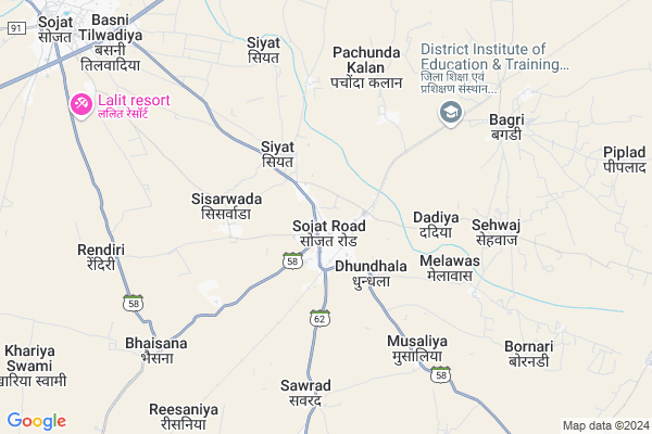
Sojat Road Map
EDIT Map
Add Your House
 ..
..
Current Corona Virus Infected Patients Count in Pali District
| City Name | District Name | Total Covid cases |
|---|---|---|
| Pali District | Pali | 4 |
Locality Name :
Sojat Road
( सोजत रोड )
Tehsil Name : Sojat
District : Pali
State : Rajasthan
Division : Jodhpur
Language : Hindi and Rajasthani
Current Time 11:10 AM
Date: Tuesday , Apr 29,2025 (IST)
Time zone: IST (UTC+5:30)
Elevation / Altitude: 295 meters. Above Seal level
Telephone Code / Std Code: 02960
Assembly constituency : Sojat assembly constituency
Assembly MLA : Shobha Chauhan
Lok Sabha constituency : Pali parliamentary constituency
Parliament MP : P. P. CHAUDHARY
Serpanch Name :
Pin Code : 306103
Post Office Name : Sojat Road
Alternate Village Name : Sojat (Rural)
Commodities Prices : Sojat Road Market / Mandi
National Highways Reachable To Sojat Road
Nationa High Way :NH58
Nationa High Way :NH62
Nationa High Way :NH58
Nationa High Way :NH62
Rivers Near Sojat Road
Nekhadi
Khari
Nekhadi
Khari
About Sojat Road
Correct below Info and add more info about Sojat RoadSojat Road is a Town in Sojat Tehsil in Pali District of Rajasthan State, India. It belongs to Jodhpur Division . It is located 51 KM towards East from District head quarters Pali. It is a Tehsil head quarter.
Sojat Road Pin code is 306103 and postal head office is Sojat Road .
Musaliya ( 5 KM ) , Sawrad ( 6 KM ) , Bhaisana ( 7 KM ) , Sehwaj ( 8 KM ) , Rendri ( 8 KM ) are the nearby Villages to Sojat Road. Sojat Road is surrounded by Kharchi(Mar.Jun) Tehsil towards South , Bhim Tehsil towards East , Raipur Tehsil towards East , Bilara Tehsil towards North .
Sojat , Bilara , Jaitaran , Pali are the nearby Cities to Sojat Road.
Sojat (Rural) 2011 Census Details
Sojat Road Local Language is Hindi. Sojat (Rural) town Total population is 1432 and number of houses are 310. Female Population is 49.1%. town literacy rate is 40.3% and the Female Literacy rate is 13.0%.
Population
| Census Parameter | Census Data |
| Total Population | 1432 |
| Total No of Houses | 310 |
| Female Population % | 49.1 % ( 703) |
| Total Literacy rate % | 40.3 % ( 577) |
| Female Literacy rate | 13.0 % ( 186) |
| Scheduled Tribes Population % | 0.0 % ( 0) |
| Scheduled Caste Population % | 67.7 % ( 970) |
| Working Population % | 58.0 % |
| Child(0 -6) Population by 2011 | 277 |
| Girl Child(0 -6) Population % by 2011 | 46.2 % ( 128) |
Sojat (Rural) Census More Deatils.
Demographics of Sojat Road
Hindi is the Local Language here.Politics in Sojat Road
Bharatiya Janata Party , BJP , INC are the major political parties in this area.Polling Stations /Booths near Sojat Road
1)Government Upper Primary School No.2 Kot Ka Mohalla (w.w.) Second Room Sojat2)Government Girls Upper Primary School Kot Ka Mohalla Sojat
3)Government Girls Higher Secondary School (n.s.) Sojat
4)Government Girls Higher Secondary School (m.w.) Sojat
5)Government Higher Secondary School (r.s.) Sojat
HOW TO REACH Sojat Road
By Rail
Sojat Road Rail Way Station , Bagri Nagar Rail Way Station are the very nearby railway stations to Sojat Road.Govt Health Centers near Sojat Road
1) Sojatroad , CHC Sojat Road , AAYI MATA CHTRAVASH KE SAMNE VALI GALI , RAILWAY STATION2) Melawas , SC Melawas , Melawas , Melawas
3) Musaliya , PHC Musaliya , Musaliya , Musaliya
Hospitals in Sojat Road,Sojat
chc sojat road
Bohro Ka Baas Road; Laddha Colony; Sojat Road; Rajasthan 306103; India
0.5 KM distance Detail
more ..
Petrol Bunks in Sojat Road,Sojat
जॉगीड वुडन फनीचर एण्ड इन्टरियर
Anand Nagar; Sojat Road; Rajasthan 306103; India
0.4 KM distance Detail
HP PETROL PUMP - SONGARA FILLING STATION
Sojat road; Anand Nagar; Sojat Road; Rajasthan 306103; India
0.5 KM distance Detail
Chandra Filling Station Essar Oil Petrol Pump
Sojat; Pali; SH-62; Pali Road; Sojat Road; Sojat Road; Rajasthan 306103; India
2.7 KM distance Detail
more ..
Colleges in Sojat Road,Sojat
Rajkiya Mahavidyalaya
Sojat; Pali; Pali Road; Sojat Road; Sojat Road; Rajasthan 306104; India
11.4 KM distance Detail
more ..
Schools in Sojat Road,Sojat
Sunrise international school
ambedkar bus stand near petrol pump; Sojat Road; Rajasthan 306103; India
0.5 KM distance Detail
Siddharth Shiksha Sadan Senior Secondary School
Sojat; Pali; Pali Road; Sojat Road; Sojat Road; Rajasthan 306103; India
0.5 KM distance Detail
Paradis Public School Sojat Road
Govt Hospital; Kakupalli-Varakavipudi Rd; Sojat Road; Andhra Pradesh 524311; India
0.6 KM distance Detail
Police Stations near Sojat Road,Sojat
Police Station Sojat Road
Pali; Pali Road; Sojat Road; Sojat Road; Rajasthan 306103; India
0.6 KM distance Detail
Governement Offices near Sojat Road,Sojat
Atal Seva Center
Sojat; Pali; Pali Road; Sojat Road; Sojat Road; Rajasthan 306103; India
0.5 KM distance Detail
Atal Seva Center
Sojat; Pali; SH-62; Pali Road; Sojat Road; Sojat Road; Rajasthan 306103; India
2.4 KM distance Detail
About Sojat Road &
History
How to reach Sojat Road
Tourist Places Near By Sojat Road
Schools in Sojat Road
Colleges in Sojat Road
Temperature & weather of Sojat Road
places in Sojat Road
Sojat Road photos
More Information
How to reach Sojat Road
Tourist Places Near By Sojat Road
Schools in Sojat Road
Colleges in Sojat Road
Temperature & weather of Sojat Road
places in Sojat Road
Sojat Road photos
More Information
Town Talk
Post News or Events about this Town
Near Cities
Sojat 11 KM near
Bilara 37 KM near
Jaitaran 46 KM near
Pali 49 KM near
Sojat 11 KM near
Bilara 37 KM near
Jaitaran 46 KM near
Pali 49 KM near
Near By Taluks
Sojat 14 KM near
Kharchi(Mar.Jun) 21 KM near
Bhim 39 KM near
Raipur 46 KM near
Sojat 14 KM near
Kharchi(Mar.Jun) 21 KM near
Bhim 39 KM near
Raipur 46 KM near
Near By Air Ports
Jodhpur Airport 92 KM near
Dabok Airport 156 KM near
Sanganeer Airport 257 KM near
Jaisalmer Airport 343 KM near
Jodhpur Airport 92 KM near
Dabok Airport 156 KM near
Sanganeer Airport 257 KM near
Jaisalmer Airport 343 KM near
Near By Tourist Places
Jodhpur 96 KM near
Ranakpur 99 KM near
Kumbhalgarh 113 KM near
Nathdwara 116 KM near
Pushkar 118 KM near
Jodhpur 96 KM near
Ranakpur 99 KM near
Kumbhalgarh 113 KM near
Nathdwara 116 KM near
Pushkar 118 KM near
Near By Districts
Pali 49 KM near
Jodhpur 95 KM near
Rajsamand 101 KM near
Bhilwara 119 KM near
Pali 49 KM near
Jodhpur 95 KM near
Rajsamand 101 KM near
Bhilwara 119 KM near
Near By RailWay Station
Sojat Road Rail Way Station 1.3 KM near
Bagri Nagar Rail Way Station 5.5 KM near
Bhesana Rail Way Station 7.2 KM near
Marwar Junction Rail Way Station 24 KM near
Sojat Road Rail Way Station 1.3 KM near
Bagri Nagar Rail Way Station 5.5 KM near
Bhesana Rail Way Station 7.2 KM near
Marwar Junction Rail Way Station 24 KM near