| Home | City Bus | Maps | Villages | Cities | Rail | Tourist Places | School | College | Pin Codes | Corona Cases Count |
| Distance Calculator Bus Services IFSC Codes Trace Mobile Number Weather Search Place Trace IP Available Cash ATM/Banks Locate Polling Booth Report an Error contact People |
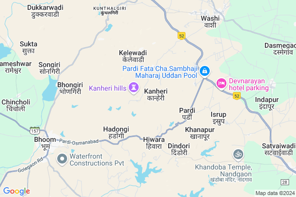
Kaneri
Kaneri Map
EDIT Map
Add Your House
 ..
..
Current Corona Virus Infected Patients Count in Osmanabad District
| City Name | District Name | Total Covid cases |
|---|---|---|
| Osmanabad District | Osmanabad | 3 |
Locality Name :
Kaneri
( कणेरी )
Taluka Name : Washi
District : Osmanabad
State : Maharashtra
Region : Marathwada
Division : Aurangabad
Language : Marathi and Hindi
Current Time 12:58 PM
Date: Tuesday , Apr 29,2025 (IST)
Time zone: IST (UTC+5:30)
Elevation / Altitude: 554 meters. Above Seal level
Telephone Code / Std Code: 02478
Assembly constituency : Paranda assembly constituency
Assembly MLA : Tanaji Jaywant Sawant
Lok Sabha constituency : Osmanabad parliamentary constituency
Parliament MP : Omprakash Bhupalsinh Alias Pawan Rajenimbalkar
Serpanch Name :
Pin Code : 413503
Post Office Name : Vashi (Osmanabad)
Alternate Village Name : Kanheri
Commodities Prices : Barshi Market / Mandi
Edit below overview about Kaneri
Edit below overview about Kaneri
OverView of Kaneri
Kanheri is near saramkundi specially known for pedha. There is famous jain tirthkshetra kunthalgiri 8 km away from kanheri.Edit below overview about Kaneri
National Highways Reachable To Kaneri
Nationa High Way :NH548C
Nationa High Way :NH548C
Rivers Near Kaneri
Kanola
Murud
Kanola
Murud
About Kaneri
Kaneri is a Village in Washi Taluka in Osmanabad District of Maharashtra State, India. It belongs to Marathwada region . It belongs to Aurangabad Division . It is located 56 KM towards west from District head quarters Osmanabad. 10 KM from Washi. 360 KM from State capital Mumbai
Kaneri Pin code is 413503 and postal head office is Vashi (Osmanabad).
Hiwara ( 4 KM ) , Hadongree ( 4 KM ) , Dindori ( 5 KM ) , Wakwad ( 6 KM ) , Golegaon ( 6 KM ) are the nearby Villages to Kaneri. Kaneri is surrounded by Bhoom Taluka towards west , Kalamb Taluka towards East , Paranda Taluka towards west , Barshi Taluka towards South .
Osmanabad , Tuljapur , Manjlegaon , Latur are the near by Cities to Kaneri.
Kanheri 2011 Census Details
Kaneri Local Language is Marathi. Kanheri Village Total population is 1467 and number of houses are 316. Female Population is 48.3%. Village literacy rate is 66.5% and the Female Literacy rate is 27.6%.
Population
| Census Parameter | Census Data |
| Total Population | 1467 |
| Total No of Houses | 316 |
| Female Population % | 48.3 % ( 709) |
| Total Literacy rate % | 66.5 % ( 975) |
| Female Literacy rate | 27.6 % ( 405) |
| Scheduled Tribes Population % | 7.4 % ( 109) |
| Scheduled Caste Population % | 31.3 % ( 459) |
| Working Population % | 58.6 % |
| Child(0 -6) Population by 2011 | 174 |
| Girl Child(0 -6) Population % by 2011 | 49.4 % ( 86) |
Kanheri Census More Deatils.
Politics in Kaneri
NCP , Shivsena , SHS are the major political parties in this area.Polling Stations /Booths near Kaneri
1)Z. P.p.s Hiwarda2)Z.p.primary School Kavadevadi Varachi
3)Z. P.p.s
4)Z. P.p.s
5)Z. P.p.s South Side Wanjarawadi
HOW TO REACH Kaneri
By Rail
There is no railway station near to Kaneri in less than 10 km. Barsi Town Rail Way Station (near to Barshi) , Uplai Rail Way Station (near to Barshi) are the Rail way stations reachable from near by towns.By Road
Bhum , Barshi , Bid are the nearby by towns to Kaneri having road connectivity to KaneriColleges near Kaneri
K.m.j.m.washi
Address :
Mahatma Phule Mahavidhyala Pargaon
Address : Hatola Road Pargoan
Schools in Kaneri
Z.p.p.school
Address : kanheri , washi , osmanabad , Maharashtra . PIN- 413503 , Post - Vashi (Osmanabad)
Govt Health Centers near Kaneri
1) Kanheri , Sub Center , Main road , Kanheri2) RH Washi , Rural Hospital, Washi , Near of Z.P. School , Old Dak Bangala
3) RH Bhoom , Rural Hospital, Bhoom , Near of Bus Stand , Near of Bus Stand
Hospitals in Kaneri,Washi
Dhanwantari Clinic
collage road behind Annapurna mangal karyala; Washi; Maharashtra 413503; India
8.7 KM distance Detail
Washi Civil Hospital
College Road; Near Z.P. Primary School; Washi; Maharashtra 413503; India
8.8 KM distance Detail
more ..
Petrol Bunks in Kaneri,Washi
HP PETROL PUMP - RAUT PETROLEUM
S NO 128 VIL Golegaon TAL Washi Yermala Dist Osmanabad; Beed - Solapur Rd; Sholapur; Maharashtra 413503; India
7.2 KM distance Detail
HP PETROL PUMP - SAHIL PETROLEUM
Pardi Near ITI TAL Bhoom.; Bhoom Road; Sholapur; Maharashtra 413504; India
8.0 KM distance Detail
more ..
Colleges in Kaneri,Washi
Government ITI Bhoom
Pardi Road; Osmanabad District; Bhoom; Maharashtra 413504; India
7.3 KM distance Detail
more ..
Super Markets in Kaneri,Washi
Chandrakant Kirana Store
Off New Gurudevdatta Highschool; Alamprabhu Road; Bhoom; Maharashtra 413504; India
8.9 KM distance Detail
Police Stations near Kaneri,Washi
Bhoom Police Station
Alamprabhu Road; Osmanabad District; Bhoom; Maharashtra 413504; India
9.2 KM distance Detail
About Kaneri &
History
How to reach Kaneri
Tourist Places Near By Kaneri
Schools in Kaneri
Colleges in Kaneri
Temperature & weather of Kaneri
places in Kaneri
Kaneri photos
More Information
How to reach Kaneri
Tourist Places Near By Kaneri
Schools in Kaneri
Colleges in Kaneri
Temperature & weather of Kaneri
places in Kaneri
Kaneri photos
More Information
Village Talk
Post News or Events about this Village
Near Cities
Osmanabad 54 KM near
Tuljapur 73 KM near
Manjlegaon 101 KM near
Latur 102 KM near
Osmanabad 54 KM near
Tuljapur 73 KM near
Manjlegaon 101 KM near
Latur 102 KM near
Near By Taluks
Washi 10 KM near
Bhoom 16 KM near
Kalamb 32 KM near
Paranda 36 KM near
Washi 10 KM near
Bhoom 16 KM near
Kalamb 32 KM near
Paranda 36 KM near
Near By Air Ports
Latur Airport 87 KM near
Sholapur Airport 109 KM near
Chikkalthana Airport 175 KM near
Nanded Airport 205 KM near
Latur Airport 87 KM near
Sholapur Airport 109 KM near
Chikkalthana Airport 175 KM near
Nanded Airport 205 KM near
Near By Tourist Places
Tuljapur 71 KM near
Solapur 103 KM near
Pandharpur 112 KM near
Ahmednagar 138 KM near
Aurangabad 179 KM near
Tuljapur 71 KM near
Solapur 103 KM near
Pandharpur 112 KM near
Ahmednagar 138 KM near
Aurangabad 179 KM near
Near By Districts
Osmanabad 53 KM near
Beed 62 KM near
Latur 100 KM near
Solapur 105 KM near
Osmanabad 53 KM near
Beed 62 KM near
Latur 100 KM near
Solapur 105 KM near
Near By RailWay Station
Barsi Town Rail Way Station 31 KM near
Osmanabad Rail Way Station 45 KM near
Barsi Town Rail Way Station 31 KM near
Osmanabad Rail Way Station 45 KM near