| Home | City Bus | Maps | Villages | Cities | Rail | Tourist Places | School | College | Pin Codes | Corona Cases Count |
| Distance Calculator Bus Services IFSC Codes Trace Mobile Number Weather Search Place Trace IP Available Cash ATM/Banks Locate Polling Booth Report an Error contact People |
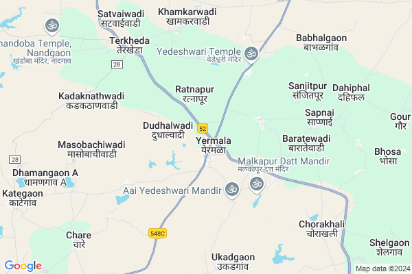
Yermala
Yermala Map
EDIT Map
Add Your House
 ..
..
Current Corona Virus Infected Patients Count in Osmanabad District
| City Name | District Name | Total Covid cases |
|---|---|---|
| Osmanabad District | Osmanabad | 3 |
Locality Name :
Yermala
( येरमाळा )
Taluka Name : Kalamb
District : Osmanabad
State : Maharashtra
Region : Marathwada
Division : Aurangabad
Language : Marathi and Hindi
Current Time 07:25 AM
Date: Saturday , Apr 26,2025 (IST)
Time zone: IST (UTC+5:30)
Elevation / Altitude: 674 meters. Above Seal level
Telephone Code / Std Code: 02473
Assembly constituency : Osmanabad assembly constituency
Assembly MLA : Kailas Balasaheb Ghadge Patil
Lok Sabha constituency : Osmanabad parliamentary constituency
Parliament MP : Omprakash Bhupalsinh Alias Pawan Rajenimbalkar
Serpanch Name :
Pin Code : 413525
Post Office Name : Yermala
Commodities Prices : Kalamb(Osmanabad) Market / Mandi
National Highways Reachable To Yermala
Nationa High Way :NH63
Nationa High Way :NH548B
Nationa High Way :NH63
Nationa High Way :NH548B
Rivers Near Yermala
Murud
Kajidi
Murud
Kajidi
About Yermala
Correct below Info and add more info about YermalaYermala is a Village in Kalamb Taluka in Osmanabad District of Maharashtra State, India. It belongs to Marathwada region . It belongs to Aurangabad Division . It is located 34 KM towards North from District head quarters Osmanabad. 21 KM from Kalamb. 380 KM from State capital Mumbai
Yermala Pin code is 413525 and postal head office is Yermala .
Uplai ( 3 KM ) , Malkapur (sdu) ( 4 KM ) , Pangaon ( 4 KM ) , Bangarwadi ( 5 KM ) , Sapnai ( 6 KM ) are the nearby Villages to Yermala. Yermala is surrounded by Washi Taluka towards North , Barshi Taluka towards South , Bhoom Taluka towards west , Osmanabad Taluka towards East .
Osmanabad , Tuljapur , Latur , Solapur are the near by Cities to Yermala.
This Place is in the border of the Osmanabad District and Beed District. Beed District Kaij is North towards this place .
Yermala 2011 Census Details
Yermala Local Language is Marathi. Yermala Village Total population is 5404 and number of houses are 1160. Female Population is 47.4%. Village literacy rate is 75.3% and the Female Literacy rate is 32.9%.
Population
| Census Parameter | Census Data |
| Total Population | 5404 |
| Total No of Houses | 1160 |
| Female Population % | 47.4 % ( 2559) |
| Total Literacy rate % | 75.3 % ( 4069) |
| Female Literacy rate | 32.9 % ( 1776) |
| Scheduled Tribes Population % | 1.6 % ( 88) |
| Scheduled Caste Population % | 16.7 % ( 900) |
| Working Population % | 47.5 % |
| Child(0 -6) Population by 2011 | 608 |
| Girl Child(0 -6) Population % by 2011 | 42.6 % ( 259) |
Yermala Census More Deatils.
Politics in Yermala
NCP , Shivsena , SHS are the major political parties in this area.Polling Stations /Booths near Yermala
1)Zilla Parishad Kendriya Primary School East Side New Building Yermala2)Zilla Parishad Kendriya Primary School East Side 1th Class Moha.
3)Zilla Parishad Kendriya Primary School Terma Nagar North Side Dhoki
4)Zilla Parishad Kendriya Primary School 5th B Class Moha.
5)Zilla Parishad Primary School Dabha
HOW TO REACH Yermala
By Rail
There is no railway station near to Yermala in less than 10 km. Barsi Town Rail Way Station (near to Barshi) , Osmanabad Rail Way Station (near to Osmanabad) , Uplai Rail Way Station (near to Barshi) are the Rail way stations reachable from near by towns.By Road
Osmanabad , Barshi are the nearby by towns to Yermala having road connectivity to YermalaColleges near Yermala
R.s.i.t.kallam
Address :
National Backward Agriculture Education Of Information Technology
Address : At Post Shelgaon D Tal Kalamb Dist Osmanabad
National Backward Agriculture Education Of Information Technology
Address : At Post Umra Tal Kalamb Dist Osmanabad
Schools in Yermala
Dnyanodyog Vidyalaya
Address : yermala , kallamb , osmanabad , Maharashtra . PIN- 413525 , Post - Yermala
Saraswati Girls
Address : yermala , kallamb , osmanabad , Maharashtra . PIN- 413525 , Post - Yermala
Govt Health Centers near Yermala
1) ukkadgaon , SubCentre Ukadgaon , ,2) Kadaknathwadi , Sub Center , Main road , Kadaknathwadi
3) Terkheda , Sub Center , Main road , Terkheda
Hospitals in Yermala,Kalamb
Primary Health Centre; Yermala
Behind Dnyanodyog Vidhyalay; MH SH158; Yermala; Maharashtra 413525; India
1.5 KM distance Detail
Yedai Irca Yermala Dr. Sandip Tambare
Pathari - Pokharni Rd; Maharashtra 413525; India
2.9 KM distance Detail
more ..
Petrol Bunks in Yermala,Kalamb
SURYAKANT & CO
YEDSI-TULJAPUR ROAD OSMA; Osmanabad; Maharashtra 413501; India
0.5 KM distance Detail
SURYAKANT & CO
KALAM-SOLAPUR ROAD YERMA; OSMANABAD; Maharashtra 413525; India
1.0 KM distance Detail
more ..
Schools in Yermala,Kalamb
Zilla Parishad (ZP) School
Main Road; MH SH158; Yermala; Maharashtra 413525; India
1.1 KM distance Detail
Dnyanodhyog Vidhyalaya
Health Centre Road-2; Yermala; Maharashtra 413525; India
1.4 KM distance Detail
Electronic Shops in Yermala,Kalamb
Sanket Motar Garage
Pathari - Pokharni Rd; Yermala; Maharashtra 413525; India
0.5 KM distance Detail
Yedeshwari Automobils Yermala
kalamb road; Yermala; Maharashtra 413525; India
0.5 KM distance Detail
Sanskar Atomobiles&servising Center
Pathari - Pokharni Rd; Yermala; Maharashtra 413525; India
0.5 KM distance Detail
Super Markets in Yermala,Kalamb
Sai Electronics & Furniture YERMA
Pathari - Pokharni Rd; Yermala; Maharashtra 413525; India
1.0 KM distance Detail
Governement Offices near Yermala,Kalamb
INDIA MOTOR GAREGE
Pandharpur - Tuljapur - Solapur - Georai Rd; Yedashi; Maharashtra 413405; India
15.4 KM distance Detail
About Yermala &
History
How to reach Yermala
Tourist Places Near By Yermala
Schools in Yermala
Colleges in Yermala
Temperature & weather of Yermala
places in Yermala
Yermala photos
More Information
How to reach Yermala
Tourist Places Near By Yermala
Schools in Yermala
Colleges in Yermala
Temperature & weather of Yermala
places in Yermala
Yermala photos
More Information
Village Talk
Post News or Events about this Village
Near Cities
Osmanabad 35 KM near
Tuljapur 54 KM near
Latur 85 KM near
Solapur 91 KM near
Osmanabad 35 KM near
Tuljapur 54 KM near
Latur 85 KM near
Solapur 91 KM near
Near By Taluks
Kalamb 20 KM near
Washi 22 KM near
Barshi 27 KM near
Bhoom 34 KM near
Kalamb 20 KM near
Washi 22 KM near
Barshi 27 KM near
Bhoom 34 KM near
Near By Air Ports
Latur Airport 70 KM near
Sholapur Airport 95 KM near
Chikkalthana Airport 190 KM near
Nanded Airport 196 KM near
Latur Airport 70 KM near
Sholapur Airport 95 KM near
Chikkalthana Airport 190 KM near
Nanded Airport 196 KM near
Near By Tourist Places
Tuljapur 53 KM near
Solapur 89 KM near
Pandharpur 110 KM near
Ahmednagar 158 KM near
Gulbarga 175 KM near
Tuljapur 53 KM near
Solapur 89 KM near
Pandharpur 110 KM near
Ahmednagar 158 KM near
Gulbarga 175 KM near
Near By Districts
Osmanabad 34 KM near
Beed 74 KM near
Latur 83 KM near
Solapur 92 KM near
Osmanabad 34 KM near
Beed 74 KM near
Latur 83 KM near
Solapur 92 KM near
Near By RailWay Station
Osmanabad Rail Way Station 26 KM near
Barsi Town Rail Way Station 26 KM near
Osmanabad Rail Way Station 26 KM near
Barsi Town Rail Way Station 26 KM near