| Home | City Bus | Maps | Villages | Cities | Rail | Tourist Places | School | College | Pin Codes | Corona Cases Count |
| Distance Calculator Bus Services IFSC Codes Trace Mobile Number Weather Search Place Trace IP Available Cash ATM/Banks Locate Polling Booth Report an Error contact People |
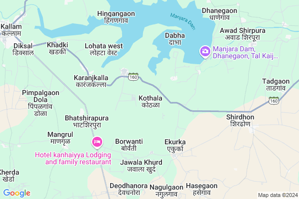
Kothala
Kothala Map
EDIT Map
Add Your House
 ..
..
Current Corona Virus Infected Patients Count in Osmanabad District
| City Name | District Name | Total Covid cases |
|---|---|---|
| Osmanabad District | Osmanabad | 3 |
Locality Name :
Kothala
( कोथळा )
Taluka Name : Kalamb
District : Osmanabad
State : Maharashtra
Region : Marathwada
Division : Aurangabad
Language : Marathi and Hindi
Current Time 12:41 PM
Date: Tuesday , Apr 29,2025 (IST)
Time zone: IST (UTC+5:30)
Elevation / Altitude: 674 meters. Above Seal level
Telephone Code / Std Code: 02473
Assembly constituency : Osmanabad assembly constituency
Assembly MLA : Kailas Balasaheb Ghadge Patil
Lok Sabha constituency : Osmanabad parliamentary constituency
Parliament MP : Omprakash Bhupalsinh Alias Pawan Rajenimbalkar
Serpanch Name :
Pin Code : 413528
Post Office Name : Shiradhon
Commodities Prices : Kalamb(Osmanabad) Market / Mandi
Kothala Live Weather
Temperature: 38.2 °C
clear sky
Humidity: 12%
Wind : 3.97 mt/sec towards N
StationName : "DhÄ\u0081rÅ«r"
observed on Now
Temperature: 38.2 °C
clear sky
Humidity: 12%
Wind : 3.97 mt/sec towards N
StationName : "DhÄ\u0081rÅ«r"
observed on Now
Kothala Weather Forecast for Next 5 days
30-04-2025
30.5°C to 39.3°C
clear sky
30.5°C to 39.3°C
clear sky
01-05-2025
29.1°C to 40.0°C
clear sky, scattered clouds, broken clouds, few clouds
29.1°C to 40.0°C
clear sky, scattered clouds, broken clouds, few clouds
02-05-2025
29.1°C to 40.8°C
scattered clouds, few clouds, clear sky
29.1°C to 40.8°C
scattered clouds, few clouds, clear sky
03-05-2025
28.2°C to 40.3°C
clear sky, scattered clouds, broken clouds
28.2°C to 40.3°C
clear sky, scattered clouds, broken clouds
04-05-2025
28.1°C to 39.4°C
clear sky, scattered clouds, broken clouds
28.1°C to 39.4°C
clear sky, scattered clouds, broken clouds
National Highways Reachable To Kothala
Nationa High Way :NH63
Nationa High Way :NH548B
Nationa High Way :NH63
Nationa High Way :NH548B
Rivers Near Kothala
Murud
Kajidi
Murud
Kajidi
About Kothala
Correct below Info and add more info about KothalaKothala is a Village in Kalamb Taluka in Osmanabad District of Maharashtra State, India. It belongs to Marathwada region . It belongs to Aurangabad Division . It is located 44 KM towards North from District head quarters Osmanabad. 15 KM from Kalamb. 407 KM from State capital Mumbai
Kothala Pin code is 413528 and postal head office is Shiradhon .
Karanjkalla ( 5 KM ) , Nagulgaon ( 7 KM ) , Deodhanora ( 7 KM ) , Hingangaon ( 7 KM ) , Shiradhon ( 7 KM ) are the nearby Villages to Kothala. Kothala is surrounded by Kaij Taluka towards North , Osmanabad Taluka towards South , Washi Taluka towards west , Ambajogai Taluka towards East .
Osmanabad , Latur , Parli , Tuljapur are the near by Cities to Kothala.
This Place is in the border of the Osmanabad District and Beed District. Beed District Kaij is North towards this place .
Kothala 2011 Census Details
Kothala Local Language is Marathi. Kothala Village Total population is 2306 and number of houses are 506. Female Population is 47.6%. Village literacy rate is 72.6% and the Female Literacy rate is 31.0%.
Population
| Census Parameter | Census Data |
| Total Population | 2306 |
| Total No of Houses | 506 |
| Female Population % | 47.6 % ( 1098) |
| Total Literacy rate % | 72.6 % ( 1675) |
| Female Literacy rate | 31.0 % ( 716) |
| Scheduled Tribes Population % | 3.9 % ( 91) |
| Scheduled Caste Population % | 20.3 % ( 467) |
| Working Population % | 54.4 % |
| Child(0 -6) Population by 2011 | 259 |
| Girl Child(0 -6) Population % by 2011 | 49.0 % ( 127) |
Kothala Census More Deatils.
Politics in Kothala
NCP , Shivsena , SHS are the major political parties in this area.Polling Stations /Booths near Kothala
1)Zilla Parishad Primary School Class 2th Dev Dhanora2)Zilla Parishad Primary School Center Side Khanapur
3)Zilla Parishad Primary School Class 2 Th Kothala
4)Zilla Parishad Primary School West Side Pohner
5)Zilla Parishad Primary School South Side Room No 4 Lohata(west)
HOW TO REACH Kothala
By Rail
There is no railway station near to Kothala in less than 10 km. Barsi Town Rail Way Station (near to Barshi) , Osmanabad Rail Way Station (near to Osmanabad) , Uplai Rail Way Station (near to Barshi) are the Rail way stations reachable from near by towns.By Road
Osmanabad , Barshi are the nearby by towns to Kothala having road connectivity to KothalaColleges near Kothala
R.s.i.t.kallam
Address :
National Backward Agriculture Education Of Information Technology
Address : At Post Shelgaon D Tal Kalamb Dist Osmanabad
National Backward Agriculture Education Of Information Technology
Address : At Post Umra Tal Kalamb Dist Osmanabad
Schools in Kothala
Dnyanyog Vidyalaya
Address : kothala , kallamb , osmanabad , Maharashtra . PIN- 413528 , Post - Shiradhon
Z.p.p.school
Address : kothala , kallamb , osmanabad , Maharashtra . PIN- 413528 , Post - Shiradhon
Govt Health Centers near Kothala
1) RH Kallam , Rural Hospital, Kalamb , Near of Bus Stand , Marketing2) SDH Omerga , Sub District Hospital, Omerga , NH No.9, Main Road, Umerga , Mahadev Mandir
3) Apegaon , PHC Apegaon , ,
Hospitals in Kothala,Kalamb
Balaji Welding Workshop And Short film Creater
Mauli Nagar; Shirdhon; Maharashtra 413528; India
8.0 KM distance Detail
Matosree Dental Hospital
अक्षय डिजिटल फोटोग्राफी Akshay Digitalphoto studio Shiradhon 413528 T.q Dist; Mali Galli; Kallam; Maharashtra 413507; India
8.2 KM distance Detail
MAULI CLINIC
MAULI MARG; MALI GALLI; SHIRADHON; MAULI MARG; Kazi Galli; Shirdhon; Maharashtra 413528; India
8.2 KM distance Detail
more ..
Petrol Bunks in Kothala,Kalamb
HP PETROL PUMP - LORD VENKATESH PETROLEUM
A/P Shiradhon Tal.-kalamb SH-160; Sholapur; Maharashtra 413528; India
3.1 KM distance Detail
more ..
Colleges in Kothala,Kalamb
Sai College of Computer Education
NATURAL SUGAR CAMPUS; Sai Nagar ;Kallam; Osmanabad; Ranjani; Maharashtra 413528; India
8.7 KM distance Detail
Government Industrial Training Institute Kalamb
Kalamb; Maharashtra 413507; India
13.1 KM distance Detail
K.B.S.S Vairag R.R.Polytechnic
Hasegaon; Kallam; Osmanabad; Maharashtra 413507; India
13.2 KM distance Detail
more ..
Schools in Kothala,Kalamb
Dharangrast Madhyamik Vidhyalaya Lohata East
Hingangaon; Maharashtra 413507; India
2.9 KM distance Detail
Electronic Shops in Kothala,Kalamb
Dhaktode Galli Shiradhon T.q Kallam Dist Osmanabad
Shiradhon T.q Dist Kallam; Dhaktode Galli; Jay Bhavani Nagar; Mali Nagar; Shirdhon; Maharashtra 413528; India
7.8 KM distance Detail
Local Parks in Kothala,Kalamb
DASARA MAIDAN SHIRADHON
TULJAI MARG; TUJAI NAGAR; SHIRADHON; Maharashtra 413528; India
9.6 KM distance Detail
Governement Offices near Kothala,Kalamb
Block Education Office Kalamb गट शिक्षण कार्यालय कळंब
Kalamb; Maharashtra 413507; India
13.8 KM distance Detail
About Kothala &
History
How to reach Kothala
Tourist Places Near By Kothala
Schools in Kothala
Colleges in Kothala
Temperature & weather of Kothala
places in Kothala
Kothala photos
More Information
How to reach Kothala
Tourist Places Near By Kothala
Schools in Kothala
Colleges in Kothala
Temperature & weather of Kothala
places in Kothala
Kothala photos
More Information
Village Talk
Post News or Events about this Village
Near Cities
Osmanabad 44 KM near
Latur 58 KM near
Parli 62 KM near
Tuljapur 65 KM near
Osmanabad 44 KM near
Latur 58 KM near
Parli 62 KM near
Tuljapur 65 KM near
Near By Taluks
Kalamb 14 KM near
Kaij 23 KM near
Osmanabad 38 KM near
Washi 40 KM near
Kalamb 14 KM near
Kaij 23 KM near
Osmanabad 38 KM near
Washi 40 KM near
Near By Air Ports
Latur Airport 43 KM near
Sholapur Airport 113 KM near
Nanded Airport 162 KM near
Chikkalthana Airport 186 KM near
Latur Airport 43 KM near
Sholapur Airport 113 KM near
Nanded Airport 162 KM near
Chikkalthana Airport 186 KM near
Near By Tourist Places
Tuljapur 64 KM near
Solapur 108 KM near
Pandharpur 141 KM near
Gulbarga 171 KM near
Ahmednagar 177 KM near
Tuljapur 64 KM near
Solapur 108 KM near
Pandharpur 141 KM near
Gulbarga 171 KM near
Ahmednagar 177 KM near
Near By Districts
Osmanabad 42 KM near
Latur 56 KM near
Beed 71 KM near
Solapur 111 KM near
Osmanabad 42 KM near
Latur 56 KM near
Beed 71 KM near
Solapur 111 KM near
Near By RailWay Station
Osmanabad Rail Way Station 36 KM near
Latur Rail Way Station 53 KM near
Osmanabad Rail Way Station 36 KM near
Latur Rail Way Station 53 KM near