| Home | City Bus | Maps | Villages | Cities | Rail | Tourist Places | School | College | Pin Codes | Corona Cases Count |
| Distance Calculator Bus Services IFSC Codes Trace Mobile Number Weather Search Place Trace IP Available Cash ATM/Banks Locate Polling Booth Report an Error contact People |
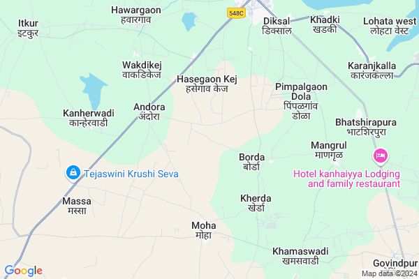
Jawala(kd)
Jawala(kd) Map
EDIT Map
Add Your House
 ..
..
Current Corona Virus Infected Patients Count in Osmanabad District
| City Name | District Name | Total Covid cases |
|---|---|---|
| Osmanabad District | Osmanabad | 3 |
Locality Name :
Jawala(kd)
( Jawala(kd) )
Taluka Name : Kalamb
District : Osmanabad
State : Maharashtra
Region : Marathwada
Division : Aurangabad
Language : Marathi and Hindi
Current Time 11:19 AM
Date: Monday , Apr 28,2025 (IST)
Time zone: IST (UTC+5:30)
Elevation / Altitude: 674 meters. Above Seal level
Telephone Code / Std Code: 02473
Assembly constituency : Osmanabad assembly constituency
Assembly MLA : Kailas Balasaheb Ghadge Patil
Lok Sabha constituency : Osmanabad parliamentary constituency
Parliament MP : Omprakash Bhupalsinh Alias Pawan Rajenimbalkar
Serpanch Name :
Pin Code : 413507
Post Office Name : Kallam
Alternate Village Name : Jawala Kd.
Commodities Prices : Kalamb(Osmanabad) Market / Mandi
Jawala(kd) Live Weather
Temperature: 34.4 °C
clear sky
Humidity: 18%
Wind : 1.84 mt/sec towards NE
StationName : "Bhūm"
observed on 54 Mins Back
Temperature: 34.4 °C
clear sky
Humidity: 18%
Wind : 1.84 mt/sec towards NE
StationName : "Bhūm"
observed on 54 Mins Back
Jawala(kd) Weather Forecast for Next 5 days
29-04-2025
30.4°C to 38.1°C
clear sky
30.4°C to 38.1°C
clear sky
30-04-2025
28.2°C to 39.3°C
clear sky, few clouds, broken clouds
28.2°C to 39.3°C
clear sky, few clouds, broken clouds
01-05-2025
28.4°C to 39.6°C
scattered clouds, clear sky, overcast clouds, broken clouds
28.4°C to 39.6°C
scattered clouds, clear sky, overcast clouds, broken clouds
02-05-2025
27.7°C to 40.5°C
scattered clouds, broken clouds, clear sky
27.7°C to 40.5°C
scattered clouds, broken clouds, clear sky
03-05-2025
27.8°C to 39.7°C
clear sky, broken clouds, scattered clouds, overcast clouds, light rain, few clouds
27.8°C to 39.7°C
clear sky, broken clouds, scattered clouds, overcast clouds, light rain, few clouds
National Highways Reachable To Jawala(kd)
Nationa High Way :NH63
Nationa High Way :NH548B
Nationa High Way :NH63
Nationa High Way :NH548B
Rivers Near Jawala(kd)
Murud
Kajidi
Murud
Kajidi
About Jawala(kd)
Correct below Info and add more info about Jawala(kd)Jawala(kd) is a Village in Kalamb Taluka in Osmanabad District of Maharashtra State, India. It belongs to Marathwada region . It belongs to Aurangabad Division . It is located 41 KM towards North from District head quarters Osmanabad. 393 KM from State capital Mumbai
Jawala(kd) Pin code is 413507 and postal head office is Kallam .
Jawala(kd) is surrounded by Kaij Taluka towards North , Washi Taluka towards west , Osmanabad Taluka towards South , Barshi Taluka towards South .
Osmanabad , Tuljapur , Latur , Parli are the near by Cities to Jawala(kd).
This Place is in the border of the Osmanabad District and Beed District. Beed District Kaij is North towards this place .
Demographics of Jawala(kd)
Marathi is the Local Language here.Politics in Jawala(kd)
NCP , Shivsena , SHS are the major political parties in this area.Polling Stations /Booths near Jawala(kd)
1)Zilla Parishad Primary School Bhatsangvi2)Zilla Parishad Primary School 3th Class Barmachiwadi
3)Zilla Parishad Primary School Shelgaon (di) West Side
4)Zilla Parishad Primary School Naigaon South Side
5)Zilla Parishad Primary School New Building East Side
HOW TO REACH Jawala(kd)
By Rail
There is no railway station near to Jawala(kd) in less than 10 km. Barsi Town Rail Way Station (near to Barshi) , Osmanabad Rail Way Station (near to Osmanabad) , Uplai Rail Way Station (near to Barshi) are the Rail way stations reachable from near by towns.By Road
Osmanabad , Barshi are the nearby by towns to Jawala(kd) having road connectivity to Jawala(kd)Colleges near Jawala(kd)
R.s.i.t.kallam
Address :
National Backward Agriculture Education Of Information Technology
Address : At Post Shelgaon D Tal Kalamb Dist Osmanabad
National Backward Agriculture Education Of Information Technology
Address : At Post Umra Tal Kalamb Dist Osmanabad
Schools near Jawala(kd)
Dnyanyog Vidyalaya
Address : kothala , kallamb , osmanabad , Maharashtra . PIN- 413528 , Post - Shiradhon
Sufiya Urdu Girls Highschool
Address : kallamb , kallamb , osmanabad , Maharashtra . PIN- 413507 , Post - Kallam
Loknayak Vidyalaya
Address : naigaon , kallamb , osmanabad , Maharashtra . PIN- 413510 , Post - Murud
Hanuman Vidyalaya
Address : ghargaon , kallamb , osmanabad , Maharashtra . PIN- 413528 , Post - Shiradhon
Govt Health Centers near Jawala(kd)
1) RH Kallam , Rural Hospital, Kalamb , Near of Bus Stand , Marketing2) SDH Omerga , Sub District Hospital, Omerga , NH No.9, Main Road, Umerga , Mahadev Mandir
3) Itkur , Primary Health Centre , Itkur , Main road
Petrol Bunks in Jawala(kd),Kalamb
HP PETROL PUMP - RAJSHREE SERVICES
Village Hasegaon(kej) Kalamb-yermala Highway TAL Kalamb; Sholapur; Maharashtra 413507; India
6.5 KM distance Detail
more ..
Colleges in Jawala(kd),Kalamb
Government Industrial Training Institute Kalamb
Kalamb; Maharashtra 413507; India
7.0 KM distance Detail
Shikshan Maharashi Dnyandeo Mohekar mahavidyalaya; kalamb
Hawargaon Rd; Datt Nagar; Hawargaon; Maharashtra 413507; India
8.7 KM distance Detail
more ..
Electronic Shops in Jawala(kd),Kalamb
Sahyadri Serviceing/Washing Centre
Dhoki Rd; Jijau Nagar; Kallam; Maharashtra 413507; India
8.6 KM distance Detail
Governement Offices near Jawala(kd),Kalamb
Sub District Office उप विभागीय कार्यालय कळंब
Kalamb; Maharashtra 413507; India
8.2 KM distance Detail
Taluka Agri Office Kalamb तालुका कृषी कार्यालय कळंब
Kalamb; Maharashtra 413507; India
8.3 KM distance Detail
About Jawala(kd) &
History
How to reach Jawala(kd)
Tourist Places Near By Jawala(kd)
Schools in Jawala(kd)
Colleges in Jawala(kd)
Temperature & weather of Jawala(kd)
places in Jawala(kd)
Jawala(kd) photos
More Information
How to reach Jawala(kd)
Tourist Places Near By Jawala(kd)
Schools in Jawala(kd)
Colleges in Jawala(kd)
Temperature & weather of Jawala(kd)
places in Jawala(kd)
Jawala(kd) photos
More Information
Village Talk
Post News or Events about this Village
Near Cities
Osmanabad 42 KM near
Tuljapur 63 KM near
Latur 71 KM near
Parli 75 KM near
Osmanabad 42 KM near
Tuljapur 63 KM near
Latur 71 KM near
Parli 75 KM near
Near By Taluks
Kalamb 0 KM near
Kaij 26 KM near
Washi 26 KM near
Osmanabad 38 KM near
Kalamb 0 KM near
Kaij 26 KM near
Washi 26 KM near
Osmanabad 38 KM near
Near By Air Ports
Latur Airport 56 KM near
Sholapur Airport 109 KM near
Nanded Airport 176 KM near
Chikkalthana Airport 183 KM near
Latur Airport 56 KM near
Sholapur Airport 109 KM near
Nanded Airport 176 KM near
Chikkalthana Airport 183 KM near
Near By Tourist Places
Tuljapur 62 KM near
Solapur 103 KM near
Pandharpur 130 KM near
Ahmednagar 165 KM near
Gulbarga 176 KM near
Tuljapur 62 KM near
Solapur 103 KM near
Pandharpur 130 KM near
Ahmednagar 165 KM near
Gulbarga 176 KM near
Near By Districts
Osmanabad 40 KM near
Beed 65 KM near
Latur 69 KM near
Solapur 106 KM near
Osmanabad 40 KM near
Beed 65 KM near
Latur 69 KM near
Solapur 106 KM near
Near By RailWay Station
Osmanabad Rail Way Station 32 KM near
Barsi Town Rail Way Station 47 KM near
Osmanabad Rail Way Station 32 KM near
Barsi Town Rail Way Station 47 KM near