| Home | City Bus | Maps | Villages | Cities | Rail | Tourist Places | School | College | Pin Codes | Corona Cases Count |
| Distance Calculator Bus Services IFSC Codes Trace Mobile Number Weather Search Place Trace IP Available Cash ATM/Banks Locate Polling Booth Report an Error contact People |
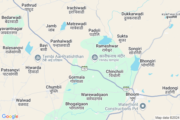
Ulup
Ulup Map
EDIT Map
Add Your House
 ..
..
Current Corona Virus Infected Patients Count in Osmanabad District
| City Name | District Name | Total Covid cases |
|---|---|---|
| Osmanabad District | Osmanabad | 3 |
Locality Name :
Ulup
( उलूप )
Taluka Name : Bhoom
District : Osmanabad
State : Maharashtra
Region : Marathwada
Division : Aurangabad
Language : Marathi and Hindi
Current Time 09:36 AM
Date: Thursday , Apr 24,2025 (IST)
Time zone: IST (UTC+5:30)
Elevation / Altitude: 528 meters. Above Seal level
Telephone Code / Std Code: 02478
Assembly constituency : Paranda assembly constituency
Assembly MLA : Tanaji Jaywant Sawant
Lok Sabha constituency : Osmanabad parliamentary constituency
Parliament MP : Omprakash Bhupalsinh Alias Pawan Rajenimbalkar
Serpanch Name :
Pin Code : 413504
Post Office Name : Bhoom
Commodities Prices : Paranda Market / Mandi
Ulup Live Weather
Temperature: 35.3 °C
few clouds
Humidity: 12%
Wind : 5.16 mt/sec towards N
StationName : "Bhūm"
observed on Now
Temperature: 35.3 °C
few clouds
Humidity: 12%
Wind : 5.16 mt/sec towards N
StationName : "Bhūm"
observed on Now
Ulup Weather Forecast for Next 5 days
25-04-2025
31.1°C to 39.6°C
few clouds, clear sky, scattered clouds
31.1°C to 39.6°C
few clouds, clear sky, scattered clouds
26-04-2025
29.4°C to 39.9°C
few clouds, clear sky, broken clouds, scattered clouds
29.4°C to 39.9°C
few clouds, clear sky, broken clouds, scattered clouds
27-04-2025
29.0°C to 39.5°C
scattered clouds, clear sky, broken clouds, light rain
29.0°C to 39.5°C
scattered clouds, clear sky, broken clouds, light rain
28-04-2025
30.0°C to 39.4°C
scattered clouds, clear sky
30.0°C to 39.4°C
scattered clouds, clear sky
29-04-2025
28.2°C to 39.8°C
clear sky
28.2°C to 39.8°C
clear sky
National Highways Reachable To Ulup
Nationa High Way :NH548C
Nationa High Way :NH548C
Rivers Near Ulup
Manjira :ಮಂಜೀರ :ಮಂಜೀರ
Sina :सीना नदी :Сіна
Manjira :ಮಂಜೀರ :ಮಂಜೀರ
Sina :सीना नदी :Сіна
About Ulup
Correct below Info and add more info about UlupUlup is a Village in Bhoom Taluka in Osmanabad District of Maharashtra State, India. It belongs to Marathwada region . It belongs to Aurangabad Division . It is located 67 KM towards west from District head quarters Osmanabad. 2 KM from Bhoom. 346 KM from State capital Mumbai
Ulup Pin code is 413504 and postal head office is Bhoom .
Rameshwar ( 2 KM ) , Chincholi ( 3 KM ) , Gormala ( 3 KM ) , Warewadgaon ( 4 KM ) , Matrewadi ( 5 KM ) are the nearby Villages to Ulup. Ulup is surrounded by Washi Taluka towards East , Paranda Taluka towards South , Jamkhed Taluka towards west , Barshi Taluka towards South .
Osmanabad , Tuljapur , Pathardi , Pandharpur are the near by Cities to Ulup.
Ulup 2011 Census Details
Ulup Local Language is Marathi. Ulup Village Total population is 1437 and number of houses are 312. Female Population is 47.4%. Village literacy rate is 68.9% and the Female Literacy rate is 28.5%.
Population
| Census Parameter | Census Data |
| Total Population | 1437 |
| Total No of Houses | 312 |
| Female Population % | 47.4 % ( 681) |
| Total Literacy rate % | 68.9 % ( 990) |
| Female Literacy rate | 28.5 % ( 409) |
| Scheduled Tribes Population % | 0.9 % ( 13) |
| Scheduled Caste Population % | 14.5 % ( 209) |
| Working Population % | 58.5 % |
| Child(0 -6) Population by 2011 | 141 |
| Girl Child(0 -6) Population % by 2011 | 50.4 % ( 71) |
Ulup Census More Deatils.
Politics in Ulup
NCP , Shivsena , SHS are the major political parties in this area.Polling Stations /Booths near Ulup
1)Z. P.p.s Tintraj2)Z. P.p.s
3)Z. P.p.s Ralesanghavi
4)Z. P.p.s Warewadgaon
5)Z. P.p.s Golegaon
HOW TO REACH Ulup
By Rail
There is no railway station near to Ulup in less than 10 km. Barsi Town Rail Way Station (near to Barshi) , Uplai Rail Way Station (near to Barshi) are the Rail way stations reachable from near by towns.By Road
Bhum , Paranda , Barshi are the nearby by towns to Ulup having road connectivity to UlupColleges near Ulup
S.c.college Bhoom& Kmj Mahavidhyalay Washi
Address :
National Agriculture Education Of Information Technology Bhoom
Address : At Paranda Raod Tal Bhoom Dist Osmanabad
Schools in Ulup
New Highschool
Address : ulup , bhoom , osmanabad , Maharashtra . PIN- 413504 , Post - Bhoom
Govt Health Centers near Ulup
1) RH Bhoom , Rural Hospital, Bhoom , Near of Bus Stand , Near of Bus Stand2) SDH Paranda , Sub District Hospital, Paranda , Near of Gov. Rest House , Bhoikot Killa
3) Ghatnandur , PHC Ghatnandur , ,
Hospitals in Ulup,Bhoom
संत रोहीदास महाराज शासकीय दवाखाना उळूप
Ulup Raod; Ulup; Maharashtra 413504; India
1.7 KM distance Detail
more ..
Petrol Bunks in Ulup,Bhoom
Prateek Petroleum Bharat Petrol Pump [R_H]
Paranda Rd; Bhoom; Maharashtra 413504; India
8.7 KM distance Detail
more ..
Colleges in Ulup,Bhoom
L.M.B. MOTE COLLEGE OF PHARMACY
Pargaon Road; Girwali; Bhoom Dist; Maharashtra 413504; India
4.8 KM distance Detail
more ..
Electronic Shops in Ulup,Bhoom
Doke Mobile Shoppy And Radium Art
Ahmednagar-Bhoom Rd; Bhoom; Maharashtra 413504; India
6.6 KM distance Detail
suraj machinery stores
s.no. near; Bus Stand Rd; Chanasma; Gujarat 384220; India
8.1 KM distance Detail
Super Markets in Ulup,Bhoom
Ganesh Traders Bhoom ( Gajanan Umbare )
Golegaon Rd; Bhoom; Maharashtra 413504; India
7.9 KM distance Detail
Police Stations near Ulup,Bhoom
Bhoom Police Station
Alamprabhu Road; Osmanabad District; Bhoom; Maharashtra 413504; India
8.6 KM distance Detail
About Ulup &
History
How to reach Ulup
Tourist Places Near By Ulup
Schools in Ulup
Colleges in Ulup
Temperature & weather of Ulup
places in Ulup
Ulup photos
More Information
How to reach Ulup
Tourist Places Near By Ulup
Schools in Ulup
Colleges in Ulup
Temperature & weather of Ulup
places in Ulup
Ulup photos
More Information
Village Talk
Post News or Events about this Village
Near Cities
Osmanabad 65 KM near
Tuljapur 82 KM near
Pathardi 98 KM near
Pandharpur 107 KM near
Osmanabad 65 KM near
Tuljapur 82 KM near
Pathardi 98 KM near
Pandharpur 107 KM near
Near By Taluks
Bhoom 1 KM near
Washi 21 KM near
Paranda 26 KM near
Jamkhed 40 KM near
Bhoom 1 KM near
Washi 21 KM near
Paranda 26 KM near
Jamkhed 40 KM near
Near By Air Ports
Latur Airport 101 KM near
Sholapur Airport 114 KM near
Chikkalthana Airport 171 KM near
Lohegaon Airport 199 KM near
Latur Airport 101 KM near
Sholapur Airport 114 KM near
Chikkalthana Airport 171 KM near
Lohegaon Airport 199 KM near
Near By Tourist Places
Tuljapur 80 KM near
Pandharpur 108 KM near
Solapur 108 KM near
Ahmednagar 126 KM near
Aurangabad 175 KM near
Tuljapur 80 KM near
Pandharpur 108 KM near
Solapur 108 KM near
Ahmednagar 126 KM near
Aurangabad 175 KM near
Near By Districts
Beed 63 KM near
Osmanabad 65 KM near
Solapur 110 KM near
Latur 115 KM near
Beed 63 KM near
Osmanabad 65 KM near
Solapur 110 KM near
Latur 115 KM near
Near By RailWay Station
Barsi Town Rail Way Station 34 KM near
Kurduvadi Junction Rail Way Station 55 KM near
Barsi Town Rail Way Station 34 KM near
Kurduvadi Junction Rail Way Station 55 KM near