| Home | City Bus | Maps | Villages | Cities | Rail | Tourist Places | School | College | Pin Codes | Corona Cases Count |
| Distance Calculator Bus Services IFSC Codes Trace Mobile Number Weather Search Place Trace IP Available Cash ATM/Banks Locate Polling Booth Report an Error contact People |
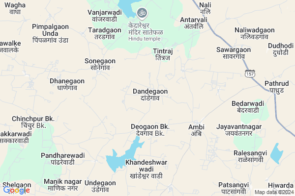
Dandegaon
Dandegaon Map
EDIT Map
Add Your House
 ..
..
Current Corona Virus Infected Patients Count in Osmanabad District
| City Name | District Name | Total Covid cases |
|---|---|---|
| Osmanabad District | Osmanabad | 3 |
Locality Name :
Dandegaon
( दांडेगाव )
Taluka Name : Bhoom
District : Osmanabad
State : Maharashtra
Region : Marathwada
Division : Aurangabad
Language : Marathi and Hindi
Current Time 07:57 PM
Date: Friday , Apr 25,2025 (IST)
Time zone: IST (UTC+5:30)
Elevation / Altitude: 528 meters. Above Seal level
Telephone Code / Std Code: 02478
Assembly constituency : Paranda assembly constituency
Assembly MLA : Tanaji Jaywant Sawant
Lok Sabha constituency : Osmanabad parliamentary constituency
Parliament MP : Omprakash Bhupalsinh Alias Pawan Rajenimbalkar
Serpanch Name :
Pin Code : 413504
Post Office Name : Bhoom
Commodities Prices : Jamkhed Market / Mandi
National Highways Reachable To Dandegaon
Nationa High Way :NH548C
Nationa High Way :NH548C
Rivers Near Dandegaon
Manjira :ಮಂಜೀರ :ಮಂಜೀರ
Sina :सीना नदी :Сіна
Manjira :ಮಂಜೀರ :ಮಂಜೀರ
Sina :सीना नदी :Сіна
About Dandegaon
Correct below Info and add more info about DandegaonDandegaon is a Village in Bhoom Taluka in Osmanabad District of Maharashtra State, India. It belongs to Marathwada region . It belongs to Aurangabad Division . It is located 88 KM towards west from District head quarters Osmanabad. 18 KM from Bhoom. 325 KM from State capital Mumbai
Dandegaon Pin code is 413504 and postal head office is Bhoom .
Tintraj ( 3 KM ) , Ambi ( 5 KM ) , Anandwadi ( 6 KM ) , Jaywantnagar ( 8 KM ) , Bagalwadi ( 8 KM ) are the nearby Villages to Dandegaon. Dandegaon is surrounded by Jamkhed Taluka towards west , Paranda Taluka towards South , Washi Taluka towards East , Karmala Taluka towards west .
Pathardi , Osmanabad , Shrigonda , Tuljapur are the near by Cities to Dandegaon.
Dandegaon 2011 Census Details
Dandegaon Local Language is Marathi. Dandegaon Village Total population is 972 and number of houses are 218. Female Population is 46.5%. Village literacy rate is 63.1% and the Female Literacy rate is 24.5%.
Population
| Census Parameter | Census Data |
| Total Population | 972 |
| Total No of Houses | 218 |
| Female Population % | 46.5 % ( 452) |
| Total Literacy rate % | 63.1 % ( 613) |
| Female Literacy rate | 24.5 % ( 238) |
| Scheduled Tribes Population % | 0.0 % ( 0) |
| Scheduled Caste Population % | 6.2 % ( 60) |
| Working Population % | 63.0 % |
| Child(0 -6) Population by 2011 | 113 |
| Girl Child(0 -6) Population % by 2011 | 39.8 % ( 45) |
Dandegaon Census More Deatils.
Politics in Dandegaon
NCP , Shivsena , SHS are the major political parties in this area.Polling Stations /Booths near Dandegaon
1)Z. P.p.s2)Z.p.p.s. Dahitana
3)Z. P.p.s Jayvantnagar
4)Z.p.p.s. Donja West Side Room No 2
5)Z. P.p.s Tambewadi
HOW TO REACH Dandegaon
By Rail
There is no railway station near to Dandegaon in less than 10 km. Barsi Town Rail Way Station (near to Barshi) , Uplai Rail Way Station (near to Barshi) are the Rail way stations reachable from near by towns.By Road
Bhum , Paranda , Barshi are the nearby by towns to Dandegaon having road connectivity to DandegaonColleges near Dandegaon
S.c.college Bhoom& Kmj Mahavidhyalay Washi
Address :
National Agriculture Education Of Information Technology Bhoom
Address : At Paranda Raod Tal Bhoom Dist Osmanabad
Schools in Dandegaon
Shivparvati Highschool
Address : dandegaon , bhoom , osmanabad , Maharashtra . PIN- 413505 , Post - Sonari (Osmanabad)
Z.p.p.school
Address : dandegaon , bhoom , osmanabad , Maharashtra . PIN- 413505 , Post - Sonari (Osmanabad)
Govt Health Centers near Dandegaon
1) Sanegav , Sub Center Sonegaon , Main Raod , Marathi Shala2) Pimpalgaon Unda , Sub Center Pimpalgaon Unda , Main Raod , Gaonthan
3) Kharda , PHC Kharda , Kharda , Sonegaon Road
Petrol Bunks in Dandegaon,Bhoom
HP PETROL PUMP - SIDDHANT CHAITANYA SERVICES
GAT NO. 1484 Village Pathrud Bhum Kharda State Highway Taluka Bhum; Sholapur; Maharashtra 413504; India
9.3 KM distance Detail
more ..
Colleges in Dandegaon,Bhoom
L.M.B. MOTE COLLEGE OF PHARMACY
Pargaon Road; Girwali; Bhoom Dist; Maharashtra 413504; India
17.4 KM distance Detail
Agricultural College Donja
Samaladev-Ambach Road; Donja; Gujarat 396540; India
21.6 KM distance Detail
more ..
Electronic Shops in Dandegaon,Bhoom
Samarth Mobile Shop & Electronics
Main Road Ambi Ta. Bhoom Dist; Maharashtra; India
5.1 KM distance Detail
Super Markets in Dandegaon,Bhoom
Janseva dudh Sankaln Kendra Ralesangvi
ralesangvi ta.bhoom dist; Maharashtra; India
9.9 KM distance Detail
About Dandegaon &
History
How to reach Dandegaon
Tourist Places Near By Dandegaon
Schools in Dandegaon
Colleges in Dandegaon
Temperature & weather of Dandegaon
places in Dandegaon
Dandegaon photos
More Information
How to reach Dandegaon
Tourist Places Near By Dandegaon
Schools in Dandegaon
Colleges in Dandegaon
Temperature & weather of Dandegaon
places in Dandegaon
Dandegaon photos
More Information
Village Talk
Post News or Events about this Village
Near Cities
Pathardi 84 KM near
Osmanabad 84 KM near
Shrigonda 89 KM near
Tuljapur 100 KM near
Pathardi 84 KM near
Osmanabad 84 KM near
Shrigonda 89 KM near
Tuljapur 100 KM near
Near By Taluks
Bhoom 18 KM near
Jamkhed 21 KM near
Paranda 28 KM near
Washi 38 KM near
Bhoom 18 KM near
Jamkhed 21 KM near
Paranda 28 KM near
Washi 38 KM near
Near By Air Ports
Latur Airport 121 KM near
Sholapur Airport 127 KM near
Chikkalthana Airport 164 KM near
Lohegaon Airport 180 KM near
Latur Airport 121 KM near
Sholapur Airport 127 KM near
Chikkalthana Airport 164 KM near
Lohegaon Airport 180 KM near
Near By Tourist Places
Tuljapur 98 KM near
Ahmednagar 107 KM near
Pandharpur 109 KM near
Solapur 121 KM near
Aurangabad 166 KM near
Tuljapur 98 KM near
Ahmednagar 107 KM near
Pandharpur 109 KM near
Solapur 121 KM near
Aurangabad 166 KM near
Near By Districts
Beed 65 KM near
Osmanabad 84 KM near
Ahmednagar 109 KM near
Solapur 123 KM near
Beed 65 KM near
Osmanabad 84 KM near
Ahmednagar 109 KM near
Solapur 123 KM near
Near By RailWay Station
Jeur Rail Way Station 49 KM near
Barsi Town Rail Way Station 49 KM near
Jeur Rail Way Station 49 KM near
Barsi Town Rail Way Station 49 KM near