| Home | City Bus | Maps | Villages | Cities | Rail | Tourist Places | School | College | Pin Codes | Corona Cases Count |
| Distance Calculator Bus Services IFSC Codes Trace Mobile Number Weather Search Place Trace IP Available Cash ATM/Banks Locate Polling Booth Report an Error contact People |
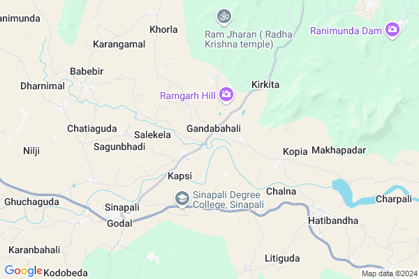
Gandabahali Map
EDIT Map
Add Your House
 ..
..
Current Corona Virus Infected Patients Count in Nuapada District
| City Name | District Name | Total Covid cases |
|---|
Locality Name :
Gandabahali
( ଗାଣ୍ଡବାହାଲି )
Tehsil Name : Sinapali
District : Nuapada
State : Odisha
Language : Oriya and Hindi
Current Time 12:59 PM
Date: Monday , Apr 28,2025 (IST)
Time zone: IST (UTC+5:30)
Elevation / Altitude: 283 meters. Above Seal level
Telephone Code / Std Code: 06672
Assembly constituency : Khariar assembly constituency
Assembly MLA : duryodhan majhi
Lok Sabha constituency : Kalahandi parliamentary constituency
Parliament MP : BASANTA KUMAR PANDA
Serpanch Name :
Pin Code : 766118
Post Office Name : Duajhar
Commodities Prices : Khariar Market / Mandi
Gandabahali Live Weather
Temperature: 41.0 °C
clear sky
Humidity: 14%
Wind : 1.19 mt/sec towards NW
StationName : "KharhiÄ\u0081l"
observed on Now
Temperature: 41.0 °C
clear sky
Humidity: 14%
Wind : 1.19 mt/sec towards NW
StationName : "KharhiÄ\u0081l"
observed on Now
Gandabahali Weather Forecast for Next 5 days
29-04-2025
28.6°C to 40.1°C
few clouds, scattered clouds, light rain, overcast clouds, clear sky
28.6°C to 40.1°C
few clouds, scattered clouds, light rain, overcast clouds, clear sky
30-04-2025
27.5°C to 40.2°C
clear sky, broken clouds, scattered clouds, few clouds
27.5°C to 40.2°C
clear sky, broken clouds, scattered clouds, few clouds
01-05-2025
26.3°C to 41.1°C
few clouds, scattered clouds, light rain
26.3°C to 41.1°C
few clouds, scattered clouds, light rain
02-05-2025
25.5°C to 43.3°C
few clouds, clear sky, scattered clouds, broken clouds
25.5°C to 43.3°C
few clouds, clear sky, scattered clouds, broken clouds
03-05-2025
25.4°C to 41.2°C
clear sky, light rain, few clouds, overcast clouds
25.4°C to 41.2°C
clear sky, light rain, few clouds, overcast clouds
Edit below overview about Gandabahali
Edit below overview about Gandabahali
OverView of Gandabahali
History:- Gandabahali might have been named for the goddess Maa Gadiani. The name might also derive from the Damba and Kandha people who have lived in the area for a long time.
Our Village Gandabahali, when Odisha got Independence as a state on 1 April 1936 at that time our Village came under the district of Sambalpur. Again, odisha reorganized in 1949 at that time our village came under the district of Kalahandi. After that, on 1 April 1993 Nuapada became a separate district carved out from the undivided kalahandi district. Then, our village comes under the district of Nuapada and block of Sinapali. Now it becomes a separate Gram Panchayat under the block of Sinapali. It is a biggest gram Panchayat of the Block of Sinapali and it is an old Village of this particular area of Gandabahali. Ramgarh hill situated on the north-west of the Village Gandabahali is given as the name of our Village's Goddess Maa Gadiani.
Some Community like Damba, Kandha have been living in this Village from the ancient time, that's why, it is considered that might be the name of the this Village as their name of the Community. Then, some other Community like, Bhulia(Meher), Mali, Gouda, Brahmin came to this Village and they settled in this Village. Most of the people of this Village are Bhulia(Meher) Community. They came from the city of Patnagarh and Sambalpur. Now, this village is known as the Bhulia(Meher) Community.
AREAS:-1. Bus Stand Pada 2. Basti Pada 3. Mali Pada 4. Bag Pada 5. Bhoi Pada 6. Harijan Pada 7. Satnami Pada 8. Upper Pada 9. Bhati Pada 10. Shibamandir Pada 11. Gangadi Pada 12. Ratalu Pada 13. Member Pada 14. School Pada 15. Tarini Chok
EDUCATION:-1. Shibamandir Primary School 2. Govt. Upper Primary School 3. M.E School 4. Panchayat High School 5. Saraswati Sishu Vidya Mandir
Medical Facilities:-1. Government Homeopathic Dispensary Gandabahali
Religion Place:- There are several religious places of different religion in Gandabahali, this indicates a diversity in religion, culture in Gandabahali. Some of the temples located in Gandabahali are:-1. Shiv Temple, Near Bus Stand Pada 2. Jagannath Temple, Near Bus Stand Pada 3. Tarini Temple, Near Member Pada
Festivals:-1. Ratha Yatra 2. Ganesh Pooja 3. Kartik Purnima 4. Diwali5. Holi 5. GangadharJayanti 6. Durga Pooja 7. Laxmi Pooja 8. Biswakarma Pooja 9. Rakshya Bandhan 8. Ram Navami 9. Shivaratri 10. Independence day 11. Republic day 12. Gandhi jayanti 13. Janmastami 14. Nuakhai 15. Chatar Jatra 17. Puspuni 18. Chandi Pooja 19. Tarini Yatra 20. Ravan Poda 21. Zero Night 22. Happy New Year 23. Saraswati Pooja 24. Ram Pooja 25. Nuakhai Bhet Ghat 26. Pahari.
Edit below overview about Gandabahali
National Highways Reachable To Gandabahali
Nationa High Way :NH130C
Nationa High Way :NH130C
Rivers Near Gandabahali
Uttia Jhor :Uttia Jhor
Āmpāni Nadi :Ampani Nadi
Uttia Jhor :Uttia Jhor
Āmpāni Nadi :Ampani Nadi
About Gandabahali
Gandabahali is a Village in Sinapali Tehsil in Nuapada District of Odisha State, India. It is located 90 KM towards South from District head quarters Nuapada. 9 KM from Sinapali. 384 KM from State capital Bhubaneswar
Gandabahali Pin code is 766118 and postal head office is Duajhar .
Chatiaguda ( 7 KM ) , Makhapadar ( 7 KM ) , Bharuamunda ( 7 KM ) , Karangamal ( 7 KM ) , Godal ( 7 KM ) are the nearby Villages to Gandabahali. Gandabahali is surrounded by Boden Tehsil towards North , Khariar Tehsil towards North , Deobhog Tehsil towards South , Golamunda Tehsil towards South .
Kantabanji , Titlagarh , Bhawanipatna , Umarkote are the near by Cities to Gandabahali.
This Place is in the border of the Nuapada District and Kalahandi District. Kalahandi District Golamunda is South towards this place .
Gandabahali 2011 Census Details
Gandabahali Local Language is Oriya. Gandabahali Village Total population is 2293 and number of houses are 551. Female Population is 50.9%. Village literacy rate is 61.0% and the Female Literacy rate is 27.9%.
Population
| Census Parameter | Census Data |
| Total Population | 2293 |
| Total No of Houses | 551 |
| Female Population % | 50.9 % ( 1167) |
| Total Literacy rate % | 61.0 % ( 1399) |
| Female Literacy rate | 27.9 % ( 639) |
| Scheduled Tribes Population % | 17.8 % ( 409) |
| Scheduled Caste Population % | 14.5 % ( 332) |
| Working Population % | 31.1 % |
| Child(0 -6) Population by 2011 | 269 |
| Girl Child(0 -6) Population % by 2011 | 46.8 % ( 126) |
Gandabahali Census More Deatils.
Politics in Gandabahali
BJP , BJD are the major political parties in this area.Polling Stations /Booths near Gandabahali
1)Sevashram Dhobei2)Primary School Boden
3)Upper Primary School Dumerjore
4)Project U P School Nagpada
5)Nodal U P School Larka
HOW TO REACH Gandabahali
By Rail
There is no railway station near to Gandabahali in less than 10 km.Colleges near Gandabahali
G.m.jr.college
Address :
National College, Nuapada
Address : Nuapada
Sinapali College
Address : Sinapali, Nuapada, Orissa
Schools in Gandabahali
Panchayt High School
Address :
Panchayat High School Gandabahali
Address : gandabahali
Govt Health Centers near Gandabahali
1) SINAPALI , SINAPALI , SINAPALI ,2) SC BADIBAHAL , SC BADIBAHAL , KENDUMUNDA ,
3) TIMANPUR , TIMANPUR , TIMANPUR ,
Petrol Bunks in Gandabahali,Sinapali
HP PETROL PUMP;RANJIT FILLING STATION
HP PETROL PUMP;RANJIT FILLING STATION; India
7.6 KM distance Detail
more ..
Schools in Gandabahali,Sinapali
Siva mandhir Prakalpa School
Bellaguntha - Baragaon; Gandabahali; Odisha 766118; India
0.4 KM distance Detail
About Gandabahali &
History
How to reach Gandabahali
Tourist Places Near By Gandabahali
Schools in Gandabahali
Colleges in Gandabahali
Temperature & weather of Gandabahali
places in Gandabahali
Gandabahali photos
More Information
How to reach Gandabahali
Tourist Places Near By Gandabahali
Schools in Gandabahali
Colleges in Gandabahali
Temperature & weather of Gandabahali
places in Gandabahali
Gandabahali photos
More Information
Village Talk
Post News or Events about this Village
Near Cities
Kantabanji 50 KM near
Titlagarh 56 KM near
Bhawanipatna 61 KM near
Umarkote 80 KM near
Kantabanji 50 KM near
Titlagarh 56 KM near
Bhawanipatna 61 KM near
Umarkote 80 KM near
Near By Taluks
Sinapali 8 KM near
Boden 16 KM near
Khariar 21 KM near
Deobhog 24 KM near
Sinapali 8 KM near
Boden 16 KM near
Khariar 21 KM near
Deobhog 24 KM near
Near By Air Ports
Raipur Airport 171 KM near
Vishakhapatnam Airport 305 KM near
Bhubaneswar Airport 365 KM near
Rajahmundry Airport 389 KM near
Raipur Airport 171 KM near
Vishakhapatnam Airport 305 KM near
Bhubaneswar Airport 365 KM near
Rajahmundry Airport 389 KM near
Near By Tourist Places
Kalahandi 64 KM near
Mahasamund 139 KM near
Kanker 140 KM near
Dhamtari 151 KM near
Jagdalpur 151 KM near
Kalahandi 64 KM near
Mahasamund 139 KM near
Kanker 140 KM near
Dhamtari 151 KM near
Jagdalpur 151 KM near
Near By Districts
Kalahandi 61 KM near
Nuapada 87 KM near
Nabarangpur 113 KM near
Balangir 117 KM near
Kalahandi 61 KM near
Nuapada 87 KM near
Nabarangpur 113 KM near
Balangir 117 KM near
Near By RailWay Station
Kantabanji Rail Way Station 49 KM near
Titlagarh Junction Rail Way Station 57 KM near
Kantabanji Rail Way Station 49 KM near
Titlagarh Junction Rail Way Station 57 KM near