| Home | City Bus | Maps | Villages | Cities | Rail | Tourist Places | School | College | Pin Codes | Corona Cases Count |
| Distance Calculator Bus Services IFSC Codes Trace Mobile Number Weather Search Place Trace IP Available Cash ATM/Banks Locate Polling Booth Report an Error contact People |
 ..
..
Current Corona Virus Infected Patients Count in Nizamabad District
| City Name | District Name | Total Covid cases |
|---|---|---|
| Nizamabad District | Nizamabad | 62 |
| Kamareddy District | Kamareddy | 11 |
Mandal Name : Makloor
District : Nizamabad
State : Telangana
Region : Telangana
Language : Telugu
Current Time 05:48 AM
Date: Monday , Apr 28,2025 (IST)
Time zone: IST (UTC+5:30)
Elevation / Altitude: 384 meters. Above Seal level
Telephone Code / Std Code: 08462
Assembly constituency : Armur assembly constituency
Assembly MLA : Paidi Rakesh Reddy
Lok Sabha constituency : Nizamabad parliamentary constituency
Parliament MP : ARVIND DHARMAPURI
Serpanch Name :
Pin Code : 503246
Post Office Name : Jannepalli
Commodities Prices : Nizamabad Market / Mandi
Temperature: 27.8 °C
few clouds
Humidity: 54%
Wind : 3.28 mt/sec towards S
StationName : "NizÄ\u0081mÄ\u0081bÄ\u0081d"
observed on 25 Mins Back
27.8°C to 40.3°C
few clouds, clear sky, scattered clouds
30.6°C to 42.6°C
few clouds, clear sky
29.5°C to 42.9°C
few clouds, scattered clouds, broken clouds, clear sky
29.6°C to 44.0°C
few clouds, scattered clouds, clear sky, broken clouds
OverView of Kothapally
India's independence in the next few Planning Commission, along with the poverty eradication is the most important factor has been. Dam building, roads, basting, urura education, medicine available to bring, all of these people's lifestyle improvement to be taken by the activity.
Nijansagar project KAMAREDDY district, nijansagar zone accampeta gramanvadda manjira over the Singur surplus waters of the Nizam hayamanlo built nijansagar catchment area of the state capital, Hyderabad, 145 kilometers away, the district center, 110 kilometers away, where the project is 58 tiyansila capacity of 2.75 lakh acres nirandincadam Built with purpose.
Over time, the Andhra Pradesh from the Nizam bhusagu sake nijansagar catchment area, many families have migrated 1951 - 1952 years in the area at the Nizamabad district balkonda constituency Nizam a village, villagers also not yet untitled town, which means that at that time, in Andhra , Nizam thought to be an ancient udala banyan tree under the property , and from time to timeOne picks the right path for the two villages and each one near that path To their residence befitting an Puri house nirmicukoni is also the name of putting the town so it is not state of the immigrants who live in the area , because the state of the city as the pilicukonevaru . As well as immigrants on the other, the other Maclure , Kothapalli various rural villages were erected .
Edit below overview about Kothapally
Manjira :Manjira :मांजरा :ಮಂಜೀರ :मांजरा :మంజీర
Godavari :ગોદાવરી :गोदावरी :ಗೋದಾವರೀ :गोदावरी :గోదావరి
About Kothapally
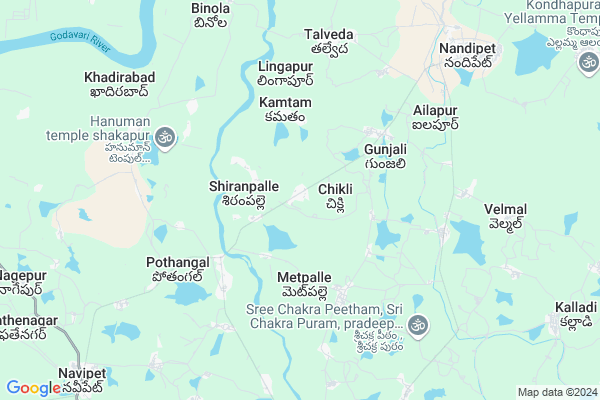
Kothapally is a Village in Makloor Mandal in Nizamabad District of Telangana State, India. It belongs to Telangana region . It is located 21 KM towards North from District head quarters Nizamabad. 8 KM from Makloor.
Kothapally Pin code is 503246 and postal head office is Jannepalli .
Gunjili ( 3 KM ) , Kamtam ( 3 KM ) , Jannepalli ( 4 KM ) , Dharmora ( 4 KM ) , Chimrajpally ( 6 KM ) are the nearby Villages to Kothapally. Kothapally is surrounded by Makloor Mandal towards South , Nandipet Mandal towards East , Renjal Mandal towards west , Nizamabad Mandal towards South .
Nizamabad , Bodhan , Bhainsa , Nirmal are the near by Cities to Kothapally.
Demographics of Kothapally
Telugu is the Local Language here.Politics in Kothapally
TDP , TRS , INC are the major political parties in this area.Polling Stations /Booths near Kothapally
1)Mandal Parishad Primary School2)Z.p.h.s. 8th Class Room
3)Zp Secondary School 6th Class Room
4)Mpps New Building East
5)Mandal Parishad Primaryschool U/m
HOW TO REACH Kothapally
By Rail
There is no railway station near to Kothapally in less than 10 km. Nizamabad Junction Rail Way Station (near to Nizamabad) , Jankampet Junction Rail Way Station (near to Nizamabad) are the Rail way stations reachable from near by towns.By Road
Nizamabad are the nearby by towns to Kothapally having road connectivity to KothapallyColleges near Kothapally
Kakatiya Institute Of Technology & Science For WomenSchools near Kothapally
Kgvb MakloorGovt Health Centers near Kothapally
1) SubCentre, Chikli , Chikli , ,2) SubCentre, Mamdapur , , ,
3) SubCentre, Andranagar , ANDRANGAR , ,
Petrol Bunks in Kothapally,Makloor
Navate Fuel Station
Jannepally Road; Jannepally; Nizamabad; Telangana TG; India
4.1 KM distance Detail
AARTI Indian Oil Petrole Pump
Velmal Cross Road; Velmal; Telangana 503213; India
6.4 KM distance Detail
SRI KRISHNA FILLING STATION
NANDIPET; MAIN ROAD; NIZAMABAD; Telangana 503212; India
8.1 KM distance Detail
more ..
Colleges in Kothapally,Makloor
Government Polytechnic
Nandipet Navipet Road; Nandipet; Nizamabad; Telangana 503212; India
8.7 KM distance Detail
more ..
Electronic Shops in Kothapally,Makloor
Laxmi Engineering And Electrical And Sanitary
nandipet.. ambedkar chourastha. near Indian; oversis bank; Nandipet; Telangana; India
9.4 KM distance Detail
Police Stations near Kothapally,Makloor
Police Station;Nandipet
near primary health center; Nandipet; Telangana; India
9.5 KM distance Detail
Governement Offices near Kothapally,Makloor
MeeSeva Center
Jannepally Village;Navipet Mandal; Jannepally; Telangana 503246; India
4.2 KM distance Detail
MeeSeva Center
opposite to grampanchayath Office; Nandhipet; Talveda; 503212; India
6.9 KM distance Detail
How to reach Kothapally
Tourist Places Near By Kothapally
Schools in Kothapally
Colleges in Kothapally
Temperature & weather of Kothapally
places in Kothapally
Kothapally photos
More Information
Village Talk
Post News or Events about this Village
Nizamabad 21 KM near
Bodhan 30 KM near
Bhainsa 37 KM near
Nirmal 45 KM near
Navipet 7 KM near
Makloor 8 KM near
Nandipet 13 KM near
Renjal 18 KM near
Nanded Airport 101 KM near
Latur Airport 198 KM near
Rajiv Gandhi International Airport 202 KM near
Sholapur Airport 295 KM near
Medak 99 KM near
Bidar 132 KM near
Hingoli 156 KM near
Hyderabad 185 KM near
Sirpur 193 KM near
Nizamabad 20 KM near
Nanded 100 KM near
Adilabad 118 KM near
Bidar 132 KM near
Basar Rail Way Station 18 KM near
Nizamabad Junction Rail Way Station 18 KM near