| Home | City Bus | Maps | Villages | Cities | Rail | Tourist Places | School | College | Pin Codes | Corona Cases Count |
| Distance Calculator Bus Services IFSC Codes Trace Mobile Number Weather Search Place Trace IP Available Cash ATM/Banks Locate Polling Booth Report an Error contact People |
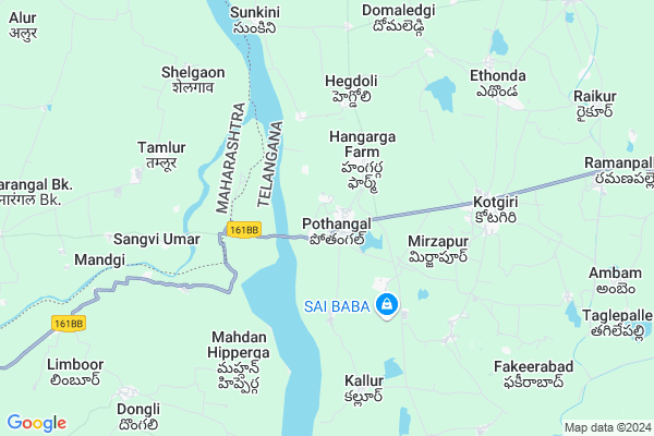
Pothangal Map
EDIT Map
Add Your House
 ..
..
Current Corona Virus Infected Patients Count in Nizamabad District
| City Name | District Name | Total Covid cases |
|---|---|---|
| Nizamabad District | Nizamabad | 62 |
| Kamareddy District | Kamareddy | 11 |
Locality Name :
Pothangal
( పొతంగల్ )
Mandal Name : Kotgiri
District : Nizamabad
State : Telangana
Region : Telangana
Language : Telugu
Current Time 05:55 AM
Date: Saturday , Apr 26,2025 (IST)
Time zone: IST (UTC+5:30)
Elevation / Altitude: 375 meters. Above Seal level
Telephone Code / Std Code: 08467
Assembly constituency : Banswada assembly constituency
Assembly MLA : Srinivas Reddy Parige (POCHARAM)
Lok Sabha constituency : Zahirabad parliamentary constituency
Parliament MP : B.B.PATIL
Serpanch Name :
Pin Code : 503207
Post Office Name : Kotgir
Alternate Village Name : Pothangal check post, Pothangal old
Commodities Prices : Varni Market / Mandi
Pothangal Live Weather
Temperature: 30.7 °C
scattered clouds
Humidity: 36%
Wind : 3.21 mt/sec towards SW
StationName : "Bodhan"
observed on 26 Mins Back
Temperature: 30.7 °C
scattered clouds
Humidity: 36%
Wind : 3.21 mt/sec towards SW
StationName : "Bodhan"
observed on 26 Mins Back
Pothangal Weather Forecast for Next 5 days
27-04-2025
30.7°C to 40.7°C
scattered clouds, broken clouds, light rain, overcast clouds
30.7°C to 40.7°C
scattered clouds, broken clouds, light rain, overcast clouds
28-04-2025
30.0°C to 38.9°C
overcast clouds, light rain, scattered clouds, broken clouds, clear sky
30.0°C to 38.9°C
overcast clouds, light rain, scattered clouds, broken clouds, clear sky
29-04-2025
28.2°C to 42.1°C
broken clouds, clear sky, scattered clouds
28.2°C to 42.1°C
broken clouds, clear sky, scattered clouds
30-04-2025
29.6°C to 43.0°C
clear sky, scattered clouds
29.6°C to 43.0°C
clear sky, scattered clouds
Edit below overview about Pothangal
Edit below overview about Pothangal
OverView of Pothangal
Pothagal near by Maharashtra Border,every Monday there is weekly where people from the near villages buy,and sell vegetables. It's a small village seeking for good educational and medical needs.Edit below overview about Pothangal
National Highways Reachable To Pothangal
Nationa High Way :NH161BB
Nationa High Way :NH161BB
Rivers Near Pothangal
Phulang Vagu
Manjira :Manjira :मांजरा :ಮಂಜೀರ :मांजरा :మంజీర
Phulang Vagu
Manjira :Manjira :मांजरा :ಮಂಜೀರ :मांजरा :మంజీర
About Pothangal
Pothangal is a Village in Kotgiri Mandal in Nizamabad District of Telangana State, India. It belongs to Telangana region . It is located 41 KM towards west from District head quarters Nizamabad. 4 KM from Kotgir.
Pothangal Pin code is 503207 and postal head office is Kotgir .
Hangarga ( 1 KM ) , Jallapalli ( 2 KM ) , Eklaspur ( 4 KM ) , Hegdoli ( 5 KM ) , Kothapalli ( 5 KM ) are the nearby Villages to Pothangal. Pothangal is surrounded by Madnur Mandal towards west , Birkoor Mandal towards South , Bodhan Mandal towards North , Varni Mandal towards East .
Bodhan , Nizamabad , Mukhed , Bhainsa are the near by Cities to Pothangal.
Pothangal 2011 Census Details
Pothangal Local Language is Telugu. Pothangal Village Total population is 6704 and number of houses are 1575. Female Population is 50.7%. Village literacy rate is 50.8% and the Female Literacy rate is 21.9%.
Population
| Census Parameter | Census Data |
| Total Population | 6704 |
| Total No of Houses | 1575 |
| Female Population % | 50.7 % ( 3397) |
| Total Literacy rate % | 50.8 % ( 3408) |
| Female Literacy rate | 21.9 % ( 1466) |
| Scheduled Tribes Population % | 0.4 % ( 25) |
| Scheduled Caste Population % | 9.9 % ( 666) |
| Working Population % | 47.7 % |
| Child(0 -6) Population by 2011 | 754 |
| Girl Child(0 -6) Population % by 2011 | 49.9 % ( 376) |
Pothangal Census More Deatils.
Politics in Pothangal
TDP , TRS , INC are the major political parties in this area.Polling Stations /Booths near Pothangal
1)Pothangal2)Pothangal
3)Pothangal
4)Pocharam
5)Thimmapur
HOW TO REACH Pothangal
By Road
Bodhan is the Nearest Town to Pothangal. Bodhan is 20 km from Pothangal. Road connectivity is there from Bodhan to Pothangal.By Rail
There is no railway station near to Pothangal in less than 10 km. How ever there are railway Stations from Near By town Bodhan. are the railway Stations near to Bodhan. You can reach from Bodhan to Pothangal by road after .Colleges near Pothangal
Government Polytechnic
Address : Kotgir
Kotagiri
Address :
Govt Jr College Kotagiri
Address : Govt Jr College Kotagiri
Schools in Pothangal
Mpps Kumarasa Farm
Address : pothangal , kotagiri , nizamabad , Andhra Pradesh . PIN- 503207 , Post - Kotgir
Mpps Potangal
Address : pothangal , kotagiri , nizamabad , Andhra Pradesh . PIN- 503207 , Post - Kotgir
Mpups Pothangal
Address : pothangal , kotagiri , nizamabad , Andhra Pradesh . PIN- 503207 , Post - Kotgir
Zilla Parishath High School Pothangal
Address : zphs pothangal kotagiri nizamabad pin : 503207
Govt Health Centers near Pothangal
1) Primary Health Centre, Pothangal , , Near ZPHS , Near Rice Mil2) SubCentre, Pothangal , , , DHARAMASHALA
3) SubCentre, Pothangal - A , 28-Jun , Near U/M School , Near U/M School
Sub Villages in Pothangal
Hospitals in Pothangal,Kotgiri
Metropolis Healthcare Ltd
139; Near Datta Mandir; A/P Kagal; Tal - Kagal; Kolhapur; Maharashtra 416216; India
9.5 KM distance Detail
more ..
Petrol Bunks in Pothangal,Kotgiri
Sai Ganesh Filling Station HPCL Retail Outlet
Kotagiri;Pothangal- bodhan Road; Nizamabad; Telangana 503001; India
7.4 KM distance Detail
Adhoc Gupta And Co.
SY NO 799/5; Rudrur Village Varni Mandal; nizambad; 503188; India
13.3 KM distance Detail
Bharat petrol bunk Poornima ENTERPRISES
Banswada - Bodhan Rd; Rudrur; Telangana 503188; India
13.7 KM distance Detail
POORNIMA ENTERPRISES
RUDRUR; NIZAM SAGAR ROAD; NIZAMABAD; Telangana 503188; India
13.8 KM distance Detail
more ..
Colleges in Pothangal,Kotgiri
College Of Food Science And Technology Rdr
Nizamabad; Telangana 503188; India
13.2 KM distance Detail
College Of Food Science And Technology
Hyderabad - Bodhan; Rudrur; Telangana 503188; India
13.2 KM distance Detail
more ..
Electronic Shops in Pothangal,Kotgiri
Famous Engineering & Submersibles
Pothangal-Kotagiri-Bodhan Rd; Kotagiri; Telangana 503207; India
6.2 KM distance Detail
Super Markets in Pothangal,Kotgiri
Vivekananda Kirana & General Store
Hunsa Sompur Road; Hunsa; Telangana 503185; India
13.1 KM distance Detail
Police Stations near Pothangal,Kotgiri
Varni Police Station
bodhan road; Bodhan - Nizamabad Rd; AP POLICE TRAINING CENTRE; Varni; Telangana 503201; India
15.5 KM distance Detail
Governement Offices near Pothangal,Kotgiri
MEE SEVA CENTER AND XEROX KOTAGIRI
Pothangal-Kotagiri-Bodhan Rd; Kotagiri; Telangana 503207; India
6.1 KM distance Detail
About Pothangal &
History
How to reach Pothangal
Tourist Places Near By Pothangal
Schools in Pothangal
Colleges in Pothangal
Temperature & weather of Pothangal
places in Pothangal
Pothangal photos
More Information
How to reach Pothangal
Tourist Places Near By Pothangal
Schools in Pothangal
Colleges in Pothangal
Temperature & weather of Pothangal
places in Pothangal
Pothangal photos
More Information
Village Talk
Post News or Events about this Village
Near Cities
Bodhan 19 KM near
Nizamabad 37 KM near
Mukhed 50 KM near
Bhainsa 71 KM near
Bodhan 19 KM near
Nizamabad 37 KM near
Mukhed 50 KM near
Bhainsa 71 KM near
Near By Taluks
Kotgiri 4 KM near
Madnur 16 KM near
Birkoor 18 KM near
Bodhan 18 KM near
Kotgiri 4 KM near
Madnur 16 KM near
Birkoor 18 KM near
Bodhan 18 KM near
Near By Air Ports
Nanded Airport 93 KM near
Latur Airport 155 KM near
Rajiv Gandhi International Airport 183 KM near
Sholapur Airport 246 KM near
Nanded Airport 93 KM near
Latur Airport 155 KM near
Rajiv Gandhi International Airport 183 KM near
Sholapur Airport 246 KM near
Near By Tourist Places
Medak 87 KM near
Bidar 87 KM near
Hingoli 160 KM near
Hyderabad 170 KM near
Gulbarga 189 KM near
Medak 87 KM near
Bidar 87 KM near
Hingoli 160 KM near
Hyderabad 170 KM near
Gulbarga 189 KM near
Near By Districts
Nizamabad 40 KM near
Bidar 86 KM near
Nanded 91 KM near
Medak 123 KM near
Nizamabad 40 KM near
Bidar 86 KM near
Nanded 91 KM near
Medak 123 KM near
Near By RailWay Station
Dharmabad Rail Way Station 40 KM near
Nizamabad Junction Rail Way Station 41 KM near
Dharmabad Rail Way Station 40 KM near
Nizamabad Junction Rail Way Station 41 KM near