| Home | City Bus | Maps | Villages | Cities | Rail | Tourist Places | School | College | Pin Codes | Corona Cases Count |
| Distance Calculator Bus Services IFSC Codes Trace Mobile Number Weather Search Place Trace IP Available Cash ATM/Banks Locate Polling Booth Report an Error contact People |
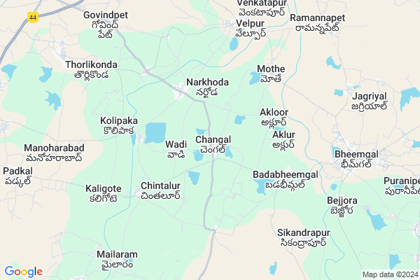
Chengal Map
EDIT Map
Add Your House
 ..
..
Current Corona Virus Infected Patients Count in Nizamabad District
| City Name | District Name | Total Covid cases |
|---|---|---|
| Nizamabad District | Nizamabad | 62 |
| Kamareddy District | Kamareddy | 11 |
Locality Name :
Chengal
( చెంగల్ )
Mandal Name : Bheemgal
District : Nizamabad
State : Telangana
Region : Telangana
Language : Telugu
Current Time 05:54 AM
Date: Saturday , Apr 26,2025 (IST)
Time zone: IST (UTC+5:30)
Elevation / Altitude: 424 meters. Above Seal level
Telephone Code / Std Code: 08463
Assembly constituency : Balkonda assembly constituency
Assembly MLA : Prashanth Reddy Vemula
Lok Sabha constituency : Nizamabad parliamentary constituency
Parliament MP : ARVIND DHARMAPURI
Serpanch Name :
Pin Code : 503307
Post Office Name : Bhimgal
Alternate Village Name : Changal , Chaingal
Commodities Prices : Armoor Market / Mandi
Chengal Live Weather
Temperature: 30.1 °C
scattered clouds
Humidity: 34%
Wind : 1.65 mt/sec towards SW
StationName : "NizÄ\u0081mÄ\u0081bÄ\u0081d"
observed on Now
Temperature: 30.1 °C
scattered clouds
Humidity: 34%
Wind : 1.65 mt/sec towards SW
StationName : "NizÄ\u0081mÄ\u0081bÄ\u0081d"
observed on Now
Chengal Weather Forecast for Next 5 days
27-04-2025
31.1°C to 39.9°C
broken clouds, overcast clouds
31.1°C to 39.9°C
broken clouds, overcast clouds
28-04-2025
28.7°C to 37.7°C
light rain, broken clouds, scattered clouds
28.7°C to 37.7°C
light rain, broken clouds, scattered clouds
29-04-2025
27.3°C to 42.0°C
few clouds, clear sky, scattered clouds
27.3°C to 42.0°C
few clouds, clear sky, scattered clouds
30-04-2025
29.1°C to 42.8°C
clear sky, few clouds, overcast clouds
29.1°C to 42.8°C
clear sky, few clouds, overcast clouds
01-05-2025
29.6°C to 43.0°C
overcast clouds, scattered clouds, few clouds, clear sky
29.6°C to 43.0°C
overcast clouds, scattered clouds, few clouds, clear sky
Edit below overview about Chengal
Edit below overview about Chengal
OverView of Chengal
chengal old name was cheganti once it was in pedavemuganti(BADA BHEEMGAL) Peddavemuganti is a country that time, it was splitted in two parts one KASPA (BHEEMGAL) and ChegantiEdit below overview about Chengal
Rivers Near Chengal
Pedda Vagu
Phulang Vagu
Pedda Vagu
Phulang Vagu
About Chengal
Chengal is a Village in Bheemgal Mandal in Nizamabad District of Telangana State, India. It belongs to Telangana region . It is located 35 KM towards East from District head quarters Nizamabad. 11 KM from Bheemgal.
Chengal Pin code is 503307 and postal head office is Bhimgal .
Akloor ( 3 KM ) , Pachal Nadukuda ( 4 KM ) , Badabheemgal ( 4 KM ) , Mothe ( 5 KM ) , Kolipyak ( 5 KM ) are the nearby Villages to Chengal. Chengal is surrounded by Bheemgal Mandal towards East , Jakranpalle Mandal towards west , Dharpalle Mandal towards South , Armur Mandal towards North .
Nizamabad , Koratla , Nirmal , Kamareddy are the near by Cities to Chengal.
This Place is in the border of the Nizamabad District and Karimnagar District. Karimnagar District Metpalli is East towards this place .
Changal 2011 Census Details
Chengal Local Language is Telugu. Changal Village Total population is 3756 and number of houses are 911. Female Population is 51.8%. Village literacy rate is 55.2% and the Female Literacy rate is 23.4%.
Population
| Census Parameter | Census Data |
| Total Population | 3756 |
| Total No of Houses | 911 |
| Female Population % | 51.8 % ( 1947) |
| Total Literacy rate % | 55.2 % ( 2075) |
| Female Literacy rate | 23.4 % ( 879) |
| Scheduled Tribes Population % | 0.0 % ( 1) |
| Scheduled Caste Population % | 22.3 % ( 838) |
| Working Population % | 57.2 % |
| Child(0 -6) Population by 2011 | 323 |
| Girl Child(0 -6) Population % by 2011 | 49.2 % ( 159) |
Changal Census More Deatils.
Politics in Chengal
TDP , TRS , PRAP , INC are the major political parties in this area.Polling Stations /Booths near Chengal
1)Chakiryal2)Changal
3)Yergatla
4)Vennal B
5)Akloor
HOW TO REACH Chengal
By Road
Nizamabad is the Nearest Town to Chengal. Nizamabad is 42 km from Chengal. Road connectivity is there from Nizamabad to Chengal.By Rail
There is no railway station near to Chengal in less than 10 km. How ever there are railway Stations from Near By town Nizamabad. are the railway Stations near to Nizamabad. You can reach from Nizamabad to Chengal by road after .Colleges near Chengal
Govt Jr College? Bheemgal
Address : Govt Jr College? Bheemgal
Sri Saraswathi Jr Coll, Bheemgal
Address : Bheemgal
Nalanda Jr Coll, Bheemgal
Address : Bheemgal
Schools in Chengal
Zphs Chengal
Address : chengal , bheemgal , nizamabad , Andhra Pradesh . PIN- 503307 , Post - Bhimgal
Govt Health Centers near Chengal
1) SubCentre, Chengal , SUBCENTRE , CHENGAL BUSSTAND , ARMUR ROAD2) SubCentre, Kothapally -N , SUBCENTRE , WADIROAD , SUBSTATION
3) SubCentre, Pachal Nadukuda , 4-Jul , NEAR MARKET , 7TH BLOCK
Hospitals in Chengal,Bheemgal
Hanmakonda Govt Hospital
hosptalTelangana; Government Maternity Hospital; Reddy Colony; Hanamkonda; Telangana 506001; India
3.5 KM distance Detail
more ..
Electronic Shops in Chengal,Bheemgal
Sri Shiva Electronics And Hardware
Mothe; Mandal; Velpoor; Telangana 503311; India
5.4 KM distance Detail
Governement Offices near Chengal,Bheemgal
MeeSeva Center
Near Bus station;Armoor Road; ;Velpur; Pachala Nadkuda; Telangana 503307; India
3.4 KM distance Detail
About Chengal &
History
How to reach Chengal
Tourist Places Near By Chengal
Schools in Chengal
Colleges in Chengal
Temperature & weather of Chengal
places in Chengal
Chengal photos
More Information
How to reach Chengal
Tourist Places Near By Chengal
Schools in Chengal
Colleges in Chengal
Temperature & weather of Chengal
places in Chengal
Chengal photos
More Information
Village Talk
Post News or Events about this Village
Near Cities
Nizamabad 36 KM near
Koratla 42 KM near
Nirmal 48 KM near
Kamareddy 49 KM near
Nizamabad 36 KM near
Koratla 42 KM near
Nirmal 48 KM near
Kamareddy 49 KM near
Near By Taluks
Velpur 8 KM near
Bheemgal 11 KM near
Jakranpalle 11 KM near
Armur 18 KM near
Velpur 8 KM near
Bheemgal 11 KM near
Jakranpalle 11 KM near
Armur 18 KM near
Near By Air Ports
Nanded Airport 138 KM near
Rajiv Gandhi International Airport 183 KM near
Latur Airport 228 KM near
Sonegaon Airport 306 KM near
Nanded Airport 138 KM near
Rajiv Gandhi International Airport 183 KM near
Latur Airport 228 KM near
Sonegaon Airport 306 KM near
Near By Tourist Places
Medak 83 KM near
Bidar 140 KM near
Hyderabad 165 KM near
Warangal 170 KM near
Sirpur 170 KM near
Medak 83 KM near
Bidar 140 KM near
Hyderabad 165 KM near
Warangal 170 KM near
Sirpur 170 KM near
Near By Districts
Nizamabad 33 KM near
Karimnagar 95 KM near
Adilabad 121 KM near
Nanded 137 KM near
Nizamabad 33 KM near
Karimnagar 95 KM near
Adilabad 121 KM near
Nanded 137 KM near
Near By RailWay Station
Nizamabad Junction Rail Way Station 32 KM near
Kamareddi Rail Way Station 48 KM near
Nizamabad Junction Rail Way Station 32 KM near
Kamareddi Rail Way Station 48 KM near