| Home | City Bus | Maps | Villages | Cities | Rail | Tourist Places | School | College | Pin Codes | Corona Cases Count |
| Distance Calculator Bus Services IFSC Codes Trace Mobile Number Weather Search Place Trace IP Available Cash ATM/Banks Locate Polling Booth Report an Error contact People |
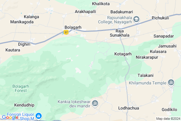
Kasanda Map
EDIT Map
Add Your House
 ..
..
Current Corona Virus Infected Patients Count in Nayagarh District
| City Name | District Name | Total Covid cases |
|---|
Locality Name :
Kasanda
( କସନଦ )
Tehsil Name : Ranapur
District : Nayagarh
State : Odisha
Language : Oriya and Hindi
Current Time 12:41 PM
Date: Monday , Apr 28,2025 (IST)
Time zone: IST (UTC+5:30)
Elevation / Altitude: 20 meters. Above Seal level
Telephone Code / Std Code: 06753
Assembly constituency : Ranpur assembly constituency
Assembly MLA : rabinarayan mohapatra
Lok Sabha constituency : Puri parliamentary constituency
Parliament MP : PINAKI MISRA
Serpanch Name :
Pin Code : 752065
Post Office Name : Rajsunakhala
Commodities Prices : Sarankul Market / Mandi
Kasanda Live Weather
Temperature: 38.4 °C
clear sky
Humidity: 28%
Wind : 5.26 mt/sec towards S
StationName : "NayÄ\u0081garh"
observed on 12 Mins Back
Temperature: 38.4 °C
clear sky
Humidity: 28%
Wind : 5.26 mt/sec towards S
StationName : "NayÄ\u0081garh"
observed on 12 Mins Back
Kasanda Weather Forecast for Next 5 days
29-04-2025
27.5°C to 37.0°C
clear sky, few clouds, scattered clouds, overcast clouds
27.5°C to 37.0°C
clear sky, few clouds, scattered clouds, overcast clouds
30-04-2025
26.7°C to 38.6°C
broken clouds, clear sky, moderate rain, light rain
26.7°C to 38.6°C
broken clouds, clear sky, moderate rain, light rain
01-05-2025
23.8°C to 36.2°C
scattered clouds, clear sky, moderate rain, light rain
23.8°C to 36.2°C
scattered clouds, clear sky, moderate rain, light rain
02-05-2025
23.3°C to 34.8°C
few clouds, scattered clouds, clear sky, light rain
23.3°C to 34.8°C
few clouds, scattered clouds, clear sky, light rain
03-05-2025
24.7°C to 35.7°C
broken clouds, clear sky, light rain
24.7°C to 35.7°C
broken clouds, clear sky, light rain
National Highways Reachable To Kasanda
Nationa High Way :NH316
Nationa High Way :NH316
Rivers Near Kasanda
Malua
Kusumi
Malua
Kusumi
About Kasanda
Correct below Info and add more info about KasandaKasanda is a Village in Ranapur Tehsil in Nayagarh District of Odisha State, India. It is located 26 KM towards East from District head quarters Nayagarh. 9 KM from Ranapurgarh. 68 KM from State capital Bhubaneswar
Kasanda Pin code is 752065 and postal head office is Rajsunakhala .
Brundabanpur ( 4 KM ) , Rajasunakhala ( 4 KM ) , Pimpal ( 5 KM ) , Gourangapur ( 6 KM ) , Talakani ( 7 KM ) are the nearby Villages to Kasanda. Kasanda is surrounded by Ranapur Tehsil towards South , Nayagarh Tehsil towards west , Bhapur Tehsil towards North , Begunia Tehsil towards East .
Khordha , Jatani , Bhubaneswar , Dhenkanal are the near by Cities to Kasanda.
This Place is in the border of the Nayagarh District and Khordha District. Khordha District Bolagarh is North towards this place .
Kasanda 2011 Census Details
Kasanda Local Language is Oriya. Kasanda Village Total population is 1303 and number of houses are 323. Female Population is 50.6%. Village literacy rate is 72.6% and the Female Literacy rate is 34.2%.
Population
| Census Parameter | Census Data |
| Total Population | 1303 |
| Total No of Houses | 323 |
| Female Population % | 50.6 % ( 659) |
| Total Literacy rate % | 72.6 % ( 946) |
| Female Literacy rate | 34.2 % ( 445) |
| Scheduled Tribes Population % | 11.6 % ( 151) |
| Scheduled Caste Population % | 15.7 % ( 204) |
| Working Population % | 40.3 % |
| Child(0 -6) Population by 2011 | 170 |
| Girl Child(0 -6) Population % by 2011 | 44.7 % ( 76) |
Kasanda Census More Deatils.
Politics in Kasanda
BJP , BJD , INC are the major political parties in this area.Polling Stations /Booths near Kasanda
1)Gaonbanikilo Pry. School2)Sukala Proj. Pry. School
3)Gadabanikilo Nup. School
4)Kasanda Nodal Up(m.e) School(r-1)
5)Taria U.g.m.e. School
HOW TO REACH Kasanda
By Rail
There is no railway station near to Kasanda in less than 10 km.Colleges near Kasanda
Mohan Mahila Mahavidyayala
Address :
Arjuna Rout Memorial Higher Secondary School Mayurjhalia
Address : Mayurajhalia,ranpur,nayagarh,odisha, 752025
Kalinga Institute Of Medical Science
Address : Kiit University, Koel Campuscampus-1, Patia,, Bhub
Schools in Kasanda
Trutiyadev Girls Hs, Kasanda
Address : kasanda , ranpur , nayagarh , Sikkim . PIN- 752065 , Post - Rajsunakhala
Randa P.s.
Address : kasanda , ranpur , nayagarh , Sikkim . PIN- 752065 , Post - Rajsunakhala
Gopabandhu High School,napalli
Address : At-kandara gadia
Govt Health Centers near Kasanda
1) BOLAGAD , Bolagarh CHC , Bolagarh , Bolagarh2) Bolagarh , Bolagarh SubCentre , Bolagarh , Bolagarh
3) Khalikote , Khalikota SubCentre , Khalikota , Khalikota
About Kasanda &
History
How to reach Kasanda
Tourist Places Near By Kasanda
Schools in Kasanda
Colleges in Kasanda
Temperature & weather of Kasanda
places in Kasanda
Kasanda photos
More Information
How to reach Kasanda
Tourist Places Near By Kasanda
Schools in Kasanda
Colleges in Kasanda
Temperature & weather of Kasanda
places in Kasanda
Kasanda photos
More Information
Village Talk
Post News or Events about this Village
Near Cities
Khordha 37 KM near
Jatani 46 KM near
Bhubaneswar 62 KM near
Dhenkanal 73 KM near
Khordha 37 KM near
Jatani 46 KM near
Bhubaneswar 62 KM near
Dhenkanal 73 KM near
Near By Taluks
Bolagarh 6 KM near
Ranapur 9 KM near
Bhapur 18 KM near
Nayagarh 18 KM near
Bolagarh 6 KM near
Ranapur 9 KM near
Bhapur 18 KM near
Nayagarh 18 KM near
Near By Air Ports
Bhubaneswar Airport 62 KM near
Vishakhapatnam Airport 387 KM near
Ranchi Airport 395 KM near
Raipur Airport 434 KM near
Bhubaneswar Airport 62 KM near
Vishakhapatnam Airport 387 KM near
Ranchi Airport 395 KM near
Raipur Airport 434 KM near
Near By Tourist Places
Chilika 42 KM near
Bhubaneswar 64 KM near
Nandan Kanan National Park 68 KM near
Puri 74 KM near
Cuttack 78 KM near
Chilika 42 KM near
Bhubaneswar 64 KM near
Nandan Kanan National Park 68 KM near
Puri 74 KM near
Cuttack 78 KM near
Near By Districts
Nayagarh 25 KM near
Khordha 63 KM near
Dhenkanal 72 KM near
Puri 73 KM near
Nayagarh 25 KM near
Khordha 63 KM near
Dhenkanal 72 KM near
Puri 73 KM near
Near By RailWay Station
Kalupara Ghat Rail Way Station 32 KM near
Nirakarpur Rail Way Station 32 KM near
Kalupara Ghat Rail Way Station 32 KM near
Nirakarpur Rail Way Station 32 KM near